


— Solutions —
—Products—
 Consumer hotline +8618073152920
 WhatsApp:+8615367865107
Address:Room 102, District D, Houhu Industrial Park, Yuelu District, Changsha City, Hunan Province, China
Weather & Environmental
Time:2025-11-13 14:25:41 Popularity:842
Climate and meteorological data form the foundational core of Earth system science, disaster prevention and mitigation, and industrial regulation. Their accuracy and continuity directly impact climate change studies, extreme weather forecasting, agricultural planning, and transportation safety.
- Scientific Research: Long-term, continuous, high-precision data is essential for analyzing greenhouse effects, monsoon variability, and more.
- Agriculture: Real-time accumulated temperature, precipitation, and wind speed directly influence crop selection and pest/disease alerts.
- Aviation, Maritime & Transportation: Visibility, wind speed, and thunderstorm parameters ensure operational safety.
- Ecology, Forestry, and Water Resources: Strong demand for fire weather indices, evaporation rates, and flood forecasting.

- Coverage Gaps: National stations cluster in urban and key areas, leaving data voids in remote mountains, plateaus, and oceans.
- Low Frequency & Latency: Manual observations occur hourly or every 6 hours, missing short-duration convective events.
- Data Inconsistency: Varied equipment and formats across institutions increase sharing costs.
- High O&M Costs: Outdoor equipment is vulnerable to wind, snow, and lightning; maintenance in remote areas is 3–5× more expensive.
With the rise of IoT, cloud computing, and big data, building a fully covered, precisely acquired, real-time transmitted, and intelligently analyzed meteorological network has become an inevitable trend. Leveraging 10 years of sensor expertise, NiuBoL introduces a customized climate research and meteorological network solution to fill data gaps and maximize data value.
- Numerous Monitoring Blind Spots: Uneven station distribution leads to incomplete data for research and early warning.
- Insufficient Parameter Dimensions: Most stations collect only temperature and precipitation, lacking solar radiation, pressure, visibility, etc.
- Delayed Data Transmission: Remote areas rely on manual or scheduled uploads, with delays of hours to days.
- Difficult Equipment Maintenance: Requires regular on-site calibration; high failure rates in extreme environments.
 Solar PV Weather Monitoring Station.jpeg")
- Full-Domain Precision Monitoring: Build a three-tier network (core + encrypted + mobile stations) covering land and water, achieving WMO Tier-1 accuracy.
- Multi-Dimensional Data Acquisition: Single station supports 10+ parameters; adjustable sampling from 1 second to 1 hour.
- Real-Time Reliable Transmission: Multi-mode communication ensures ≥99.8% success rate in remote areas with ≤3-second latency.
- Low-Power Long-Life Operation: Annual failure rate ≤0.5%; supports remote O&M and auto-calibration, reducing lifecycle costs.
- Multi-Parameter Integrated Sensing: Modular design integrates temperature, humidity, wind speed/direction, precipitation, solar radiation, pressure, visibility, evaporation, and more.
- Temp/Humidity: ±0.1°C / ±1% RH
- Ultrasonic Anemometer: ±0.1 m/s
- Solar Radiation: 280–3000 nm
- Multi-Mode Transmission:
- 4G/5G for urban/plains
- LoRa + 4G relay for remote mountains
- End-to-end encryption for data security
- Low-Power Intelligent O&M:
- Triple backup: solar + lithium + grid power
- ≥7-day autonomy in cloudy conditions
- Built-in health diagnostics and remote calibration; only 1 annual on-site visit

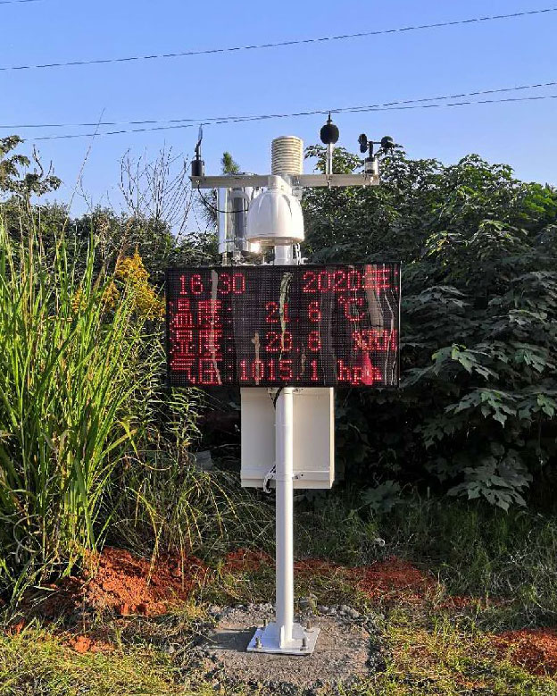
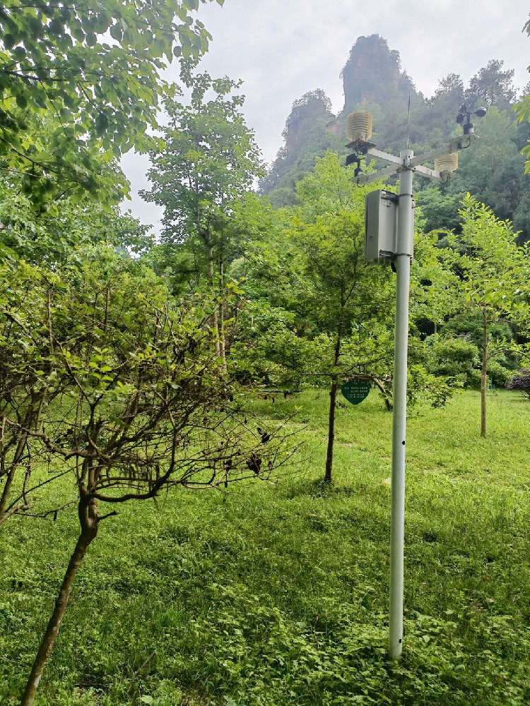
- Basic Climate Station: 5 parameters (temp, humidity, wind, precipitation); IP67, ideal for agriculture and municipal use.
- Research-Grade Climate Station: Expands to solar radiation, pressure, visibility, evaporation; modular sensor expansion for scientific studies.
- Extreme Environment Station: Operates in -60°C to +80°C, IP68, with anti-lightning, anti-icing, anti-sandstorm modules for plateaus, polar regions, and deserts.
- Auxiliary Equipment: 3–10m masts, solar systems, 128GB storage expansion, HD cameras.
- Supports 16 sensor inputs (analog, digital, RS485)
- 64GB onboard storage → caches 3 years of data; auto-resend on reconnection
- GPS/Beidou positioning for precise station tracing
- Remote configuration of sampling/transmission; intelligent battery management
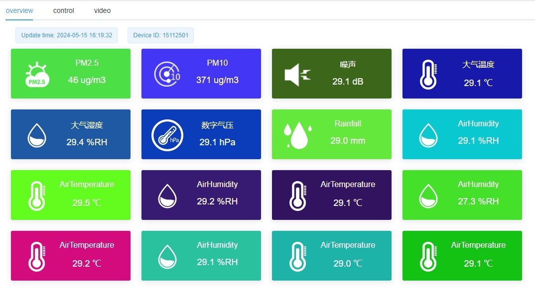
- Data Monitoring Center: Map-based real-time station status and data; 1-second refresh
- Data Governance Center: Auto-cleaning, calibration, and WMO-compliant standardization; exportable research datasets
- Climate Analysis Center: Generates daily/weekly/monthly/annual reports; detects trends and anomalies
- Multi-Platform Access: Web, mobile, API integration
- Industry Customization:
- Agriculture: Accumulated temperature, pest risk forecasts
- Aviation: Visibility, thunderstorm alerts
- Disaster Prevention: Fire danger rating, emergency dispatch

- Network Planning: Core stations every 50 km, encrypted every 10 km, mobile stations flexibly deployed
- Site Survey: Avoid shading and low-lying areas; assess power and signal
- Installation & Commissioning: Pre-configure parameters; secure masts, anti-wind/sand/lightning, align solar panels
- Joint Testing & Acceptance: Verify transmission stability, parameter accuracy, and user training
- Stations collect per set frequency; edge processing before cloud upload
- Cross-calibration with national stations ensures long-term high-precision datasets
- Research: Identify climate trends; generate regional temperature and anomaly reports
- Early Warning: Multi-channel push for wind, thunderstorm, heavy rain alerts
- Industry Regulation: Optimize sowing, irrigation, flight schedules, fire patrols
- Policy Formulation: Provide regional meteorological reports for water resources and disaster planning

Basic Climate Station → Data Collector (4G) → NiuBoL Cloud → Farmer App
- 1 station per 10 km
- Cloud analyzes accumulated temperature & precipitation → growth reports & pest forecasts
- Farmers receive irrigation recommendations via app → smart farming
Basic Station: Infrared Sensor → Collector (LoRa+4G) → Cloud → Fire Patrol App
- Deploy in forest zones to monitor temp, humidity, wind, surface temp
- Platform calculates fire danger level (1–5)
- App pushes alerts → guides patrol deployment

Q1: Can data be uploaded from remote mountains without cellular signal?
A1: Supports Beidou short-message mode; only satellite signal needed. Collector caches data and resends upon signal recovery — no data loss.
Q2: Will equipment be damaged in extreme weather?
A2: IP65–IP68 rating, withstands Category 12 typhoon winds, prevents water ingress, includes built-in lightning protection.
NiuBoL is a high-tech enterprise specializing in meteorological monitoring and IoT solutions. Focused on climate stations, sensors, and cloud platforms, our products are certified with ISO9001, CE, RoHS. We deliver end-to-end services — R&D, manufacturing, installation, and O&M — providing reliable support for scientific research and industrial applications.
Climate research and meteorological network construction are foundational to addressing climate change, ensuring industrial safety, and supporting scientific discovery. The NiuBoL solution uses intelligent climate stations as sensing endpoints, multi-mode transmission networks as backbone, and the cloud platform as the data hub to create a fully covered, precisely acquired, real-time analyzed, and flexibly applied meteorological monitoring system. It resolves the pain points of traditional systems — limited coverage, low accuracy, high cost — delivering high-precision, real-time, reliable data services across research, agriculture, aviation, and disaster prevention.
Prev:Environmental Pollution Monitoring — Air Pollutant Detection, Industrial Monitoring
Next:Air Quality Monitoring — PM2.5 Sensor, CO₂ Monitoring, AQMS Solution
Related recommendations
Sensors & Weather Stations Catalog
 Agriculture Sensors and Weather Stations Catalog-NiuBoL.pdf
Weather Stations Catalog-NiuBoL.pdf
Agriculture Sensors Catalog-NiuBoL.pdf
Water Quality Sensor Catalog-NiuBoL.pdf
Related products
 Combined air temperature and relative humidity sensor
 Soil Moisture Temperature sensor for irrigation|NBL-S-THR
 Soil pH sensor RS485 soil Testing instrument soil ph meter for agriculture |NBL-S-PH
 Wind Speed sensor Output Modbus/RS485/Analog/0-5V/4-20mA
 Tipping bucket rain gauge for weather monitoring auto rainfall sensor RS485/Outdoor/stainless steel
 Pyranometer Solar Radiation Sensor 4-20mA/RS485

Screenshot, WhatsApp to identify the QR code
WhatsApp number:+8615367865107
(Click on WhatsApp to copy and add friends)
