





— Blogs —
—Products—
 Consumer hotline +8618073152920
WhatsApp:+8615367865107
Address:Room 102, District D, Houhu Industrial Park, Yuelu District, Changsha City, Hunan Province, China
Product knowledge
Time:2025-09-26 15:28:26 Popularity:1346
IoT sensors for rice irrigation should distinguish ponded water depth, below-surface water level and soil moisture. Those are different measurements, especially during alternate wetting and drying. Select the sensor and its reference position around the irrigation method, then verify that the inlet, pump or gate can deliver water when needed. Remote visibility does not establish that irrigation actually occurred.
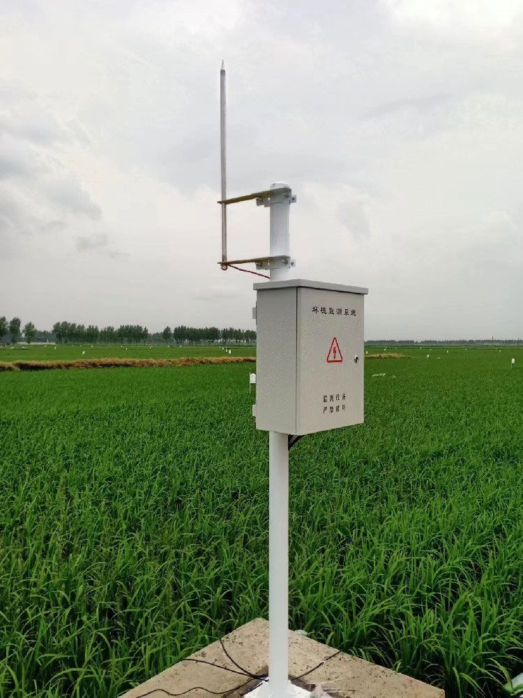
For a managed paddy, the useful question may be how much water stands above the field surface, how far the water level has fallen inside an observation tube, or whether the soil at a particular depth is drying. Specify that question first. A single channel called water condition leaves too much room for the installer and operator to interpret the same number differently.
The ICAR Indian Institute of Rice Research description of alternate wetting and drying identifies intermittent irrigation and the use of a field observation tube. The appropriate practice still depends on controlled water delivery and local agronomic advice. A sensor can support the observation, but it does not determine a universal drying limit for every soil, crop stage and water-supply arrangement.
| Quantity | Reference | Important limitation |
|---|---|---|
| Ponded depth | Water above the chosen field-surface elevation | Zero ponded depth does not establish how far water has fallen below the surface. |
| Water level in an observation tube | Level against a defined tube and field reference | The tube must exchange water appropriately with the surrounding soil. |
| Soil moisture | Water-content response in the probe's local sensing volume | It is neither a water-level reading nor a direct measurement of soil water tension. |
| Delivered irrigation | Measured flow or another suitable delivery check | A valve-open command alone does not prove water entered the block. |

A hydrostatic sensor responds to water pressure above its sensing point. If it is mounted at the field surface, it can observe ponded water while submerged; it cannot continue reporting a falling below-surface level after it is exposed to air. An observation-tube installation needs a suitable submerged sensing position and an explicit offset to the field reference.
Keep the pressure port clear of sediment and avoid a tube arrangement that fills or drains differently from the surrounding field. Compare the electronic reading with a visible manual level before automating notifications. Check again after sediment movement, tube cleaning or a change in mounting. A stable trace can be caused by a blocked path rather than stable field water conditions.
The NiuBoL NBL-WLS-1 provides a low-range water-level option. Confirm the ordered output and scaling; displayed resolution is not a statement of field accuracy.
The NBL-S-THR soil probe provides moisture and temperature at its installed depth. It can complement a water-level record where the project needs local soil observations, but it should not be relabeled as a tensiometer. A water-content percentage cannot be converted to tension without a suitable soil-specific relationship.
| Component | Selected capability | Rice-project use |
|---|---|---|
| NBL-WLS-1 | Level 0-1000 mm; resolution 0.1 mm; DC 12-24 V; selected RS485, 4-20 mA or voltage output | Submerged level measurement with a defined field-reference offset. |
| NBL-S-THR | Moisture 0-100%, specified accuracy +/-3%; temperature -50 to 100 C, +/-0.5 C; IP68 | Local soil record at a documented depth, with good electrode contact. |
| NBL-W-RS | Liquid rainfall; 0.2 mm per pulse | Compare local rainfall timing with field-level changes. |
| NBL-PH-1 logger | Local FLASH recording, configured 4G communication, RS485/RS232 and selected counter inputs | Acquire compatible channels and retain observations independently of the remote display. |
Place monitoring points in independently managed irrigation blocks and account for differences in field elevation, leakage and inlet position. One low corner may remain flooded after higher ground is exposed. A nearby weather station supplies useful rainfall and atmospheric context, but cannot replace the local water reference that governs a particular block.
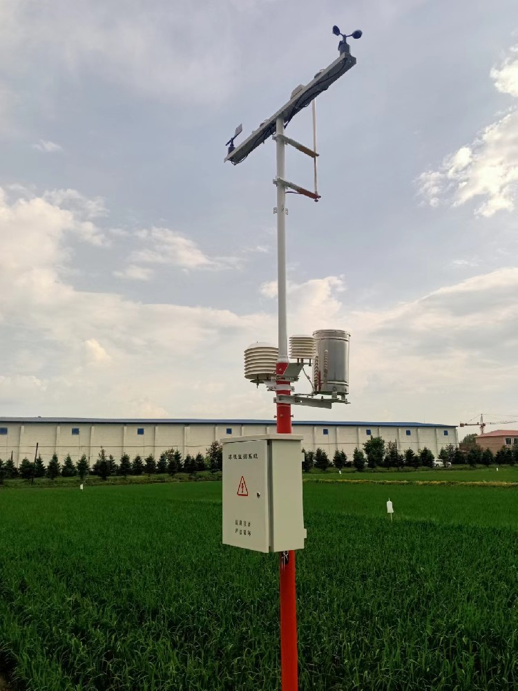
Record the observation before irrigation, the command or manual action, the actual delivery and the subsequent level response. If the level does not rise, check supply availability, gate operation and losses before changing the sensor threshold. If one point rises much earlier than the rest of the field, investigate the hydraulic distribution rather than treating it as a completed refill.
For an automated system, the irrigation designer must specify pump protection, permitted operating conditions, gate or valve control and manual override. Missing or suspect measurements need a defined response. An internet connection should not be the only way to stop an actuator or confirm that the block has received water.
The NBL-WLS-1 RS485 version uses Modbus RTU. Its documented example decodes a raw value of 180 as 18.0 mm after division by ten. Test the actual register map for the supplied version; do not apply that scaling to an analog output or a different level instrument. The specified communication interval is at least 1000 ms.
For pulse rainfall, verify counting and accumulation separately from digital level polling. Preserve acquisition time and units when records reach the PLC, RTU or remote platform. Test a communications outage and confirm how locally stored observations are retrieved. Do not assume a logger automatically supplies an app, irrigation advice or complete retransmission of all missed records.
A water-saving assessment needs measured or otherwise defensible irrigation volumes, rainfall, area and crop records for a suitable comparison. Sensor counts and dashboard screenshots do not establish reduced water use. Electricity consumption is also influenced by pumping head and efficiency, so it should not be treated as water volume without an appropriate measurement basis.
Provide NiuBoL with the field layout, irrigation method, observation-tube arrangement, maximum water depth, cable needs and receiving equipment. Identify whether the scope is observation, operator notification or actuator integration. This allows a specific quotation without inventing a gateway coverage area, transmission distance or guaranteed yield outcome.
Not after its sensing point is exposed to air. Below-surface observation needs an appropriate submerged position, a tube that responds to surrounding conditions and a defined offset to the field reference.
No. It observes local water-content response, while the tube provides a water-level reference. Select according to the irrigation method and retain the quantities separately when both are used.
Begin with independently controlled blocks and important elevation or hydraulic differences. Compare points through an irrigation cycle before extending coverage. A single fixed number per farm or gateway is not a defensible design rule.
Only if a separately specified method uses suitable observations, crop information and supply constraints. A level sensor reports a measurement; it does not contain a universal rice-irrigation schedule.
That depends on the supplied model and register scaling. For the NBL-WLS-1 example, divide 180 by ten to obtain 18.0 mm. Verify this at the final receiver rather than assuming the same scale for every channel.
Use a defined comparison with irrigation volume, rainfall, area and relevant crop records. Keep operational changes identifiable. A working sensor network alone does not demonstrate a particular percentage saving or unchanged yield.
IoT sensors for rice irrigation are useful when water-level and soil observations remain distinct and relate to real delivery. NiuBoL probes, rain gauges and loggers can support that record. Verify the reference, field response and complete irrigation cycle before relying on notifications or automated action.
Prev:Weather Stations for Coffee Plantations: Reference Weather or Canopy Data?
Next:Weather Stations for Smallholder Farmers: Own or Share a Station?
Related recommendations
Sensors & Weather Stations Catalog
 Agriculture Sensors and Weather Stations Catalog-NiuBoL.pdf
Weather Stations Catalog-NiuBoL.pdf
Agriculture Sensors Catalog-NiuBoL.pdf
Water Quality Sensor Catalog-NiuBoL.pdf
Related products
 Combined air temperature and relative humidity sensor
 TDR Soil Moisture & Temperature Sensor for irrigation| RS485 |4-20mA| NBL-S-THR
 Soil pH sensor RS485 soil Testing instrument soil ph meter for agriculture |NBL-S-PH
 Wind Speed sensor Output Modbus/RS485/Analog/0-5V/4-20mA
 Tipping bucket rain gauge for weather monitoring auto rainfall sensor RS485/Outdoor/stainless steel
 Pyranometer Solar Radiation Sensor 4-20mA/RS485


Screenshot, WhatsApp to identify the QR code
WhatsApp number:+8615367865107
(Click on WhatsApp to copy and add friends)

