





— Blogs —
—Products—
 Consumer hotline +8618073152920
WhatsApp:+8615367865107
Address:Room 102, District D, Houhu Industrial Park, Yuelu District, Changsha City, Hunan Province, China
Product knowledge
Time:2025-10-11 13:44:21 Popularity:1354
Forestry weather station data is useful only when the observation environment is defined. An open reference station, an under-canopy point and a catchment rainfall site answer different questions. Record location, exposure, height, method and changes to the surrounding stand before comparing their values. Weather observations can support ecological analysis and fire-danger assessment, but they do not by themselves detect ignition or quantify forest carbon storage.
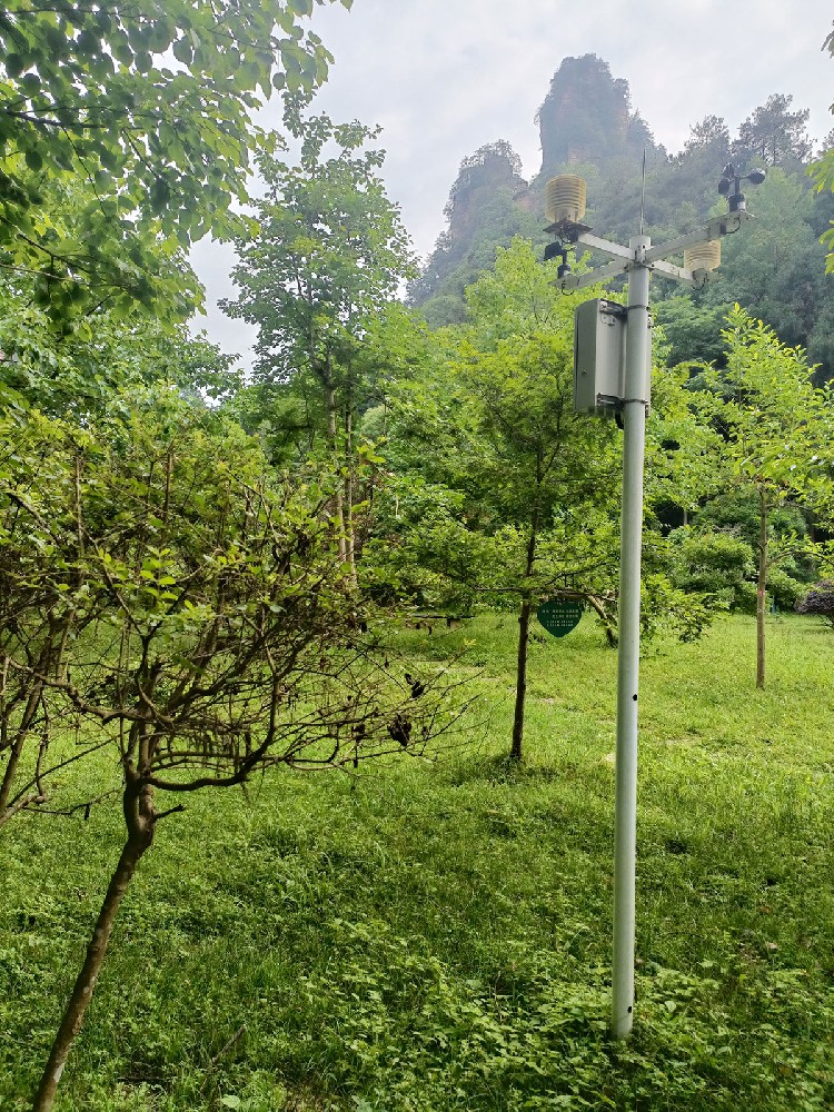
For a forest manager or research contractor, the initial task is to decide which comparison the project needs: conditions outside the stand, the environment experienced beneath the canopy, or differences between management areas. Calling every installation a smart forestry station does not resolve that choice. It can instead conceal why two correctly functioning instruments produce different readings.
An open reference site can describe regional weather context near a forest. An under-canopy station describes a particular stand environment affected by shade, shelter and vegetation. Neither is automatically wrong, but they are not interchangeable. A difference in humidity between these locations may be the subject of the study rather than evidence of calibration drift.
Keep a site record with coordinates, elevation, sensor heights, nearby obstructions and photographs of the exposure. Identify stand age or canopy condition where relevant to the study. If thinning or storm damage changes the surroundings, record the event date. A continuous electronic time series can contain a real exposure change even when no instrument has been replaced.
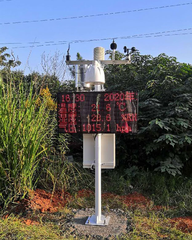
| NiuBoL component | Technical detail | Interpretation boundary |
|---|---|---|
| NBL-W-LBTH air temperature, humidity and pressure | Temperature accuracy +/-0.5 degrees C; humidity accuracy +/-5% RH | A sheltered stand observation is not automatically an open-site reference. |
| NBL-W-SS and NBL-W-DS wind instruments | Separate speed and direction channels; IP65 | Wind below canopy differs from exposed wind; document height and shelter. |
| NBL-W-RS tipping-bucket rain gauge | 0.2 mm resolution; operating temperature 0-50 degrees C | Liquid precipitation only; collection below canopy is not open rainfall. |
| NBL-PH-1 data logger | Configurable saving interval of 1-240 minutes | Saving interval is not a guarantee of upload speed or warning response. |
A shielded air measurement assembly needs suitable exposure even when its housing is protected. Solar heating, restricted ventilation and a nearby enclosure can affect readings. Where the purpose is canopy microclimate, specify that purpose explicitly rather than applying an open-weather-station interpretation to a shaded mounting point.
Weather data can contribute to a fire-danger method, but air temperature, humidity and wind alone do not establish that a fire has started. The US National Park Service explanation of fire danger describes the combined roles of weather, fuels and topography. A project using a danger rating needs the selected method and its required inputs, not a universal threshold invented for a dashboard.
Smoke, flame or camera-based detection belongs to a separate subsystem with its own coverage and verification requirements. The illustration below concerns that separate detection task; it does not show a standard weather measurement channel. Do not infer detection distance, alarm timing or automatic response capabilities from an illustration or from the presence of a communications gateway.
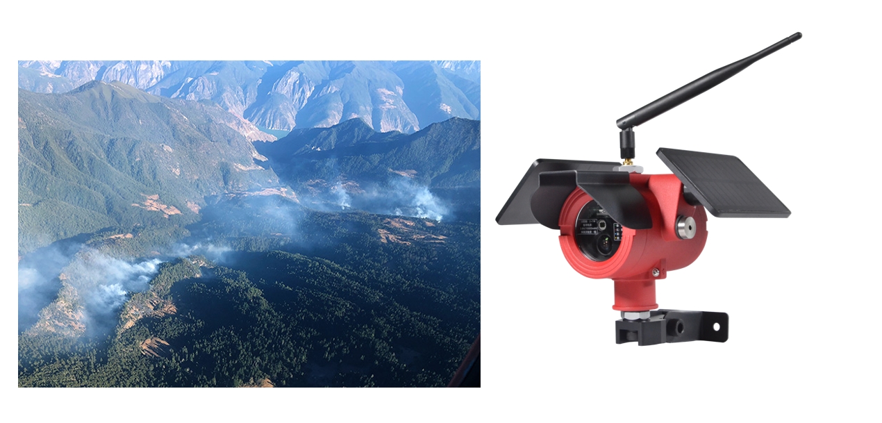
An open rain gauge records precipitation reaching its collection opening. A collector beneath trees records water reaching that position after canopy interception and redistribution. Branches can concentrate drips, so one collector beneath a canopy is not automatically representative of an entire stand. Define the sampling layout with the research team before buying additional gauges or comparing totals.
Soil moisture adds another boundary. It describes conditions around the installed sensing volume and depth, not water content throughout the catchment or the moisture of dead forest fuels. If the research concerns drought response, retain soil depth and site condition with the weather record. Do not relabel a soil moisture channel as fuel moisture to complete a fire-risk dashboard.
Remote forest sites may have intermittent mobile service. Specify local recording and test the delivered logger's recovery behavior rather than assuming every missed upload is automatically backfilled. Store observation time separately from receipt time and retain an explicit gap when data is unavailable. Zero rainfall or zero wind is a measurement, not a suitable placeholder for a failed channel.

For RS485 Modbus RTU instruments, check the selected output version, addresses, baud rate, register meanings and scaling. Protect field connections and assess grounding and surge protection for the actual installation. A logger supporting serial communications does not automatically supply a database interface, a fire-danger calculation or unlimited downstream connections. Agree those functions separately.
A solar supply must be sized for the measured station load, communication duty and seasonal exposure. Canopy growth or changing shade can reduce charging. Request a power budget for the proposed configuration rather than a blanket assurance of operation through any cloudy period. If the site cannot support the required energy supply, adjust its location or operating design before deployment.
Plan access for clearing gauge debris, checking moving wind components, inspecting cable protection and comparing suspect channels. Retain maintenance dates without deleting the measurements that prompted a visit. An as-found observation can explain a suspect interval; replacing all unusual readings with smooth estimates destroys that evidence and can mislead a long-term study.
When requesting a quotation, provide the research comparison, site layout, observation heights, required channels, recording interval and available communications. Include the expected access constraints and any separate fire-detection scope. This lets NiuBoL distinguish the weather instrumentation from power, mounting, telemetry and specialist analysis instead of bundling undefined functions into one station label.
Choose according to the variable being studied. An open reference site describes different exposure from an under-canopy point. Where the project compares those environments, maintain separate records rather than treating either location as representative of both.
Not reliably without a sampling design supporting that interpretation. Canopy interception and concentrated dripping vary spatially. Distinguish open precipitation from throughfall and specify how multiple observations will be combined.
No. Weather channels support assessment of conditions. Detecting smoke or flame requires a separate system and an appropriate verification procedure; a weather threshold does not confirm ignition.
That depends on the site's seasonal light and the station load. Assess shade and calculate the energy budget, including communications, before choosing a panel and battery. A panel fitted to the mast is not proof of sufficient charging.
The difference may be meaningful, but the records describe different exposures. Keep height, shelter and processing method with both series. Do not interpret the difference as instrument error without checking those conditions.
Record instrument replacements, calibration work, mounting changes, clearing or thinning, nearby construction and relevant storm damage. These events can alter comparability even if timestamps remain continuous.
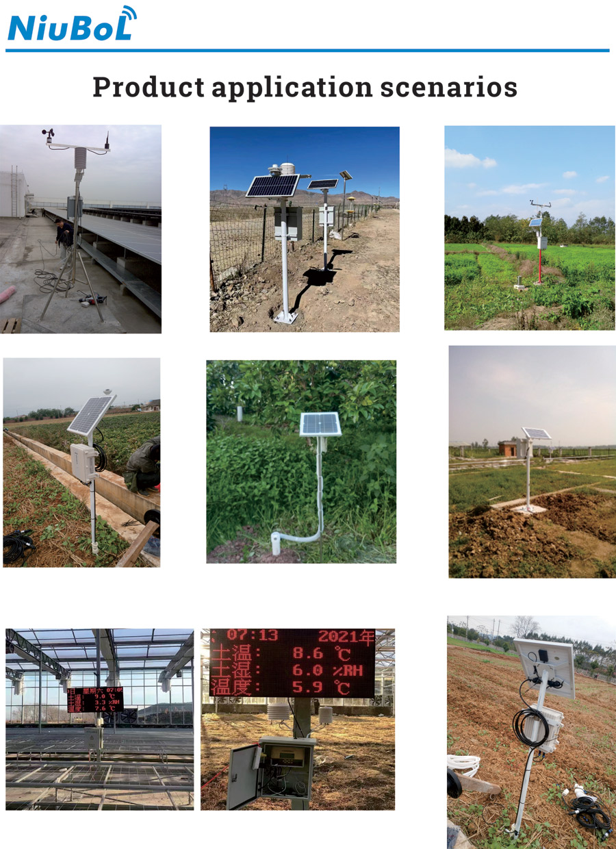
Forestry weather station data should retain the environment and method behind every value. Separate reference weather, canopy conditions, water pathways and fire-detection tasks, then choose the instruments and recording architecture for the intended comparison. This produces records that forest managers and researchers can interpret without assigning unsupported meaning to a station's output.
Prev:Disadvantages of Solar Insect Traps: When the Method Does Not Fit
Next:Multi-Crop Monitoring Systems: Keep Crop, Plot and Sensor Data Distinct
Related recommendations
Sensors & Weather Stations Catalog
 Agriculture Sensors and Weather Stations Catalog-NiuBoL.pdf
Weather Stations Catalog-NiuBoL.pdf
Agriculture Sensors Catalog-NiuBoL.pdf
Water Quality Sensor Catalog-NiuBoL.pdf
Related products
 Combined air temperature and relative humidity sensor
 TDR Soil Moisture & Temperature Sensor for irrigation| RS485 |4-20mA| NBL-S-THR
 Soil pH sensor RS485 soil Testing instrument soil ph meter for agriculture |NBL-S-PH
 Wind Speed sensor Output Modbus/RS485/Analog/0-5V/4-20mA
 Tipping bucket rain gauge for weather monitoring auto rainfall sensor RS485/Outdoor/stainless steel
 Pyranometer Solar Radiation Sensor 4-20mA/RS485


Screenshot, WhatsApp to identify the QR code
WhatsApp number:+8615367865107
(Click on WhatsApp to copy and add friends)

