





— Blogs —
—Products—
 Consumer hotline +8618073152920
WhatsApp:+8615367865107
Address:Room 102, District D, Houhu Industrial Park, Yuelu District, Changsha City, Hunan Province, China
Product knowledge
Time:2025-09-29 16:49:49 Popularity:1159
Quick Answer: Portable weather stations for research are temporary observation systems that must remain stable and consistently exposed during measurement. Choose channels and logging behavior for the research question, then document location, mounting, timing and maintenance. Portability does not make measurements from different locations directly comparable, and an ordinary station is not automatically a turbulence or carbon-flux system.

A crop trial, catchment survey and short construction study do not need identical weather channels. For a crop trial, local temperature, humidity, rainfall and radiation may help interpret treatment responses. A catchment study may emphasize rainfall timing and spatial coverage. A temporary engineering survey may require local wind observations with a precisely described exposure.
Start with the variable the study will analyze, its required temporal resolution and the area it is intended to represent. Then decide whether the station will remain in one place for the campaign or move between survey locations. A fixed temporary station can describe changes through time at its site. Sequential visits to different sites mix time differences with location differences.
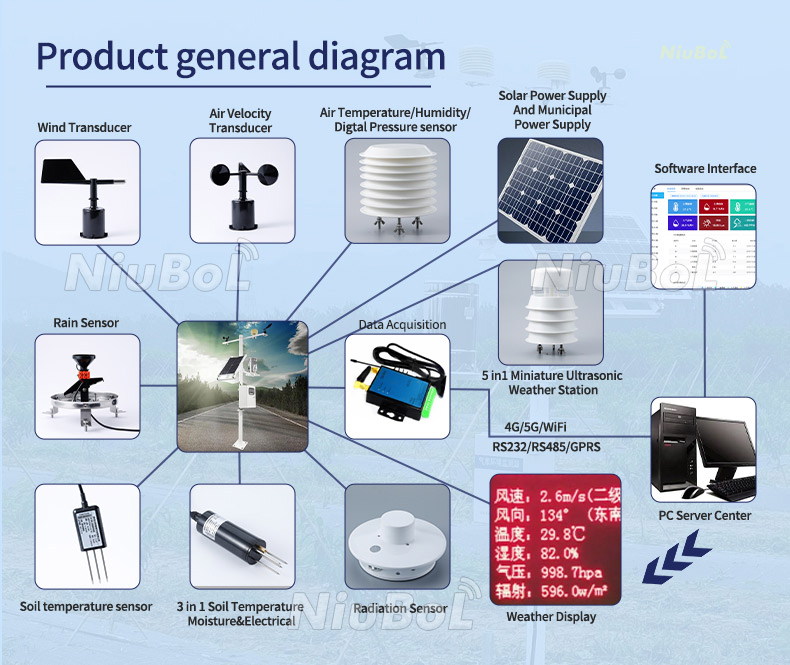
The original monitoring screen above illustrates the data-viewing function; it does not mean every displayed channel belongs in each portable package. Specify only the channels the study can use and maintain. Extra channels increase power, installation and checking tasks without necessarily improving the experiment.
A portable tripod system is normally deployed and left stationary while recording. A handheld instrument is useful for spot surveys but has a different exposure and operating procedure. Operator body heat, shade and movement can affect a spot reading. A wind value measured while the operator or vehicle is moving also includes motion relative to the air.
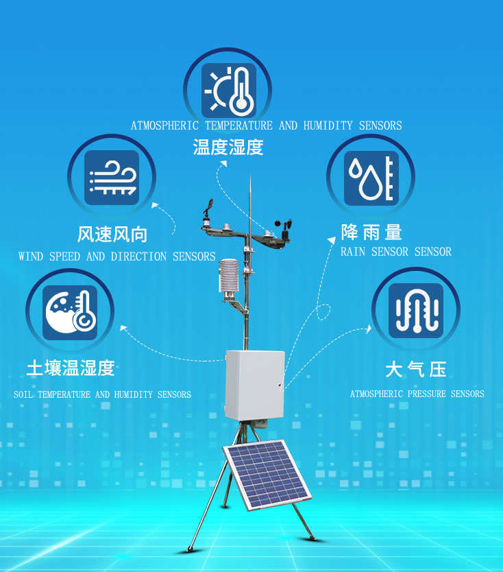
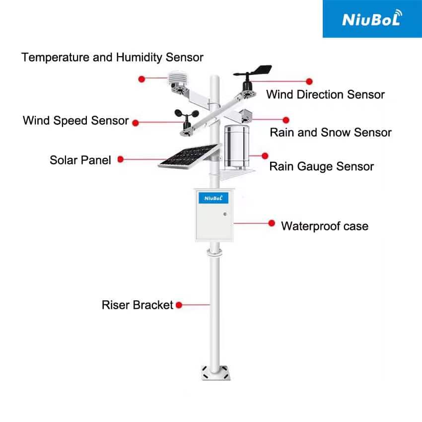
NiuBoL weather station configurations can combine separate instruments with a data logger. The equipment schedule should identify the exact sensor version, not apply one accuracy or operating limit to the whole station. The most restrictive component can determine whether a planned deployment is suitable.
| Observation | Configuration example | Research limitation to address |
|---|---|---|
| Air temperature and humidity | NBL-W-LBTH: -40 to +80 degrees C, +/-0.5 degrees C; 0-100% RH, +/-5% RH | Use appropriate radiation shielding and exposure; sensing range does not remove solar-heating bias. |
| Air pressure | NBL-W-LBTH: 10-1200 hPa, +/-1.5 hPa; 0.1 hPa resolution | Distinguish local pressure from any calculated sea-level value. |
| Wind speed and direction | NBL-W-SS and NBL-W-DS options; IP65 | Define mounting height, nearby obstructions and direction reference; do not assign a generic station-wide accuracy. |
| Solar radiation | NBL-W-HPRS thermopile option: 0-2000 W/m2; 99% response within 35 s | Match the integration period to sensor response; it is not a fast turbulence channel. |
| Rainfall | A selected tipping-bucket gauge and compatible counter input | Keep the collector level and specify the actual tip resolution, exposure and accumulation rules. |
| LBTH supply and signal | 12-24 V DC; RS485 or ordered 4-20 mA version | Confirm the delivered interface and register exchange rather than assuming all versions use the same wiring. |
| Cabinet, cable and energy | Specified for the chosen logger and deployment | Define jacket material, connectors, cable lengths, consumption and enclosure rating separately. |
The LBTH operating temperature is -40 to +80 degrees C. That does not establish the battery, display, modem or radiation sensor operating range. Likewise, an IP65 wind sensor does not make an open connector or indoor logger suitable for rain exposure. Review the assembled system, including its field joints.
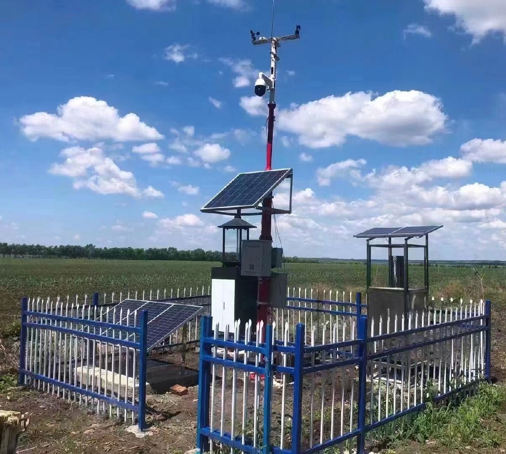
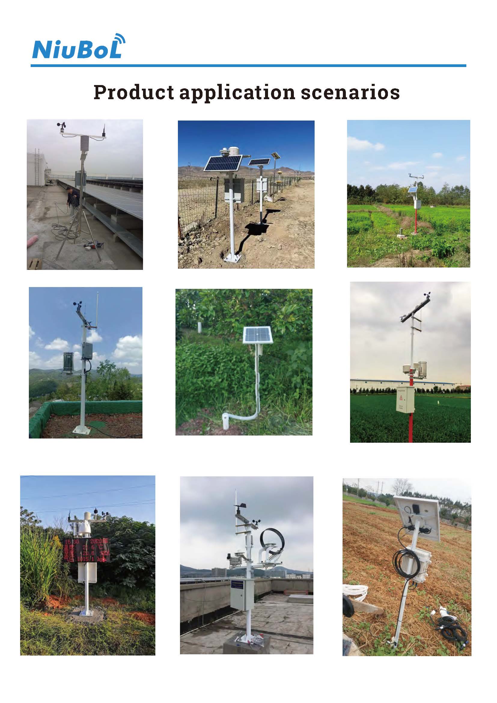
Before the campaign, prepare a site record containing coordinates, ground conditions, instrument heights, orientation and photographs of nearby obstructions. Describe whether the intended observation is an open-site reference, a crop-canopy condition or a local microclimate. These are different measurement purposes; an open-site installation rule should not be imposed blindly on a canopy experiment.
Secure the mount against the conditions expected during the deployment. Check ground bearing, anchoring, cable strain and access for maintenance. Tripod portability is not a wind-load rating. A lightweight mast may move, tilt a radiation sensor or disturb a rain gauge before it visibly fails.
Keep the solar panel and enclosure from shading or obstructing the instruments. Position the temperature and humidity element so that its shielding and airflow remain appropriate throughout the day. For a radiation channel, inspect the actual horizon and potential shadows rather than evaluating the point only at installation time.
When a station is moved, record when measurement stopped and when valid observation resumed. A new location creates a new exposure, even if the hardware is unchanged. If two sites need comparison, simultaneous observations are preferable to treating a morning reading at one site and an afternoon reading at another as a spatial difference.
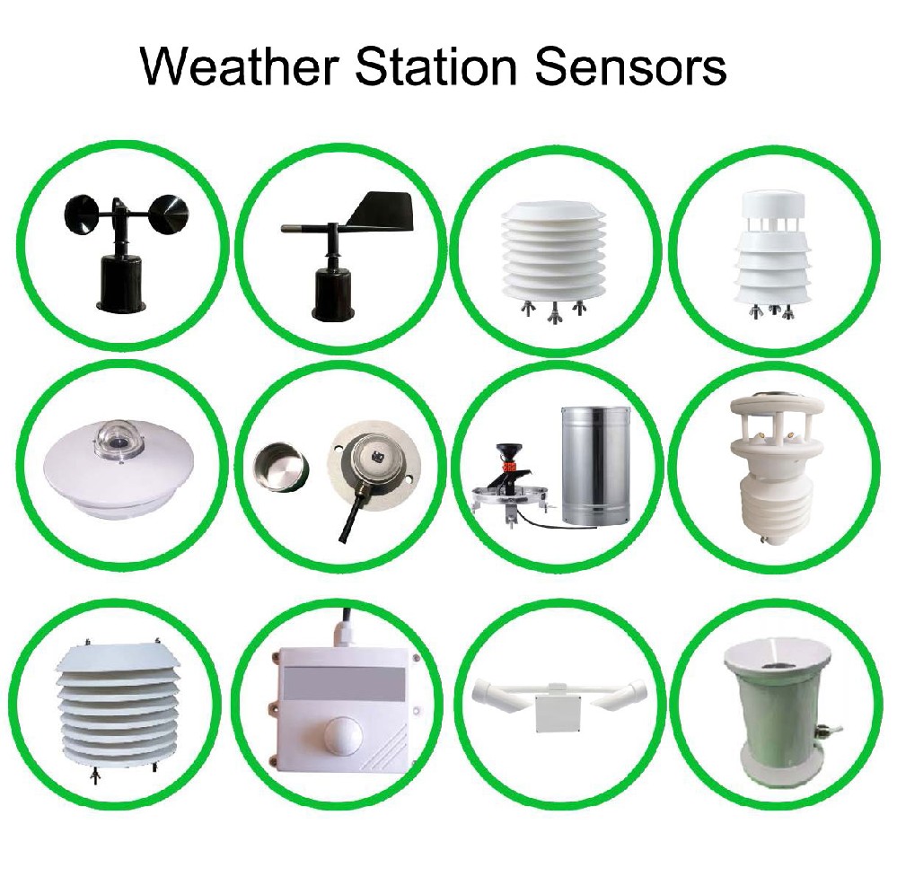
A logger can request a value more often than the sensing element can respond independently. Repeating a slowly changing radiation value every second does not create a one-second-response pyranometer. Specify sampling, averaging, extrema and storage intervals separately, and retain the definitions in the dataset.
For wind research, distinguish an instantaneous reported value from a defined average or gust statistic. Direction near calm conditions also needs careful interpretation. A general weather station should not be presented as an eddy-covariance system: that application requires suitable fast-response instruments, synchronized acquisition and specialized processing.
Check the logger clock against the study time reference before and after deployment. Network synchronization, if implemented, can help maintain clock time but does not establish channel phase synchronization or eliminate sensor delay. Record the time zone and any clock correction. Avoid silently shifting earlier measurements when a clock is corrected later.
For rainfall, identify whether the stored channel is a tip count, interval depth or running total. If a cumulative register resets during a power interruption, differencing it without a reset rule can produce false rainfall. Include a controlled pulse or equivalent input test appropriate to the selected gauge and counter, without claiming that it calibrates the complete rainfall catch.
RS485 Modbus RTU, analog inputs and pulse inputs each need appropriate acquisition handling. Establish addresses and serial settings for digital instruments, input scaling for analog versions, and pulse characteristics for a rain gauge. A logger or gateway then provides the selected remote connection; field-bus compatibility does not establish mobile coverage.
Make a short test recording and export the actual file researchers will use. Check headers, units, timestamps, missing-value treatment and sensor identifiers. If the station supports local storage and remote upload, interrupt the network under controlled conditions and inspect the recovered observations. A chart that connects across a gap is not proof that the missing period was recorded.
Power testing should include startup and transmission, not only a quiet operating value. Define the load and anticipated solar conditions for the campaign. Battery-only operation may suit a short survey, while longer deployment may need a properly sized charging arrangement. Do not promise weeks of autonomy without the complete load, battery and temperature assumptions.
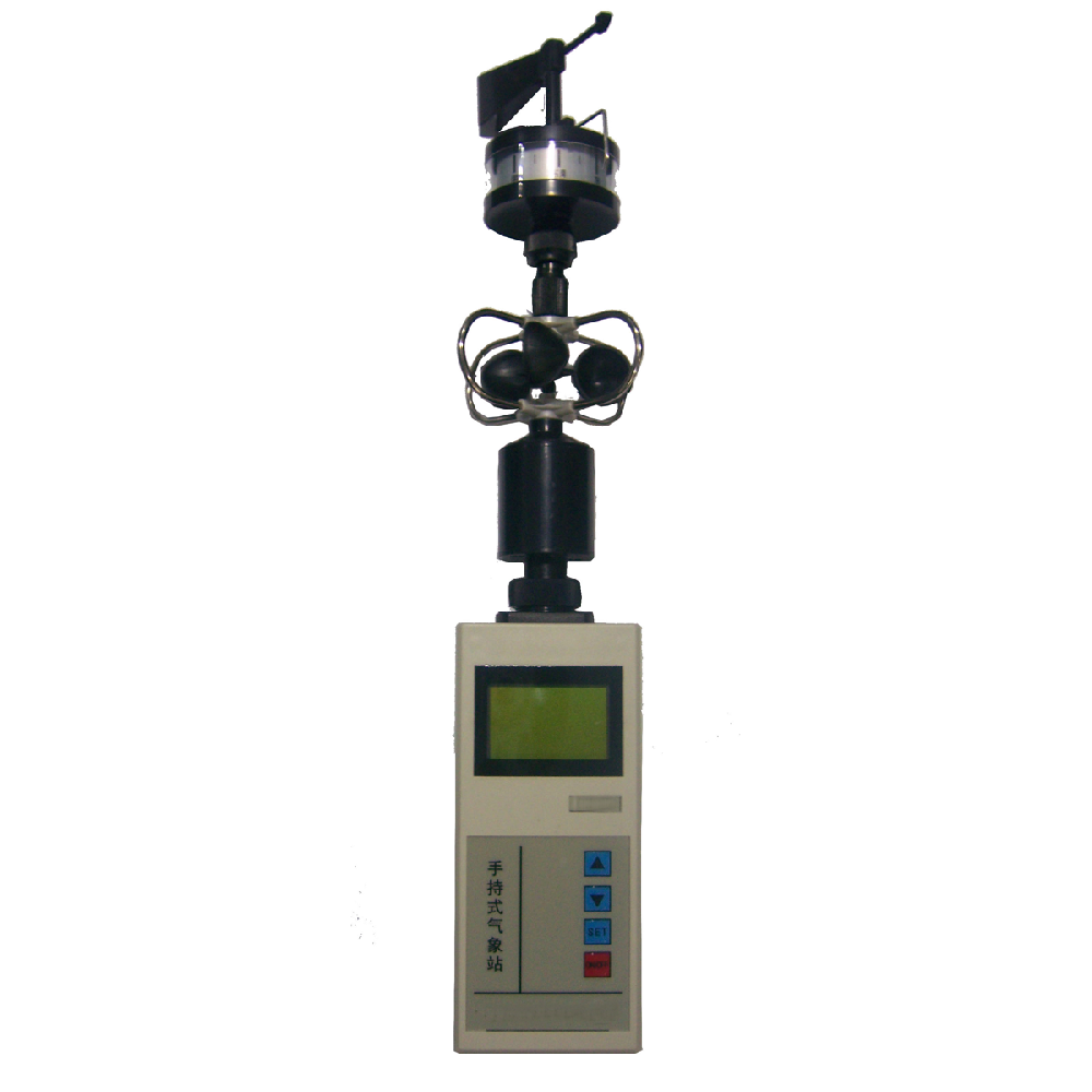
The handheld instrument shown above represents a separate spot-measurement approach, not a substitute for the temporary station's mounting and logging procedure. When spot checks are used alongside a station, match the location, stabilization period and observation time. Otherwise, differences can reflect the procedure rather than drift.
Review data for impossible values, repeated stale readings and changes coinciding with maintenance or relocation. Do not automatically delete an extreme simply because it is unusual. Investigate whether neighboring channels and the field record support it. Keep original observations and identify any edited or excluded values in the analysis workflow.
Before reusing equipment in another campaign, check connectors, mounting geometry, level, direction reference and channel configuration. A successful communications test from the previous project does not establish that the new deployment has the same channel assignments or averaging definitions.
Send NiuBoL the research variables, deployment duration, location, mounting approach, required intervals and intended data format. State whether simultaneous sites, local storage, a display or remote access are necessary. Describe the receiving software and required channel definitions so that acquisition can be evaluated before equipment is selected.
For comparable quotations, separate instruments, mount, logger, communication, energy supply and field installation. Ask which items are included and which measurements need a calibration record for the project. A lower price obtained by omitting radiation measurement or local storage is not a like-for-like alternative if the study depends on those functions.
Yes, for a planned survey with location and time recorded. However, sequential readings do not isolate spatial variation from changing weather. Use simultaneous points when that distinction is important to the analysis.
No. Sensor response, synchronized acquisition and processing must support the research method. A conventional radiation or weather channel cannot become a fast-response flux instrument through a shorter storage interval.
Only the study can define that. List the variables required by the analysis, then select instruments with suitable ranges, exposure and maintenance requirements. Do not select a larger channel count as a substitute for a measurement plan.
A suitable calculation needs the required weather inputs, exposure assumptions and method. Purchasing a temperature and humidity channel alone does not provide a complete radiation-based reference evapotranspiration dataset.
Define the complete operating load, battery basis, allowable discharge and environmental assumptions. Test representative operation and recovery. A panel rating or battery capacity without those conditions is not an autonomy result.
Inspect mounting and exposure, compare live channel values, export a sample dataset and verify time, units and outage behavior. A connected dashboard alone is insufficient for a research deployment.
Portable research stations are valuable when their measurements can be interpreted after the equipment has left the site. Specify the observation purpose, keep the mount and exposure reproducible, and test the actual data export. Treat relocation, timing and maintenance as part of the dataset rather than assuming that portability guarantees comparability.
Prev:Agricultural IoT Solutions in Latin America: Design for Local Operation
Next:Automated Weather Stations for Early Warning: Validate the Observation Feed
Related recommendations
Sensors & Weather Stations Catalog
 Agriculture Sensors and Weather Stations Catalog-NiuBoL.pdf
Weather Stations Catalog-NiuBoL.pdf
Agriculture Sensors Catalog-NiuBoL.pdf
Water Quality Sensor Catalog-NiuBoL.pdf
Related products
 Combined air temperature and relative humidity sensor
 TDR Soil Moisture & Temperature Sensor for irrigation| RS485 |4-20mA| NBL-S-THR
 Soil pH sensor RS485 soil Testing instrument soil ph meter for agriculture |NBL-S-PH
 Wind Speed sensor Output Modbus/RS485/Analog/0-5V/4-20mA
 Tipping bucket rain gauge for weather monitoring auto rainfall sensor RS485/Outdoor/stainless steel
 Pyranometer Solar Radiation Sensor 4-20mA/RS485


Screenshot, WhatsApp to identify the QR code
WhatsApp number:+8615367865107
(Click on WhatsApp to copy and add friends)

