





— Blogs —
—Products—
 Consumer hotline +8618073152920
WhatsApp:+8615367865107
Address:Room 102, District D, Houhu Industrial Park, Yuelu District, Changsha City, Hunan Province, China
Product knowledge
Time:2024-04-13 21:35:50 Popularity:1973
Quick Answer: Rain gauges for livestock and rangeland provide local precipitation records for pasture, water and drought management. They do not directly measure forage growth, reservoir volume or flood risk. Use rainfall alongside field inspections, soil conditions, water storage and demand, and treat missing observations differently from a verified dry period.
| Decision | Rainfall contribution | Additional information |
|---|---|---|
| Pasture planning | Event totals and seasonal comparison | Forage condition, soil moisture, stocking rate and grazing history |
| Drought response | Documents rainfall deficit at the monitored point | Water storage, feed availability and regional forecasts |
| Water supply planning | Input to catchment and runoff assessment | Catchment area, losses, storage level and demand |
| Storm review | Time and amount of local rainfall | Terrain, drainage, stream level and field observations |
Install the gauge in a representative open location, away from splash, buildings and severe airflow disturbance. Terrain and convective storms can make rainfall vary over short distances, so a single gauge may not represent a large ranch. Select the number of sites from management zones and rainfall variability rather than property area alone.
A gauge near the ranch office may be convenient to service but poorly represent a distant grazing block. Hills, exposure and localized storms can produce different rain at separate management units. Select sites that answer the management question, then assess whether the records can reasonably be grouped. More instruments are useful only when their locations add relevant information.
Protect the installation from livestock contact without obstructing the collector or changing airflow unnecessarily. Keep trough overflow, irrigation spray and vehicle splash away from the point. Check vegetation as the season progresses; a clear location at installation may become obstructed as grass or nearby crops grow.
A wind-exposed site can undercatch rain, while shelter placed too close can create its own error. Keep the siting record and review unusual differences between points before assigning them to drought or soil variation. A rainfall map made from poorly exposed gauges can create false confidence in the spatial pattern.
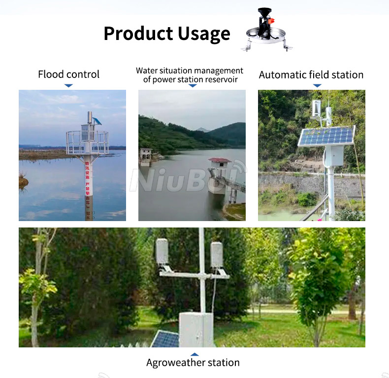
A tipping-bucket gauge can provide pulse or transmitter output to a data logger. For remote rangeland sites, the system may include solar power, local storage and a cellular or radio gateway. Confirm the ordered signal and logger scaling. RS485 is the local sensor interface; remote transmission needs a compatible logger or gateway.
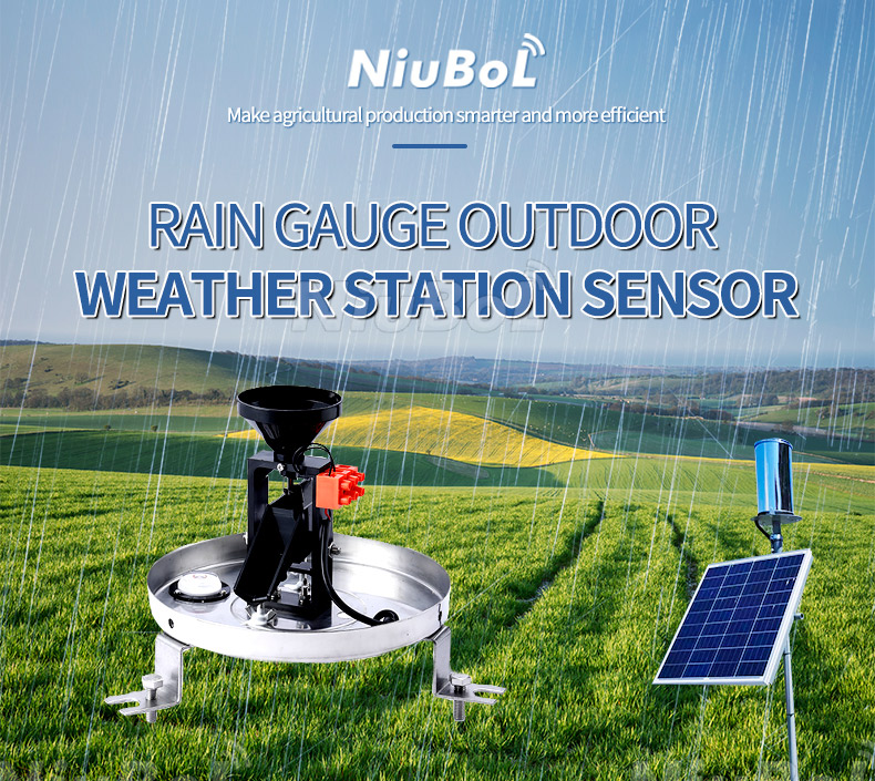
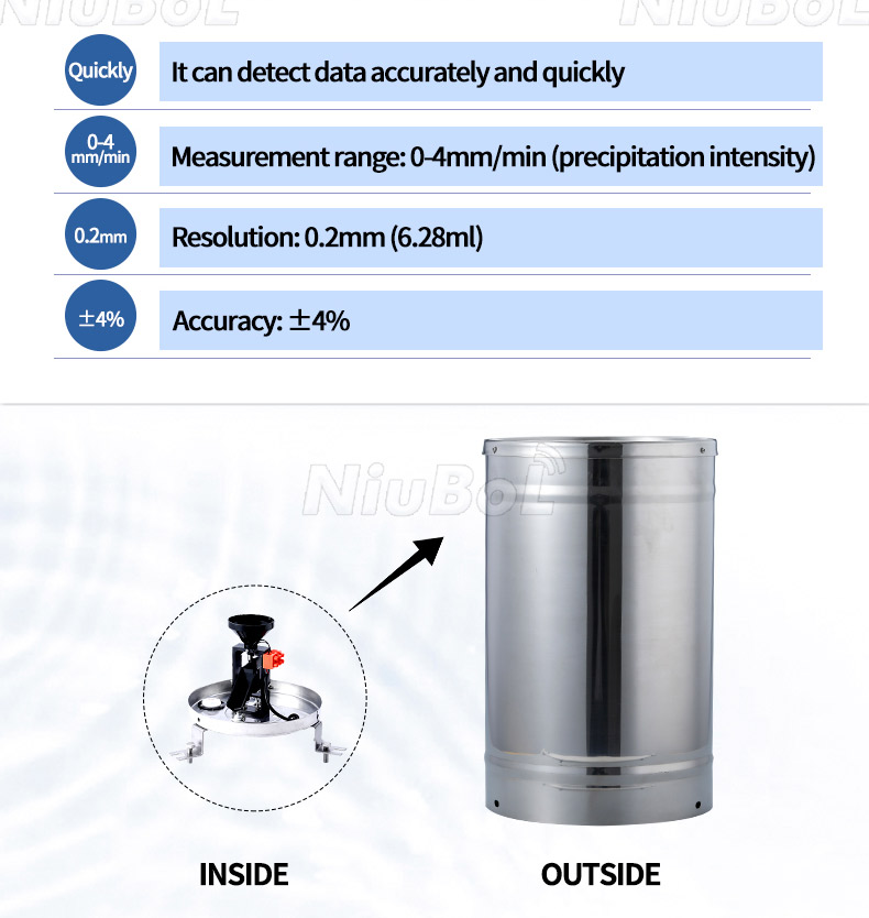
The NBL-W-RS 0.2 mm tipping-bucket option provides a concrete example for a ranch monitoring point. A mechanical reed-switch output and a powered transmitter version are different electrical arrangements. Specify the ordered interface, then ensure the logger counts or reads it correctly.
| NBL-W-RS 0.2 mm option | Characteristic | Meaning for a ranch site |
|---|---|---|
| Collector | 200 +/-0.6 mm diameter | Maintain a clear, undamaged opening and stable level. |
| Tip resolution | 0.2 mm, approximately 6.28 mL per tip | Set the counter scale for this actual version, not another bucket resolution. |
| Intensity range | 0-4 mm/min | Do not confuse an intensity range with maximum accumulated rainfall. |
| Accuracy condition | +/-4% in the stated indoor static test at 2 mm/min | This is not a guarantee of identical field catch under all wind and rainfall conditions. |
| Temperature | Operating 0-50 degrees C; storage -40 to +80 degrees C | Storage temperature does not establish snowfall measurement capability. |
| Outputs and supply | Reed-switch or ordered transmitter output; 5 V or 12-24 V DC powered options | Match the exact variant; confirm RS485 Modbus RTU exchange for the ordered digital version. |
| Cable and field protection | Standard cable 5 m; jacket, extensions, power demand and protection details to be specified | Protect field entries and choose cabling for animals, sunlight and service access. |
Rainfall helps explain a change in pasture conditions; it does not directly quantify available feed. A dry soil profile may absorb an event without a rapid response in forage, and species, temperature and grazing pressure affect subsequent growth. Compare rain with soil moisture and the actual pasture assessment before changing stocking or rotation.
For an illustrative count, 75 valid tips from a 0.2 mm gauge correspond to 15 mm of collected rainfall. If the logger is mistakenly configured for 0.5 mm per tip, it reports 37.5 mm from the same count. Checking the scale is therefore important before using a seasonal total in a drought review.
Event timing can matter as much as the total. A daily amount hides whether rain arrived gradually or in a short burst. Keep sufficient event information for the intended runoff or field-access review. A count accumulated over a long interval does not establish the peak rainfall intensity within that interval.
Rain depth multiplied by catchment area gives a gross rainfall volume, not the volume entering a pond. For example, 10 mm over one hectare equals 100 m3 of rainfall on that area before interception, infiltration, evaporation and routing losses. It does not establish 100 m3 of usable stored water.
Water planning also needs the catchment response, storage level, evaporation and livestock demand. If water shortage is the operating concern, a suitable water-level observation can complement the gauge. Do not use rainfall alone as proof that a trough, bore or reservoir can meet demand.
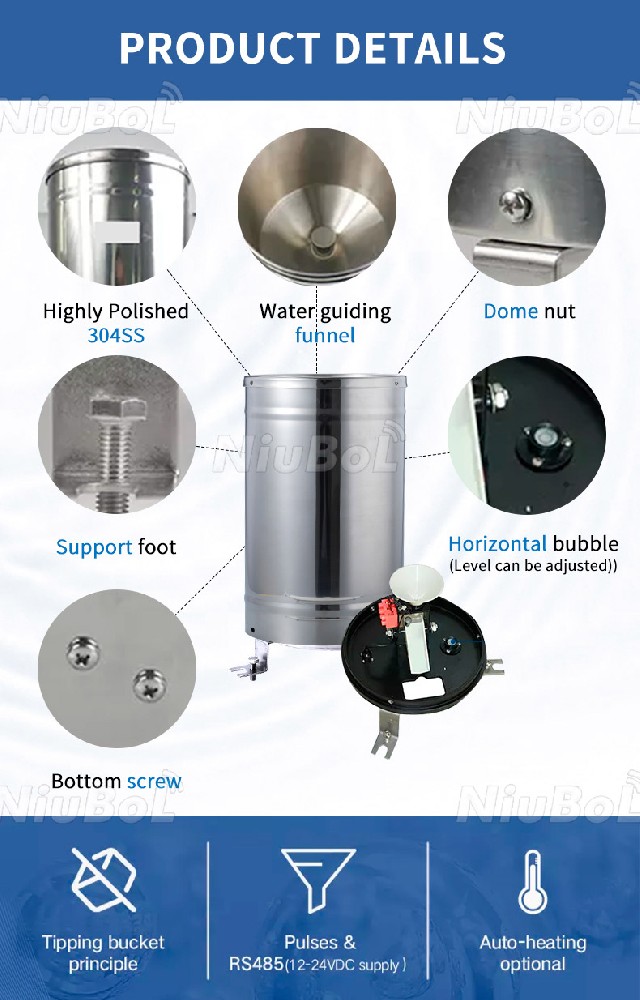
Inspect the collector, filter, bucket, drain, level and mounting. Leaves, insects and dust can cause low readings; vibration or incorrect scaling can create false tips. During commissioning, use a controlled test to confirm pulse count, units, timestamps, local storage and data upload.
For procurement, state the number of stations, rainfall resolution, output, cable length, power autonomy, communication coverage, mounting, lightning protection, documentation and commissioning responsibility. This separates the rain gauge price from the cost of a complete remote station.
A remote station reporting zero rain may be working correctly, but the same result can arise from a blocked funnel, stopped counter or loss of acquisition. Inspect the gauge and review station availability before declaring a prolonged dry period. A frozen last value on a platform is not a current observation.
Use a controlled-water test appropriate to the gauge when checking its mechanical response. Pouring an arbitrary volume rapidly can overflow or exceed the test conditions and does not establish calibration. An electrical pulse simulation checks the logger's counter and data path, not the collector or tipping mechanism.
After cleaning or changing the counter configuration, record the work and verify the next observations. Avoid silently mixing records from different tip resolutions. If a logger total resets, retain that event so later cumulative calculations do not create negative rainfall or discard a genuine event.
Use the same accumulation period and a defensible reference when describing a deficit. A partial current month should not be compared casually with a complete historical month. Also identify gaps in the record: a period of unknown rainfall should not become zero rainfall in a seasonal calculation.
If the gauge has moved, inspect whether the new exposure changes comparability. A new point beside a different paddock may improve the current management decision while breaking continuity with the old series. Keep both location histories rather than presenting the joined values as an unchanged climate record.
When two sites disagree after a localized storm, inspect both before choosing the larger or smaller total as correct. Check collector blockage, level and acquisition, then consider the actual spatial variability. The purpose is to obtain a defensible local record, not force every gauge to match a distant station.
A useful ranch report can group rainfall by the grazing or water-management unit while retaining each instrument's own record. State which point represents each area and identify periods with missing coverage. This lets the manager distinguish an observed dry condition from an unavailable measurement before deciding on feed, grazing access or water checks.
For a remote station, check whether records are stored locally during an outage and recovered afterward. An installation with no network coverage needs a workable retrieval plan, not an assumption that RS485 provides a cellular connection. Assess power using the logger, modem and accessories as well as the gauge.
Ask NiuBoL for a gauge-only quotation when the existing acquisition system can handle the selected output. For a new rangeland point, identify the required logger, energy supply, mounting and receiving system separately. Provide the climate, site access, desired event record and whether frost or snow must be measured.
No. Growth also depends on soil water, species, temperature, grazing pressure and management. Use rainfall to interpret field observations and soil conditions rather than applying one rain-to-forage conversion to every paddock.
There is no justified universal gauge-per-hectare rule. Start with distinct management areas, terrain and rainfall variability, then assess whether additional points change a real decision. Serviceability and data recovery matter as much as nominal coverage.
A standard unheated tipping-bucket gauge is not a complete snowfall solution. Freezing can interrupt collection and delay meltwater. Specify the precipitation measurement needed under freezing conditions and select an appropriate arrangement.
Choose the interval from the intended decision. Daily totals may support a seasonal review, while event and runoff analysis need finer timing. Keep the underlying event information when later intensity calculations may be required.
No. Combine the rain value with acquisition status and maintenance information. Check the collector and counting path if the result conflicts with field observations or nearby points.
The gauge version, acquisition, communication, power, mounting and site work determine the assembly. A sensor price alone does not include remote access or autonomous operation; request those functions explicitly when comparing offers.
Rain gauges support livestock management when the location represents the decision area and the data is combined with pasture, soil and water records.
For livestock projects, the strongest rainfall record is one whose location, availability and counter scale are known. Combine it with pasture and water observations, preserve event timing where useful, and investigate missing coverage before interpreting a dry spell.

Related recommendations
Sensors & Weather Stations Catalog
 Agriculture Sensors and Weather Stations Catalog-NiuBoL.pdf
Weather Stations Catalog-NiuBoL.pdf
Agriculture Sensors Catalog-NiuBoL.pdf
Water Quality Sensor Catalog-NiuBoL.pdf
Related products
 Combined air temperature and relative humidity sensor
 TDR Soil Moisture & Temperature Sensor for irrigation| RS485 |4-20mA| NBL-S-THR
 Soil pH sensor RS485 soil Testing instrument soil ph meter for agriculture |NBL-S-PH
 Wind Speed sensor Output Modbus/RS485/Analog/0-5V/4-20mA
 Tipping bucket rain gauge for weather monitoring auto rainfall sensor RS485/Outdoor/stainless steel
 Pyranometer Solar Radiation Sensor 4-20mA/RS485


Screenshot, WhatsApp to identify the QR code
WhatsApp number:+8615367865107
(Click on WhatsApp to copy and add friends)

