

— Blogs —
—Products—
 Consumer hotline +8618073152920
WhatsApp:+8615367865107
Address:Room 102, District D, Houhu Industrial Park, Yuelu District, Changsha City, Hunan Province, China
Product knowledge
Time:2026-03-13 15:53:44 Popularity:567
Quick Answer: A scenic area weather station should measure conditions relevant to a defined part of the site and deliver clearly identified observations to operators. Separate weather monitoring, optional environmental measurements and public displays. A station in a sheltered valley cannot represent every exposed viewpoint, and a local rain gauge alone cannot establish the safety of a whole catchment.
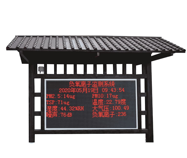
A tourist destination may contain open ridges, wooded paths, buildings, water features and enclosed valleys. Each can have a different monitoring purpose. An exposed wind point can inform the operator of a viewing platform, while a shaded path point may describe the local temperature and humidity experienced by visitors.
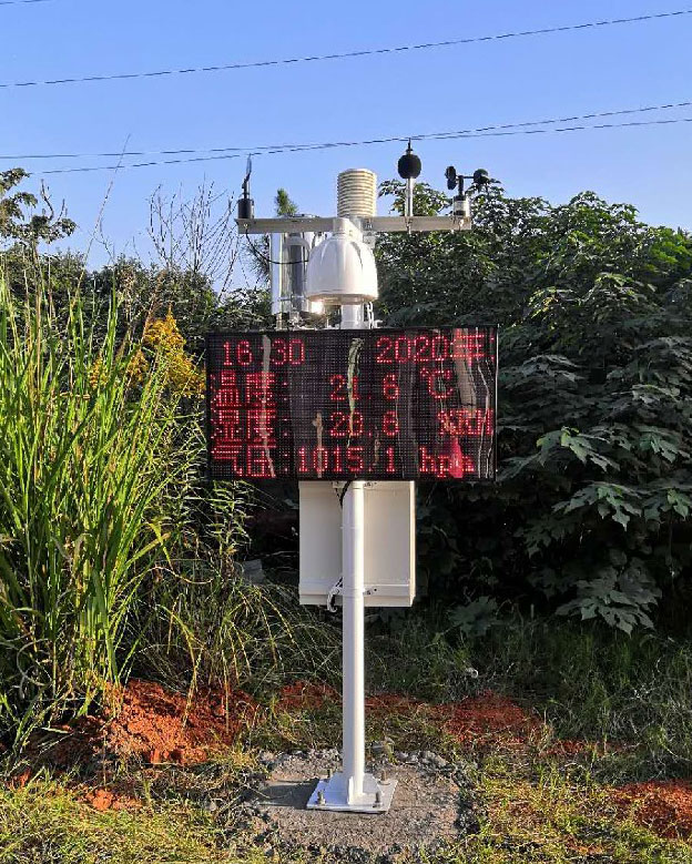
Tourist site weather monitoring is therefore a placement and interpretation problem before it is a sensor-count problem. State the location and operational use of each point. A single prominent public display is not necessarily the right physical position for all the instruments feeding it.
NiuBoL modular stations can combine selected weather and environmental channels with a data logger and a display or remote application. The project should identify which quantities are included, where they are measured and which equipment receives them. Do not use scenic area weather station and negative ion monitoring system as interchangeable names for every configuration.
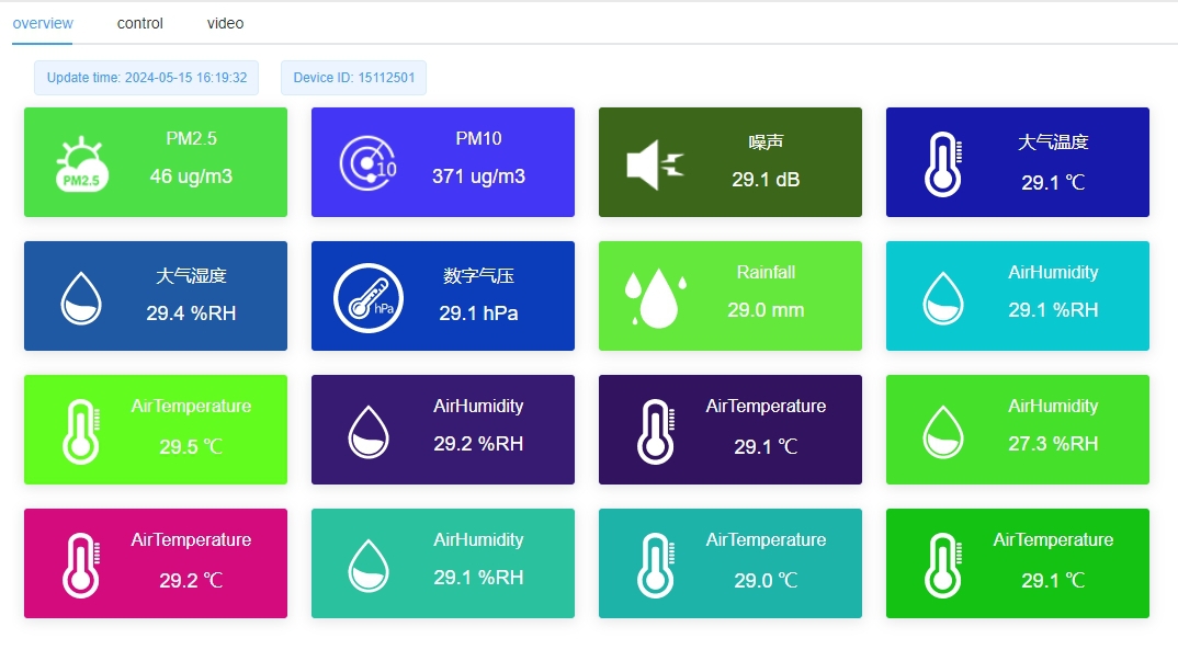
Visitors and staff need a measurement name, unit, location and recent update time. Temperature from a sheltered woodland point should not be presented as a sun-exposed surface temperature. Rainfall needs a stated interval, and wind needs an agreed current or averaged descriptor rather than an unexplained number.
Keep channel labels separate during commissioning. Change one input in a controlled test and confirm which display field responds. This detects copied labels and crossed point mappings that can survive a general check because every tile contains a plausible number.
Define what the screen shows when data becomes old or unavailable. A communication outage must not leave yesterday's calm wind appearing current. A fallback message, visibly stale value or blank field should follow the agreed display design. An attractive screen without data-age handling can be misleading during an outage.
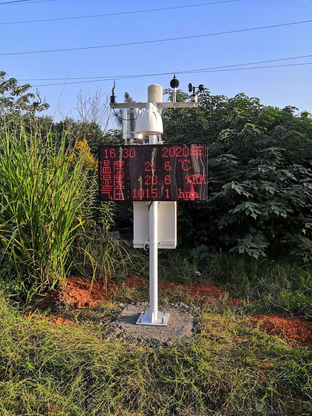
A forest or valley location is not automatically unsuitable. It is unsuitable for an exposed regional-wind reference if shelter dominates the result, but it may be appropriate when the intended observation is that sheltered microclimate. The measurement objective determines how surrounding vegetation and terrain are interpreted.
Do not assume that a scenic area has undisturbed wind simply because there are no tall buildings. Trees, cliffs, slopes and narrow passes can shelter, accelerate or redirect airflow. Record the relevant sectors and retain photographs and a position drawing for future comparisons.
Changes matter. Growing vegetation, a new viewing shelter or a relocated solar panel can alter exposure without causing an electrical fault. Review the measurement environment after construction work and seasonal vegetation changes. Keep a station move visible in the historical record rather than joining unlike locations into one apparently continuous series.
| Site position | Question to answer | Design consequence |
|---|---|---|
| Exposed viewpoint | What wind occurs at the relevant operating location? | Assess local flow and structures; use limits approved for the facility, not a generic station threshold. |
| Stream or valley route | What rain and water conditions affect access? | Review upstream coverage and add suitable water observations where required. |
| Wooded walking route | How does the local shaded environment change? | Identify the point as a woodland microclimate rather than a regional reference. |
| Visitor plaza | What environmental information should the public see? | Separate the screen location from representative sensing points and retain timestamps. |
| Coastal boardwalk | How will exposure affect observation and service? | Assess salt, wind-driven spray, mounting corrosion and access for cleaning. |
Stations serving different purposes need not carry identical channels. A remote rainfall point may not need the same display or air-quality instruments as an entrance plaza. Agree the essential observations for each operating decision before duplicating one large configuration across the entire destination.
Field instruments provide RS485, analog or pulse signals according to the selected version. The logger reads those signals and creates records; a communications device transfers them to the selected receiving system. A display consumes an agreed data feed rather than proving every upstream measurement is valid.
For RS485 Modbus RTU integration, provide a point schedule containing sensor identity, address, register interpretation, unit and physical location. Digital weather heads, noise instruments and environmental modules can have different maps. Standardizing the electrical bus does not standardize their data definitions.
In hilly terrain, test coverage at the actual antenna height and intended mounting point. A signal measurement at the visitor office cannot establish connectivity in a valley. Where the project needs outage recovery, specify local storage, clock retention and later transfer, then test them with the chosen logger and application.
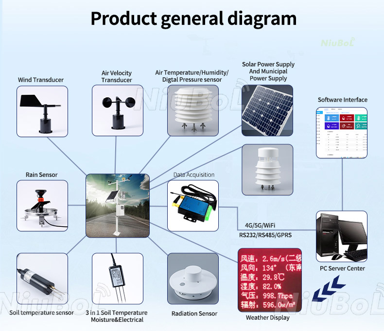
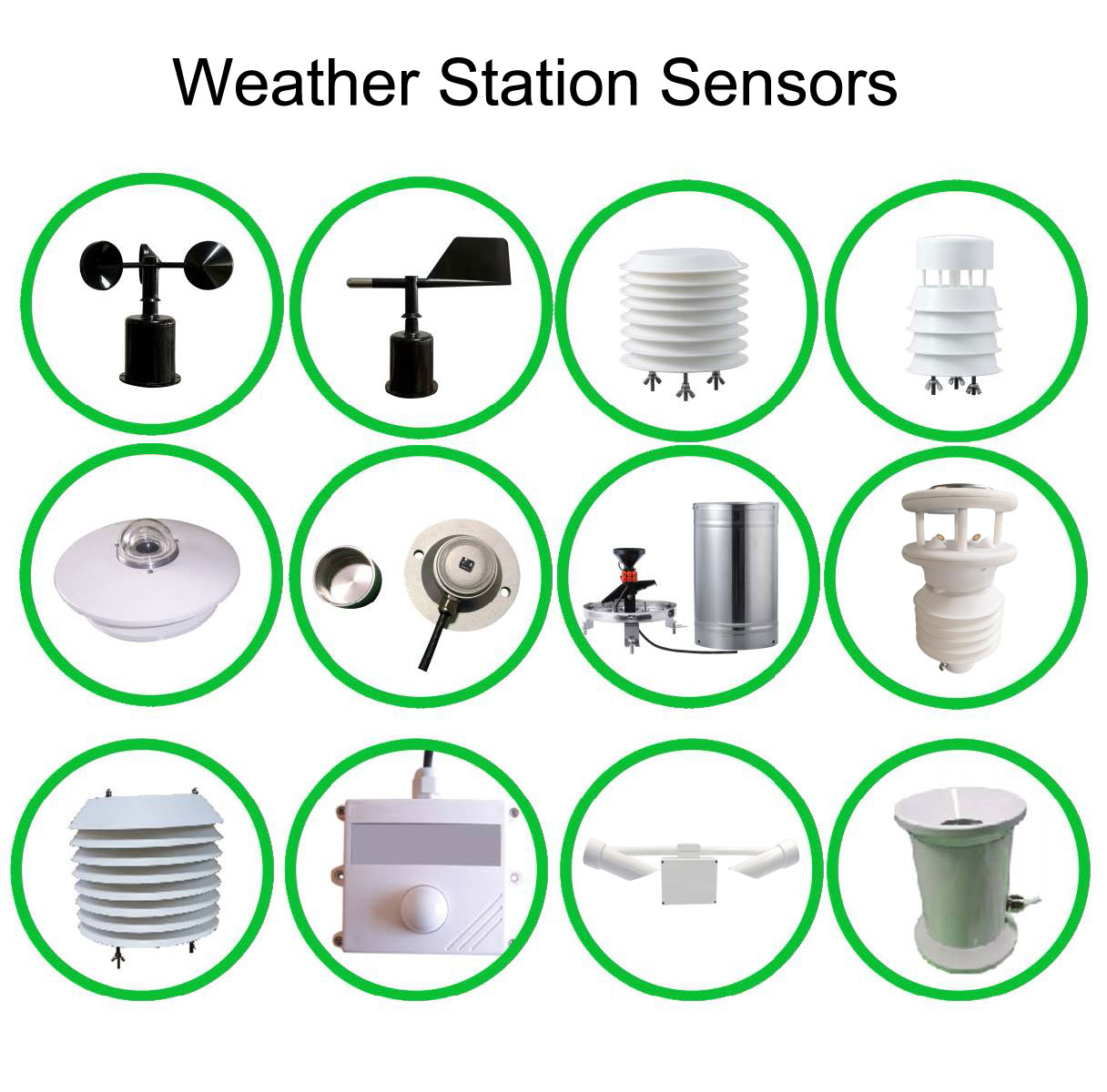
The examples below illustrate a modular NiuBoL configuration. They are not a single specification for every scenic area weather station. The operating environment and power supply must accommodate each ordered instrument, including the component with the most restrictive working conditions.
| Instrument or function | Example specification | Project implication |
|---|---|---|
| Air temperature and humidity | NBL-W-LBTH: -40 to +80 degrees C, +/-0.5 degrees C; 0-100% RH, +/-5% RH | Use a representative, shielded air position. |
| Atmospheric pressure | NBL-W-LBTH: 10-1200 hPa; +/-1.5 hPa | Label station pressure and any calculated correction separately. |
| Wind speed | NBL-W-SS: selected 0-45 or 0-70 m/s range; +/-(0.3 + 0.03V) m/s, V in m/s | Select the range and output; do not substitute an ultrasonic model's accuracy. |
| Wind protection | NBL-W-SS and NBL-W-DS sensor housings: IP65 | The mast, joints and cabinet still need their own suitable design. |
| Rainfall | NBL-W-RS example: 0.2 mm resolution; +/-4% in an indoor static test at 2 mm/min; 0-50 degrees C working temperature | This unheated configuration is not a blanket winter precipitation specification. |
| Noise, if required | NBL-W-NS 12 V configuration: 30-130 dB; -15 to +50 degrees C; below 80% RH | Confirm descriptor and environment; do not assign the air sensor's wider temperature limits to it. |
| Supply and interface | LBTH selected 12-24 VDC; NS 12 VDC; RS485 Modbus RTU or specified analog/pulse versions | Prepare the supply and input schedule by device, not by a whole-station assumption. |
| Consumption and cables | SS example 50 mW; confirm all other selected loads and each cable assembly | Include modem, display and enclosure loads; specify cable jacket and protected terminations. |
A large LED display can change the energy design substantially compared with a measurement-only point. Calculate the actual load and operating hours for the selected screen, communications and sensors. Available winter sunlight, canopy shading and battery conditions determine the required charging arrangement; an optional solar panel is not a guarantee of continuous operation.
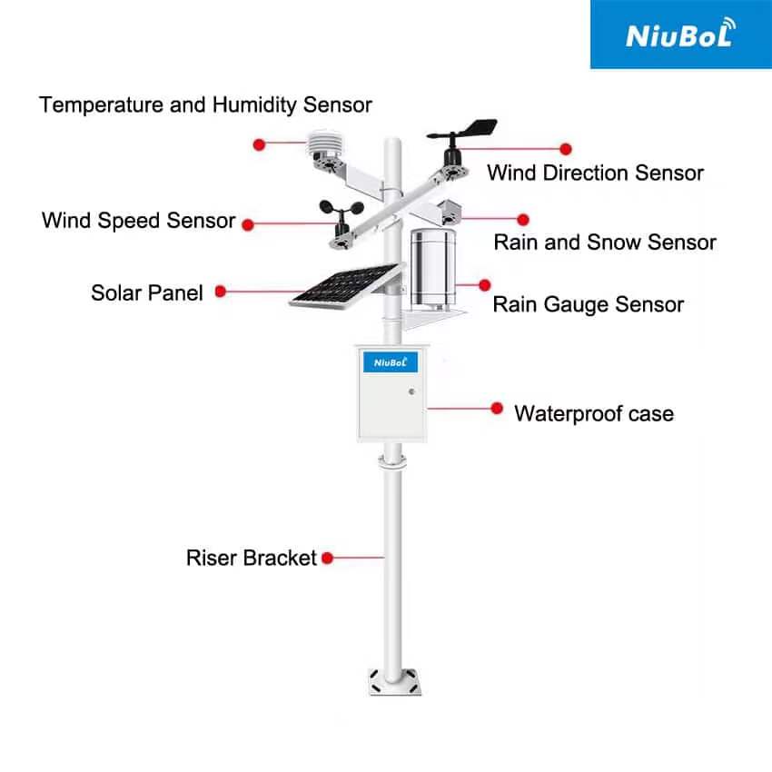
Park environmental monitoring may include particulate matter, noise or negative ion monitoring alongside weather. Each channel answers a different question. A negative ion count is not oxygen volume concentration, and neither quantity substitutes for particulate or gas measurements.
For an ion channel, confirm the range, unit, measurement method, environmental conditions and inlet-service requirements for the selected module. Avoid assigning a universal range to every system. Specify how its status and maintenance periods appear in stored data and on any public display.
Do not convert one environmental reading into an unsupported health benefit or declare the whole site safe from it. If the project publishes an air-quality index or another classification, define the required measurements, calculation and applicable reporting method. A standalone ion, noise or particulate value does not automatically produce that classification.
A local rain gauge records rain at that point. Stream conditions can depend on rain falling upstream, travel times, drainage changes and obstructions. A low local rain value therefore cannot establish that a valley route is free from flood risk. Site-specific hydrological and operating plans may require more points and different instruments.
Wind observations can be compared with an approved operating rule for a platform, temporary structure or other facility. The rule should identify the relevant location, averaging period, response and recovery conditions. Do not derive a universal closure threshold from the sensor's maximum measurement range.
Temperature, humidity and rainfall alone do not detect lightning, establish slope stability or diagnose a forest fire. Where those hazards matter, use the required dedicated observations and approved procedures. A general weather station should not be advertised as providing a guaranteed warning interval for every event.
Keep an observation alarm distinct from an equipment interlock and an emergency instruction. Agree who receives the notification and what happens if a station, communication link or display is unavailable. Test the response with site operators before depending on unattended operation.
Walk through the installed points and compare their location labels with the drawings. Check sensor orientation, shielding, rain-gauge level, vegetation and access. Verify each value through the logger and final screen, including the unit, aggregation interval and acquisition time.
Run separate tests for a missing sensor, a failed remote link and a stopped display feed. Confirm data retention and visible recovery. A screen reconnecting successfully does not demonstrate that every missing observation has been recovered.
Set service tasks around the actual exposure: rain-collector debris, acoustic obstruction, inlet deposits, connector moisture and vegetation growth. Provide safe access to the installed height. Ask for the calibration or test documents required for the selected instruments rather than assuming one certificate covers every channel and completed structure.
For a NiuBoL proposal, provide a site map with elevation and terrain, the operating purpose of each point, required channels, power availability and the intended display or monitoring platform. State installation responsibilities and required documentation in the quotation so the configuration can be reviewed before construction.
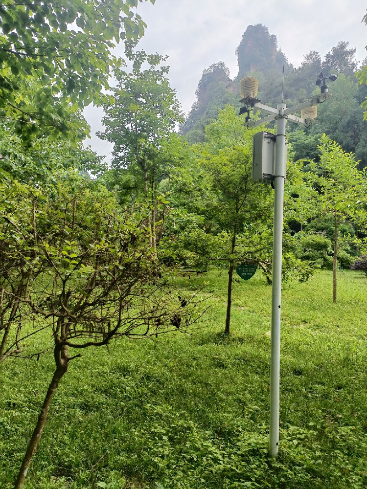
Only where the required conditions are sufficiently represented by that location. Exposed ridges, wooded paths and enclosed valleys can differ. Use the operating questions and a site survey to decide where additional points are needed.
No. Weather and ion measurements are distinct functions that may be combined. Confirm the actual channel list, environmental limits and data interpretation for the ordered configuration.
No. The screen should be readable, while sensors need representative exposure. Use compatible data connections when the appropriate sensing location is elsewhere.
No. Upstream rainfall and catchment conditions may be important. A warning design requires the relevant observations and operating procedure, not just one rainfall threshold.
Its data should become visibly stale or unavailable according to an agreed timeout. Retain the acquisition time and avoid presenting a held value as a new observation.
It may be, after assessing seasonal shading, available mounting positions and the total load. Include the screen and modem where fitted; sensor consumption alone is insufficient for sizing the supply.
Agree point locations, channel specifications, power, communications, display behavior, service access and acceptance documents. Keep environmental display functions separate from any dedicated hazard or emergency system.
A scenic area weather station is useful when each observation has a clear location and operational purpose. Select weather and environmental channels deliberately, keep public information current and verify the full data path. NiuBoL modular configurations can support that design while leaving dedicated hazard assessment and emergency decisions with the appropriate systems and site procedures.
Prev:Small Weather Station Applications and System Integration
Next:Radar Water Level and Rainfall Monitoring: Define What Flood Data Can Establish
Related recommendations
Sensors & Weather Stations Catalog
 Agriculture Sensors and Weather Stations Catalog-NiuBoL.pdf
Weather Stations Catalog-NiuBoL.pdf
Agriculture Sensors Catalog-NiuBoL.pdf
Water Quality Sensor Catalog-NiuBoL.pdf
Related products
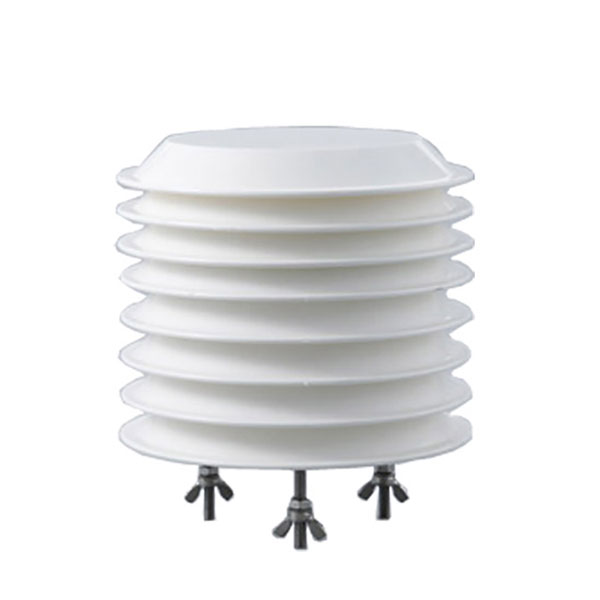 Combined air temperature and relative humidity sensor
 TDR Soil Moisture & Temperature Sensor for irrigation| RS485 |4-20mA| NBL-S-THR
 Soil pH sensor RS485 soil Testing instrument soil ph meter for agriculture |NBL-S-PH
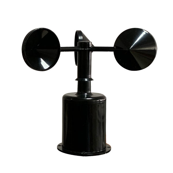 Wind Speed sensor Output Modbus/RS485/Analog/0-5V/4-20mA
 Tipping bucket rain gauge for weather monitoring auto rainfall sensor RS485/Outdoor/stainless steel
 Pyranometer Solar Radiation Sensor 4-20mA/RS485


Screenshot, WhatsApp to identify the QR code
WhatsApp number:+8615367865107
(Click on WhatsApp to copy and add friends)