





— Blogs —
—Products—
 Consumer hotline +8618073152920
WhatsApp:+8615367865107
Address:Room 102, District D, Houhu Industrial Park, Yuelu District, Changsha City, Hunan Province, China
Product knowledge
Time:2025-10-14 14:44:33 Popularity:1222
An agrometeorological station records weather and, where configured, soil or crop-environment conditions for agricultural use. Its measurements can support irrigation assessment, crop development records and local risk evaluation. The station supplies observations; crop recommendations and automatic actions require separately defined methods, software and controls.
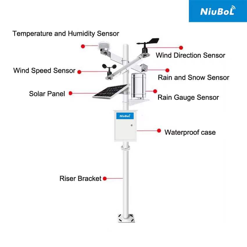
For a project engineer, the distinction matters when comparing quotations. Two stations can share the same name while providing very different channels. A basic temperature, humidity, wind and rain arrangement does not necessarily include solar radiation, soil moisture, leaf wetness or an irrigation controller.
The intended question determines the measurement arrangement. A reference weather site describes a defined exposure; a canopy observation describes the crop's local environment. Both can be useful, but they should not be combined without identifying which conditions each represents.
An agrometeorological station is therefore not defined simply by adding more channels to a mast. It needs a channel list, siting plan and record format that fit its agricultural task. Soil probes may be distributed away from the mast, and leaf-surface observations may need placement near representative foliage.
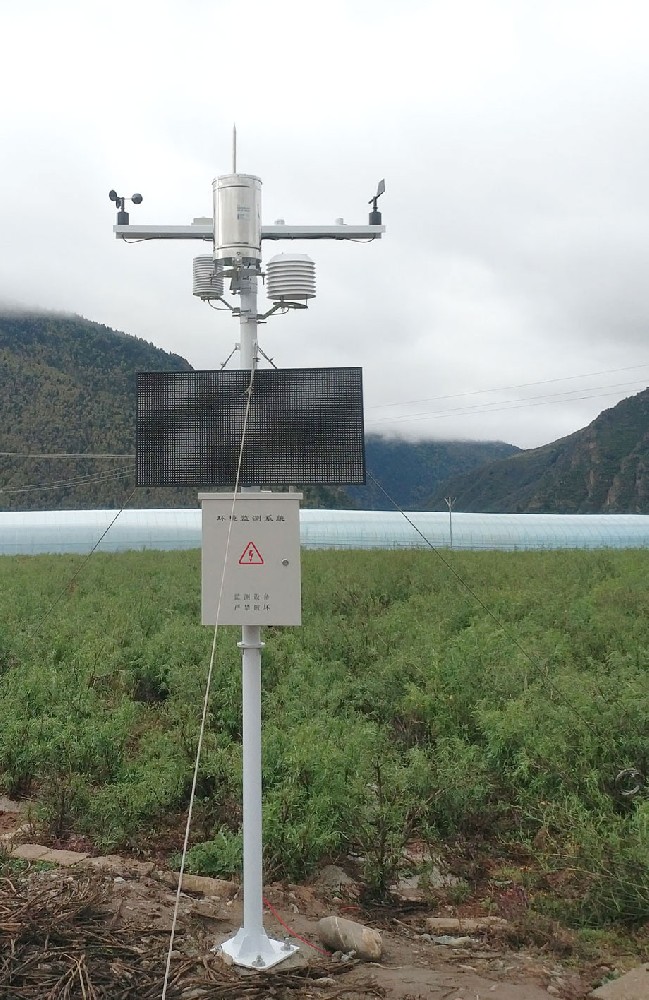
For irrigation assessment, rainfall records indicate water received at the gauge, while root-zone probes show the local soil response. Weather-based demand estimates provide another part of the picture. None alone establishes the amount of water reaching every plant.
The FAO-56 reference evapotranspiration method uses temperature, humidity, wind and radiation information with defined calculation procedures. Reference evapotranspiration is not the same as a crop's final irrigation requirement. Crop factors, effective rainfall, soil storage and system performance still need consideration. The method uses wind referenced to 2 m; data from another height need appropriate treatment.
For crop development, temperature records can support an accumulated-temperature calculation with a crop-specific base and method. For disease-risk assessment, leaf wetness and temperature may be relevant inputs. A wetness signal is not a pathogen diagnosis, and no universal warning lead time applies to every crop and disease.
| Instrument | Measurement or interface | What must be selected |
|---|---|---|
| NBL-W-LBTH | Air temperature -40 to 80 degrees C; RH 0-100%; pressure 10-1200 hPa; DC 12-24 V | RS485 Modbus RTU or 4-20 mA output version; representative shielded air exposure |
| NBL-W-SS and NBL-W-DS | Separate wind speed and direction instruments; IP65 protection | Range/output versions, mounting height, direction orientation and logger input |
| NBL-W-RS | Liquid rainfall; 0.2 mm resolution; reed-switch, voltage or RS485 options | Output and matching supply version; tip factor and pulse handling where applicable |
| NBL-W-HPRS | Solar irradiance 0-2000 W/m2; 0.3-3 micrometre spectral range | Output version, measurement plane, leveling and logger conversion |
| NBL-S-TMC, optional | Soil temperature, moisture and EC; RS485 Modbus RTU; IP68 | Soil location/depth, supply configuration and interpretation of each channel |
| NBL-PH-1 logger | RS485/RS232; local FLASH; configured 4G transmission; saving interval 1-240 minutes | Actual device list, time settings, record contents, power and receiving-system format |
These are component examples, not a mandatory station package. The NBL-W-RS rain gauge measures liquid precipitation; its 0-50 degrees C operating range should not be presented as evidence of heated snow measurement. Similarly, a pyranometer measures irradiance in its configured plane, not crop photosynthetic efficiency.
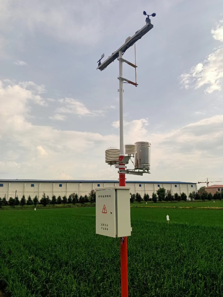
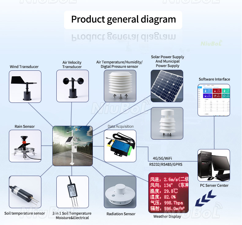
In a typical NiuBoL arrangement, instruments feed a compatible data logger, which displays or stores observations and sends configured records to a receiving system. RS485 Modbus RTU is a local interface, while 4G is an uplink. A matching connector does not establish compatible register addresses or output scaling.
Before commissioning, compare a sensor value with the decoded logger value and the exported record. Confirm units, timestamps, rain totals and the meaning of interval values. An average wind speed is not a gust, and one radiation reading in W/m2 is not a daily energy total.
Keep rainfall collectors clear of local obstruction and inspect them for debris. Keep a radiation instrument level and free from shading for its intended observation. Mount air sensors in a suitable shield with airflow, and establish wind exposure for the chosen method. A convenient mast position is not automatically representative for every channel.
For soil measurements, record the depth and relation to crop rows or emitters. A single point represents its immediate surroundings. Where different blocks behave differently, plan additional agricultural measurement points around that difference rather than applying an acreage-only rule.
Set inspection intervals from the exposure and operating experience. Inspect after events likely to disturb the installation. Keep cleaning, relocation and replacement dates with the records. Automatic acquisition reduces manual transcription; it does not eliminate field maintenance or make every anomaly remotely repairable.
Only if the system includes compatible control hardware, a defined decision method and tested local operating logic. Sensors and a 4G data logger alone do not establish valve control, pump protection or an irrigation schedule.
No. Request an itemized channel and model list. Soil moisture, EC and leaf wetness are optional measurements whose installation requirements differ from the instruments on the mast.
It can provide useful weather context, but terrain, shelter, irrigation and soil can create local differences. Check the intended representation before using one point for every block or greenhouse compartment.
Possibly, if the local interfaces and transmitted format are compatible. Provide the existing platform's requirements and test a sample record. Modbus support alone does not imply an included API or identical data fields.
Verify channel identity and units, reference comparisons, rain-count conversion, clock settings and local records. Interrupt the network and confirm how missing updates are shown. Check power reserve and any control functions under their own agreed test procedures.
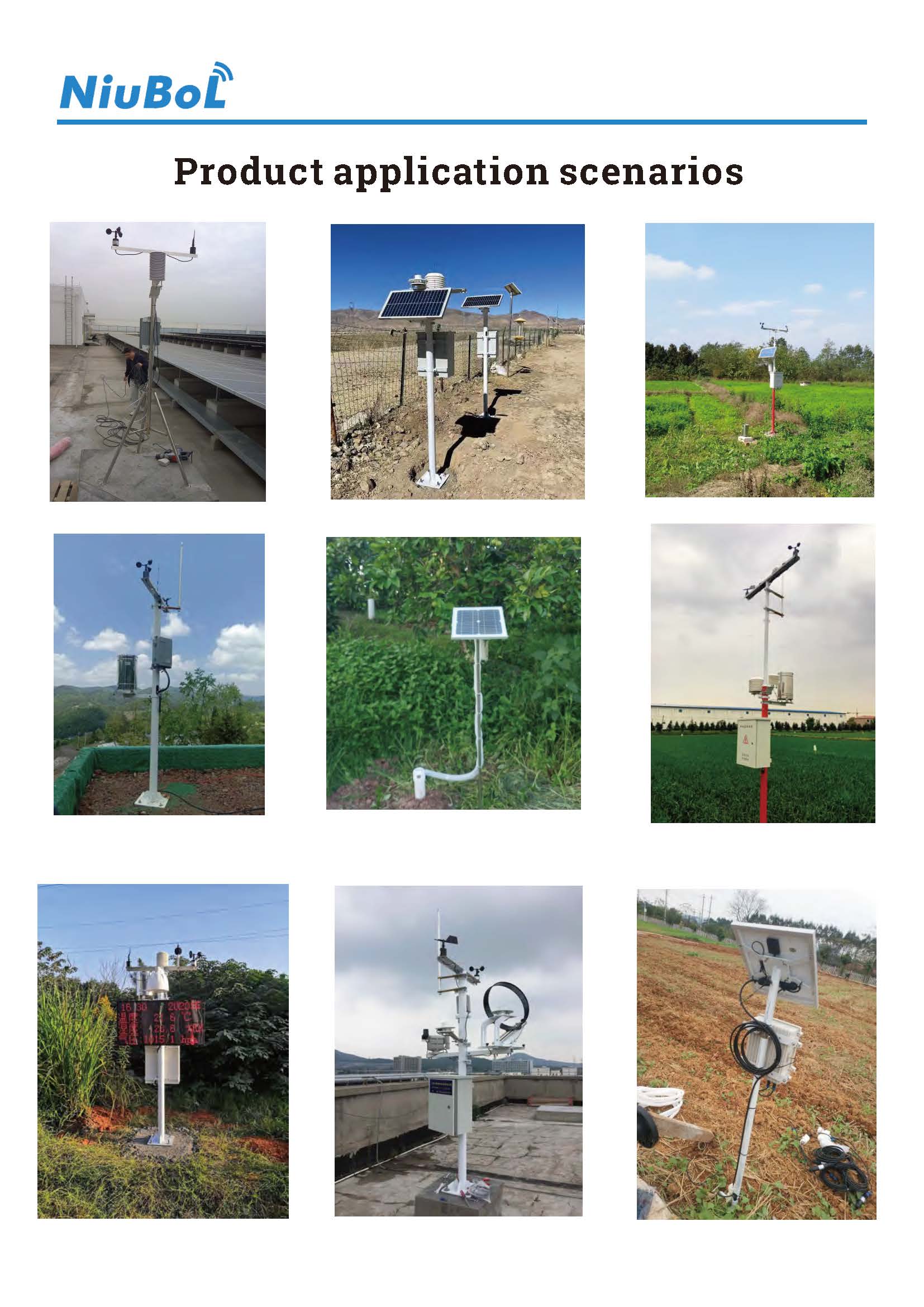
An agrometeorological station is a configured observation system, not an automatic agronomy service. NiuBoL weather, soil and logging components can support the measurements a project needs. Define the intended decisions, specify the channels and verify the full record before relying on the system in daily farm management.
Prev:Ambient Temperature Sensors: Element Types, Exposure and Field Checks
Next:Wind Speed vs. Wind Direction: Differences and Farm Uses
Related recommendations
Sensors & Weather Stations Catalog
 Agriculture Sensors and Weather Stations Catalog-NiuBoL.pdf
Weather Stations Catalog-NiuBoL.pdf
Agriculture Sensors Catalog-NiuBoL.pdf
Water Quality Sensor Catalog-NiuBoL.pdf
Related products
 Combined air temperature and relative humidity sensor
 TDR Soil Moisture & Temperature Sensor for irrigation| RS485 |4-20mA| NBL-S-THR
 Soil pH sensor RS485 soil Testing instrument soil ph meter for agriculture |NBL-S-PH
 Wind Speed sensor Output Modbus/RS485/Analog/0-5V/4-20mA
 Tipping bucket rain gauge for weather monitoring auto rainfall sensor RS485/Outdoor/stainless steel
 Pyranometer Solar Radiation Sensor 4-20mA/RS485


Screenshot, WhatsApp to identify the QR code
WhatsApp number:+8615367865107
(Click on WhatsApp to copy and add friends)

