


— Blogs —
—Products—
 Consumer hotline +8618073152920
 WhatsApp:+8615367865107
Address:Room 102, District D, Houhu Industrial Park, Yuelu District, Changsha City, Hunan Province, China
Product knowledge
Time:2026-06-25 10:58:37 Popularity:20
The monitoring range of an automatic weather station is one of the most misunderstood procurement questions. A station does not create a fixed circular coverage area like a lamp. It measures conditions at its installation point, and the representativeness of that point depends on terrain, land use, obstacles, rainfall pattern and project purpose.
For buyers, the useful question is not simply how far one station can cover. The useful question is how many stations are needed to describe the weather risk of the project area with acceptable confidence.
Small weather stations are now used in schools, farms, scenic areas, industrial parks, urban drainage and disaster warning projects. These projects have different spatial requirements. A school may need one demonstration station. A mountain rainfall warning project may need dense station spacing because rainfall changes quickly with terrain.
Monitoring range should be understood as representativeness. In flat open land, one station may represent a larger area. In mountains, cities, valleys and coastal zones, the same station may represent a smaller area because conditions change faster across short distances.
A single automatic weather station is a point sensor node. A station network is a spatial monitoring system. The network becomes useful when each station has clear coordinates, consistent parameters, stable communication and a platform that can compare data between locations.
When planning a network, buyers should define which parameter drives the decision. Rainfall warning, wind safety, school education, agricultural irrigation and urban heat monitoring do not need the same spacing.
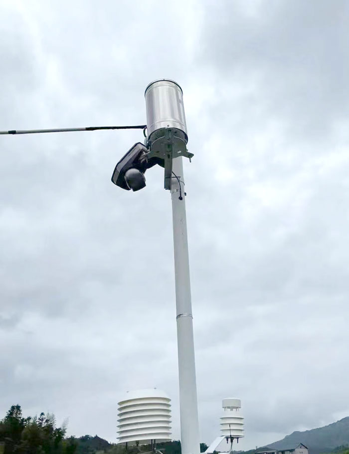
Station networks need communication planning. RS485 is useful within one station or local cabinet, while 4G, Ethernet or other communication methods send data to the platform. The platform should show station location, status, data interval and alarm rules so that operators can compare nearby points.
If stations are deployed across remote areas, power and communication reliability may influence spacing. A technically ideal point may not be practical if maintenance access, solar exposure or signal coverage is poor.
| Parameter | Typical Project Value | Engineering Use |
|---|---|---|
| Supply voltage | DC 12-24V, solar power optional for remote stations | Power design for field cabinet or unattended site |
| Communication | RS485 / Modbus RTU; 4G or Ethernet through collector or gateway | Connection to data logger, platform, PLC or SCADA |
| Wind speed | 0-60 m/s, typical accuracy ±0.3 m/s or ±3%FS | Wind load, spraying, safety and weather analysis |
| Wind direction | 0-359° or 0-360°, typical accuracy ±3° | Wind rose, dispersion and site operation |
| Air temperature | -40 to 80℃, typical accuracy ±0.5℃ | Heat, frost and growth environment monitoring |
| Relative humidity | 0-100%RH, typical accuracy ±5%RH | Disease risk, comfort and microclimate evaluation |
| Pressure | 10-1100 hPa, typical accuracy ±1.5 hPa | Meteorological trend reference |
| Rainfall | Tipping bucket rain gauge, 0.2 mm or 0.01 mm resolution by model | Rainfall event, drainage and disaster response |
| Protection level | IP65 for outdoor station enclosure; IP68 for buried soil probes | Outdoor reliability and maintenance planning |
| Site Type | Reference Spacing | Why It Differs |
|---|---|---|
| Mountain areas | Average spacing usually less than 25 km, adjusted by terrain and disaster risk | Rainfall, wind and temperature can change sharply with elevation and valleys |
| Urban areas | Average spacing usually less than 10 km; key zones may use about 5 km | Buildings, heat islands, drainage risk and population density require finer monitoring |
| Plain areas | Common monitoring reference range about 20-25 km in open terrain | Terrain is more uniform, so one station can often represent a wider area |
| Coastal and large river basins | Average spacing often about 10 km for key monitoring | Wind, humidity, rainfall and flood response vary along water bodies |
| School or demonstration site | Usually one station for the campus or teaching site | Purpose is education and local observation, not regional warning |
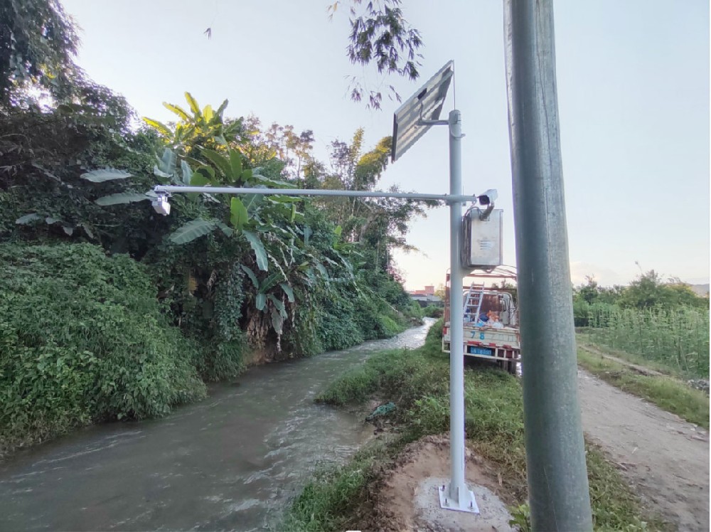
Site challenge: Rainfall may be intense in one valley while a nearby area remains lower risk.
System integration scheme: Use denser rainfall and weather stations with remote communication.
User value: Warning teams gain local rainfall evidence for landslide or flood response.
Site challenge: Short-distance rainfall differences can affect underpasses, drainage points and dense population zones.
System integration scheme: Deploy stations around key districts and connect alarms to the platform.
User value: Managers can compare rainfall intensity by district and respond faster.
Site challenge: Weather is more spatially uniform, but crop blocks still differ by soil and irrigation.
System integration scheme: Use stations at representative areas and add soil monitoring where irrigation decisions matter.
User value: Farm managers avoid overbuilding station networks while still receiving useful data.
Site challenge: Wind, humidity and rainfall change along coastlines and river corridors.
System integration scheme: Use station spacing around key hydrological and operational points.
User value: Operators improve flood, wind and environmental monitoring decisions.
If the project budget is limited, start with high-risk points rather than evenly spreading stations across a map. For example, low-lying urban areas, mountain valleys, river crossings and key agricultural blocks may be more useful than geometrically perfect spacing.
Station spacing should also be reviewed after the first season. If two nearby stations always show similar data, spacing may be enough. If important events are missed between stations, the network may need an additional point.
Procurement teams often ask for a single coverage number because it seems convenient. In practice, station quantity should be decided by risk points. A drainage project should prioritize low-lying zones and rainfall concentration areas. An agricultural project should prioritize crop blocks and soil differences. A mountain warning project should prioritize valleys, slopes and historical disaster points.
The reference spacing values are starting points, not guarantees. Mountains may require less than 25 km average spacing, urban projects often need less than 10 km and key urban zones may need around 5 km. Plains may use 20-25 km as a broader reference, while coastal and river-basin projects often use about 10 km around key corridors.
One station may be enough for a school demonstration site, a small uniform farm, a factory yard or a single greenhouse park when the goal is local observation. It is usually not enough for regional disaster warning, complex terrain, city drainage management or farms with separated blocks and different soil conditions.
A clear way to explain monitoring range is to compare it with soil sampling. One soil sample describes the place where it was taken; it may represent a field only if the field is uniform. A weather station is similar. It describes its location directly and represents a wider area only when terrain and weather conditions are similar.
This explanation helps prevent overpromising. A supplier should avoid claiming that one small station can cover a large city, mountain region or river basin without considering terrain. A stronger proposal explains the limitation and shows how stations should be distributed by risk area.
For a monitoring range inquiry, the buyer should provide project area, terrain type, main risk, required parameter and management objective. A quotation for a campus station is very different from a quotation for mountain rainfall warning or city drainage monitoring. The more clearly the buyer describes the risk area, the more useful the station layout recommendation will be.
A: It measures the weather at its installation point. Its representative range depends on terrain, obstacles, land use and the parameter being monitored.
A: Mountain weather changes quickly with elevation, slope and valleys, so one station represents a smaller area.
A: Open plain areas may use a reference range around 20-25 km, but crop type, irrigation and local risk still matter.
A: Buildings, heat islands, drainage points and population density create strong local differences, so spacing is often less than 10 km and key areas may be closer.
A: It can represent a farm if terrain and crop blocks are uniform. Large or varied farms may need more stations or soil sensors.
A: Representativeness is more important than distance. A poorly located station can be less useful than a well-located station farther away.
A: It should be planned before installation but reviewed after seasonal data and risk events are observed.
A: Use the project objective, terrain, risk areas, budget and platform management capacity to decide quantity. High-risk points should be prioritized before evenly filling a map.
A: NiuBoL can provide automatic weather station equipment and configuration options for local stations and multi-point monitoring networks.
A: The inquiry should include project area, terrain type, main weather risk, required parameters and management objective. This allows the supplier to discuss station spacing as a risk-based layout rather than a fixed coverage claim.
Automatic weather station monitoring range is not a fixed number. It is a representativeness decision shaped by terrain, risk, parameter type and management purpose. Buyers should plan station spacing from the decision they need to support, then choose sensors, communication and platform functions that make the network usable.
Prev:Automatic Weather Station Installation Guide: Site Selection, Interference Control and Commissioning
Next:no more
Related recommendations
Sensors & Weather Stations Catalog
 Agriculture Sensors and Weather Stations Catalog-NiuBoL.pdf
Weather Stations Catalog-NiuBoL.pdf
Agriculture Sensors Catalog-NiuBoL.pdf
Water Quality Sensor Catalog-NiuBoL.pdf
Related products
 Combined air temperature and relative humidity sensor
 Soil Moisture Temperature sensor for irrigation|NBL-S-THR
 Soil pH sensor RS485 soil Testing instrument soil ph meter for agriculture |NBL-S-PH
 Wind Speed sensor Output Modbus/RS485/Analog/0-5V/4-20mA
 Tipping bucket rain gauge for weather monitoring auto rainfall sensor RS485/Outdoor/stainless steel
 Pyranometer Solar Radiation Sensor 4-20mA/RS485

Screenshot, WhatsApp to identify the QR code
WhatsApp number:+8615367865107
(Click on WhatsApp to copy and add friends)
