





— Blogs —
—Products—
 Consumer hotline +8618073152920
WhatsApp:+8615367865107
Address:Room 102, District D, Houhu Industrial Park, Yuelu District, Changsha City, Hunan Province, China
Product knowledge
Time:2022-07-11 10:38:46 Popularity:1790
Quick Answer: Agricultural automatic weather stations measure local conditions that support irrigation planning, field-work scheduling and crop-risk assessment. Their useful functions depend on the installed channels and the decisions attached to them. A station measures weather; it does not directly measure crop water demand, diagnose disease or operate irrigation unless the required models, root-zone measurements and controls are included.

A farm station becomes useful when someone can connect its records to a specific operation: deciding whether to inspect a dry block, postponing spraying because of wind, checking a cold pocket before a frost event, or comparing rainfall between fields. Collecting more parameters without deciding how they will be interpreted often produces a dashboard with little operational use.
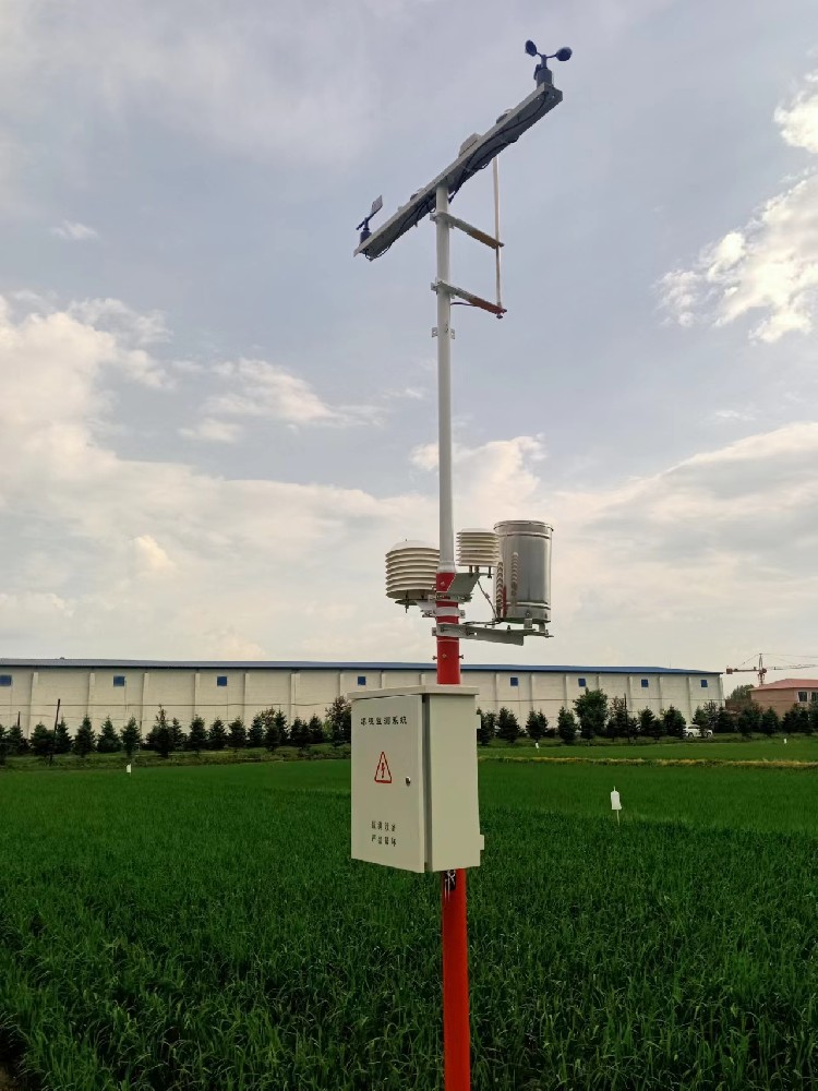
The station normally includes meteorological sensors, a data logger, a mounting structure, power and a communication path. Soil probes, leaf-wetness sensors and other crop-related devices are extensions selected for the application. They should not be assumed to be included in every agricultural automatic weather station simply because they can connect to the same logger.
NiuBoL supplies configurable automatic weather stations. For procurement, separate the required observations from calculated indicators and commanded actions. An air-temperature record is an observation. Reference evapotranspiration is a calculation. Starting an irrigation pump is an action that requires an appropriate controller and permission to operate.
| Task | Useful measurements | Decision limit |
|---|---|---|
| Irrigation planning | Rainfall, air temperature, humidity, wind and solar radiation; optional root-zone water measurements | Weather-based demand must be related to crop stage, effective rainfall and irrigation performance. |
| Spray scheduling | Wind speed and direction, temperature and humidity at a relevant location | Use the pesticide label and local requirements; a station reading is not a universal permission to spray. |
| Cold-weather response | Air temperature at vulnerable sites; additional crop-level or wet-bulb measurements where needed | A distant or elevated station may miss the coldest crop zone. |
| Disease-risk assessment | Temperature, humidity and, where required, leaf wetness | An applicable crop/pathogen model is needed; high humidity alone is not a diagnosis. |
| Field access and operations | Recent rainfall, soil moisture or field inspection, wind and short-term forecasts | Weather records cannot establish soil bearing capacity or guarantee safe machinery access. |
| Seasonal comparisons | Consistent daily temperature, rainfall and radiation records | Changed exposure, sensor replacement and missing intervals can invalidate simple comparisons. |
Use this task list to decide the instrument package. An irrigation project may need a radiation sensor and soil probes but no CO2 channel. A spray advisory point may need representative wind measurements more urgently than a large collection of unrelated soil parameters. The number of sensors is not a measure of agricultural usefulness.

Reference evapotranspiration, ETo, expresses atmospheric evaporative demand for a reference surface. The FAO Penman-Monteith method uses radiation, air temperature, humidity and wind speed. An AWS with those inputs can support the calculation, but the logger or software must actually implement the chosen method. A rainfall-and-temperature station should not be represented as providing the same calculation without explaining any estimated inputs.
For a specified crop and growth stage, crop evapotranspiration can be estimated using ETc = Kc x ETo. Kc is a crop coefficient, not a sensor reading. Soil-water storage, rooting depth, irrigation efficiency and drainage then affect how that estimate becomes an irrigation instruction. The FAO reference evapotranspiration method explains the distinction between the reference calculation and crop conditions.
Consider an illustrative field calculation, not a product performance claim. If ETo is 4.0 mm/day and an appropriate Kc is 0.8, ETc is 3.2 mm/day. Across one hectare, that depth represents 32 cubic meters of water because 1 mm over one hectare is 10 cubic meters. It is not automatically the pump delivery volume: effective rainfall, soil-water depletion and application losses still have to be included.
A rain gauge measures precipitation at its collector, not the fraction retained in the root zone. Runoff, interception and deep drainage can make effective rainfall smaller than the measured amount. On the other hand, a root-zone probe measures conditions around its installation, not the water status of the entire farm. Use both records to investigate the field rather than letting one sensor stand in for the full water balance.
Soil moisture is a key factor in determining the health and growth of crops. For irrigation use, install probes at depths and positions that represent the active roots and wetting pattern. A probe beside a dripper may show a rapid response while the inter-row root zone remains dry. A sensor below the main roots can help identify drainage but should not be interpreted as the crop's only moisture reference.
Record soil type, probe depth and distance from emitters. Compare several locations before deciding that one station point can represent multiple blocks. If soil texture, slope or irrigation scheduling changes across the farm, separate monitoring zones may be necessary even when one weather station provides an acceptable atmospheric reference.
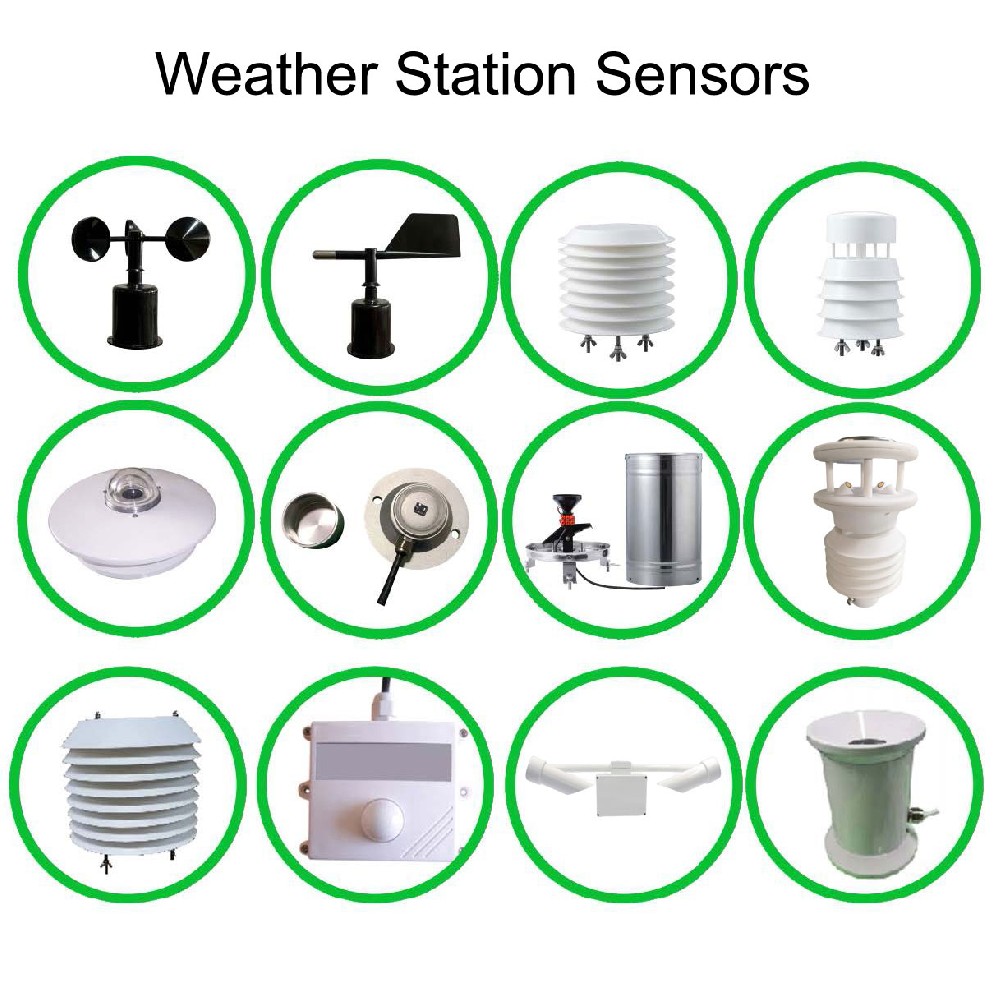
Temperature, electrical conductivity and pH can be useful additional soil channels, but they answer different questions. Conductivity is not a direct nitrogen, phosphorus or potassium measurement. A weather station does not infer fertilizer requirements simply because it stores conductivity alongside rainfall. Select probes and interpretation methods for the agronomic question rather than treating every numeric output as a fertilizer recommendation.
Wind measurements help document working conditions and identify periods unsuitable for a planned spray operation. Install the instrument with an unobstructed exposure appropriate to the intended measurement height. Wind behind a shed or within a dense hedge is not a reliable representation of an open field. Record whether a value is a sampled speed, an interval average or a gust statistic.
Wind direction indicates where the wind comes from. If an advisory system uses circular direction data, averaging 359 and 1 degrees arithmetically gives the wrong result. Verify the software's directional treatment and use the pesticide label, application equipment requirements and applicable rules for the actual decision. No single universal wind threshold is suitable for every spray operation.
Cold-air drainage creates another siting problem. A station on a raised, well-mixed point may not detect the lowest temperature in a sheltered hollow. Add a representative low-point measurement when frost management depends on it. A shielded dry-bulb air temperature is also not automatically leaf temperature or wet-bulb temperature; equipment that needs those inputs must receive the appropriate measurement.
Temperature and moisture duration can indicate conditions favorable to a particular pathogen. Disease models differ by crop, pathogen, measurement interval and required inputs. Some require leaf wetness rather than relative humidity alone. Check the model before ordering sensors, and determine who will inspect the crop when an alert occurs.
Insect cameras or traps are separate monitoring equipment. A meteorological station can add weather context to their records, but it cannot identify pest populations from atmospheric pressure or humidity alone. Similarly, a barometric trend can describe changing local conditions but is not a stand-alone storm or drought forecast.
A practical alert includes the measurement, duration, location, data age and responsible recipient. Suppress or mark conclusions when a required channel is missing. A silent communication failure must not be reported as a rain-free day or a period without crop risk. Store the logger record locally where the selected configuration supports it, then label delayed uploads with their measurement time.
Field weather monitoring needs consistent units as well as reliable transmission. The data logger must support the installed electrical interfaces. A tipping-bucket gauge may use a pulse input; other sensors may provide RS485 Modbus RTU or analog outputs, depending on version. RS485 terminals alone do not establish protocol compatibility. Match the actual register map, scaling, polling interval and rain-counter behavior before selecting the logger.
| Recorded quantity | Unit or format | Check before analysis |
|---|---|---|
| Rainfall | mm per event or interval; cumulative counter where available | Confirm depth per pulse, reset behavior and the daily boundary. |
| Wind | m/s and degrees | Distinguish average, sample and gust; record exposure height and direction convention. |
| Solar radiation | W/m2 instantaneously; energy integrated over time | Do not substitute lux or sunshine duration without an applicable estimation method. |
| Soil water | Volumetric water content or water potential, depending on probe | These quantities are not interchangeable; retain depth and soil information with the result. |
Define daily rainfall boundaries, local time and any daylight-saving handling in the software. Preserve cumulative counters or event records where needed to reconcile uploads. For temperature summaries, distinguish interval averages from minima and maxima. A system receiving one value every hour cannot reconstruct a brief cold minimum that was never measured or stored.
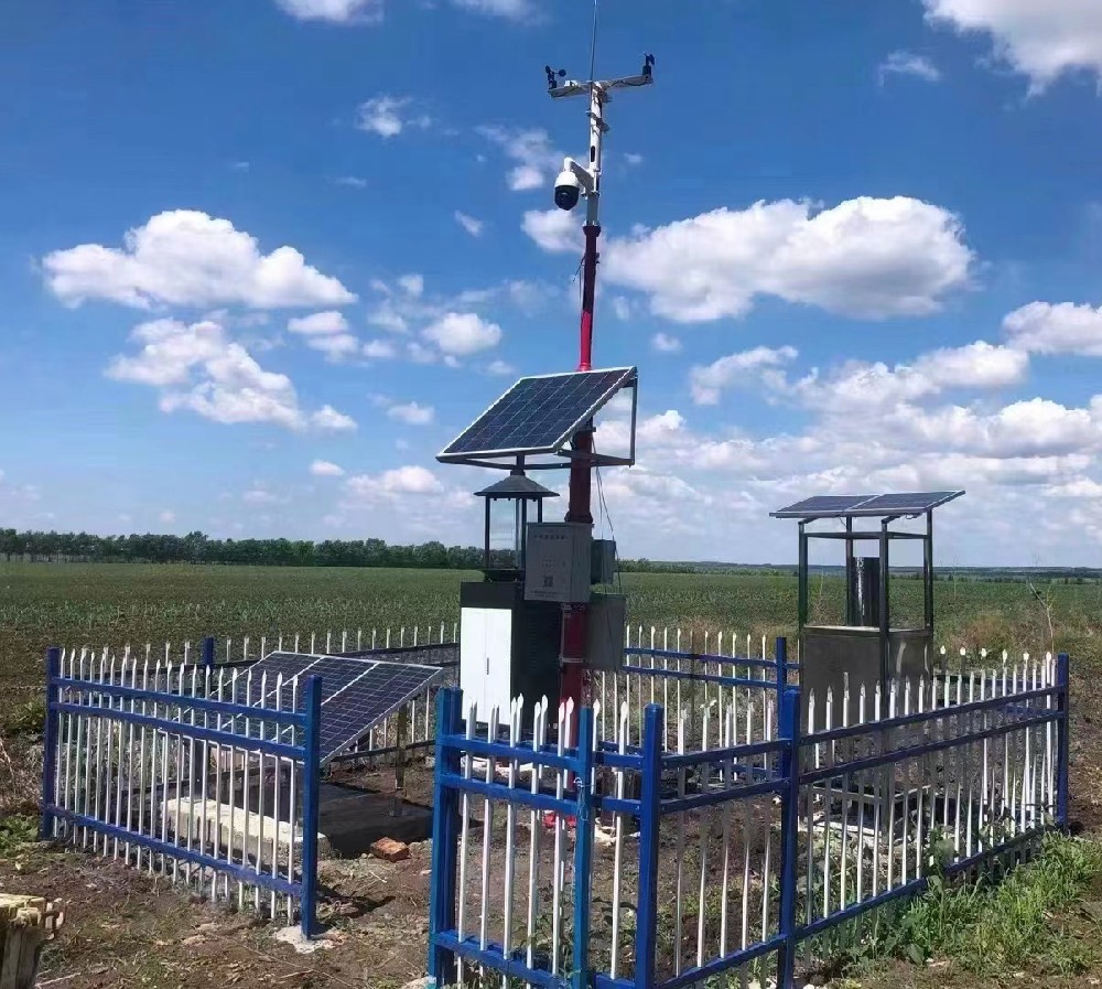
Before accepting the installation, follow one complete record from sensor to export. Check engineering units, timestamps, missing-data flags and daily totals. Compare the rain-gauge count with a controlled input suitable for that gauge; compare air sensors under similar exposure. Confirm that an alarm reaches its recipient and that the operator can identify which field the alarm represents.
Power and maintenance should match the crop season. Solar charging must cover the logger, radio, sensors and selected reporting schedule through expected poor-weather periods. Keep the rain collector clean and level, radiation surfaces clear, and wind instruments free to operate. For separate NBL-W-SS wind speed and NBL-W-DS wind direction sensors, specify IP65; the cabinet and cable entries need their own protection assessment.
When requesting a configuration, identify the crop, field layout, irrigation method, decisions to be supported and communication coverage. Ask for the sensor list, logger input allocation, calculation functions and service scope as separate items. This makes it possible to compare quotations for the same agricultural task without relying on a headline sensor count or an unsupported savings percentage.

No. Soil probes are additional channels in many configurations. Specify probe type, depth, quantity and logger compatibility. A standard meteorological package may contain only atmospheric instruments.
Possibly for some atmospheric observations on a relatively uniform site, but not automatically for soil-water conditions or cold pockets. Compare terrain, exposure, crop blocks and irrigation zones before selecting the number of measurement points.
Not necessarily. The useful contribution depends on infiltration, runoff, storage and rooting depth. Use an effective-rainfall method and root-zone observations appropriate to the field rather than subtracting the gauge total without review.
Confirm temperature, humidity, wind and radiation inputs, calculation software, crop coefficients and soil-water accounting. If some weather inputs are estimated, retain that distinction so users can judge the resulting uncertainty.
Only through a deliberately designed control system with suitable outputs and local protections. Irrigation also needs limits for pressure, flow, water availability and permitted run time. A weather notification or cloud dashboard is not that complete control system.
No. They provide environmental inputs for applicable risk models. Diagnosis still requires crop assessment, and some models need additional measurements such as leaf wetness. Define the intended model before choosing the sensor package.
Compare the same measurements, exposure arrangements, logger functions, communication service and installation scope. Include calibration, field maintenance and data export. A cheaper package missing radiation or root-zone points may not perform the intended irrigation task.
The useful functions of agricultural automatic weather stations are local observations linked to specific farm decisions. Specify the task first, then the measurements, interpretation and responsible action. Rainfall, soil water, ETo and irrigation delivery belong in the same decision process, but they are not interchangeable measurements.
Prev:Agrometeorological Station Value: A Project Guide
Next:Common types of weather stations are handheld, automatic, digital, ultrasonic
Related recommendations
Sensors & Weather Stations Catalog
 Agriculture Sensors and Weather Stations Catalog-NiuBoL.pdf
Weather Stations Catalog-NiuBoL.pdf
Agriculture Sensors Catalog-NiuBoL.pdf
Water Quality Sensor Catalog-NiuBoL.pdf
Related products
 Combined air temperature and relative humidity sensor
 TDR Soil Moisture & Temperature Sensor for irrigation| RS485 |4-20mA| NBL-S-THR
 Soil pH sensor RS485 soil Testing instrument soil ph meter for agriculture |NBL-S-PH
 Wind Speed sensor Output Modbus/RS485/Analog/0-5V/4-20mA
 Tipping bucket rain gauge for weather monitoring auto rainfall sensor RS485/Outdoor/stainless steel
 Pyranometer Solar Radiation Sensor 4-20mA/RS485


Screenshot, WhatsApp to identify the QR code
WhatsApp number:+8615367865107
(Click on WhatsApp to copy and add friends)

