


— Blogs —
—Products—
 Consumer hotline +8618073152920
 WhatsApp:+8615367865107
Address:Room 102, District D, Houhu Industrial Park, Yuelu District, Changsha City, Hunan Province, China
Product knowledge
Time:2025-10-25 10:51:28 Popularity:830
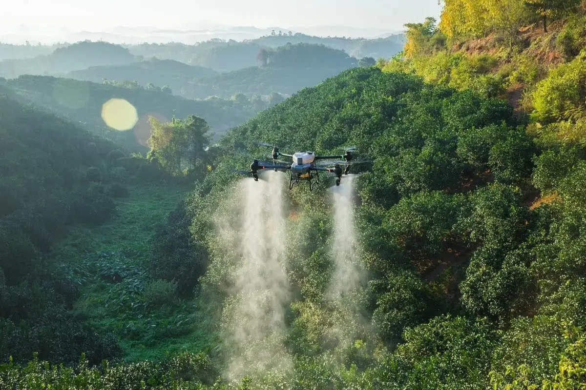
Modern agriculture is quietly ushering in a profound transformation. The combination of drones and smart sensors has become one of the most influential technological trends reshaping farm operations. From real-time aerial imaging to precise monitoring of soil and crop conditions, this synergy empowers farmers with faster, smarter, and more sustainable decision-making capabilities. Traditional agriculture relied on manual labor and experiential judgment, but today it shifts toward data precision, automation, and intelligent integration. Drones capture dynamic aerial data, while ground sensors provide accurate environmental insights—together, they form the cornerstone of precision agriculture. According to the 2025 International Agricultural Technology Report, this fusion can increase global farm yields by over 15% while reducing resource waste by 20%. This article delves into the technical principles, integration advantages, real-world cases, implementation strategies, and how NiuBoL facilitates this transition.
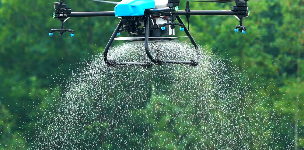
Contemporary agricultural drones are equipped with multispectral, RGB, and thermal imaging cameras, allowing farmers to gain insights into details invisible to the naked eye. These flying devices can complete mapping of large farmland areas in minutes, with core functions including:
- Rapidly generating farm field maps to support large-scale plot planning.
- Identifying plant stress through NDVI (Normalized Difference Vegetation Index) analysis for early diagnosis and treatment.
- Monitoring irrigation coverage and detecting outbreaks of pests or diseases early.
- Creating 3D terrain models to optimize irrigation and fertilization layouts.
For example, the DJI Agras series drones come with high-resolution sensors that transmit data in real-time during flight, achieving centimeter-level accuracy. According to the 2025 Gartner Agricultural Technology Report, drone deployment has reached a 35% penetration rate in global farms, particularly in high-value crop areas like rice and grapes.
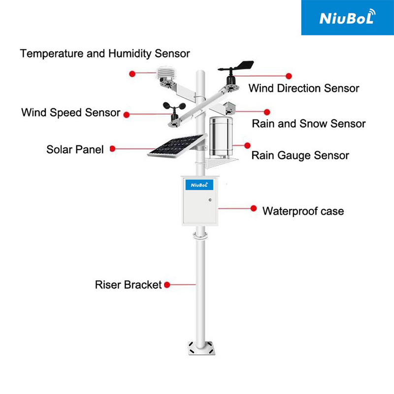
While drones scan the surface, IoT sensors capture fine-grained parameters of soil and the environment:
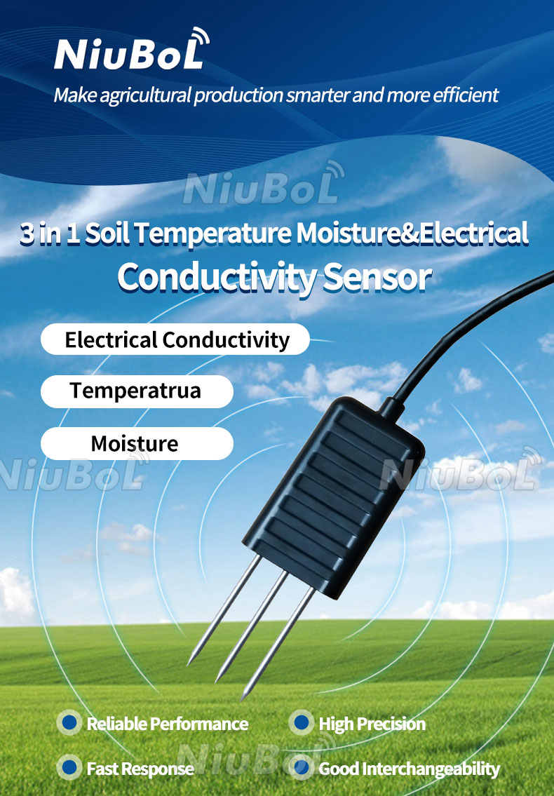
- Soil moisture sensors optimize irrigation through real-time water content data, avoiding over- or under-watering.
- Temperature and humidity sensors maintain stable crop microclimates, preventing extreme fluctuations.
- Soil pH and electrical conductivity (EC) sensors assist in nutrient management for precise fertilizer application.
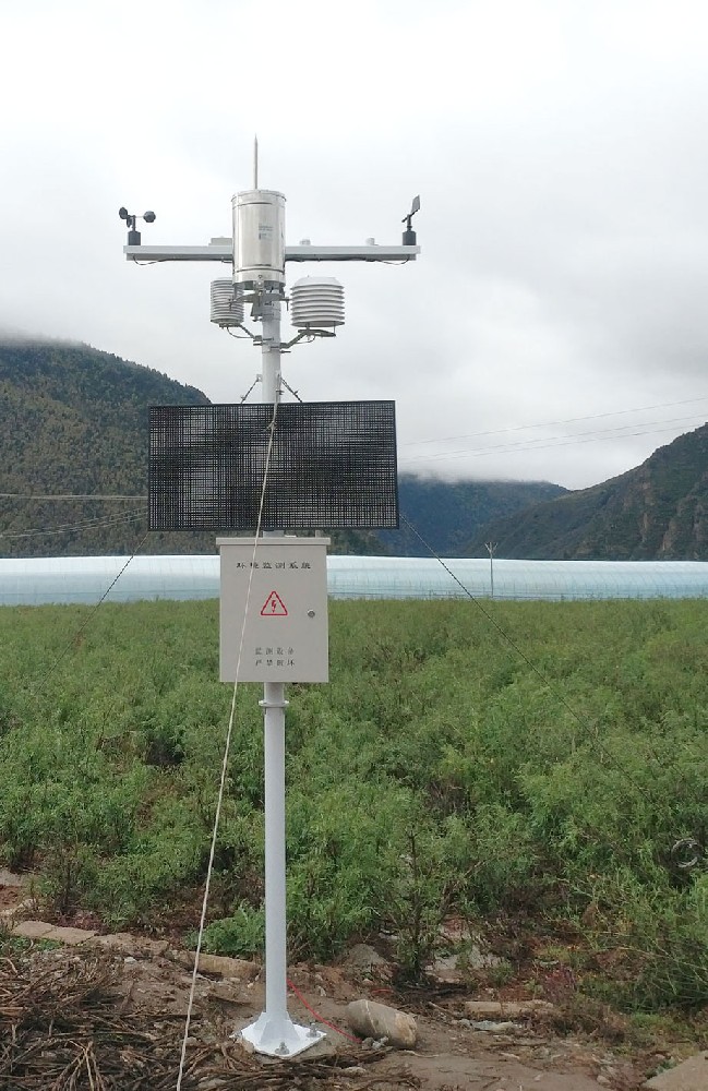
- Weather stations track rainfall, wind speed, and solar radiation to support predictive model building.
When aerial data from drones fuses with ground sensor data, farmers gain a 360° panoramic view of their fields. This closed-loop system is the core of precision agriculture. For example:
- Drones identify drought-prone areas → Sensors confirm low soil moisture → Irrigation systems activate automatically.
- Drones detect uneven crop growth → Soil EC sensors reveal nutrient deficiencies → Fertilizer plans are adjusted.
This mechanism minimizes resource waste, improves yield consistency, and supports data-driven agricultural practices. Cloud services like AWS IoT further amplify value by analyzing fused data through machine learning algorithms, achieving up to 90% prediction accuracy. In an era of variable climates, this integration is not just a technological upgrade but also a risk buffer.
Real-time aerial data can identify crop stress before issues become visible, enabling timely interventions. Traditional field scouting takes days, while drone + sensor combinations complete diagnostics in hours, reducing losses by 10%-20%.
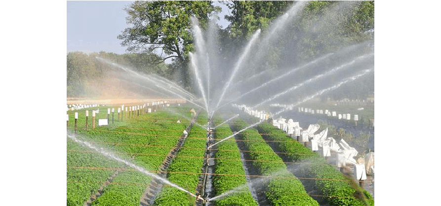
Integrating soil moisture sensors with drone mapping allows irrigation to be precise in "where, when, and how much." An EU study shows such systems can save 25%-30% of water, which is crucial for drought-prone regions.
Drones and soil nutrient sensors work together to reduce over-fertilization, protecting soil health and lowering costs. Global data indicates that precision fertilization can increase nitrogen utilization from 40% to 70%.
Early detection by drones, combined with temperature and humidity monitoring, can predict pest outbreaks.
IoT platforms collect and store data, supporting seasonal plot performance tracking. Blockchain technology ensures data integrity, applicable for organic certification and carbon footprint audits.
Reducing manual inspections promotes automation—directly boosting farm productivity.
Theory must be validated through practice. The following three cases, based on public research and project reports, demonstrate the multidimensional value of drone and sensor fusion. These are not isolated examples but representatives of global agricultural transformation.
In the Dutch Koppert Cress greenhouse (microgreens and watercress cultivation), the PATS system (reported in the 2024 Harvard Business School Environmental Blog) deploys indoor drones combined with AI computer vision and infrared sensors for automated pest management. Drones autonomously take off, analyzing insect size, speed, and flight paths (via camera + AI models) to intercept and eliminate pests; integrated with 70 sensors monitoring humidity, heat, and stem height, providing microclimate data inputs. The system covers greenhouses in 25 countries, with 50% of decisions relying on software. Results include a sharp reduction in chemical pesticide needs and significant labor savings; combined with geothermal heating, energy efficiency improves, supporting uniform growth (automated seeding ensures consistency). Post-yield optimization, microgreen quality has improved, aiding the EU's energy transition. The project is funded by Syngenta and others, now expanding to rose and tomato greenhouses. (Source: Harvard Business School Blog, 2024)
To achieve drone-sensor integration, farm owners and enterprises can follow these steps:
- Define objectives: Focus on yield improvement, cost reduction, or resource efficiency.
- Select compatible equipment: Ensure drones, sensors, and IoT gateways use unified protocols (e.g., Modbus).
- Strategically deploy sensors: Place soil and environmental sensors based on terrain and crop variability.
- Data integration platform: Adopt cloud platforms for visualization, analysis, and automated responses.
- Train operators: Cover drone flight planning, data interpretation, and maintenance.
- Iterative optimization: Refine management practices using continuous feedback.
Q1: Can drones and sensors operate in environments without internet?
A: Yes. NiuBoL sensors support local data logging and LoRa/Wi-Fi communication, with drone data syncing offline for later upload.
Q2: How should the frequency of drone field patrols be set?
A: For most crops, every 7-14 days; high-value crops should be monitored weekly, adjusted based on growth stages.
Q3: Is the cost of drone-sensor systems high?
A: Costs have dropped significantly. Initial investment for medium-sized farms is under $5,000, with ROI visible within one growing season.
Q4: How does this technology support sustainability goals?
A: By reducing input waste (water, fertilizer, energy) and improving yield predictability, it directly supports carbon emission reductions and green agriculture.
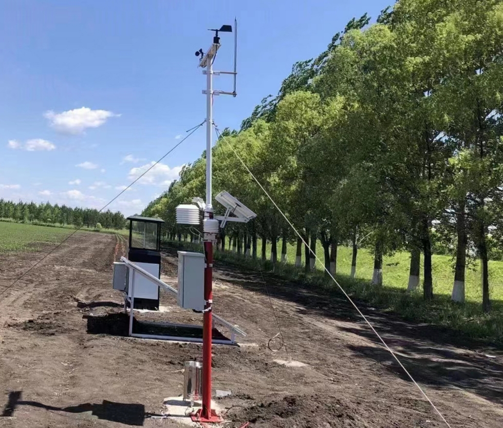
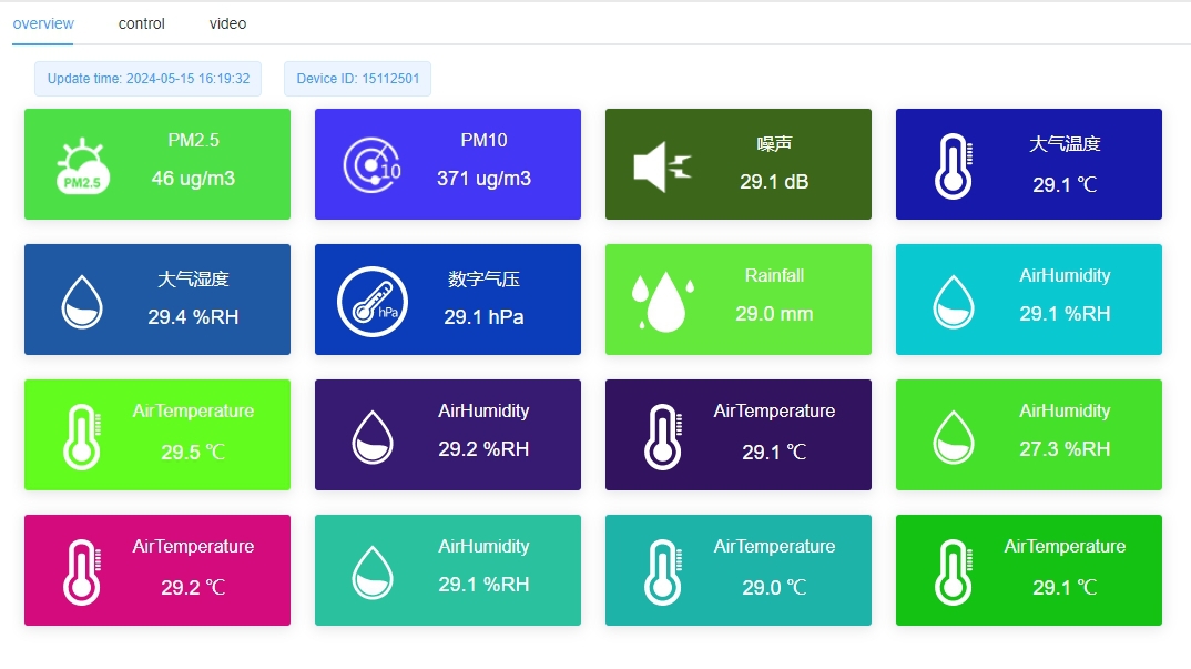
NiuBoL provides complete IoT agricultural sensor and environmental monitoring system kits, seamlessly integrating drone data. Our product line includes:
- Soil moisture, temperature, EC, and pH sensors
- Weather stations and radiation sensors
- IoT gateways and cloud connectivity
- Data visualization and analysis software
Whether for vineyards, greenhouses, or open fields, NiuBoL helps you transform data into actionable intelligence—enhancing efficiency, yields, and sustainability. 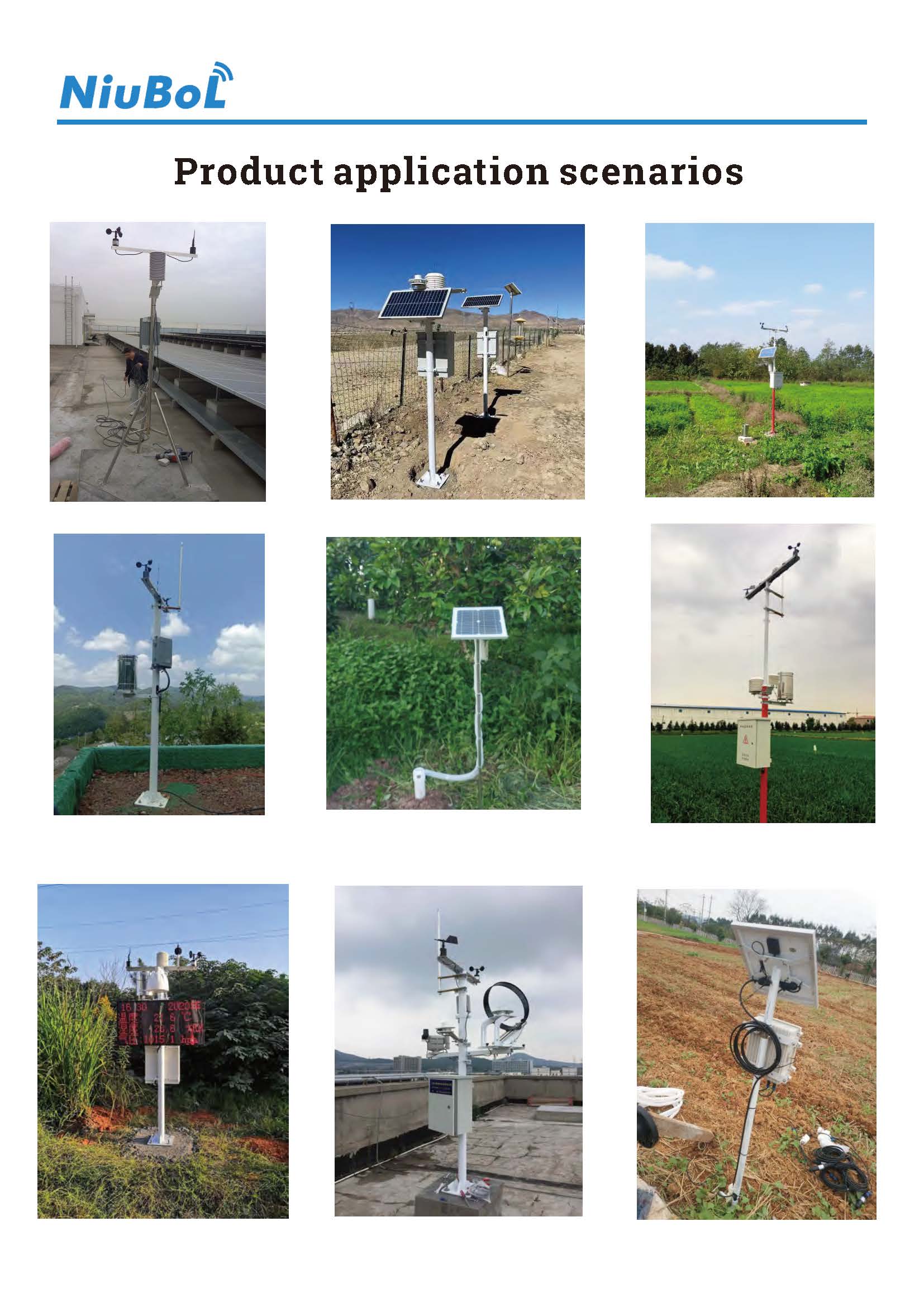
The fusion of drones and smart sensors marks a pivotal step in agricultural evolution. It goes beyond automation, embodying precision, sustainability, and insight. By combining aerial intelligence with ground-based evidence, farmers gain control over every variable affecting crops. As AI, IoT, and autonomous drones mature, this integration will become the new standard for efficient, green, and intelligent global agriculture. Companies like NiuBoL are leading the ecosystem build, allowing data to truly nurture growth.
Prev:The Future of Anemometers: From Mechanical to Digital
Next:Top Countries Driving Smart Agriculture Sensor Adoption
Related recommendations
Sensors & Weather Stations Catalog
 Agriculture Sensors and Weather Stations Catalog-NiuBoL.pdf
Weather Stations Catalog-NiuBoL.pdf
Agriculture Sensors Catalog-NiuBoL.pdf
Water Quality Sensor Catalog-NiuBoL.pdf
Related products
 Combined air temperature and relative humidity sensor
 Soil Moisture Temperature sensor for irrigation|NBL-S-THR
 Soil pH sensor RS485 soil Testing instrument soil ph meter for agriculture |NBL-S-PH
 Wind Speed sensor Output Modbus/RS485/Analog/0-5V/4-20mA
 Tipping bucket rain gauge for weather monitoring auto rainfall sensor RS485/Outdoor/stainless steel
 Pyranometer Solar Radiation Sensor 4-20mA/RS485

Screenshot, WhatsApp to identify the QR code
WhatsApp number:+8615367865107
(Click on WhatsApp to copy and add friends)
