





— Blogs —
—Products—
 Consumer hotline +8618073152920
WhatsApp:+8615367865107
Address:Room 102, District D, Houhu Industrial Park, Yuelu District, Changsha City, Hunan Province, China
Product knowledge
Time:2025-10-22 16:50:52 Popularity:1143
Agricultural weather stations in Africa need a site-specific design, not a single continental package. The crop question, local exposure, access, power and available communication determine the configuration. Start by separating rainfed observations, irrigation investigations and research records, then specify the sensors and service arrangement needed at the actual locations. Regional interest does not establish network coverage or a guaranteed crop outcome.
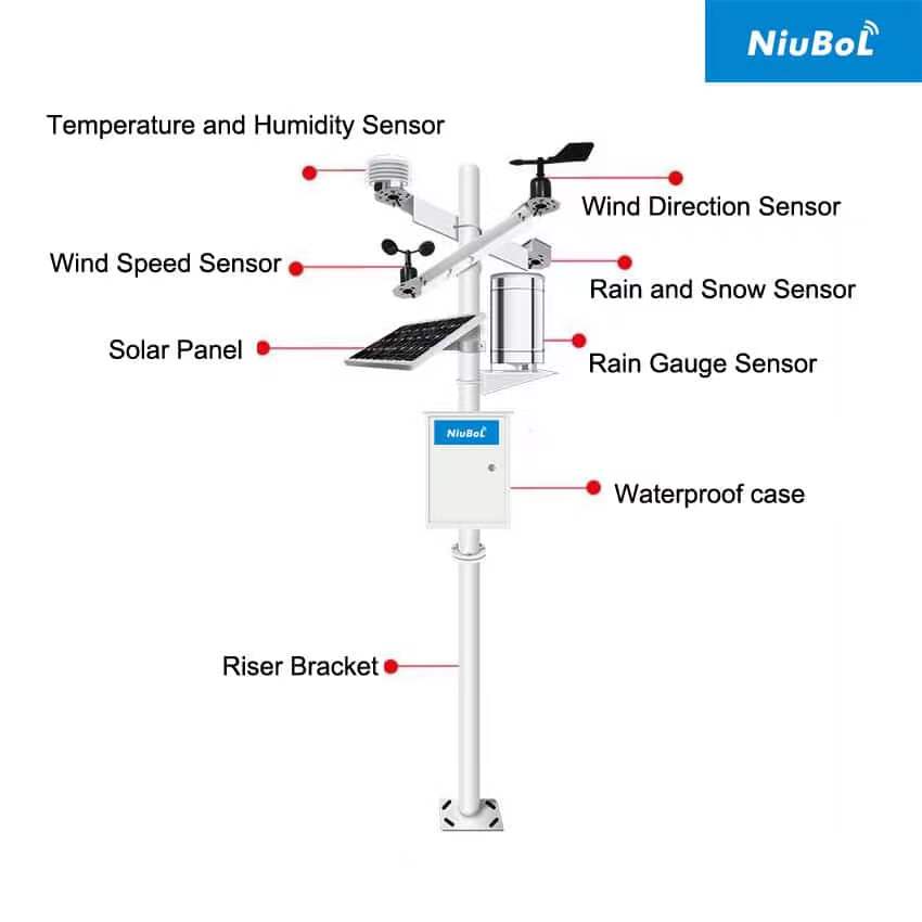
A coastal field, a highland research plot and an irrigated dryland farm can need different observation arrangements. Country borders alone do not identify the conditions at an installation. Record coordinates, elevation, crop, irrigation practice and surrounding obstacles before preparing the equipment schedule.
For rainfed production, a local rainfall record can help investigate the timing of wet periods alongside field and crop observations. For irrigation, soil-water response and irrigation events add information that rainfall alone cannot provide. A research project may prioritize continuity and documented methods over a large live display.
These are possible project tasks, not claims about every farm in a country. Use a pilot or site survey to determine which observations are missing. A national agriculture narrative cannot determine how many stations or soil probes a particular project requires.
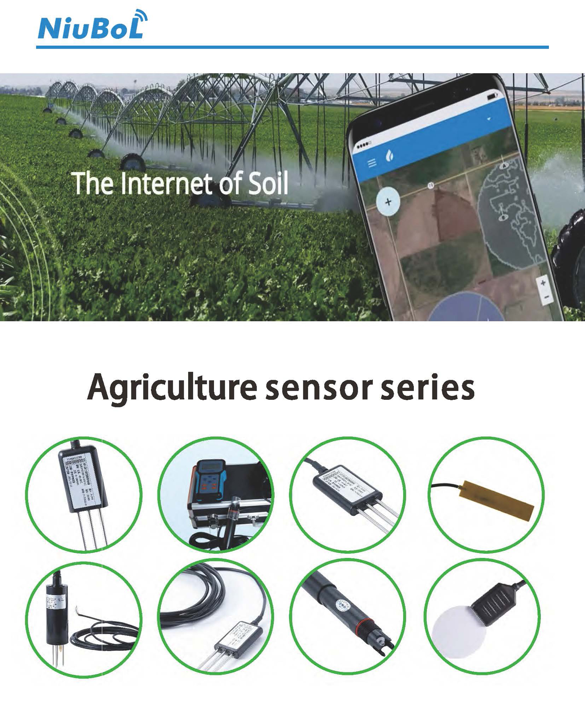
| Installation condition | Observation priority | Design consequence |
|---|---|---|
| Rainfed crop investigation | Rainfall timing with local atmospheric context | Choose the rainfall method, exposure and recording interval |
| Irrigated field | Root-zone response alongside irrigation and rain | Select soil positions and depths separately from the weather mast |
| Long-term research site | Comparable records through seasons and instrument changes | Retain site history and acquisition settings |
| Infrequently visited location | Continued acquisition and recoverable local records | Review energy reserve, storage and practical maintenance access |
The NBL-W-LBTH measures air temperature, relative humidity and barometric pressure. Its RS485 Modbus RTU version uses DC 12-24 V and a default baud rate of 9600 bps, with at least 1000 ms between communications. Match the receiver to that instrument rather than assuming all station devices share identical polling settings.
Where root-zone conditions matter, the NBL-S-TMC adds soil temperature, moisture and EC. These are local observations at the installed depth. EC is not an individual fertilizer-nutrient assay, and a single moisture threshold should not be copied across different soil or crop conditions without assessment.
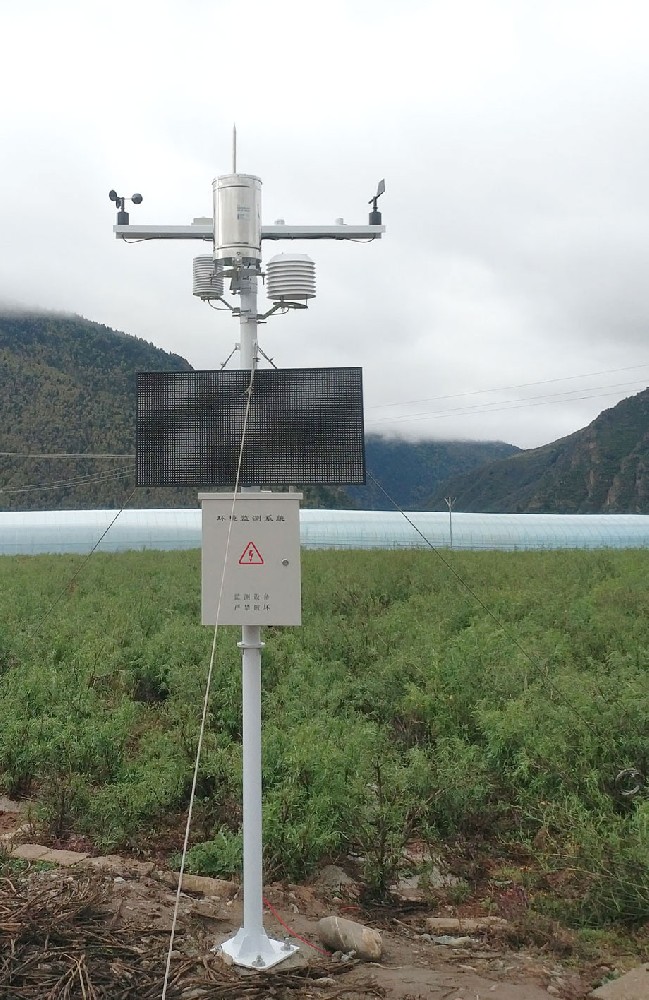
Confirm the energy demand of the complete configured system, including the acquisition unit and communications. Solar supply and battery reserve should reflect the intended operation through periods of poor charging. Size autonomy from the full operating load and planned charging reserve, rather than from the power rating of one sensing element.
Test connectivity at the proposed equipment position. Coverage at an office or on a nearby road does not establish reliable service at the field. Match modem bands, SIM and APN arrangements to the destination network and receiving service. A different cellular generation does not by itself solve every terrain or coverage problem.
The NBL-PH-1 provides compatible sensor acquisition, local FLASH recording and configured 4G transfer. Check storage capacity, retention and retrieval against the channel schedule. A local record and successful remote delivery are separate outcomes; explicitly test communication interruption and recovery rather than assuming historical records automatically reappear online.

Plan how a technician will reach the rain collector, optical surface, enclosure and battery without damaging the installation. Match inspection frequency to exposure and observations from early visits. A dusty site and a site with rapid vegetation growth can need different work even if the electronic instruments are identical.
Agree on practical replacement parts, connector identification and records for any sensor change. If local staff can inspect a suspect value but cannot safely reach the instrument, that limitation belongs in the installation plan. Expansion should include a maintainable service route, not just additional remote map points.
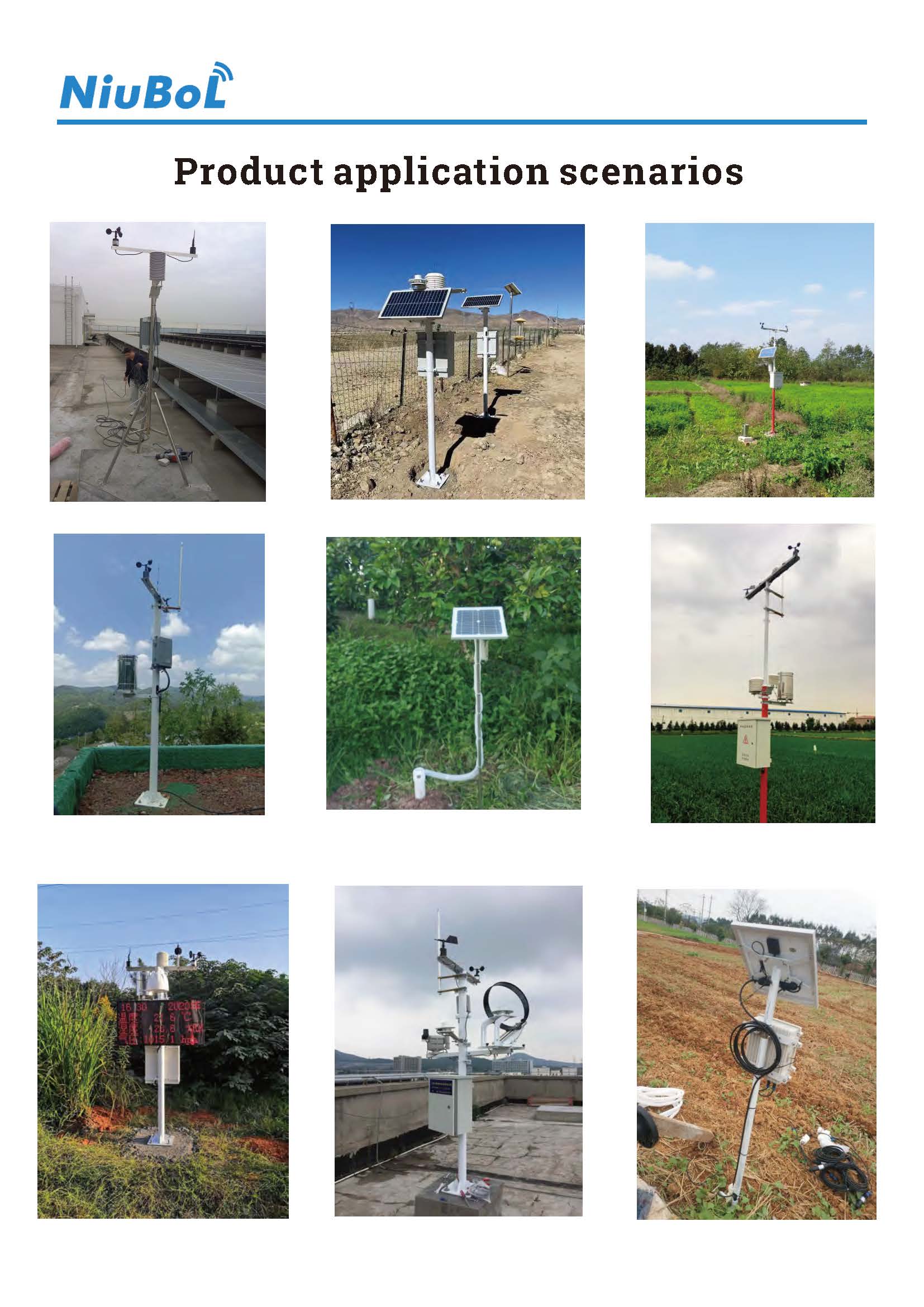
NiuBoL's 10-meter research weather station in Tanzania combines selected meteorological instruments with acquisition, solar power and supporting structure. Its channel mix follows a meteorological research task; an irrigation investigation may instead need a different balance of atmospheric and root-zone measurements.
Its relevance to a new project is the need to consider instruments and supporting infrastructure together. Select mounting height, exposure and observation channels for the new site's purpose; do not copy a research mast simply because the country or continent matches.
No. Specify the actual site, crop question, exposure, power, network and service conditions. A continental label is insufficient to establish a compatible installation.
Power availability and remote communication are separate. Local recording may support later retrieval, but the selected storage and retrieval method must suit the service arrangement. A solar panel does not create network coverage.
No. Atmospheric and root-zone observations have different spatial meanings. Add soil measurements where the project needs conditions at defined positions and depths rather than relying on rainfall alone.
Only where the farm's observation purpose and installation assessment justify it. The research case illustrates a configuration; it does not establish the required height or channels for another site.
Provide the intended task, site and channel schedule, power source, available network, installation scope and local service plan. Separate instruments from communications, mounting and commissioning so the proposal covers the actual project.
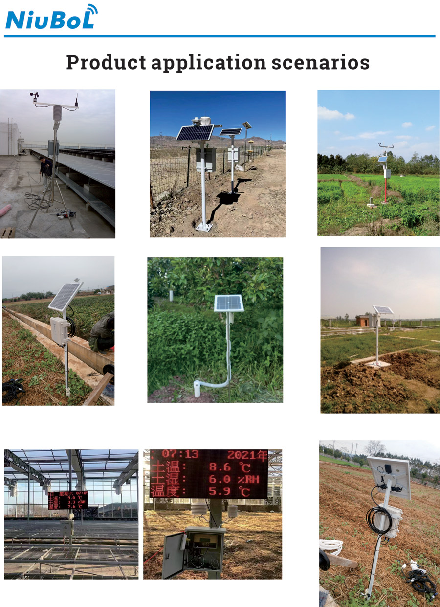
Specify agricultural weather stations in Africa around local observations and a sustainable field-service arrangement. Confirm power and communications at the site and distinguish weather from root-zone measurements. Use an existing installation as a configuration reference, then reassess its suitability for the new crop, location and observation purpose.
Prev:How Startups Innovate in Agricultural IoT
Next:Automated Weather Station FAQ: Scope, Records and Service Questions
Related recommendations
Sensors & Weather Stations Catalog
 Agriculture Sensors and Weather Stations Catalog-NiuBoL.pdf
Weather Stations Catalog-NiuBoL.pdf
Agriculture Sensors Catalog-NiuBoL.pdf
Water Quality Sensor Catalog-NiuBoL.pdf
Related products
 Combined air temperature and relative humidity sensor
 TDR Soil Moisture & Temperature Sensor for irrigation| RS485 |4-20mA| NBL-S-THR
 Soil pH sensor RS485 soil Testing instrument soil ph meter for agriculture |NBL-S-PH
 Wind Speed sensor Output Modbus/RS485/Analog/0-5V/4-20mA
 Tipping bucket rain gauge for weather monitoring auto rainfall sensor RS485/Outdoor/stainless steel
 Pyranometer Solar Radiation Sensor 4-20mA/RS485


Screenshot, WhatsApp to identify the QR code
WhatsApp number:+8615367865107
(Click on WhatsApp to copy and add friends)

