


— Blogs —
—Products—
 Consumer hotline +8618073152920
 WhatsApp:+8615367865107
Address:Room 102, District D, Houhu Industrial Park, Yuelu District, Changsha City, Hunan Province, China
Product knowledge
Time:2025-10-14 15:39:13 Popularity:1390
Meteorological monitoring, as the foundational discipline for human understanding and prediction of the natural environment, is undergoing a profound revolution driven by IoT, materials science, optical technology, and artificial intelligence (AI). The core goal of this technological transformation is: higher precision, faster response, broader coverage, and lower maintenance costs. Traditional meteorological monitoring equipment, reliant on bulky mechanical components and time-consuming manual inspections, can no longer meet the demands of modern precision agriculture and disaster warnings for real-time, high-frequency data.
These cutting-edge technological breakthroughs not only improve data collection quality but, more importantly, enable automated weather stations (AWS) and agrometeorological stations to be deployed on a large scale in more remote and harsher environments, providing unprecedented data support for 90% of global farming decisions.
Replacing traditional mechanical cup or propeller structures, ultrasonic anemometers calculate wind speed and direction by measuring the time difference of sound waves propagating through the air. Advantages include: no moving parts, meaning zero wear, extremely low maintenance, and high sensitivity to light winds, avoiding the jamming issues of traditional devices in freezing or dusty environments. It is the top choice for high-reliability meteorological stations.
MEMS technology significantly reduces the size of sensors for temperature, humidity, and pressure, while integrating highly digitized interfaces. This greatly lowers manufacturing costs, making it economically feasible to deploy high-density, low-power sensor arrays within farms.
Laser rain gauges measure the attenuation and scintillation effects of laser beams caused by raindrop obstruction, not only accurately measuring rainfall but also analyzing raindrop size distribution. This is more precise than traditional tipping-bucket rain gauges, helping to distinguish between rain, snow, and hail, and guiding assessments of soil erosion risks.
By combining real-time high-frequency data from ground agrometeorological stations with numerical weather prediction models (NWP) and satellite remote sensing data, and training and optimizing through deep learning AI models, this significantly improves the 1-7 day forecast accuracy for local severe convective weather, frost, and other microclimate events.
Integrating multispectral or hyperspectral sensors into fixed stations or unmanned aerial vehicles (UAVs) for remote monitoring of crop leaf pigments, moisture content, and nitrogen levels. These data help farm managers assess crop health status and stress indices in real-time, enabling non-contact precision diagnostics.
Through efficient miniature solar panels, thermoelectric generation, or wind energy harvesting technologies, this solves the power supply bottlenecks for AWS in remote areas. It allows meteorological stations to operate completely off-grid, enabling 24/7 autonomous operation, especially suitable for developing countries and remote farmlands.
Phased-array radar quickly changes radar beam direction electronically, rather than relying on mechanical rotation, achieving extremely high scanning frequencies. This captures the formation and evolution of heavy rain, hail, and other severe convective weather with higher resolution and faster speed.
Pushing data processing capabilities down to the local data logger of the automated weather station. Sensor data undergoes preprocessing, compression, and preliminary AI analysis (e.g., running frost or pest warning models) on-site, with only key results transmitted to the cloud, reducing cloud bandwidth and latency.
Integrating high-precision, long-life sensors for CO₂, CH₄, O₃, and other gases into meteorological stations. This serves not only environmental science but also monitors CO₂ concentrations in greenhouses to optimize fertilization and carbon sequestration projects.
LiDAR systems measure aerosols, cloud heights, and water vapor content in the atmosphere, providing vertical meteorological information. In agriculture, it can precisely locate cloud heights to assist in predicting light and radiation intensity, improving the accuracy of crop yield estimates.
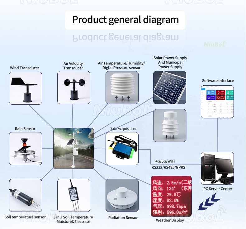
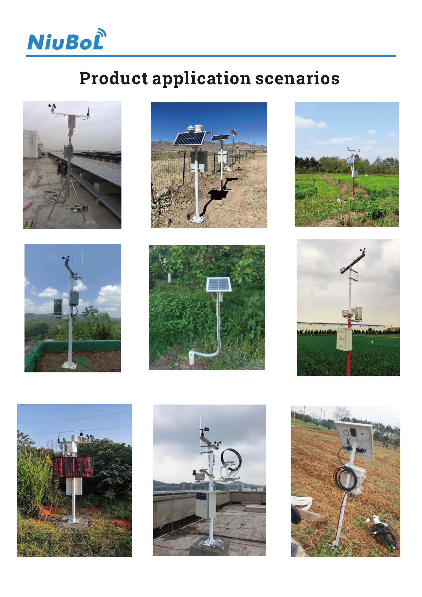
Agrometeorological stations are the comprehensive embodiment of these innovative technologies. They not only enhance the reliability of basic meteorological data but also directly convert data into agricultural decisions.
NiuBoL has always regarded technological innovation as its core competitiveness. We actively adopt and optimize multiple items from the top ten cutting-edge technologies, such as integrating ultrasonic anemometers, MEMS sensor technology, and edge computing into our flagship AWS series. We are committed to providing you with the most forward-looking and reliable meteorological monitoring solutions.
Call to Action: Embrace the latest achievements in meteorological monitoring to base your decisions on the most precise and reliable data. Contact us to learn how our innovative technologies can bring competitive advantages to your business.
A: The application of miniaturization technologies like MEMS actually reduces the cost of basic sensors. While the initial cost of ultrasonic anemometers is slightly higher than mechanical types, due to their extremely low maintenance costs and long service life (typically 5-10 years), they are more cost-effective from a total cost of ownership (TCO) perspective.
A: The platform simplifies the complex results of AI models into executable farming instructions. For example, when the AI predicts a frost probability exceeding 80%, the system sends to the farm manager: "Instruction: Immediately activate the irrigation system and run for 2 hours for frost protection." What we provide is decision-making, not raw data.
A: Laser rain gauges distinguish precipitation types by analyzing the signal waveforms and particle velocities formed after particles obstruct the laser beam. Raindrops, snowflakes, and hail differ in density and shape, producing unique signal characteristics. Through advanced algorithms analyzing these features, the rain gauge can accurately identify precipitation types with high precision.
Related recommendations
Sensors & Weather Stations Catalog
 Agriculture Sensors and Weather Stations Catalog-NiuBoL.pdf
Weather Stations Catalog-NiuBoL.pdf
Agriculture Sensors Catalog-NiuBoL.pdf
Water Quality Sensor Catalog-NiuBoL.pdf
Related products
 Combined air temperature and relative humidity sensor
 Soil Moisture Temperature sensor for irrigation|NBL-S-THR
 Soil pH sensor RS485 soil Testing instrument soil ph meter for agriculture |NBL-S-PH
 Wind Speed sensor Output Modbus/RS485/Analog/0-5V/4-20mA
 Tipping bucket rain gauge for weather monitoring auto rainfall sensor RS485/Outdoor/stainless steel
 Pyranometer Solar Radiation Sensor 4-20mA/RS485

Screenshot, WhatsApp to identify the QR code
WhatsApp number:+8615367865107
(Click on WhatsApp to copy and add friends)
