





— Blogs —
—Products—
 Consumer hotline +8618073152920
WhatsApp:+8615367865107
Address:Room 102, District D, Houhu Industrial Park, Yuelu District, Changsha City, Hunan Province, China
Product knowledge
Time:2024-11-20 14:29:34 Popularity:2138
Farm weather stations can supply observations to agronomic software, but the station's sensor list must match the model's required inputs. A platform field labelled evapotranspiration or disease risk does not establish that the corresponding calculation is included or valid for the crop. Before ordering a NiuBoL station, obtain the model's variables, units, observation intervals and exposure requirements, then check the instruments and data handoff against that list.
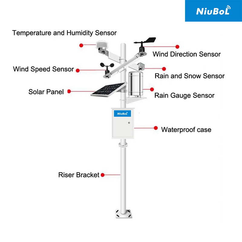
The same agricultural station can be used for field observation, irrigation analysis or research, but those tasks do not require identical data. Ask the agronomist or software provider which calculation will use the measurements. A request for weather data is too broad to determine whether temperature and rain alone are sufficient.
Identify whether the application needs actual observations, forecasts, calculated reference values or crop-specific advice. These are different inputs and outputs. A new station can improve local observation availability without providing a forecast service or replacing the crop and soil information used in an agronomic model.
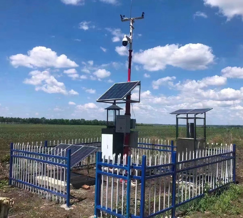
The FAO Penman-Monteith method defines a reference evapotranspiration calculation using meteorological data and a defined reference surface. Reference evapotranspiration, often written ETo, is not the same as measured soil moisture or the actual water use of a particular crop. Crop characteristics and management remain separate parts of an irrigation assessment.
For a station proposal, establish how the application obtains air temperature, humidity, wind and radiation information, together with location and elevation where required. If a method estimates missing inputs, identify them as estimates. A screen containing an ETo field does not show whether the calculation is enabled or whether all its inputs are measured locally.
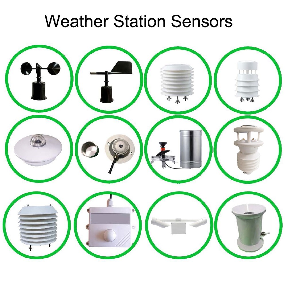
| Application requirement | Possible NiuBoL observation | Point to resolve |
|---|---|---|
| Air temperature and humidity | NBL-W-LBTH; temperature -40 to 80 C, +/-0.5 C; humidity 0-100% RH, +/-5% RH | Required statistics and shielded exposure, not just the latest value |
| Wind speed | NBL-W-SS; selected 0-45 or 0-70 m/s range; IP65 | Measurement height and averaging interval required by the method |
| Wind direction | NBL-W-DS; 0-360 degrees, +/-3 degrees; IP65 | Include it where the task uses direction; it is not a substitute for wind speed. |
| Solar irradiance | NBL-W-HPRS; 0-2000 W/m2 | Instantaneous irradiance versus radiation energy over the model interval |
| Liquid rainfall | NBL-W-RS; selected 0.2 mm resolution; basic operation 0-50 C | Correct precipitation type, interval and accumulation interpretation |
| Local soil condition | NBL-S-THR soil moisture and temperature | Probe depth and soil zone; these are not calculated atmospheric water demand. |
The required instrument list depends on the application. For example, a wind-direction channel may matter to an operation while a particular ETo calculation uses wind speed. Similarly, a soil probe can help assess local conditions without replacing the weather inputs required by that calculation.
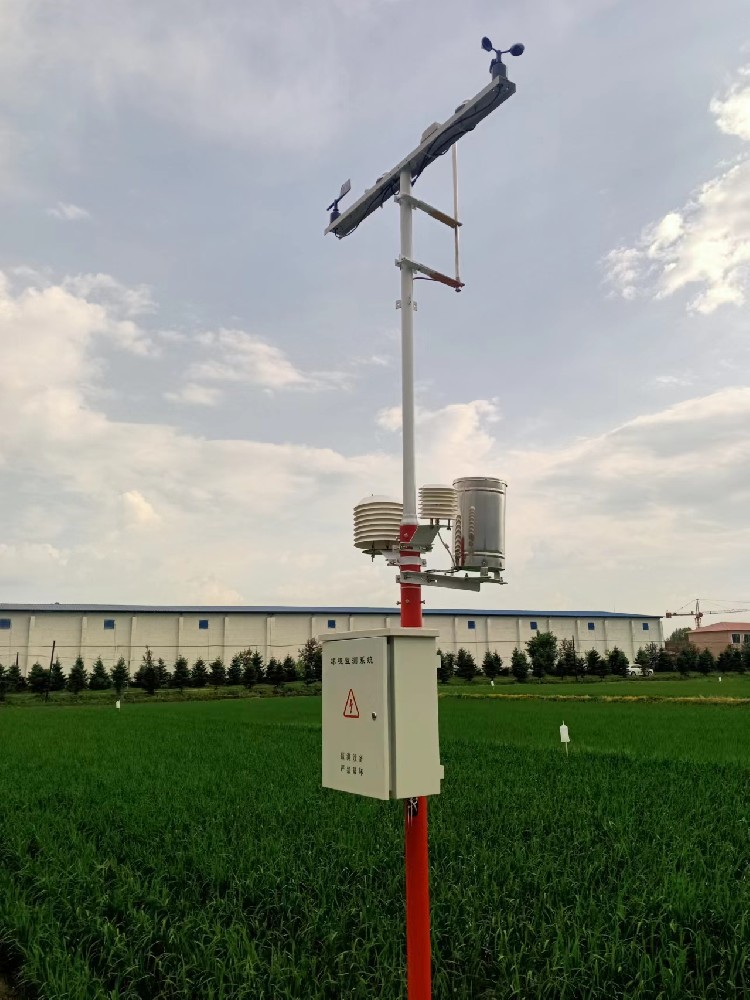
An application asking for a daily minimum and maximum temperature cannot recover them reliably from one current temperature value transmitted at the end of the day. A rain interval needs a defined start and end; the acquisition clock, reporting clock and application's date boundary must agree. Establish those fields before the receiving software is configured.
Solar irradiance in W/m2 is not daily radiation energy. As an illustrative unit check, a constant 200 W/m2 over one hour corresponds to 0.72 MJ/m2. Real measurements vary, so integration must use the applicable intervals and handle gaps. Multiplying a final instantaneous reading by the length of a day is not an acceptable substitute for a daily radiation record.
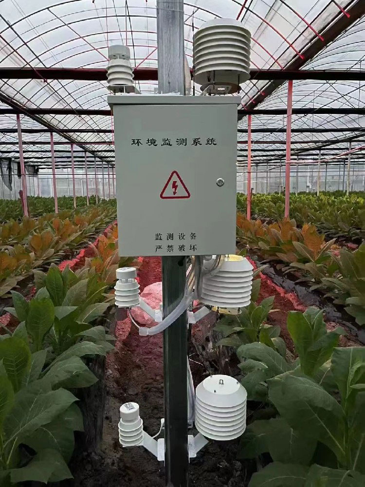
An outdoor station and an instrument inside a greenhouse observe different environments. Use greenhouse observations with a method appropriate to that environment rather than substituting them into an outdoor calculation without assessment. Specify the environment attached to each field and check the method's exposure assumptions.
For disease-risk work, obtain the actual crop-specific input list and method. Some applications may require leaf-wetness observations or other information beyond a basic air-temperature and humidity package. Do not create a wetness-duration field simply by renaming high relative humidity, and do not describe a weather station as detecting the pathogen or confirming infection.
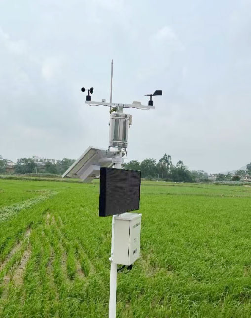
A wind value needs its measurement height as well as its unit. The FAO meteorological-data guidance uses wind speed at 2 m for reference evapotranspiration and describes height adjustment under specified exposure assumptions. Do not enter a different-height value as 2 m wind simply because the numerical unit is correct.
Keep the actual position and any transformation identifiable. Avoid applying a height correction in both the logger and the farm application. Changes to a sensor position or an input source should be reviewed with the person maintaining the model, particularly where a seasonal record spans different installation conditions.
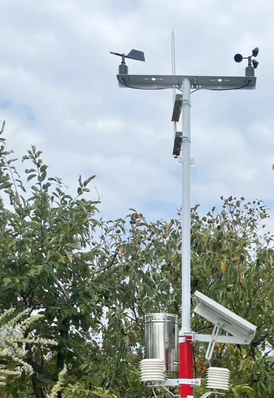
The TG462/TG462S data logger and gateway can acquire compatible instruments and support a configured network handoff. Selected sensor versions can use RS485 Modbus RTU; the agronomic application's import method is a separate interface. MQTT availability, for example, does not automatically establish an accepted variable schema at a particular software endpoint.
Before deployment, exchange a short sample containing timestamps, units, field names and missing-data indications. Check a complete interval and one unavailable input. Trace the resulting calculation back to its weather inputs. If an absent value is replaced by an estimate or a previous observation, the application should make that behaviour identifiable rather than presenting it as a new measurement.
Send NiuBoL the software input specification, intended crop or research use, installation environment and communication destination. Mark which calculations or alerts will run in existing software and which services are being requested with the station. This avoids purchasing sensors that cannot supply the required fields or expecting a model that was never included.
A successful data import is only one check. Review whether the observations fit the selected method and whether the resulting output has the intended meaning. An irrigation recommendation is not evidence that water has been delivered, and a risk indication is not proof that the predicted event has occurred.
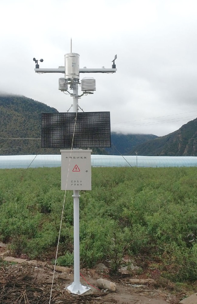
Only where the ordered logger or application includes a defined calculation with suitable inputs. Sensors provide observations; the existence of a weather station alone does not establish an enabled ETo service.
Not without an applicable estimation method and an assessment of its limitations. Obtain the software's actual requirements and identify measured versus estimated inputs before choosing the station.
No. W/m2 describes irradiance, whereas a daily energy input requires integration over time and an appropriate energy-per-area unit. Confirm the application's field definition and gap handling.
No. RS485 is the field connection to an instrument. The logger must interpret that instrument, and a separate import or network arrangement must supply the software's required fields.
No. It can be an input to a suitable assessment, but damage and infection depend on additional conditions. Match the model, crop context and measurement location rather than treating a threshold crossing as a confirmed outcome.
Use a short real dataset with known units and timing, including a missing-input example. Check how the application imports it and which observations or estimates contribute to its result. This is more informative than a dashboard showing untraceable example values.
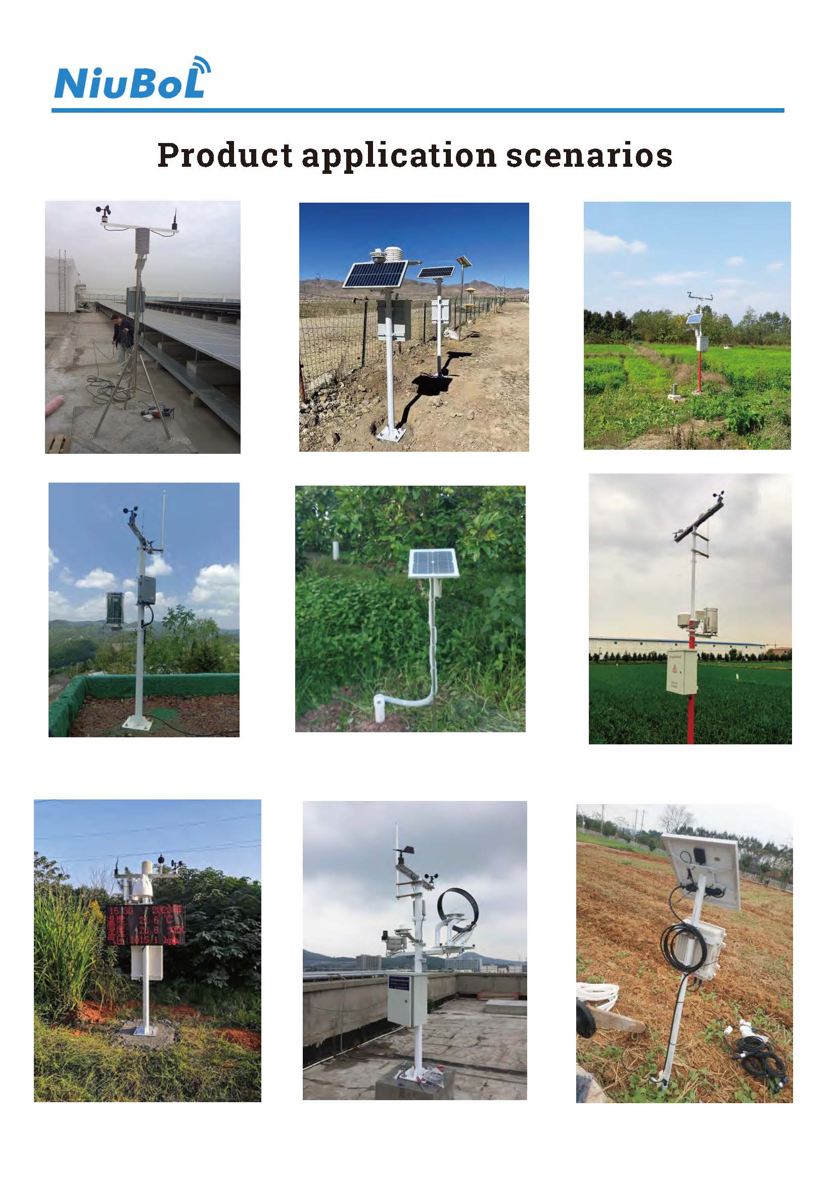
Choose farm weather stations against the data requirements of the intended agronomic method. Check quantities, intervals, units, measurement height and missing-input treatment before relying on calculated results. A clearly specified NiuBoL observation package can then connect to the project's chosen software without confusing sensor measurements with forecasting, crop diagnosis or irrigation execution.
Prev:Weather Station for Freezing Conditions: Check Each Channel
Next:Pyrheliometer Price: Compare the Instrument, Tracker and Acquisition
Related recommendations
Sensors & Weather Stations Catalog
 Agriculture Sensors and Weather Stations Catalog-NiuBoL.pdf
Weather Stations Catalog-NiuBoL.pdf
Agriculture Sensors Catalog-NiuBoL.pdf
Water Quality Sensor Catalog-NiuBoL.pdf
Related products
 Combined air temperature and relative humidity sensor
 TDR Soil Moisture & Temperature Sensor for irrigation| RS485 |4-20mA| NBL-S-THR
 Soil pH sensor RS485 soil Testing instrument soil ph meter for agriculture |NBL-S-PH
 Wind Speed sensor Output Modbus/RS485/Analog/0-5V/4-20mA
 Tipping bucket rain gauge for weather monitoring auto rainfall sensor RS485/Outdoor/stainless steel
 Pyranometer Solar Radiation Sensor 4-20mA/RS485


Screenshot, WhatsApp to identify the QR code
WhatsApp number:+8615367865107
(Click on WhatsApp to copy and add friends)

