





— Blogs —
—Products—
 Consumer hotline +8618073152920
WhatsApp:+8615367865107
Address:Room 102, District D, Houhu Industrial Park, Yuelu District, Changsha City, Hunan Province, China
Product knowledge
Time:2025-12-31 15:21:59 Popularity:884
The number of agricultural weather stations a farm needs depends on the conditions that must be represented, not a universal hectare-per-station rule. One well-exposed station may support shared weather observations while several soil or canopy points describe local differences. Add another full station when a distinct weather regime or operational requirement cannot be represented by the first location.
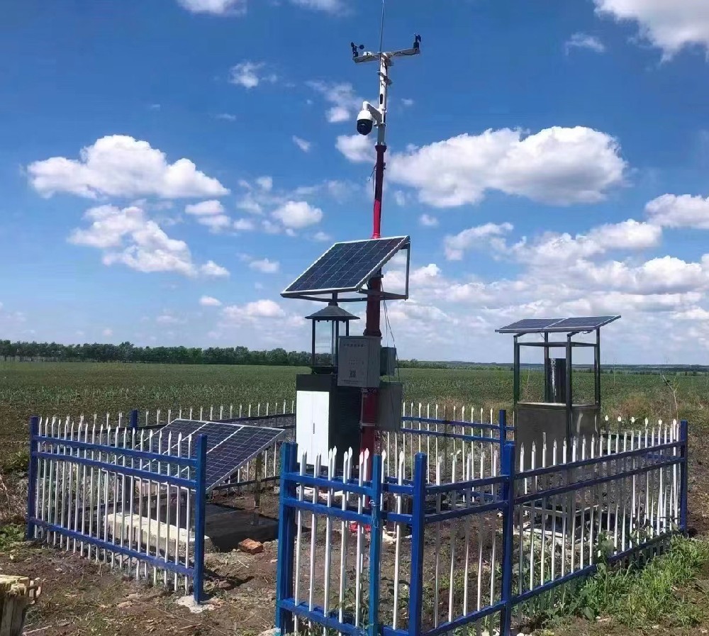
A farm can need many measurement points without needing a complete weather station at each one. Rainfall and exposed wind observations answer different questions from soil water beneath a dripper or temperature within a dense canopy. Treating them as one interchangeable environment can produce a technically connected system that is difficult to interpret.
Begin with the decisions: irrigation scheduling, weather context for operations, canopy-temperature investigation or a research comparison. Map the relevant management zones, terrain and structures. Then decide which observations can reasonably be shared and which need local measurement. A station count should follow that map.
| Farm condition | Possible arrangement | Reason to add measurement points |
|---|---|---|
| Similar open terrain with several irrigation zones | One representative weather station plus separate soil points | Different water distribution, soil texture or root depth |
| Exposed ridge and sheltered valley | Compare candidate weather locations before deciding coverage | Persistent differences affecting the intended operation |
| Greenhouses beside open fields | Outdoor weather observations plus internal climate/soil sensing | The covered growing environment is not the outdoor reference environment |
| Separated blocks with variable rainfall | Additional rainfall points or stations according to required channels | One rain gauge may not represent rainfall across all blocks |
| Research plots needing controlled comparisons | Matched measurement positions and a defined trial layout | The research question requires observations at each relevant treatment/location |
These are design options, not prescriptions for a fixed number of stations. A second rain gauge may resolve a rainfall question without duplicating wind, pressure and radiation channels. Conversely, adding soil probes to one sheltered mast does not establish exposed wind coverage for another block.
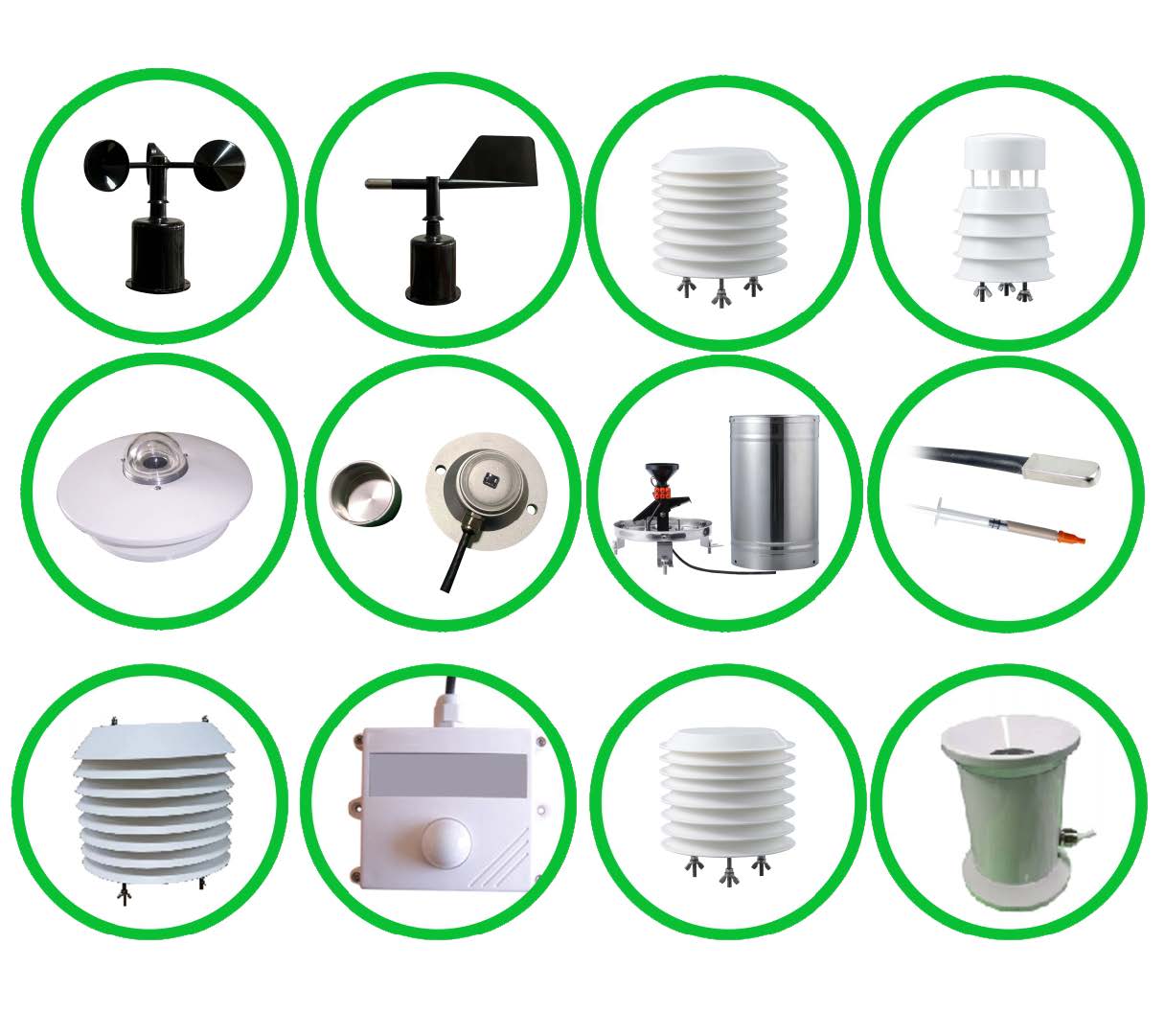
Air temperature and relative humidity describe the local atmosphere; rainfall records natural water input; wind helps characterize exposure; solar irradiance is relevant to energy and evaporation calculations. Root-zone moisture and temperature describe a different part of the crop environment. Optional channels should have an identified use rather than being included simply because a station can accept them.
The FAO reference evapotranspiration framework uses radiation, air temperature, humidity and wind speed. Reference evapotranspiration is not the same as the water requirement of every crop or the volume a pump should deliver. Use the chosen method, appropriate measurement heights and crop/soil information. Illumination in lux or pan evaporation should not be substituted into a different calculation without the required method and conversion.
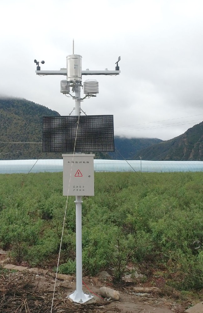
| Example NiuBoL component | Technical information | Implication for network design |
|---|---|---|
| NBL-W-LBTH atmospheric sensor | Temperature -40 to 80 C, +/-0.5 C; RH 0-100%, +/-5% RH; pressure 10-1200 hPa, +/-1.5 hPa | Three atmospheric channels at the installed location, not whole-farm uniformity |
| NBL-S-TM soil temperature/moisture sensor | Temperature -40 to 80 C, +/-0.5 C; moisture 0-100% VWC, stated +/-5% | Select representative zones and depths separately from the weather mast |
| NBL-W-SS wind speed sensor | 0-45 or 0-70 m/s range; starting speed at most 0.5 m/s; IP65 | Choose the range and exposure for the actual wind task |
| NBL-PH-1 logger | RS485/RS232, local FLASH and 4G functions according to configuration; saving interval 1-240 minutes | Confirm available channels, local retention and the receiving-system arrangement |
Temperature accuracy at a sensor does not define the temperature difference between a valley and ridge. Likewise, a soil probe's range does not establish that its point represents every irrigation zone. Keep instrument performance separate from the spatial question the network must answer.
Where representativeness is uncertain, compare temporary observations at the proposed locations over conditions relevant to the decision. Use comparable instruments, mounting and reporting intervals, and record the differences in exposure. A single afternoon does not establish the contrast during rain, nighttime cooling or a different wind regime.
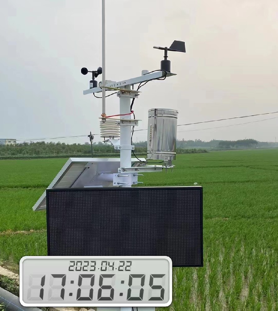
Investigate the pattern rather than only the average difference. A low-lying area may differ mainly during certain nights, while rainfall can differ by event. If those differences affect a management decision, identify the additional channel and location needed. If they do not, duplicating a complete station may add service cost without changing the operation.
Do not use a remote public weather feed as an unquestioned calibration reference for a local point. The locations, exposure and statistics can differ. A comparison can reveal a reason to investigate, but forcing both records to agree may erase the actual site contrast.
For RS485 Modbus RTU sensors, allocate unique device addresses, compatible serial settings and model-specific register mappings. Check the supply available at distant points and the communication layout separately. More nodes on one bus affect polling and wiring; there is no universal sensor count or cable distance appropriate to every farm.
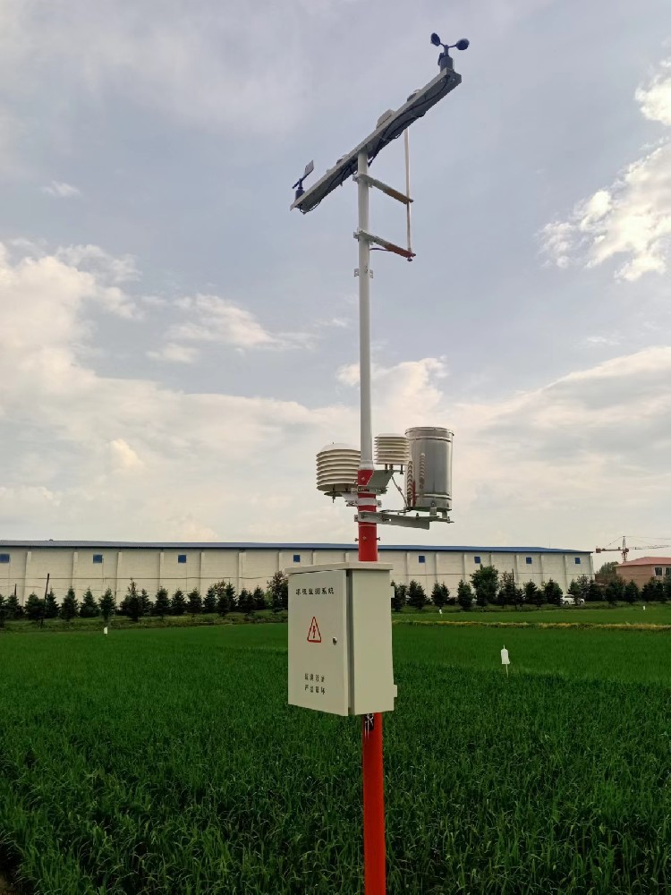
Where another logger or uplink is needed, preserve station and point identifiers in the receiving system. Keep installation height/depth and relocation dates with the records. A dashboard that averages unlike points without showing their identities can conceal the very difference that justified buying extra sensors.
Price the network as an installed and serviced arrangement: sensors, mounting, power, communications, access and field work. Solar autonomy and automatic backlog upload need configuration-specific verification. Neither a larger battery label nor local flash alone guarantees uninterrupted observations through every network or weather event.
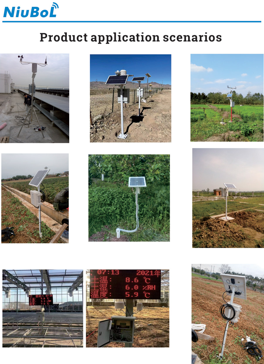
Not a universal rule for every farm and task. Terrain, structures, rainfall variability and the required decision determine representativeness. Establish the measurement objective and compare uncertain locations before fixing the station count.
No. Several soil points can be combined with shared weather observations where appropriate. They may still need separate acquisition or power arrangements depending on distance and interfaces.
It provides external context, not a substitute for internal observations. Ventilation, shading and the covered environment can create different conditions that need their own sensors.
No. An evapotranspiration or irrigation calculation needs a defined method, other required inputs and crop/soil interpretation. A radiation channel alone does not establish a pump runtime.
Consider one where separated blocks may receive materially different rainfall and that difference affects operations. Determine whether rainfall alone is needed or whether the second location also needs other weather channels.
Provide the farm/block layout, terrain and structures, intended decisions, proposed points/depths, power and communication access. Ask NiuBoL to distinguish shared station equipment from local sensor nodes and explain what each additional point contributes.
Useful agricultural weather stations represent defined conditions. Choose the number of stations and local nodes from the farm's actual contrasts, then verify their acquisition and service requirements. More measurements are worthwhile when they resolve a decision that the existing point cannot represent.
Prev:Weather Station Wind Sensor Upgrade: Cups and Vane to Ultrasonic
Next:Wind Speed and Direction Recorder Troubleshooting: Zero, Fixed and Missing Data
Related recommendations
Sensors & Weather Stations Catalog
 Agriculture Sensors and Weather Stations Catalog-NiuBoL.pdf
Weather Stations Catalog-NiuBoL.pdf
Agriculture Sensors Catalog-NiuBoL.pdf
Water Quality Sensor Catalog-NiuBoL.pdf
Related products
 Combined air temperature and relative humidity sensor
 TDR Soil Moisture & Temperature Sensor for irrigation| RS485 |4-20mA| NBL-S-THR
 Soil pH sensor RS485 soil Testing instrument soil ph meter for agriculture |NBL-S-PH
 Wind Speed sensor Output Modbus/RS485/Analog/0-5V/4-20mA
 Tipping bucket rain gauge for weather monitoring auto rainfall sensor RS485/Outdoor/stainless steel
 Pyranometer Solar Radiation Sensor 4-20mA/RS485


Screenshot, WhatsApp to identify the QR code
WhatsApp number:+8615367865107
(Click on WhatsApp to copy and add friends)

