


— Blogs —
—Products—
 Consumer hotline +8618073152920
 WhatsApp:+8615367865107
Address:Room 102, District D, Houhu Industrial Park, Yuelu District, Changsha City, Hunan Province, China
Product knowledge
Time:2026-03-08 15:08:14 Popularity:397
In the current dual context of intensifying global climate change and accelerating urbanization, hydrological dynamic monitoring of small and medium-sized rivers has become a core component in flood evaluation, watershed management, and urban drainage and flood prevention systems. Due to the characteristics of small and medium-sized rivers—such as short confluence time, drastic water level fluctuations, and complex runoff generation and concentration mechanisms—traditional contact-based monitoring methods often face pain points such as equipment damage, data interruption, and high maintenance costs during extreme flood periods.
As an industrial-grade sensor manufacturer, NiuBoL is committed to providing system integrators and project contractors with excellent performance monitoring terminals. By introducing 77-81GHz millimeter-wave radar technology, we have built a non-contact flow and water level monitoring matrix to ensure real-time and reliable data in harsh outdoor environments.

1. Impact of Urbanization on Runoff Generation and Concentration Mechanisms
With the increase in the proportion of impervious surfaces (roads, buildings, hardened channels), the infiltration capacity of natural underlying surfaces has significantly decreased. This means that for the same rainfall intensity, the total runoff generated in small and medium-sized river basins is larger, the peak is higher, and the evolution speed is faster. Traditional empirical formulas are gradually failing in highly urbanized basins, urgently requiring high-frequency measured data to calibrate hydrological models.
2. Necessity of Flood Warning and Non-Contact Measurement
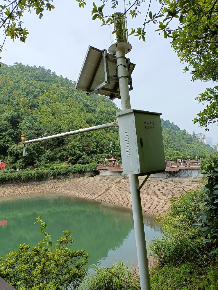
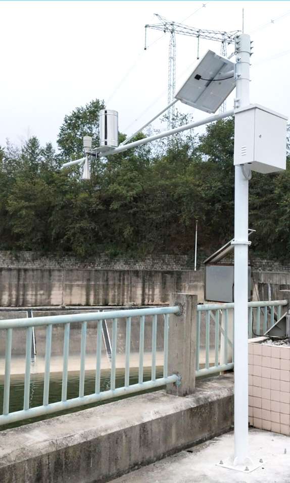
Small and medium-sized rivers are mostly distributed in mountainous areas or urban-rural fringe zones, with complex river cross-sections, abundant floating debris, and fast flow velocities. Contact sensors (such as static pressure water level gauges and float-type water level gauges) are prone to being buried by sediment, entangled by garbage, or physically impacted, leading to failure at critical flood control moments. Non-contact radar technology obtains physical characteristics of the water surface by emitting microwaves that penetrate rain, snow, and fog, making it an ideal choice for unattended, long-term monitoring.
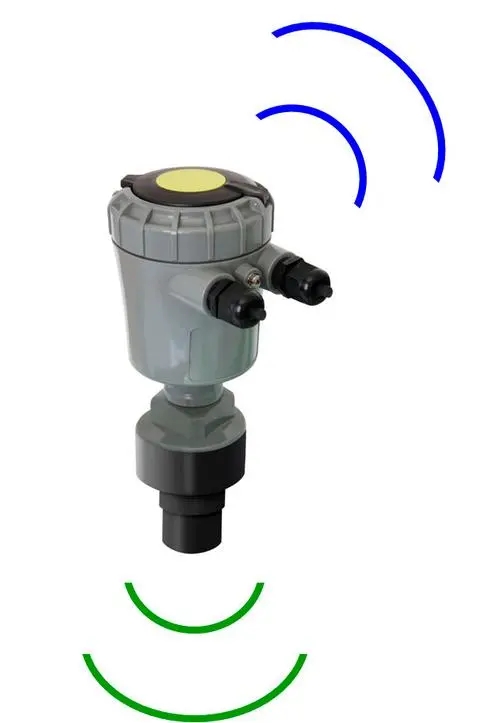
In smart water affairs projects, water level is the foundation for flow calculation. The 77GHz~79GHz Frequency Modulated Continuous Wave (FMCW) radar water level meter developed by NiuBoL represents the current top level of industrial-grade water level measurement.
| Parameter Item | Technical Specifications |
|---|---|
| Operating Frequency | 77GHz ~ 79GHz (FMCW) |
| Measurement Range | 0.15m ~ 65m |
| Measurement Accuracy | ±1mm (under 4m, 40%RH, 25℃ environment) |
| Resolution | 1mm |
| Antenna Beam Angle | 8° |
| Power Supply Voltage | DC 10-30V |
| Maximum Power Consumption | 0.6W |
| Communication Interface | RS485 (standard ModBus-RTU) |
| Protection Rating | IP67 |
| Ambient Temperature | -40℃ ~ +80℃ |
Echo Filtering Algorithm: The system has a built-in dynamic tracking algorithm that can automatically identify and filter out false echoes generated by raindrops, fog, or floating objects on the water surface.
Spatial Filtering Technology: Combined with an 8° narrow beam antenna, digital signal processing (DSP) is used to achieve spatial filtering, excluding static interference from fixed targets such as riverbank guardrails and bridge piers.
Multi-Point Average Sampling: The device supports configurable sampling period and smoothing factor. By performing weighted average processing on instantaneous water levels, it effectively eliminates wave fluctuation errors caused by gusts or passing vessels.
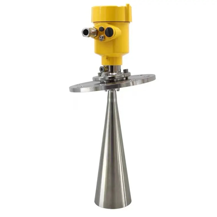
For projects that need to master water balance and total volume control, water level data alone is insufficient. NiuBoL flow monitoring system achieves the leap from "point measurement" to "cross-section quantification" by integrating radar velocity calculation models.
System Working Principle
The system senses the Doppler frequency shift on the water surface through 24GHz radar to obtain surface velocity (V_surface), while using 80GHz radar to obtain precise water level (H). Through preset channel cross-section parameters, the system automatically calculates the flow area (A), and introduces correction coefficients based on fluid mechanics models to finally output instantaneous flow (Q).

| Parameter Item | Technical Specifications |
|---|---|
| Velocity Measurement Frequency | 24.00GHz |
| Velocity Range | 0.1 ~ 20m/s |
| Velocity Accuracy | ±2% |
| Ranging Frequency (Water Level) | 76GHz ~ 81GHz |
| Water Level Range | 0.1 ~ 65m |
| Ranging Accuracy | ±1mm |
| Communication Protocol | RS485 (standard ModBus-RTU) |
| Power Supply Requirement | DC 10-30V / 1.3W (maximum) |
For system integrators (SI), NiuBoL provides standardized physical layer and protocol layer interfaces to ensure rapid access of devices to various monitoring platforms.
1. Typical IoT Architecture
Perception Layer: NiuBoL radar water level meter/flow meter array.
Transmission Layer: Industrial-grade RTU, supporting the Ministry of Water Resources SL651-2014 "Hydrological Monitoring Data Transmission Protocol".
Platform Layer: Smart water affairs cloud platform, realizing real-time alarms, historical curve analysis, and flow accumulation reports.
2. Compliance with Industry Standards
NiuBoL hydrological monitoring equipment strictly follows the following standards to ensure project acceptance:
SL/T 712 "River Velocity and Flow Hydrological Industry Standard".
GB/T 15966 "Basic Parameters and General Technical Conditions for Hydrological Instruments".

On-Site Installation Recommendations
Range Matching: Ensure the maximum range of the water level meter covers the historical extreme high water level, and the installation height is more than 0.5m above the extreme high water level.
Cross-Section Selection: Flow measurement should select straight river sections with regular river channels, stable flow, and no obvious backflow or vortices.
Horizontal Calibration: The transmitting surface of the water level meter must remain parallel to the water surface. An installation deviation of every 1° may cause a 0.01% distance error.
| Configuration Parameter | Description | Default Value |
|---|---|---|
| Device Address | Unique identification code during networking | 0x01 |
| Baud Rate | Adapt to RTU sampling frequency | 9600 bps |
| Smoothing Factor | Filtering strength of sampled data (1-200) | 10 |
| Cross-Section Type | Rectangular, trapezoidal, irregular cross-section, etc. | Customer-defined |
Q1: What are the advantages of radar water level meters compared to ultrasonic water level meters?
A1: Radar waves are minimally affected by ambient temperature and air pressure, with strong penetration. In heavy rain and dense fog environments, their stability far exceeds that of ultrasonic sensors.
Q2: How does non-contact velocity measurement ensure the accuracy of cross-section average velocity?
A2: The system has built-in velocity distribution models for different cross-section shapes. By setting correction coefficients (usually 0.85-0.9), surface velocity is converted to average velocity.
Q3: What improvements does 77GHz radar have over 24GHz radar in water level measurement?
A3: 77GHz has a wider sweep bandwidth, achieving 1mm resolution, and a narrower beam angle, effectively reducing false echoes in complex environments.
Q4: What data output interfaces does the device support?
A4: Standard products provide RS485 interface, supporting ModBus-RTU protocol, convenient for access to PLC, DTU, or smart water affairs gateways.
Q5: How to calculate flow if the cross-section is irregular?
A5: The system supports "water level-area" curve fitting. Users only need to provide cross-section area points corresponding to different water levels, and the system can calculate flow through piecewise linear interpolation.
Q6: Can it be used to measure rivers with a large amount of floating debris?
A6: Yes. Radar identifies water ripple texture, and a small amount of floating debris does not affect measurement. The system has built-in algorithms to filter non-typical echoes.
Q7: Can NiuBoL sensors' protection rating really cope with outdoor environments?
A7: Adopts IP67 full-sealed design, housing resistant to UV and salt spray, integrated lens to prevent insects from nesting and blocking the antenna.
Q8: How to solve data remote transmission problems in outdoor environments?
A8: RS485 transmission distance can reach more than 1200 meters. For longer distances, it is recommended to pair with NiuBoL wireless telemetry terminals to achieve 4G/5G cloud synchronization.

Hydrological monitoring of small and medium-sized rivers is not only the cornerstone of disaster prevention and mitigation but also the key to scientific allocation of water resources. The radar water level meter and flow monitoring solutions provided by NiuBoL, with high-frequency FMCW technology, industrial-grade signal processing algorithms, and strong anti-interference capabilities, offer system integrators highly reliable perception-layer options.
Through standardized interfaces and protocol support, partners can quickly build monitoring systems that comply with national water conservancy standards. In the future globalization process of smart water conservancy, we will continue to iterate non-contact measurement technology to create long-term value for project contractors.
If you have specific project site deployment requirements or need detailed protocol documents, please contact the NiuBoL technical team, and we will provide you with customized selection solutions.
Related recommendations
Sensors & Weather Stations Catalog
 Agriculture Sensors and Weather Stations Catalog-NiuBoL.pdf
Weather Stations Catalog-NiuBoL.pdf
Agriculture Sensors Catalog-NiuBoL.pdf
Water Quality Sensor Catalog-NiuBoL.pdf
Related products
 Combined air temperature and relative humidity sensor
 Soil Moisture Temperature sensor for irrigation|NBL-S-THR
 Soil pH sensor RS485 soil Testing instrument soil ph meter for agriculture |NBL-S-PH
 Wind Speed sensor Output Modbus/RS485/Analog/0-5V/4-20mA
 Tipping bucket rain gauge for weather monitoring auto rainfall sensor RS485/Outdoor/stainless steel
 Pyranometer Solar Radiation Sensor 4-20mA/RS485

Screenshot, WhatsApp to identify the QR code
WhatsApp number:+8615367865107
(Click on WhatsApp to copy and add friends)
