





— Blogs —
—Products—
 Consumer hotline +8618073152920
WhatsApp:+8615367865107
Address:Room 102, District D, Houhu Industrial Park, Yuelu District, Changsha City, Hunan Province, China
Product knowledge
Time:2026-02-16 12:25:53 Popularity:668
Quick Answer: A portable soil moisture meter is useful for surveying irrigation variation, checking suspected dry areas and evaluating where permanent sensors should be installed. It provides measurements at visited points, not a continuous record of the whole field. Select a matched host and probe, keep depth and insertion conditions consistent, and validate the moisture scale in the relevant soil. USB data export from a handheld unit should not be confused with an RS485 interface on a separate fixed sensor.

An irrigation contractor may need to establish whether a dry reading represents a management zone, poor emitter performance or one badly installed probe. A portable instrument lets the team inspect several locations during the same visit. It is particularly useful before permanent node placement, after irrigation modifications and when a fixed measurement disagrees with crop or soil observations.
The result is a field comparison, not automatically a prescription. A single shallow reading cannot describe the full rooting depth, and a route completed over several hours may combine measurements taken before and after irrigation starts. Record what changed during the survey. For a commissioning visit, schedule comparable irrigation conditions or separate the affected measurements in the analysis.
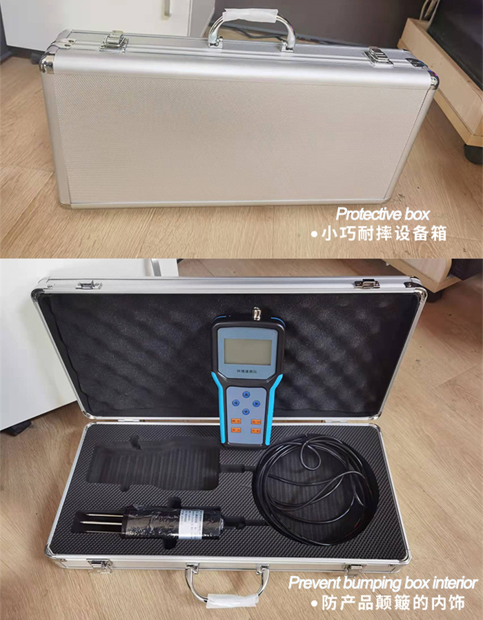
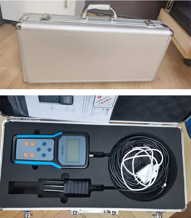
A NiuBoL handheld soil moisture and temperature kit combines a portable host, matched probe and local recording. A different kit can add conductivity or salinity-related functions. Order the required combination explicitly; similar connectors or similar-looking probes do not establish interchangeable firmware, measurement scale or power requirements.
Divide the area into meaningful comparison groups: soil texture, irrigation sector, topography or known management differences. Include a representative location in each group and targeted checks where a problem is suspected. Keep the targeted measurements separate from the representative sample when calculating a group average; deliberately sampling dry patches can otherwise make the entire sector appear drier than it is.
Write the measurement depth and position relative to the plant and emitter into the route plan. Under drip irrigation, distance from a dripper can matter as much as the field coordinate. A measurement near the wetted center is not directly comparable with one near the edge of the wetting pattern. Use repeated insertions at comparable locations to examine local variation rather than repeatedly recording the same undisturbed insertion as independent samples.
| Record with each point | Why it changes interpretation |
|---|---|
| Zone, point identifier and depth | Separates spatial variation from a different layer or location |
| Time and irrigation status | Distinguishes a field difference from a wetting event during the route |
| Distance from emitter or crop row | Allows comparison within a similar wetting geometry |
| Probe identity and calibration | Prevents a probe change from appearing as a soil change |
| Insertion quality and unusual material | Identifies rocks, voids, compaction or disturbed soil affecting contact |
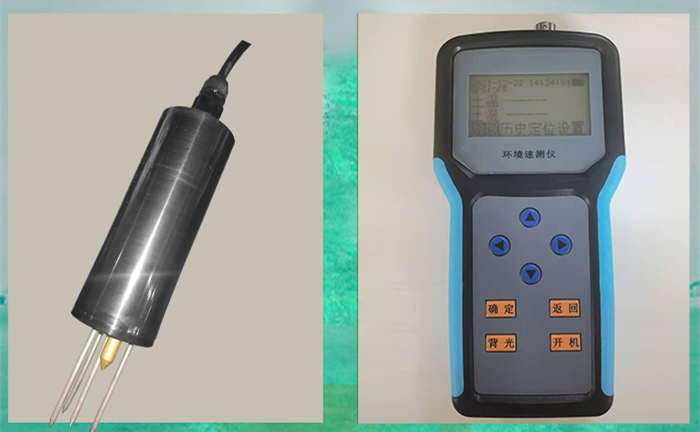
The handheld display is not the same component as the buried sensing element. A probe may tolerate conditions that the host, charging connector and display cannot. Do not bury the complete kit or assume that an IP68 probe gives the handheld unit an immersion rating. Protect the host during rain and cleaning according to the supplied assembly's enclosure requirements.
| Item | NiuBoL moisture/temperature kit reference |
|---|---|
| Measurements | Soil moisture scale 0-100%; soil temperature -50 to 100 C |
| Resolution | 0.1% moisture; 0.1 C temperature |
| Accuracy for this configuration | Moisture +/-3%, with the percentage basis agreed for acceptance; temperature +/-0.5 C |
| Host power | Rechargeable lithium-ion battery; use the matched charger and charging input |
| Host data interface | USB download using compatible PC software |
| Storage | Approximately 40,000 records; confirm record definition and overwrite behavior |
| Host size; kit mass | 200 x 105 x 28 mm; approximately 0.5 kg |
| Host operating environment | -20 to 80 C; 5-95% RH; charging conditions must match the supplied battery and charger |
| Probe, cable and enclosure | Specify the matched probe, required cable length, jacket material and separate host/probe protection ratings |
Soil moisture is not atmospheric relative humidity. Establish whether the instrument's moisture scale is calibrated to volumetric water content for the intended soil before using it in a water-storage calculation. Likewise, a broad temperature measuring range does not establish that the host can be operated at every probe temperature. Include the host operating envelope and charging conditions in the accepted configuration.
Battery capacity and storage capacity answer different questions. Thousands of available memory slots do not establish how long a charged instrument will operate with its display and probe active. For a long survey, check actual runtime with the supplied probe and recording mode, and verify that the day's route can be completed without losing point identification.
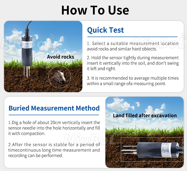
For soil moisture spot checks, insert the probe into representative, undisturbed soil with good contact around the sensing region. Avoid rocks and do not twist or lever the rods to force insertion. An oversized hole or a gap around the probe changes the dielectric environment. Adding water to make insertion easier also changes the quantity being measured.
Keep the insertion method consistent across the survey. Where a hard layer prevents proper insertion, record the limitation and use an appropriate access method rather than bending the probe or silently reducing the depth. For a buried installation used during a longer test, restore the soil carefully and allow disturbed conditions to stabilize. Do not compare freshly excavated, loosely backfilled soil with an established installation as though contact conditions were identical.
Repeat measurements across a small area to examine spatial variation. If nearby values differ, inspect the wetting pattern, soil texture and contact before averaging them. Repeating one electronic reading can test short-term stability, but it does not measure the variation across a root zone. Both checks may be useful; label which one was performed.
For a reference comparison, distinguish gravimetric water content from volumetric water content. In an illustrative soil sample, 140 g wet mass and 120 g oven-dry soil mass give a gravimetric water content of 20/120, or 16.7%. With an independently determined dry bulk density of 1.35 g/cm3 and water density near 1 g/cm3, the corresponding volumetric value is approximately 22.5%. Comparing the instrument's volumetric scale directly with 16.7% would create an apparent error from unlike quantities.
Use suitable laboratory procedures and representative samples across the moisture range of interest. Texture, density, salinity and contact can affect dielectric measurements. A single comparison at one moisture level cannot establish a reliable correction throughout drying and wetting. Keep the raw reading and the applied calibration identifiable so future surveys can be compared.
Portable versus fixed soil sensors is mainly a choice between spatial coverage during visits and temporal coverage at installed points. A handheld survey can compare many locations. A fixed probe and logger can reveal when a wetting front arrived or when a layer dried between visits. The two approaches are often complementary: survey first to assess variation, then use permanent nodes to follow selected zones.
When checking a fixed node with a handheld kit, compare the sensing depths and positions rather than just the map coordinates. Avoid disturbing the soil around the installed probe. A difference may reflect sensing volume, calibration or local moisture variation, not a failed device. Repeat the comparison under reasonably stable conditions and investigate persistent differences before changing coefficients.
For an illustrative 200 mm soil layer, field capacity of 0.31 m3/m3 and a representative measured value of 0.25 m3/m3 imply a 12 mm water deficit in that layer. This does not describe every deeper layer or automatically prescribe 12 mm of applied irrigation. Root distribution, other layers, rainfall and application efficiency still affect the decision.
A NiuBoL portable temperature, moisture, conductivity and salinity tester can add an ionic-condition measurement to a survey. Compare conductivity only with a defined method and moisture condition. Direct soil readings and laboratory extract results are not automatically interchangeable, and a conductivity increase does not identify which ion caused it.
Conductivity is not a measurement of individual nitrogen, phosphorus or potassium concentrations. Do not use a salinity-related value as a replacement for the crop's required soil analysis. For fertigation investigations, combine the soil route with irrigation-water quality, injector operation and appropriate laboratory results.
USB soil data export should be tested on the computer and software that will receive the survey. Record a short sequence with known point identifiers, download it and check timestamps, units, decimal places and channel names. Verify the recording mode and whether one memory record contains all channels or only one reading. Keep a verified copy before clearing the host.
A USB connection may use a PC driver and software workflow; it is not necessarily a removable storage disk or an open application interface. Confirm software compatibility and required permissions with the project's IT team. Do not assume that a handheld unit exposes an RS485 Modbus RTU slave interface simply because a fixed probe in the same product family does.
For continuous PLC or RTU integration, select a probe and data logger with the required interface. Confirm power, connector pinout, addressing and register layout for that arrangement. Add location information through an ordered positioning option or a defined external survey method. Four decimal places in a coordinate are a display format, not a five-metre positioning guarantee.
Request the NiuBoL field kit with the target soil types, required moisture basis, depth, additional parameters, daily route size and export requirements. Ask for a matched probe and a short acceptance trial. This makes the quotation relevant to the survey rather than a comparison of handheld display units alone.
It can support visited-point surveys but cannot record what happens between visits unless left in a suitable logging arrangement. Use permanent sensors when event timing or continuous control is required.
No. Texture, root depth, available water and crop stage affect the interpretation. Establish the soil-specific moisture basis and agronomic limits instead of applying one displayed percentage to every field.
No. Host, connector and probe ratings must be checked separately. Protect the display and charging connection according to the supplied host configuration.
They may sample different depths or soil volumes, or have different contact and calibration. Repeat a position-matched comparison before concluding that either instrument is defective.
Not without a supported interface and data workflow. For direct industrial polling, order a suitable digital probe and controller arrangement rather than assuming USB download implements Modbus RTU.
Demonstrate representative soil measurements, reference comparisons, point identification, recording and export on the actual computer. Confirm the ordered probe, battery runtime and treatment of full memory.
A portable soil moisture meter is a useful field-survey tool when depth, contact and data identity are controlled. Match the host and probe, check the moisture basis and use spot surveys alongside continuous measurements where needed. NiuBoL can help configure the field kit once the survey task and export workflow are defined.
Prev:Soil Moisture Monitoring Applications: Match Readings to Decisions
Next:Campus Weather Station Acceptance: Teaching Data and Safe Access
Related recommendations
Sensors & Weather Stations Catalog
 Agriculture Sensors and Weather Stations Catalog-NiuBoL.pdf
Weather Stations Catalog-NiuBoL.pdf
Agriculture Sensors Catalog-NiuBoL.pdf
Water Quality Sensor Catalog-NiuBoL.pdf
Related products
 Combined air temperature and relative humidity sensor
 TDR Soil Moisture & Temperature Sensor for irrigation| RS485 |4-20mA| NBL-S-THR
 Soil pH sensor RS485 soil Testing instrument soil ph meter for agriculture |NBL-S-PH
 Wind Speed sensor Output Modbus/RS485/Analog/0-5V/4-20mA
 Tipping bucket rain gauge for weather monitoring auto rainfall sensor RS485/Outdoor/stainless steel
 Pyranometer Solar Radiation Sensor 4-20mA/RS485


Screenshot, WhatsApp to identify the QR code
WhatsApp number:+8615367865107
(Click on WhatsApp to copy and add friends)

