





— Blogs —
—Products—
 Consumer hotline +8618073152920
WhatsApp:+8615367865107
Address:Room 102, District D, Houhu Industrial Park, Yuelu District, Changsha City, Hunan Province, China
Product knowledge
Time:2025-04-08 11:14:09 Popularity:1566
Urban rainfall monitoring provides local precipitation observations for road operations, but it does not directly measure standing water, drain capacity or vehicle safety. A rain station can prompt an inspection or contribute to an agreed warning process. Decisions about a flooded underpass or road closure also require information about the affected location, drainage response and the operator's procedures.
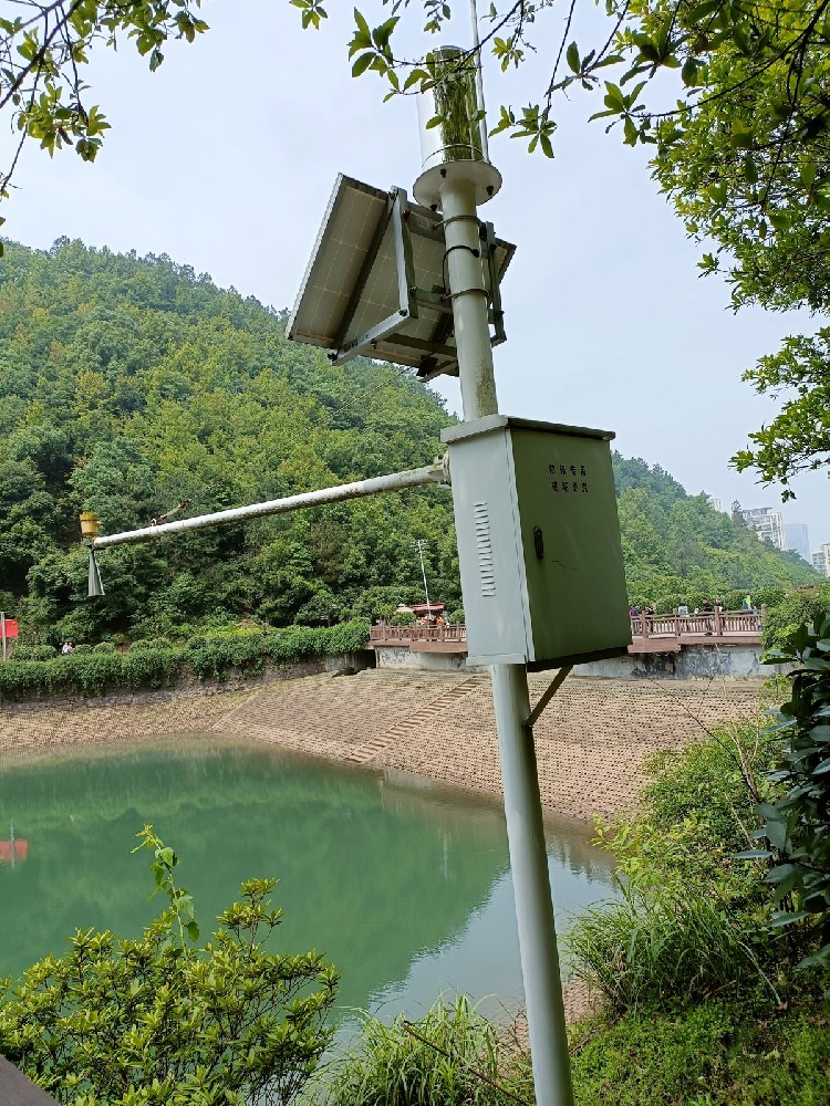
A rainfall station normally combines a gauge, acquisition equipment, power and a selected communications connection. It measures precipitation at its collector. Road flooding depends additionally on where water arrives, how it moves and whether the drainage system can remove it. A high rainfall total is not a direct reading of road water depth.
This distinction matters when selecting equipment for an urban operations centre. If the requirement is to know how much rain fell near a road asset, a suitable rain station addresses it. If the requirement is to detect water in an underpass, the project needs an appropriate water-level observation or another validated site-specific detection method as well.
Use urban rainfall monitoring to establish the weather context of an incident, identify periods requiring attention and support a wider operating process. Do not describe a gauge alone as a complete flood-warning, automatic road-closure or drainage-control system.
| Operational question | Rainfall contribution | Other information needed |
|---|---|---|
| Has rain begun near the monitored road? | Local rainfall events or interval amount | Collector condition and the definition of the reported interval |
| Should a drainage hotspot be inspected? | Recent amount and intensity under an agreed rule | Site history, access arrangements and operator criteria |
| Is an underpass flooded? | Context for how the event developed | Actual water conditions at the underpass |
| Did a pump remove water? | Input context, not proof of pumping | Pump state, discharge or level response as required by the asset |
| Is visibility reduced on the road? | Precipitation context | A relevant visibility observation and local operating assessment |
A weather station may combine several of these sensors, but the channels remain separate. Rainfall does not replace an optical visibility measurement, and an electrical pump command does not prove hydraulic performance. Keep each requirement explicit in the equipment schedule.
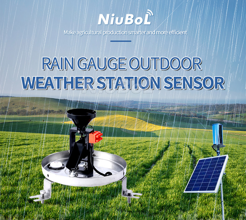
The NiuBoL NBL-W-RS stainless steel tipping bucket rain gauge collects liquid rainfall and generates the selected electrical output as the mechanism tips. The acquisition system must convert that output into the specified time series. A gauge's physical resolution and a platform's reporting interval are different parts of that process.
| NBL-W-RS parameter | Specification | Roadside project implication |
|---|---|---|
| Receiving opening | 200 ±0.6 mm diameter | Keep it level and clear of interception, splash and runoff from structures. |
| Rainfall increment | 0.2 mm; 6.28 mL per tip | A tip represents a collected depth increment, not a road water-depth increment. |
| Intensity range | 0-4 mm/min | Evaluate the model against the expected liquid-rainfall conditions. |
| Accuracy condition | ±4% in the specified indoor test at 2 mm/min | Not an unconditional accuracy guarantee for every roadside exposure or storm. |
| Supply and output versions | DC 5 V or DC 12-24 V; switching, selected voltage or RS485 output | Match the ordered version to the receiving input and available supply. |
| Operating environment and lead | 0°C to 50°C; standard cable 5 m | Freezing capability and a longer cable route need separate assessment. |
The ABS-housed NBL-W-ARS is a separate model from the stainless steel NBL-W-RS. A shared tipping mechanism does not make their housing and environmental specifications interchangeable. Select and document the actual model and output version in the quotation, and retain the matching equipment information for later service.
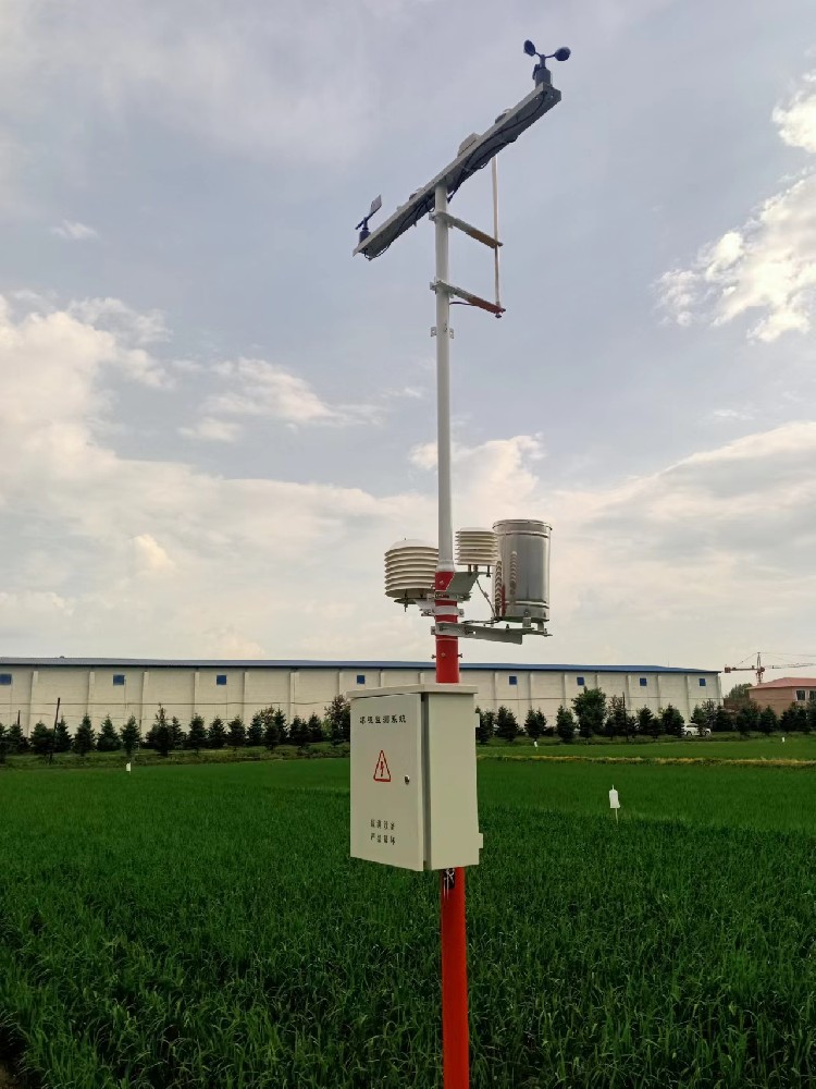
For a switching-output NBL-W-RS configured at 0.2 mm per tip, 20 counted tips represent 4 mm. If those tips belong to a defined five-minute interval, the average intensity for that interval is 4 / 5 × 60 = 48 mm/h. This calculation illustrates reporting; it is not a measured project result or a road-warning threshold.
The same total does not establish the instantaneous peak rate or the water depth on a carriageway. If an operator needs the timing of individual tips, confirm that the logger records those events. Storing only periodic totals cannot later recreate every event time.
For an RS485 Modbus RTU version, use the actual rainfall field, units, scaling and reset behavior. Do not apply the pulse factor to an already converted millimetre value. Distinguish an interval amount from a cumulative counter so restarting equipment does not create an apparent negative or unusually large rain event.
Roadside locations can be affected by trees, signs, bridges, roof edges, vehicle spray and maintenance activity. A convenient cabinet position may not be a suitable collector position. A gauge receiving drips from a structure describes intercepted water from that structure, not undisturbed rainfall at the site.
Keep service access practical and separate from the hazard being observed. An instrument that cannot be inspected during or after heavy rain may remain blocked through the period when its record is most needed. Document the location and surrounding features, and recheck them after vegetation growth or construction changes.
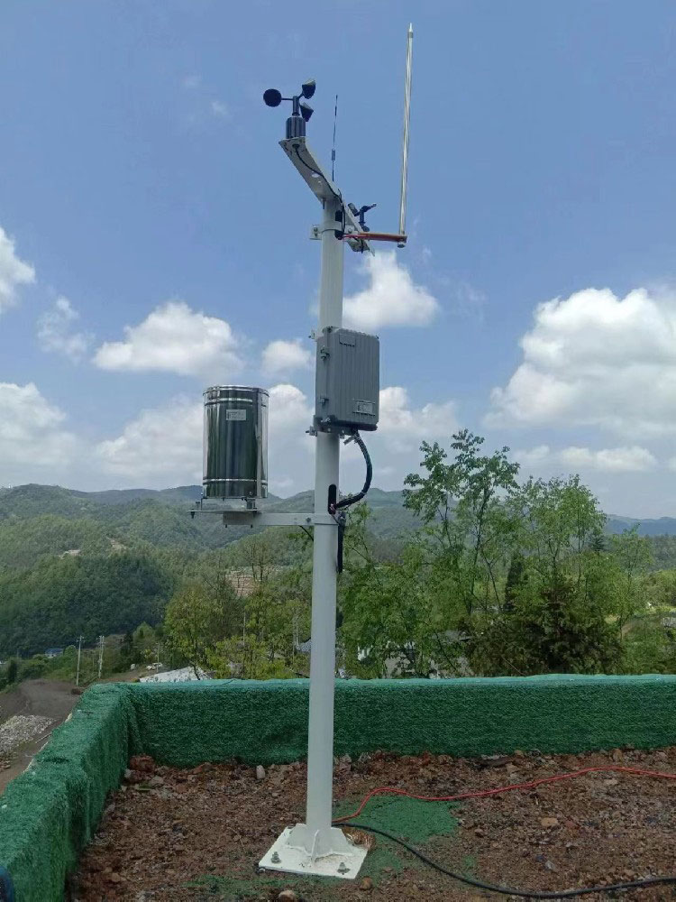
Agree what the rainfall input is allowed to do: display conditions, notify an operator, request a site check or contribute to a broader decision rule. Specify who authorizes the response. Avoid a single universal rain threshold that supposedly determines safe road operation at every asset.
| Test situation | Expected information | Incorrect conclusion to avoid |
|---|---|---|
| Heavy local rain, no observed standing water | Rainfall and the actual road condition remain separate. | Rain intensity alone proves a flooded carriageway. |
| Water remains after rain stops | Continue observing the water condition and asset response. | A dry interval automatically means the road has drained. |
| Rain station stops communicating | Show unavailable or stale rainfall and follow the agreed fault procedure. | No message means no rain. |
| Maintenance water is poured through the gauge | Identify the service period and test-generated tips. | The test is a natural rain event requiring an operational warning. |
Test receiver logic with labelled simulated inputs before a controlled field exercise. That checks the data handling and notification path; it does not calibrate the gauge or prove drainage performance. Any test connected to live road signs or closure equipment needs the road operator's approved arrangements.
The NiuBoL NBL-W-TG462 logger family offers acquisition and gateway configurations, including RS485. Confirm that the ordered unit accepts the selected rain-gauge output and supplies the required recording and delivery functions. The logger's IP30 enclosure needs suitable outdoor protection; it is not the weather rating of the complete roadside station.
For a quotation, provide the asset location, monitoring question, required intervals, existing PLC or RTU, power source and receiving-system format. Identify separate water-level or visibility requirements where they are part of the operating task. Request the sensor, acquisition, cabinet, installation and service scope separately enough to compare offers.
Include collector inspection, levelling, cleaning, counting-path checks and documentation of test tips in the maintenance plan. A suitable rain gauge configuration depends on the observed precipitation and site conditions, not an assumption that optical, weighing or tipping instruments are universally more accurate in every urban setting.
A municipal operator can compare rainfall with a water-depth observation only when both points, units and timestamps are identified. Document the underpass datum and the road low point; a rain gauge on a nearby mast measures precipitation, not the water accumulated at the drain. This distinction should be visible on the dashboard before staff rely on an alert.
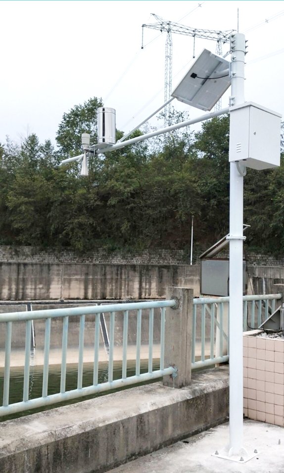
No. It records precipitation at the gauge. Underpass water conditions need a relevant local observation or another validated detection method. Use rainfall as context, not as a substitute for the condition the operator must assess.
No. Rainfall depth refers to collected precipitation. Road water depth depends on runoff, drainage, geometry and other inflows. The two measurements have the same length unit but describe different quantities.
The gauge provides a signal. Road closure requires a separately designed and approved operating system, criteria and authority. Confirm the permitted role of the rain input rather than treating a sensor output as a complete control system.
Select the gauge version to match the controller's counting, analog or RS485 Modbus RTU capability. Verify supply, wiring and conversion with the actual input. A pulse output cannot be connected and decoded as a Modbus device.
Remote delivery may stop even if local acquisition continues. Test the ordered logger's storage and recovery behavior, and show data age at the receiver. Do not replace unavailable rain observations with zero.
Trace controlled gauge input to the recorded amount and receiving display, check timestamps and interval definitions, and test unavailable data and service periods. Verify any notifications separately from the measurement check and from the asset's hydraulic performance.
Locate the rain gauge for representative precipitation exposure and the depth instrument at the actual low point or drainage feature the road operator needs to manage. They need not be on the same mast. Document each datum and maintenance access; moving either sensor can change the meaning of a historical trend.
Show an explicit unavailable or fault state with the last valid observation time. Do not display the last depth as if it were current, and do not substitute zero water. The operating procedure should define what staff do when the sensor or communications path fails during a rain event.
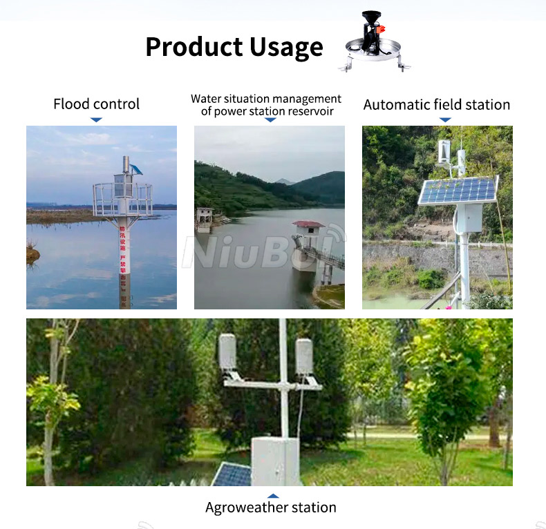
Urban rainfall monitoring supports road operations when precipitation, road condition and response authority remain distinct. Select the NiuBoL gauge and acquisition path for a clear local record, then combine it with the observations required at the affected asset. A useful rain station contributes evidence without claiming to measure every road hazard.
Prev:Ultrasonic Weather Station Working Principle: Wind Is Only One Channel
Next:Soil Moisture Monitoring Stations and Sensors: Smart Assistants for Modern Agricultural Production
Related recommendations
Sensors & Weather Stations Catalog
 Agriculture Sensors and Weather Stations Catalog-NiuBoL.pdf
Weather Stations Catalog-NiuBoL.pdf
Agriculture Sensors Catalog-NiuBoL.pdf
Water Quality Sensor Catalog-NiuBoL.pdf
Related products
 Combined air temperature and relative humidity sensor
 TDR Soil Moisture & Temperature Sensor for irrigation| RS485 |4-20mA| NBL-S-THR
 Soil pH sensor RS485 soil Testing instrument soil ph meter for agriculture |NBL-S-PH
 Wind Speed sensor Output Modbus/RS485/Analog/0-5V/4-20mA
 Tipping bucket rain gauge for weather monitoring auto rainfall sensor RS485/Outdoor/stainless steel
 Pyranometer Solar Radiation Sensor 4-20mA/RS485


Screenshot, WhatsApp to identify the QR code
WhatsApp number:+8615367865107
(Click on WhatsApp to copy and add friends)

