





— Blogs —
—Products—
 Consumer hotline +8618073152920
WhatsApp:+8615367865107
Address:Room 102, District D, Houhu Industrial Park, Yuelu District, Changsha City, Hunan Province, China
Product knowledge
Time:2025-03-25 09:25:22 Popularity:1454
Small weather stations for agriculture provide local observations for field operations and crop records. Their value depends on the decision they support: rainfall for irrigation review, wind for assessing application conditions, or air temperature and humidity for crop-risk models. A station does not independently predict storms, diagnose crop disease or guarantee a yield improvement.
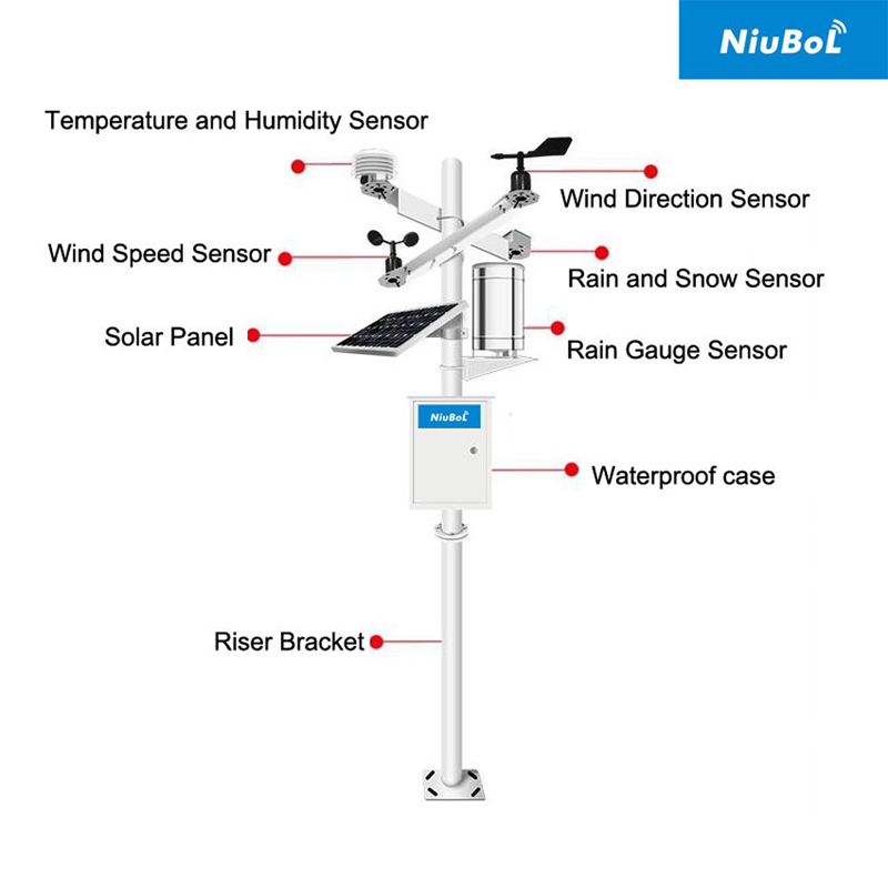
An agricultural project does not need every available sensor simply because it is building a connected farm. Begin with the decision that is currently uncertain. If staff cannot tell whether rainfall reached a field, a rain channel may solve a specific record gap. If irrigation timing is uncertain, rainfall alone is insufficient: root-zone water conditions, irrigation delivery and crop demand also matter.
Local observations are particularly useful where a distant weather report does not describe the crop environment. However, the station represents its own exposure. An instrument beside a tree line, one above an open field and one inside a greenhouse are observing different conditions. Their differences may be real rather than faults. Do not merge them into one farm-wide series without retaining the location and measurement context.
| Farm question | Measurements that help | What the station cannot establish alone |
|---|---|---|
| Should a scheduled irrigation be reviewed after rain? | Local rainfall plus representative soil moisture and irrigation records | Rainfall depth does not equal effective root-zone recharge or account for runoff. |
| Are current conditions suitable for spraying? | Wind speed, direction, temperature and humidity near the relevant operation | The station does not replace the product label, local restrictions or an assessment of drift and inversions. |
| Does a crop-risk model have the inputs it needs? | Temperature, humidity and any required leaf-wetness or rainfall channel | Air humidity alone is not leaf wetness or a disease diagnosis. |
| Why did two planting blocks develop differently? | Comparable weather records, crop stage, soil observations and management history | A weather correlation does not isolate variety, nutrition or irrigation effects. |
A useful first phase has a named user for each channel and a defined response to its data. If nobody can explain how a CO2 or ultraviolet reading would change an open-field operation, postpone that channel until its purpose is clear. Greenhouse CO2 monitoring may be relevant, but it should be specified for the growing environment rather than treated as a standard outdoor weather measurement.
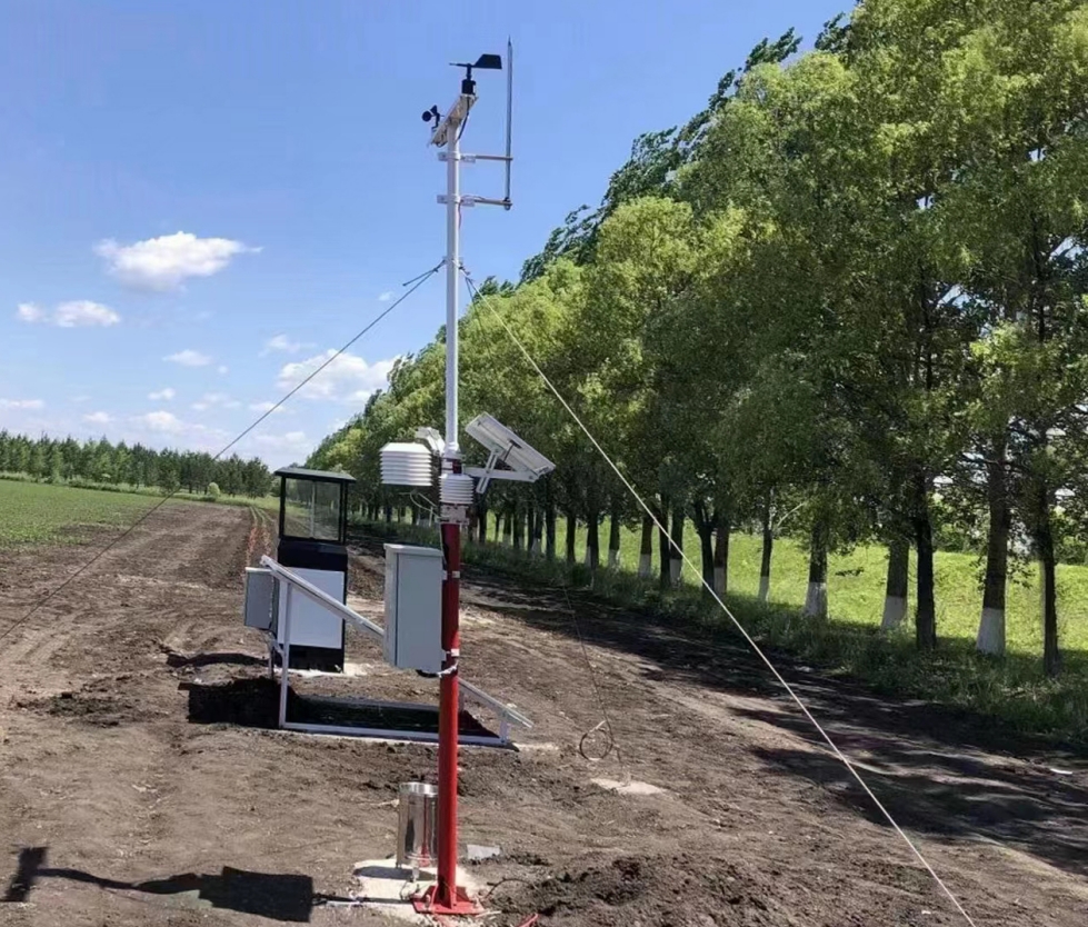
The first layer is what the instruments measure: air temperature, relative humidity, wind, rain or solar radiation. The second layer contains calculations, such as accumulated temperature or a crop-risk index. The third uses a model to estimate future conditions. A display showing measured humidity does not demonstrate that either of the latter layers has been implemented.
For each calculated indicator, ask which inputs, time step and method it uses. Reference evapotranspiration requires a defined method and suitable input data; it is not a direct sensor output and it is not the irrigation amount for every crop. Crop coefficients, growth stage, soil conditions and the irrigation system still affect the management decision.
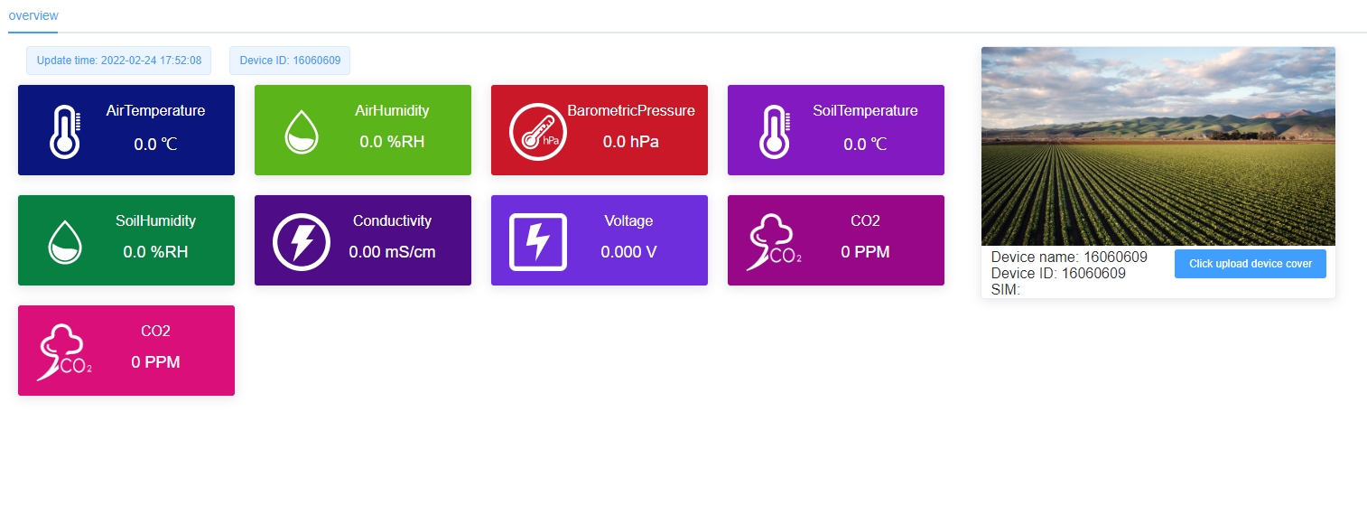
A dashboard image illustrates one possible presentation, not a promise that every station includes every displayed channel or service. Confirm which sensors are actually supplied, which values are calculated and whether historical exports include quality flags. If a crop-risk alert is required, define the model and validation responsibility separately from the instrument list.
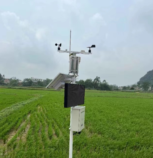
NiuBoL modular stations allow air, wind and rain measurements to be selected separately. A separate component is useful when its mounting exposure differs from the rest of the mast or when the operator wants to replace one channel without changing the complete weather head. An integrated head can reduce mechanical connections, but the selected version still needs the required measurements and suitable exposure.
| Component | Relevant parameter | Consequence for the farm project |
|---|---|---|
| NBL-W-LBTH | Air temperature -40 to +80 degrees C, accuracy +/-0.5 degrees C; relative humidity 0-100% RH, accuracy +/-5% RH | Allow for sensor accuracy when choosing decision thresholds; a narrow threshold is not automatically meaningful. |
| NBL-W-RS | Rain increment 0.2 mm; intensity range 0-4 mm/min; operating temperature 0 to +50 degrees C | Check event intensity and freezing conditions. Increment is not total rainfall accuracy. |
| NBL-W-SS and NBL-W-DS | Wind speed and wind direction components; IP65 | Provide suitable exposure and maintain field connections. These are observations, not a spray authorization system. |
| Data logger or gateway | Inputs and communication depend on the selected model and configuration | Check all sensor interfaces, record intervals and the required destination before ordering. |
The NBL-W-RS accuracy figure is conditional: its stated +/-4% applies to an indoor static test at 2 mm/min. It is not a blanket field accuracy claim for every storm or installation. For soil probes, specify measurement depths and soil conditions separately; an above-ground weather mast does not measure root-zone water simply because the dashboard contains a soil-moisture tile.
RS485 Modbus RTU can connect compatible digital sensors to a field logger, PLC or RTU. Compatibility still requires the correct supply, unique addresses, serial settings and register interpretation. Identify whether rainfall enters as pulses or through a digital interface, and whether a radiation channel needs a low-level voltage input rather than RS485. Do not assume a connector type identifies the electrical signal.
Define how intervals are formed. A daily rainfall total needs a day boundary; a wind average needs an averaging period; a crop model needs timestamps consistent with its other inputs. For multiple fields, retain station IDs in the export so that an irrigation operator cannot accidentally use rainfall from another block.
Test communication loss before relying on remote alerts. Determine whether the logger continues recording, whether older records can be recovered and how a stale value is displayed. A delayed alert may be useless for an immediate field operation even if the data eventually reaches the archive. Local logging and timely operational notifications are different requirements.
During the first deployment, review missed events, blocked collectors, unreliable power and complaints about unrepresentative readings. Compare records with documented field observations, not just a second station at an unknown exposure. If one field repeatedly differs because of terrain or shelter, an additional station may be more useful than adding channels to the original mast.
Evaluate value against the original decision: did staff obtain the rainfall record they lacked, identify an irrigation discrepancy or preserve comparable trial observations? Do not assign a percentage yield or water-saving claim without measured evidence and a defensible comparison. For a quotation, supply the crop, field layout, intended decisions, required measurements and existing controller or data platform.
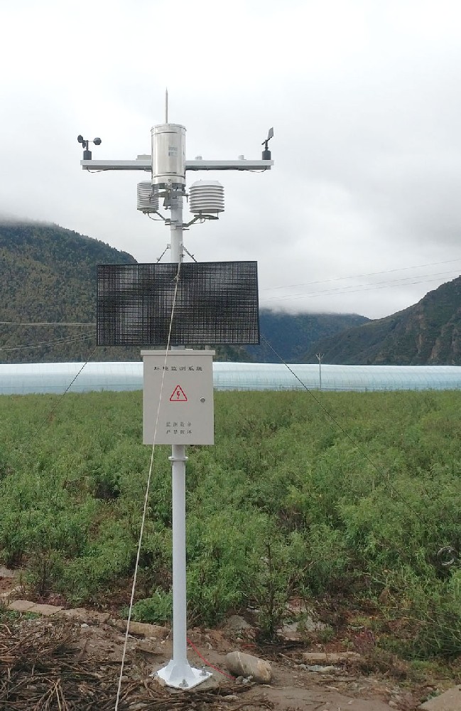
It measures local conditions. A forecast requires an additional forecasting method or service and appropriate validation. Local rain measurements are useful for event records and irrigation review, but are not advance warning of every storm.
There is no fixed area-per-station rule. Review terrain, shelter, elevation, crops and the decision's sensitivity to local differences. Start with representative exposure and assess whether additional locations resolve a real uncertainty.
Only if the selected model explicitly uses it that way. Some models require leaf-wetness duration, rain, crop stage or other inputs. Specify the model first and then select instruments capable of supplying its required data.
Only a configured control system can do that. Confirm the controller, outputs, interlocks and response to missing or implausible data. Supplying Modbus measurements does not by itself provide a validated irrigation-control function.
The sensor set, mounting, power reserve, logger inputs, communication, installation and software scope determine the quotation. Request an itemized configuration rather than comparing a basic weather head with a complete installed monitoring system.

Small weather stations for agriculture are useful when their observations answer a defined field question. Choose measurements around that question, retain the difference between observations and models, and test the data path used by the operational team. NiuBoL can review an agricultural configuration against the required channels and receiving system without assuming that every farm needs the same instrument package.
Prev:Small Weather Station Lightning Protection: Earthing, Bonding and Surge Routes
Next:Small Weather Station Installation and Maintenance: Preserve the Data Record
Related recommendations
Sensors & Weather Stations Catalog
 Agriculture Sensors and Weather Stations Catalog-NiuBoL.pdf
Weather Stations Catalog-NiuBoL.pdf
Agriculture Sensors Catalog-NiuBoL.pdf
Water Quality Sensor Catalog-NiuBoL.pdf
Related products
 Combined air temperature and relative humidity sensor
 TDR Soil Moisture & Temperature Sensor for irrigation| RS485 |4-20mA| NBL-S-THR
 Soil pH sensor RS485 soil Testing instrument soil ph meter for agriculture |NBL-S-PH
 Wind Speed sensor Output Modbus/RS485/Analog/0-5V/4-20mA
 Tipping bucket rain gauge for weather monitoring auto rainfall sensor RS485/Outdoor/stainless steel
 Pyranometer Solar Radiation Sensor 4-20mA/RS485


Screenshot, WhatsApp to identify the QR code
WhatsApp number:+8615367865107
(Click on WhatsApp to copy and add friends)

