





— Blogs —
—Products—
 Consumer hotline +8618073152920
WhatsApp:+8615367865107
Address:Room 102, District D, Houhu Industrial Park, Yuelu District, Changsha City, Hunan Province, China
Product knowledge
Time:2024-12-09 20:20:44 Popularity:3720
A weather measuring device observes a defined atmospheric quantity, such as air temperature, wind speed or rainfall. A complete station combines several such instruments with acquisition and reporting equipment. The important distinction is between a directly measured quantity, a value calculated from measurements and a warning decision. Specifying one does not automatically provide the others.

A temperature instrument responds to the temperature of its sensing element. For air monitoring, exposure and a suitable radiation shield help that element represent the surrounding air rather than direct solar heating or nearby hot surfaces. A soil or water temperature probe observes a different medium; mounting it beside an air sensor does not make their readings equivalent.
Relative humidity describes water vapor relative to saturation at the measured temperature. It is not soil moisture content. Dew point can be calculated from suitable temperature and humidity observations, but should be identified as a derived value unless an instrument measures it by another specified method.
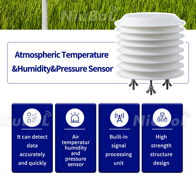
The NiuBoL NBL-W-LBTH combines air temperature, humidity and atmospheric pressure channels, with the following stated specifications. Pressure at the station must not be confused with software-reduced sea-level pressure when comparing values from different locations.
| NBL-W-LBTH channel | Measurement range | Stated accuracy |
|---|---|---|
| Air temperature | -40 to +80 C | +/-0.5 C |
| Relative humidity | 0-100% RH | +/-5% RH |
| Atmospheric pressure | 10-1200 hPa | +/-1.5 hPa |
Different weather measuring devices may have similar enclosures or share one mounting assembly. Use the quantity and unit to identify their role. A presence contact cannot replace a rainfall depth channel, and a broadband solar reading cannot replace a specialised ultraviolet or visibility measurement.
| Quantity | Typical reported unit or state | What it does not establish by itself |
|---|---|---|
| Air temperature and relative humidity | C and % RH | Road-surface temperature, soil water content or a complete crop-disease forecast |
| Wind speed and direction | m/s and degrees | A defined gust statistic, wind loading or permission to operate lifting equipment |
| Rainfall amount and intensity | mm and mm/h or mm/min | Water level, snow depth or a flood prediction |
| Precipitation presence | Present/absent contact state | Collected rain depth or classification of all precipitation types |
| Solar irradiance | W/m2 | Accumulated energy, sunshine duration or all separate radiation components |
| Meteorological Optical Range | m or km | Road friction, a camera image or pollutant mass concentration |
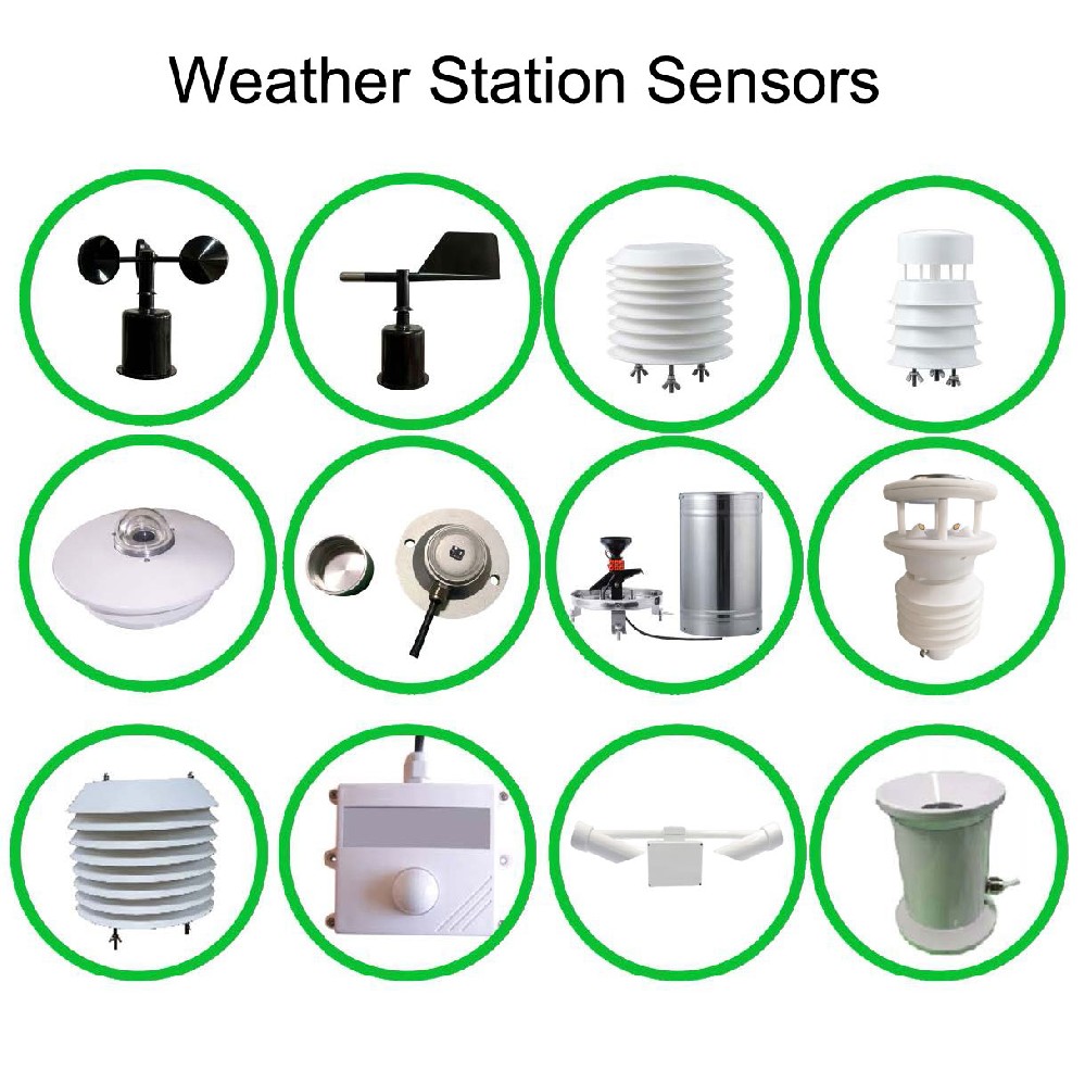
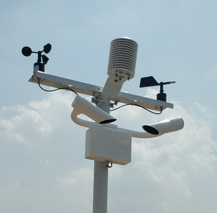
A cup anemometer relates rotor movement to wind speed. An ultrasonic instrument derives air movement from acoustic transit times. Their measurement principles differ, but neither makes the reporting interval irrelevant. A momentary value, an interval mean and a gust statistic are different outputs. Specify how the acquisition system samples and processes them.
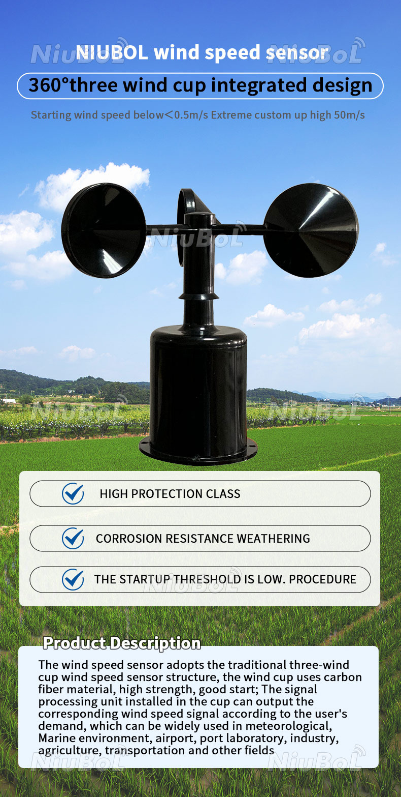
The NBL-W-SS cup wind speed sensor is offered in 0-45 m/s or 0-70 m/s versions, with 0.1 m/s resolution and stated accuracy of +/-(0.3 + 0.03V) m/s, where V is wind speed. Its starting wind speed is no more than 0.5 m/s. Select the range and electrical output version rather than treating the two ranges as one interchangeable setting.
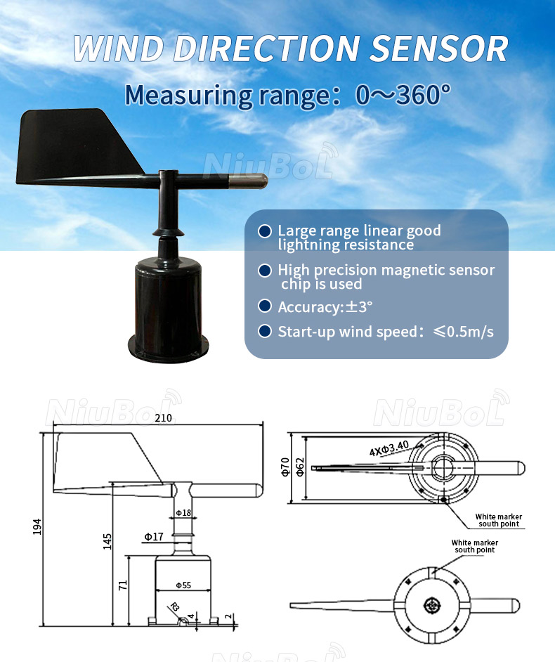
A vane follows the airflow and reports an angle relative to its installed orientation. Align the instrument using the required geographic reference and retain any configured offset. Otherwise an electrically correct signal can report the wrong direction. The NBL-W-DS wind direction sensor uses magnetic position sensing and has a 0-360 degree range with stated +/-3 degree accuracy.
Direction is circular. An ordinary arithmetic average of 350 and 10 degrees gives 180 degrees, which points opposite to the two observations. Use suitable circular or vector processing for the intended statistic and define the treatment of calm conditions. Specify IP65 protection for the NBL-W-SS and NBL-W-DS instruments; this does not assign the same rating to the entire station.
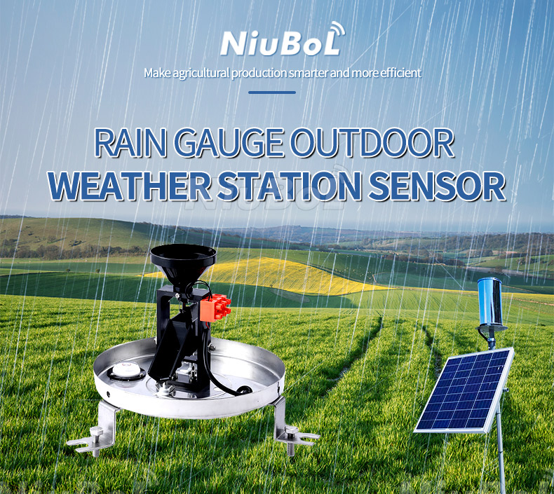
A tipping-bucket gauge collects water and converts completed tips into rainfall increments. The NBL-W-RS standard configuration has a 200 +/-0.6 mm collection diameter, 0.2 mm resolution and a 0-4 mm/min intensity range. Its stated +/-4% accuracy applies to an indoor static test at 2 mm/min. Tip resolution is not the same as measurement accuracy.
Accumulated depth becomes an interval amount only when the start and end of the accumulation are defined. Intensity adds a time basis. The standard instrument's operating range is 0-50 C, so a storage limit below freezing does not establish snow-measurement capability. Keep the collector level and the water path clear to protect the measurement.
The NBL-W-RSS rain and snow sensor detects moisture at a surface electrode and provides a relay contact. Its automatic heating helps clear accumulated moisture or frozen material from the sensing surface. This is qualitative presence detection, not a measurement of millimetres of rain or snow-water equivalent.
Use this type of channel when a controller needs an indication that precipitation is present. Specify a separate gauge when the project needs accumulated rain depth. A heated detection surface does not make an unheated tipping-bucket gauge suitable for freezing conditions, and presence alone does not classify rain, snow, hail and sleet into separate measured quantities.

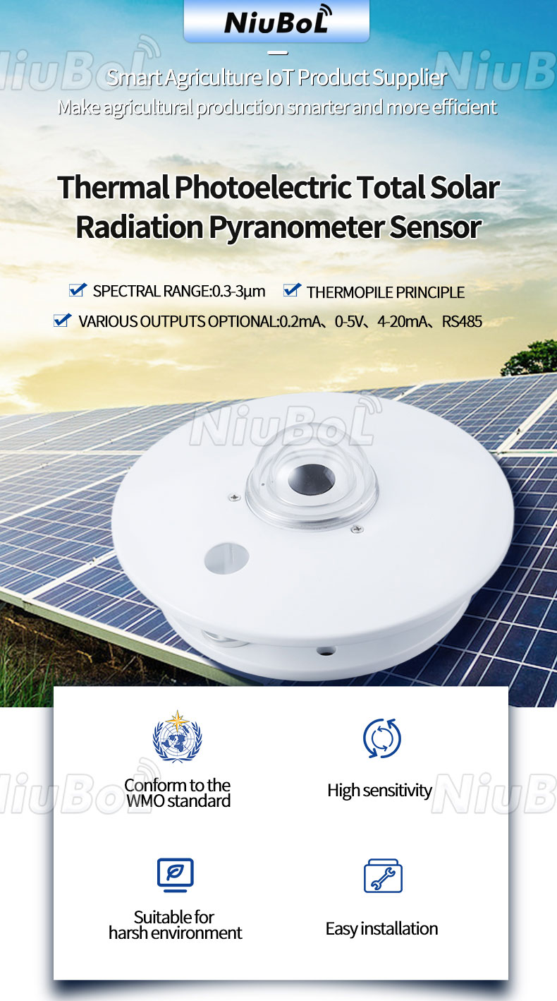
A pyranometer measures incident solar irradiance over its response band and field of view. The NBL-W-HPRS has a 0-2000 W/m2 measurement range and 0.3-3 micrometre spectral range, with a stated response time up to 35 seconds at 99%. A horizontal installation observes global horizontal irradiance; a differently oriented or shaded arrangement changes the quantity observed.
One unshaded horizontal sensor does not independently report direct, diffuse and reflected components. Those require suitable separate measurement arrangements. Integrating irradiance over time produces energy per area, while sunshine duration requires its own defined detection or calculation method. A UV sensor observes a different spectral duty; a broadband pyranometer does not automatically provide a UV index.
The NBL-W-VS atmospheric visibility sensor uses forward scattering to estimate Meteorological Optical Range. Its stated range is 5 m to 10 km, with RS485 Modbus RTU output, DC 12 V supply and approximately 0.8 W average consumption. It samples an optical volume rather than viewing the whole road as a camera does.
A transmissometer instead measures attenuation along a defined optical path. Neither principle directly measures road grip or identifies the chemical composition of haze. Choose visibility equipment when the required result is optical range, and add separate instruments for pavement condition or pollutant concentration when those are the actual questions.
Acquisition equipment converts compatible electrical or digital outputs into records. RS485 is an interface, and Modbus RTU supplies a communication method for compatible versions. Obtain the register definitions and scale for each device. Analog versions need the correct input range; contact-based rainfall needs a suitable counter. Matching a cable connector alone does not establish compatibility.
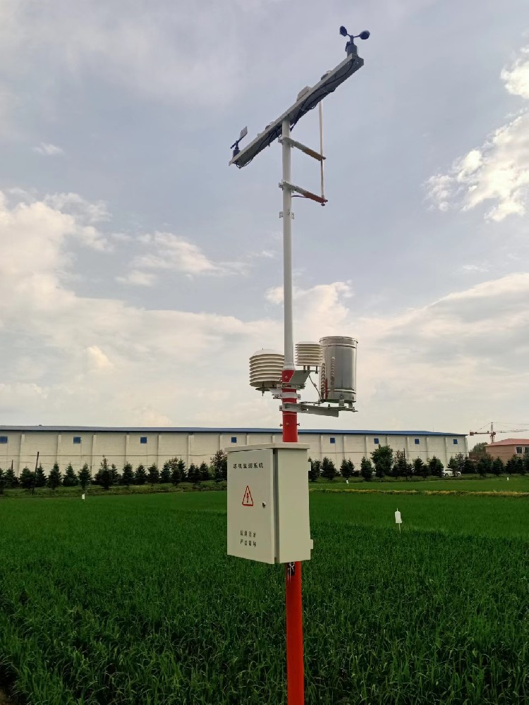
The logger may also calculate dew point, interval rainfall or other outputs when configured to do so. Identify those processing steps and retain invalid-data flags. A warning threshold is another layer: it combines readings, rules and an operational response. A weather measuring device should not be described as guaranteeing safe flight, lifting, driving or flood protection merely because it supplies one input to that decision.
A road station may require pavement temperature, surface condition and visibility in addition to air measurements. A lightning-location network needs specialised detection and location infrastructure; a mast's lightning protection device is not a lightning-location sensor. Present-weather classification likewise requires identified instrument capability, not simply a collection of temperature and humidity readings.
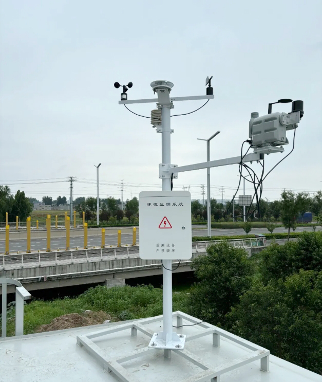
At an agricultural site, soil temperature and moisture probes extend observation into the root zone. At a reservoir, water level is a separate hydrological measurement. These channels can share a data platform with weather instruments without becoming atmospheric quantities. Keep the channel names, medium and units explicit when building a mixed monitoring station.
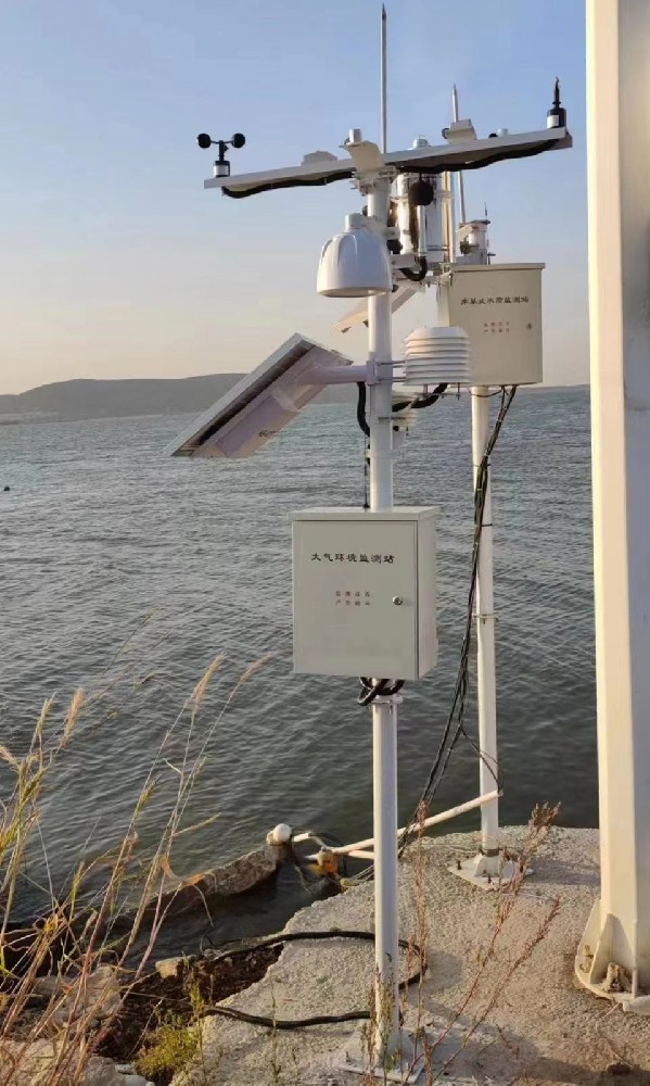
An integrated head can provide a defined group of channels. Check its actual model specification. Rain amount, visibility, soil moisture, radiation components and specialist road measurements should not be assumed unless the selected equipment provides them.
No. They are different resistance-based temperature sensor types. A platinum RTD such as Pt100 and a thermistor require the appropriate excitation, conversion and wiring arrangement. Specify the actual element or transmitter output rather than using the names interchangeably.
Not for rainfall depth. A presence sensor provides a state, whereas a gauge quantifies collected precipitation. Choose according to whether the controller needs a wet-weather indication or a numerical rainfall record.
No. Gust reporting depends on sensor response, sampling and the processing definition. Uploading an instantaneous reading more frequently is not a substitute for the specified gust statistic.
Do not assume it can. A pyranometer supplies irradiance. Sunshine duration needs a defined detection method or an agreed calculation with suitable inputs. Request that function explicitly if the project requires it.
List the selected outputs, supply voltages, input requirements and cable routes. For Modbus RTU, include serial settings, addresses, register definitions, units and scale. For analog or pulse channels, confirm the PLC input and acquisition method.
Describe the required quantity, operating range, expected uncertainty, installation conditions and receiving equipment. State whether calculations, warnings or specialist observations are also needed. NiuBoL can then identify which functions come from sensors and which require additional system configuration.
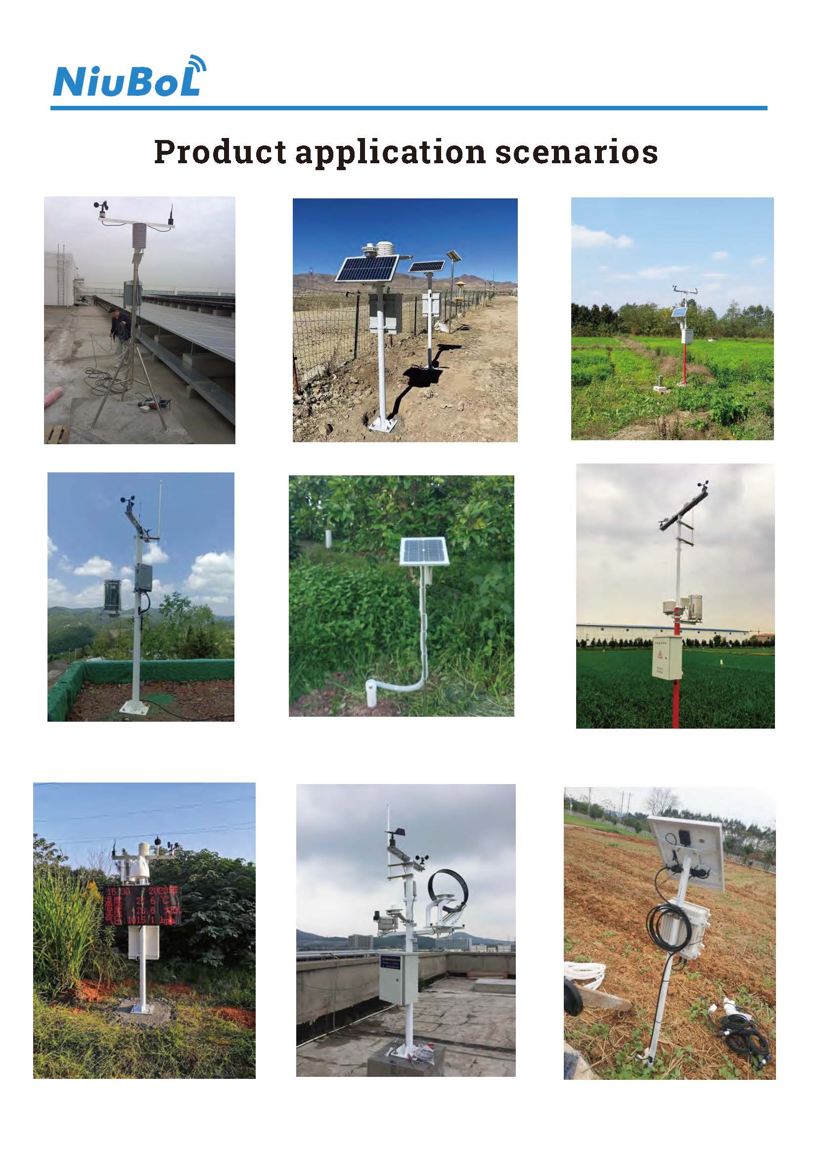
Select a weather measuring device by the quantity it actually observes, not by the breadth of a station description. Keep measurement, calculation and warning functions distinct. This prevents a presence contact being ordered as a rain gauge, an air reading being used as pavement temperature, or one radiation channel being treated as several independent observations.
Prev:Wired Weather Station: Sensor Circuits, Cable Routes and Power Drop
Next:Wireless Weather Station Architecture: Shared Gateways or Independent Sites
Related recommendations
Sensors & Weather Stations Catalog
 Agriculture Sensors and Weather Stations Catalog-NiuBoL.pdf
Weather Stations Catalog-NiuBoL.pdf
Agriculture Sensors Catalog-NiuBoL.pdf
Water Quality Sensor Catalog-NiuBoL.pdf
Related products
 Combined air temperature and relative humidity sensor
 TDR Soil Moisture & Temperature Sensor for irrigation| RS485 |4-20mA| NBL-S-THR
 Soil pH sensor RS485 soil Testing instrument soil ph meter for agriculture |NBL-S-PH
 Wind Speed sensor Output Modbus/RS485/Analog/0-5V/4-20mA
 Tipping bucket rain gauge for weather monitoring auto rainfall sensor RS485/Outdoor/stainless steel
 Pyranometer Solar Radiation Sensor 4-20mA/RS485


Screenshot, WhatsApp to identify the QR code
WhatsApp number:+8615367865107
(Click on WhatsApp to copy and add friends)

