





— Blogs —
—Products—
 Consumer hotline +8618073152920
WhatsApp:+8615367865107
Address:Room 102, District D, Houhu Industrial Park, Yuelu District, Changsha City, Hunan Province, China
Product knowledge
Time:2025-01-11 17:07:38 Popularity:2419
An automatic snow depth monitoring station measures the depth of the snowpack at its observation point. A rise in depth is not necessarily the same as fresh snowfall, and a fall is not negative precipitation. Settlement, melting, drifting, surface disturbance and measurement faults can all change the record. Keep snow depth, new snowfall and snow water equivalent as separate quantities.
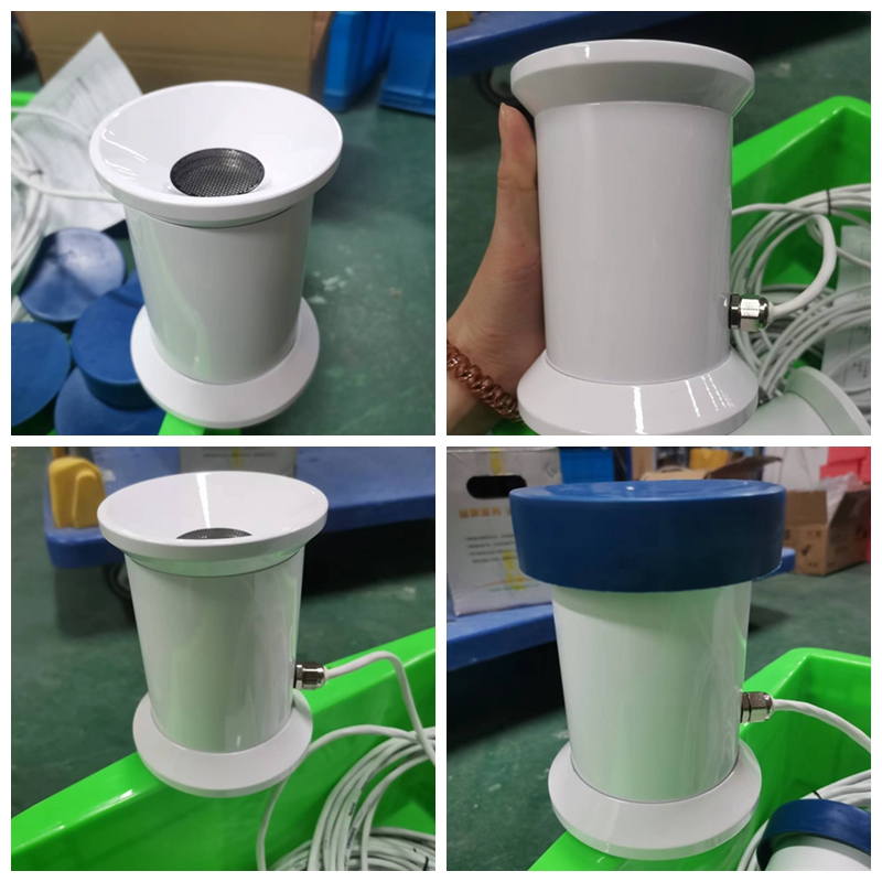
Snow depth describes the snow remaining on the ground at an observation time. New snowfall describes fresh accumulation over a defined observation interval and procedure. Snow water equivalent describes the water contained in the snowpack. These quantities answer different questions for winter operations, catchment studies and research.
The National Weather Service snow-measurement guidance distinguishes the undisturbed surface used to observe snow depth from the separate procedure used for new snowfall. Natural settling and melting are part of the depth record. An automated distance measurement should not silently be relabelled as a snowfall total.
| Reported quantity | Meaning | Can a single ultrasonic depth channel provide it? |
|---|---|---|
| Current snow depth | Thickness above a defined ground reference at that point | Yes, within the configured measurement and installation limits |
| Depth change | Difference between valid observations | Yes, but the change includes physical snowpack processes and possible measurement effects |
| New snowfall | Fresh accumulation measured using a defined observation procedure | Not directly from a simple difference in undisturbed snowpack depth |
| Snow water equivalent | Water contained in the snowpack | No; an appropriate additional measurement is required |
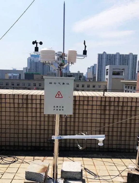
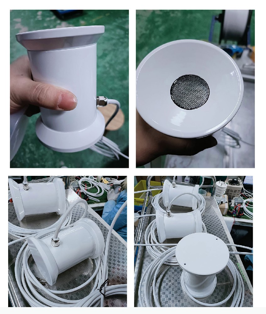
The NiuBoL NBL-W-SNOW emits 50 kHz ultrasonic pulses toward the surface and measures their return time. Depth is derived from the difference between the established snow-free reference distance and the current measured surface distance. The logger then time-stamps and stores the result; a communications gateway can forward it to the receiving system.
Depth belongs to the defined observation patch below the sensor. Air, rain and wind channels on the same station remain separate observations. They can help interpret snowpack changes, but the station does not directly measure fresh snowfall or assess avalanche stability. For changes in reference geometry, use the separate snow-depth zero-reference and mast-movement checks.
| Parameter | NBL-W-SNOW specification | Interpretation |
|---|---|---|
| Snow-depth range | 0-1000 mm | Check the expected maximum accumulation and installation geometry |
| Accuracy | +/-0.1% FS | A sensor specification, not a guarantee of representative snow depth over an entire site |
| Supply | DC 12 V | Provide the required sensor supply through the winter operating period |
| Power | Approximately 180 mW normally; approximately 3 W with heating active | Do not size winter power from normal-temperature consumption alone |
| Operating temperature and protection | -40 to 50 degrees C; IP66 | Inspect exposure and the acoustic opening despite the enclosure rating |
| Interface and baud rate | RS485; default 9600 bps | Match the receiving device to the actual message format |
| Default protocol and cable | NBL private protocol; standard 5 m cable | Standard Modbus RTU is not an automatic consequence of the RS485 interface |
If a PLC, RTU or third-party data logger requires Modbus RTU, specify that requirement before ordering and obtain the applicable protocol for the supplied configuration. Test a real sensor message at the host. A gateway with an RS485 port is not necessarily able to interpret the default NBL message without an appropriate driver or configuration.
Suppose a valid depth record falls from 200 mm to 170 mm after snowfall stops. The 30 mm decrease is a depth change, not proof that 30 mm of water has left the site. Snow can settle and become denser. Melting or wind removal may also contribute, but the depth channel alone cannot separate those processes.
Compare the timing with air temperature, wind observations and an inspection of the observation patch where available. A warming period supports investigating melt, but air temperature alone does not quantify snowmelt. A windy period supports checking redistribution, not assigning every change to wind. Preserve the measured depth and add an interpretation separately rather than replacing the observation with a guessed cause.
A depth increase can follow snowfall, but blowing snow can also accumulate at the patch. The problem is particularly important near fences, buildings, ploughed edges and other structures that alter deposition. A locally deep drift should not be described as the uniform depth across a road corridor or research plot.
Do not add every positive sample-to-sample difference to produce a seasonal snowfall total. Measurement noise, drifting and repeated small surface changes can inflate that sum. If the project needs new snowfall, define a separate observation method and interval. If it needs snow water equivalent for water-resource accounting, specify a suitable method for that quantity instead of using an assumed fixed snow-to-water ratio.
A sudden step, an impossible value or a long unchanging sequence should trigger inspection of the measurement path and data chain. Check obstruction or icing around the transducer, disturbance of the surface, reference movement and the logger's handling of failed messages. A last known value repeated during a communication outage must not be interpreted as proof that the snowpack stayed unchanged.
Use distinct flags for a valid depth, an invalid sensor response and a missing transmission. Keep the observation time separate from the time it reaches the server. If smoothing is applied, retain enough original observations to investigate a short event; the displayed smooth curve should not be mistaken for the unfiltered record.
For a transport project, a point depth record may support site inspections and snow-management decisions, but it does not measure pavement friction or the distribution of drifting along the route. For hydrology, depth trends can describe local snow cover, while runoff estimation requires further information. For snow-cover research, the observation patch and its disturbance history are part of the interpretation.
When requesting a station from NiuBoL, identify whether the required output is current depth, new snowfall, snow water equivalent or a combination. Include expected accumulation, winter power availability, communications requirements and the intended surface. These details prevent a correctly functioning depth sensor from being purchased for the wrong measurement.
Not without a suitable observation method and assessment of settlement, melting and redistribution. The difference in undisturbed depth measures the net change at that patch; it is not automatically fresh accumulation.
No. Settlement, melt and wind movement can produce a real decrease. Check the observation context and measurement quality before recalibrating. A depth decrease alone cannot identify the physical cause.
Not with a universal conversion factor. Snow density varies, so depth alone does not establish snow water equivalent. Select an appropriate additional measurement when water storage or runoff accounting is the objective.
Not necessarily. The NBL-W-SNOW default configuration uses an NBL private protocol over RS485. Confirm the supplied protocol and host support, or agree a suitable protocol configuration before purchase.
Only within the limits of the chosen observation patch. Drifting, shade and disturbance can make nearby conditions different. Broader spatial claims require an observation design and field checks, not simply a more precise point sensor.
Verify the reference distance, depth output, correct time stamps, host interpretation and invalid-data indication. Compare with an appropriate independent depth observation. Test heating and winter power separately; neither establishes a snowfall or water-equivalent measurement.
An automatic snow depth monitoring station is useful when its record is named and interpreted correctly. Keep depth separate from snowfall and snow water equivalent, investigate physical change before declaring a fault, and specify the actual protocol and observation method needed by the receiving project.
NBL-W-SNOW ultrasonic snow depth sensor manual V4.0.

Prev:Agricultural Weather Station for Crop Emergence: Investigating Uneven Stands
Next:Submersible Level Sensor in Closed Tanks: Check Headspace Pressure
Related recommendations
Sensors & Weather Stations Catalog
 Agriculture Sensors and Weather Stations Catalog-NiuBoL.pdf
Weather Stations Catalog-NiuBoL.pdf
Agriculture Sensors Catalog-NiuBoL.pdf
Water Quality Sensor Catalog-NiuBoL.pdf
Related products
 Combined air temperature and relative humidity sensor
 TDR Soil Moisture & Temperature Sensor for irrigation| RS485 |4-20mA| NBL-S-THR
 Soil pH sensor RS485 soil Testing instrument soil ph meter for agriculture |NBL-S-PH
 Wind Speed sensor Output Modbus/RS485/Analog/0-5V/4-20mA
 Tipping bucket rain gauge for weather monitoring auto rainfall sensor RS485/Outdoor/stainless steel
 Pyranometer Solar Radiation Sensor 4-20mA/RS485


Screenshot, WhatsApp to identify the QR code
WhatsApp number:+8615367865107
(Click on WhatsApp to copy and add friends)

