


— Blogs —
—Products—
 Consumer hotline +8618073152920
 WhatsApp:+8615367865107
Address:Room 102, District D, Houhu Industrial Park, Yuelu District, Changsha City, Hunan Province, China
Product knowledge
Time:2026-03-06 17:29:03 Popularity:369
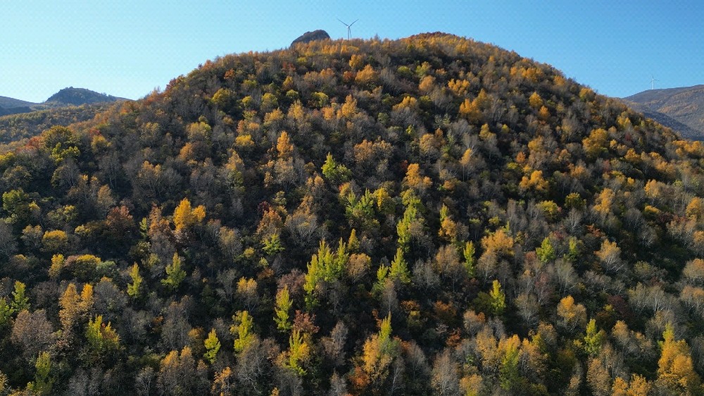
Tourist scenic areas, as high-traffic public spaces with intensive outdoor activities, have meteorological conditions and air quality that directly impact visitor experience, safety management, operation scheduling, and emergency response capabilities. Traditional manual observation or single weather stations can no longer meet the modern scenic area's needs for high spatiotemporal resolution, continuity, coverage, and multi-element integration. The scenic area automatic weather station, as an IoT-driven distributed sensing terminal, provides system integrators, IoT solution providers, and engineering companies with the core hardware foundation for building a "smart scenic area" meteorological service base through multi-parameter real-time collection and wireless networking.
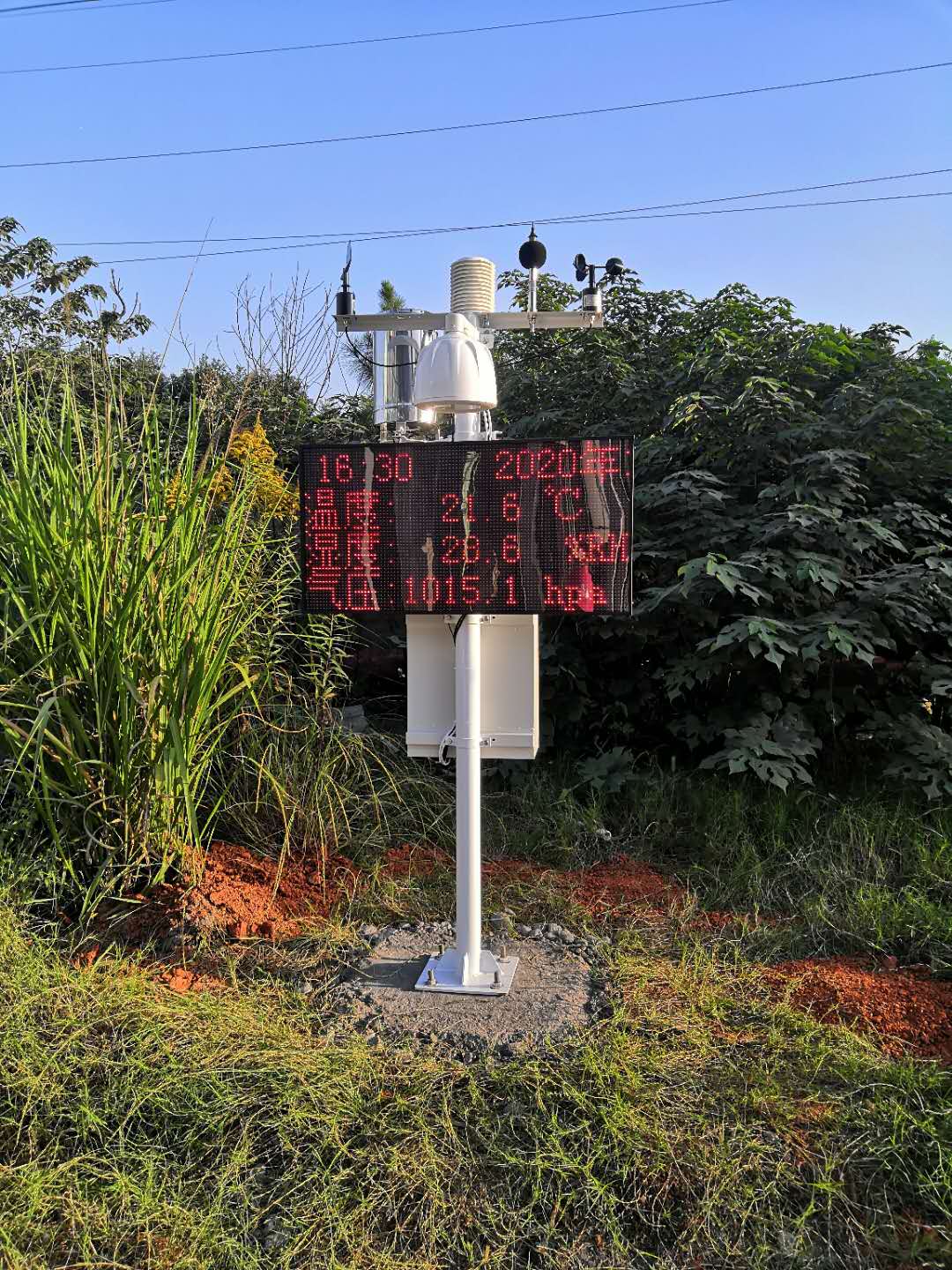
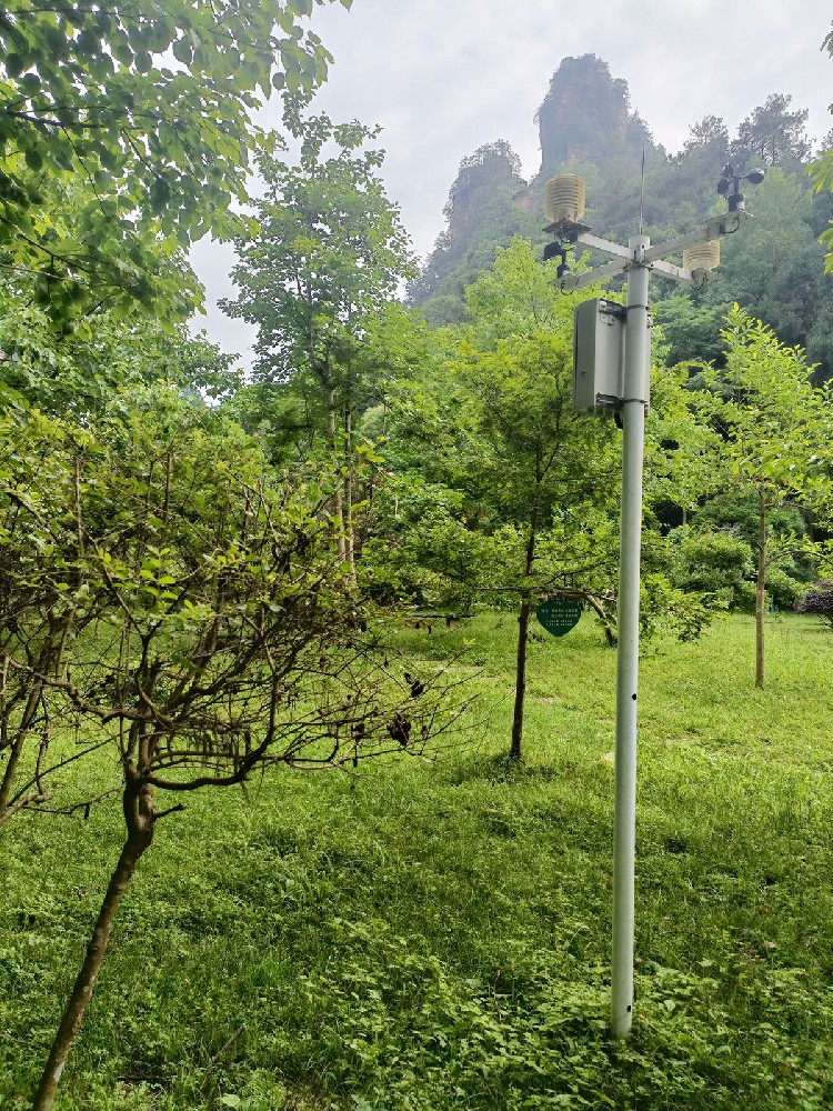
The NiuBoL scenic area automatic weather station adheres to World Meteorological Organization (WMO) observation standards, integrating elements such as air temperature, humidity, barometric pressure, wind speed & direction, rainfall, illumination intensity, total radiation, noise, PM2.5, PM10, TSP, etc. It supports LoRa wireless networking + independent solar power supply, enabling unattended, flexible deployment, and all-weather operation. It is widely applicable to 5A/4A-level scenic areas, national parks, forest parks, wetland parks, theme parks, mountain resorts, and other scenarios.
The scenic area automatic weather station is essentially a multi-element environmental monitoring node optimized for tourism scenarios. Its design focuses on:
High spatiotemporal resolution monitoring (minute-level sampling, multi-point distribution)
Early warning for extreme weather and air quality
Deep integration with scenic area security, broadcasting, ticketing, guidance, and emergency command systems
Low-power, wiring-free, easily expandable deployment characteristics
The typical NiuBoL system architecture includes:
Perception Layer: Independent or networked meteorological/environmental sensor nodes
Communication Layer: LoRa (medium-to-long-range low-power wide-area network) + 4G/NB-IoT master station to cloud
Power Layer: Patch solar + large-capacity lithium battery (default 60W PV + 30Ah lithium battery)
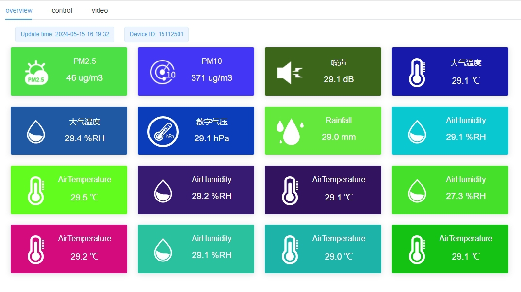
Data Layer: Cloud platform, edge gateway, local server (optional)
Extension Interfaces: RS485, Modbus RTU, MQTT, HTTP
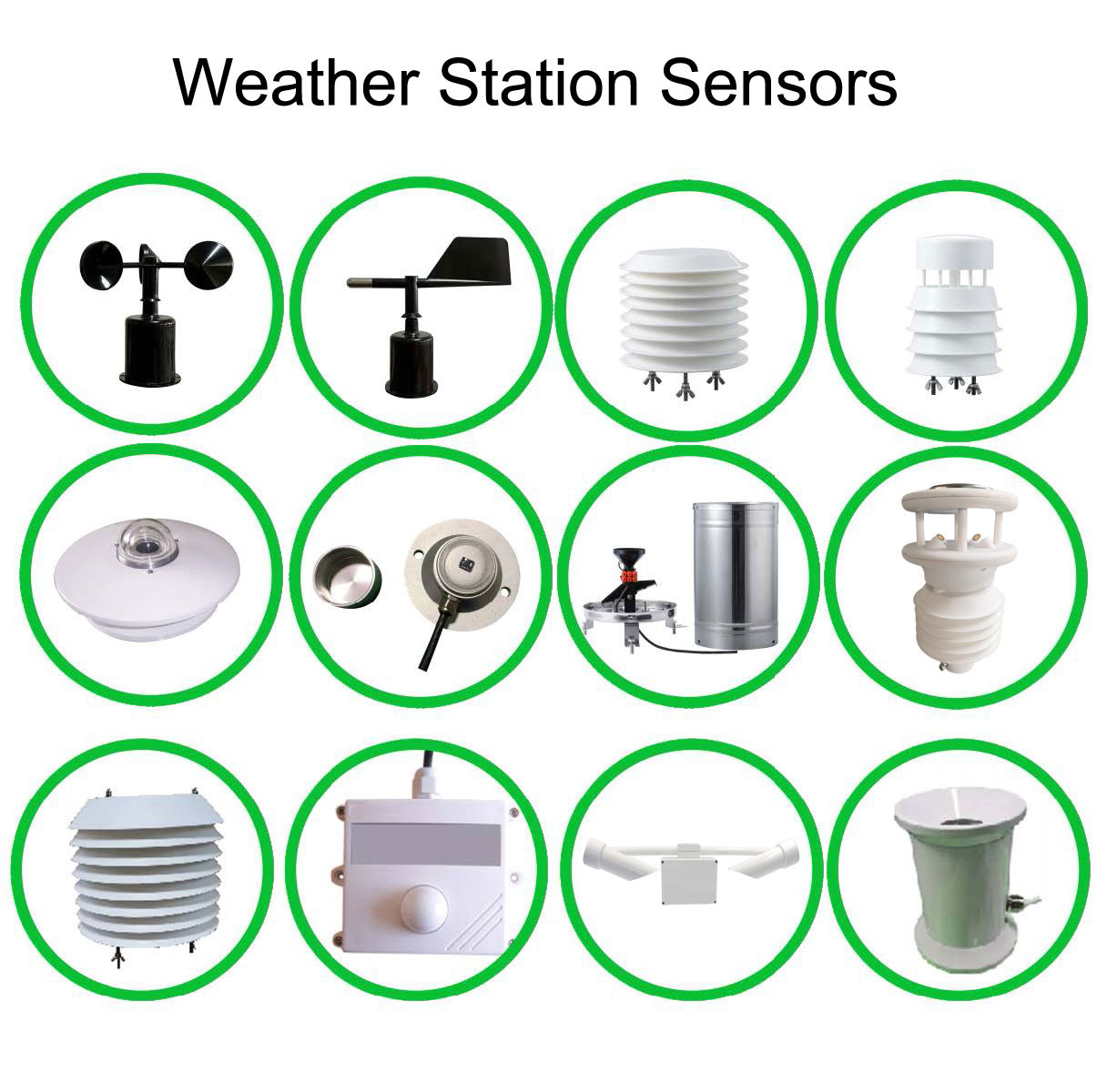
The following are the main sensor parameters for the typical configuration of the NiuBoL scenic area automatic weather station (can be increased or decreased according to project requirements):
| Monitoring Element | Sensor Type | Measurement Range | Remarks and Scenic Area Application Value |
|---|---|---|---|
| Air Temperature | Pt1000 / Digital | -40 ~ +80 °C | Apparent temperature calculation, heat wave warning, high-temperature heatstroke risk assessment |
| Relative Humidity | Capacitive | 0 ~ 100 % RH | Sultriness index, rime/frost judgment, comfort assessment |
| Barometric Pressure | Silicon Piezoresistive | 300 ~ 1100 hPa | Sudden pressure drop warning (strong convection, typhoon) |
| Wind Speed | Three-Cup / Ultrasonic | 0 ~ 60 m/s | Strong wind warning, cable car/glass walkway suspension decision |
| Wind Direction | Magnetic Encoder / Wind Vane | 0 ~ 360 ° | Wind direction for fire spread, pollutant diffusion direction judgment |
| Rainfall | Tipping Bucket / Weighing Type | 0 ~ ∞ mm | Heavy rain, waterlogging, scenic road ponding warning |
| Illumination Intensity | Silicon Photocell | 0 ~ 200 klx | Sunshine duration statistics, plant landscape illumination assessment |
| Total Radiation | Thermopile | 0 ~ 2000 W/m² | UV intensity reference, photovoltaic power generation potential assessment |
| Noise | Capacitive Microphone | 30 ~ 130 dB(A) | Acoustic environment comfort, construction/performance noise compliance monitoring |
| PM2.5 | Laser Scattering | 0 ~ 1000 µg/m³ | Air quality AQI, haze warning, mask reminder |
| PM10 | Laser Scattering | 0 ~ 2000 µg/m³ | Dust, sandstorm impact assessment |
| TSP (Total Suspended Particulates) | Laser Scattering | 0 ~ 2000 µg/m³ | Construction dust, road dust supervision |
Minute-level warnings for strong winds, heavy rain, lightning, high/low temperatures, dense fog, and other meteorological disasters
Linkage with scenic area broadcasting, LED screens, and APP to achieve graded, zoned, and time-segmented warning push
Automatic suspension/resumption decision basis for high-risk projects such as cable cars, glass bridges, rafting, and hiking trails
PM2.5/PM10/TSP data used for scenic area Air Quality Index (AQI) release
Noise monitoring for environmental compliance management during large-scale performances, festivals, and construction
Combined with meteorological elements to determine pollutant diffusion conditions, guiding traffic control and visitor evacuation
Real-time apparent temperature and heat-humidity index to guide zoned visitor comfort recommendations
Illumination and radiation data to support night tour lighting and landscape illumination energy-saving scheduling
Multi-point meteorological data grid analysis to optimize tour route planning and visitor flow prediction models
Provide long-term meteorological baseline data for scenic area carbon emission accounting and green certification
Historical data tracing to support post-disaster assessment, insurance claims, and liability determination
Linkage with video surveillance, drone inspection, and emergency broadcasting systems to form a "meteorology + video + command" closed loop
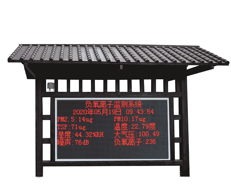
Public and transparent real-time meteorological and environmental data release to enhance scenic area credibility
Modules such as "Today's Scenic Weather", "Air Quality", and "Comfort Index" to increase user stickiness
Single-point high-value areas: Core attractions, cable car stations, glass walkway entrances → Independent 4G nodes
Area coverage: Large mountain/forest scenic areas → LoRa networking (1 master station + N slave stations, coverage radius 1–5 km)
Hybrid mode: Core area LoRa + edge area 4G to minimize signal blind spots
Power strategy: Full solar power supply, continuous operation ≥7–10 days during rainy weather (depending on configuration)
Supports standard Modbus RTU (RS485), MQTT, HTTP POST
Can seamlessly connect to platforms such as Alibaba Cloud IoT, ThingsBoard, etc.
1. What is the main difference between a scenic area automatic weather station and a regular weather station?
The scenic station focuses more on multi-dimensional perception such as tourist safety, comfort, air quality, and acoustic environment. It features more flexible deployment, supports LoRa networking and independent solar power supply, with data directly serving tourist warnings and operational scheduling.
2. Is LoRa networking stable in mountainous scenic areas?
Yes. LoRa has strong penetration and diffraction capabilities. In typical open scenarios, a single hop covers 2–5 km. With relays or high-position master stations, full-area coverage can be achieved.
3. How long can solar power last during continuous rainy weather?
The default 60W PV + 30Ah lithium battery configuration can maintain 7–10 days of normal sampling and transmission in mid-latitude regions during continuous rain. In extreme cases, it can be extended through low-power mode.
4. Do noise and PM sensors require frequent calibration?
Noise sensors are recommended for annual calibration; laser particulate sensors are recommended for inspection or on-site comparison every 12–18 months, with very low daily maintenance.
5. How to achieve linkage warning with scenic area broadcasting and LED screens?
Set threshold rules through the cloud platform to output switching signals, Modbus commands, or API calls to trigger broadcast voice, screen scrolling subtitles, or graded warnings.
6. Does it support data fusion with third-party air quality monitoring systems?
Yes. Through MQTT subscription or API docking, fusion analysis of scenic area self-owned data and ecological environment department monitoring stations can be achieved.
The scenic area automatic weather station has evolved from a simple meteorological observation tool into an indispensable environmental perception and safety assurance infrastructure for modern smart scenic areas. The NiuBoL scenic area automatic weather station, with WMO standard accuracy, multi-element integration, and fully independent solar power supply as its core advantages, provides system integrators and engineering companies with a fast-deployable, highly reliable, and easily expandable hardware foundation.
Through scientific deployment, threshold warnings, data linkage, and visual presentation, this system can significantly improve scenic areas' extreme weather response capabilities, air and acoustic environment management levels, operational refinement, and visitor satisfaction. Under the policy guidance of "smart tourism", "safe tourism", and "green tourism", selecting an industrial-grade solution that complies with industry standards and has rich integration experience will provide long-term value for the digital transformation and high-quality development of scenic areas.
For specific scenic area terrain, area, visitor flow, or integration solutions with existing systems, welcome to contact the NiuBoL technical team for on-site survey and customized deployment planning.
Prev:Core Monitoring Elements and Sensor Configuration of NiuBoL Photovoltaic Environmental Monitor
Next:Industrial-Grade Automatic Soil Moisture Monitoring System: Building Smart Agriculture
Related recommendations
Sensors & Weather Stations Catalog
 Agriculture Sensors and Weather Stations Catalog-NiuBoL.pdf
Weather Stations Catalog-NiuBoL.pdf
Agriculture Sensors Catalog-NiuBoL.pdf
Water Quality Sensor Catalog-NiuBoL.pdf
Related products
 Combined air temperature and relative humidity sensor
 Soil Moisture Temperature sensor for irrigation|NBL-S-THR
 Soil pH sensor RS485 soil Testing instrument soil ph meter for agriculture |NBL-S-PH
 Wind Speed sensor Output Modbus/RS485/Analog/0-5V/4-20mA
 Tipping bucket rain gauge for weather monitoring auto rainfall sensor RS485/Outdoor/stainless steel
 Pyranometer Solar Radiation Sensor 4-20mA/RS485

Screenshot, WhatsApp to identify the QR code
WhatsApp number:+8615367865107
(Click on WhatsApp to copy and add friends)
