





— Blogs —
—Products—
 Consumer hotline +8618073152920
WhatsApp:+8615367865107
Address:Room 102, District D, Houhu Industrial Park, Yuelu District, Changsha City, Hunan Province, China
Product knowledge
Time:2026-04-08 11:30:02 Popularity:677
An agricultural monitoring zone layout defines which parts of a farm each weather station, soil profile, insect trap and crop camera can reasonably describe. The four-condition approach combines weather, soil moisture, insect observations and crop appearance. It does not mean one installation can represent every field simply because its channels appear on one platform.
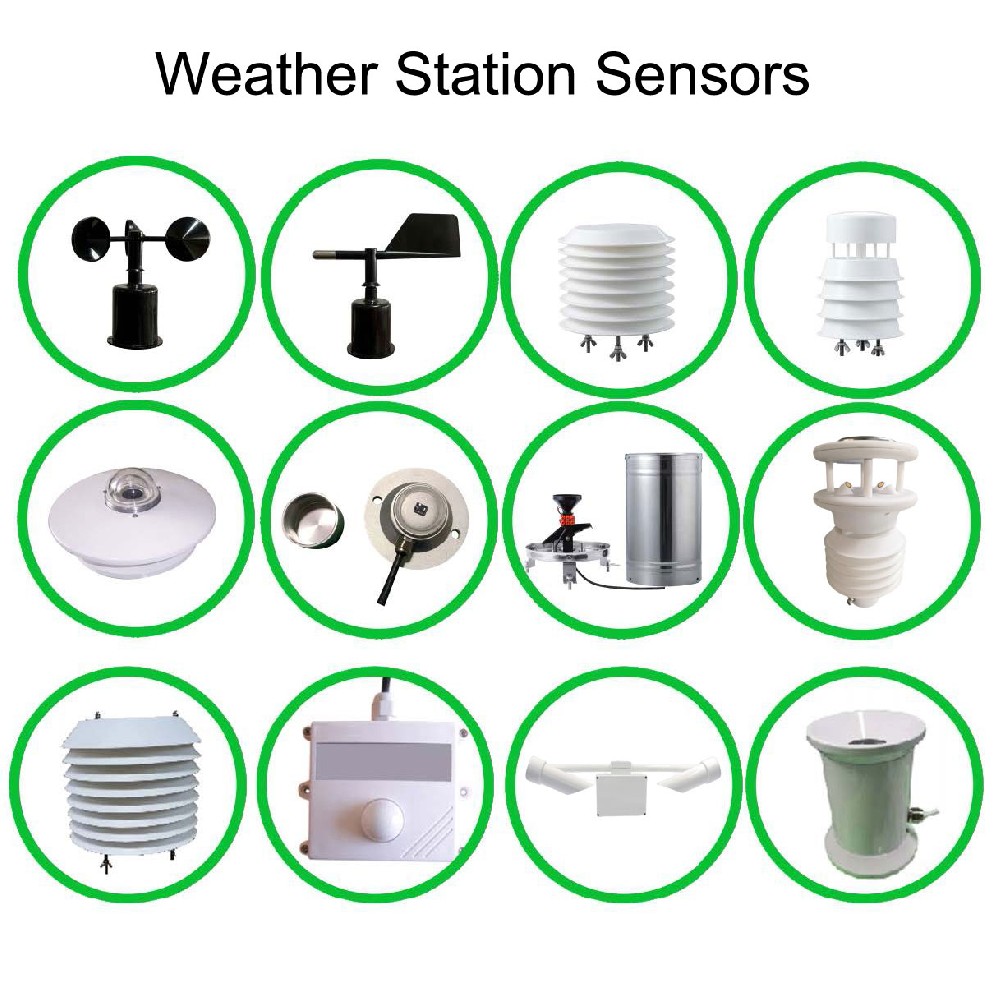
Divide the project by decisions that can differ: irrigation block, crop and growth stage, soil variation, protected versus open cultivation, and relevant pest habitat. Mark existing valves, weather stations and access routes. A property boundary alone is rarely a sufficient reason to average all observations into one farm condition.
For example, a cereal field and a drip-irrigated orchard may share broadly similar open-air weather while needing separate soil observations and crop images. A greenhouse on the same property has a different internal environment. Treat those as candidate observation zones, then check their actual differences before specifying quantities.
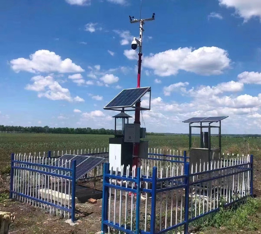
| Module | Possible shared observation | Reason to separate a zone |
|---|---|---|
| Weather | Exposed outdoor conditions at a representative location | Different shelter, elevation, greenhouse enclosure or local rainfall pattern |
| Soil moisture and temperature | A point selected for a defined soil and irrigation unit | Different soil, wetting pattern, root depth or irrigation operation |
| Insect monitoring | Catches at an identified trap under its operating conditions | Different target, habitat, crop boundary or attraction environment |
| Crop imaging | A repeatable view of an identified crop area | Different crop stage, canopy, viewing obstruction or inspection task |
The NiuBoL NBL-S-TMSMS profile sensor observes multiple depths at one installed position. Extra depth channels do not add horizontal sampling points. A wet profile beside a dripper and a dry profile outside the wetted region may both be correct, yet answer different management questions.
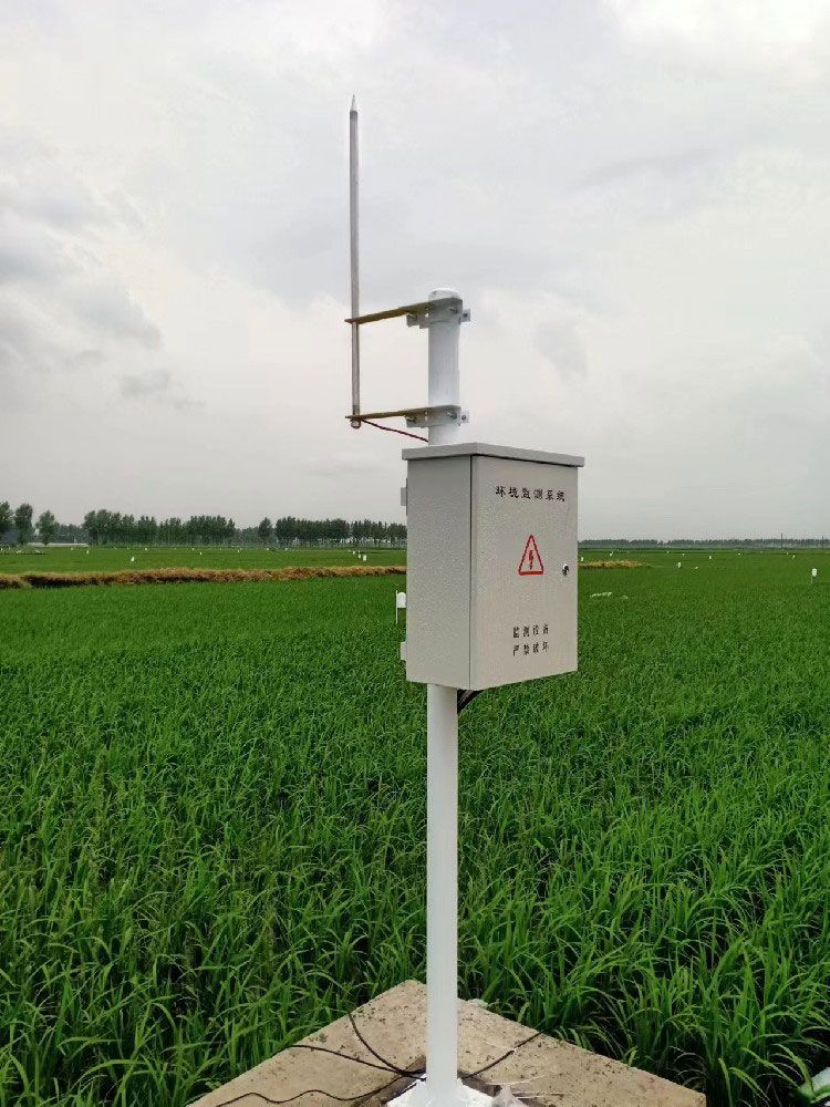
An insect station needs conditions suited to the attraction and collection method. A weather mast's open exposure does not automatically make it a suitable trap location. Nearby lighting, vegetation and crop boundaries can change what reaches the trap. A catch belongs to that observation point; it is not a census of every insect in the mapped zone.
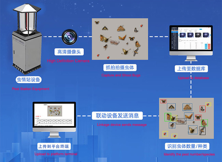
The NiuBoL NBL-IoT-SRPMS combines insect collection, processing and imaging. Select the intended target and verify the configured observation method. Do not convert a trap count directly into crop damage or assume that an insect-control lamp supplies the same records as an imaging station.
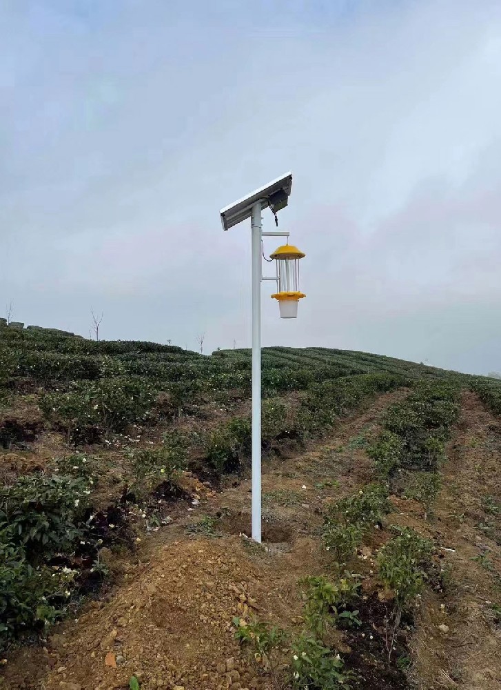
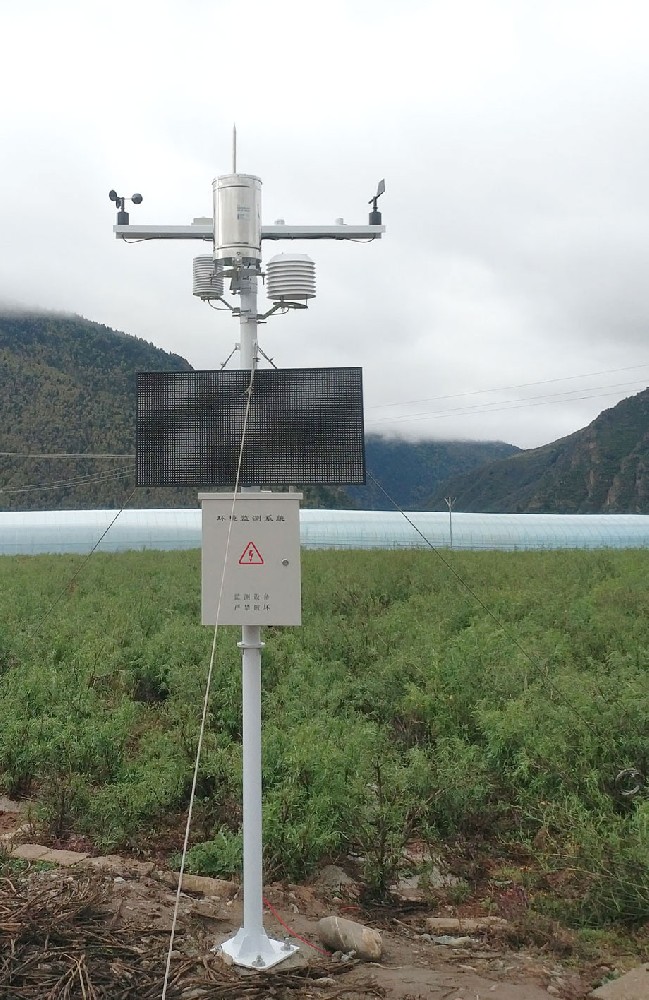
A conventional open-air station can describe its measured air temperature, humidity, wind and rainfall. A shaded canopy location or greenhouse interior may differ. If the decision concerns conditions within that environment, add a suitable local observation rather than applying the outdoor station's values without checking representativeness.
Use clear names such as orchard-open-air, greenhouse-interior and block-A-soil-profile. Avoid a single humidity tag for both relative humidity in air and soil volumetric water content. The latter is not automatically gravimetric moisture or a percentage of field capacity; those quantities require their own definitions and any necessary soil-specific information.
| Selected component | Specified feature | Layout implication |
|---|---|---|
| NBL-S-TMSMS depth arrangement | Standard nodes at 10/20/30/40 cm; other depths by configuration | Match the soil profile to the crop question |
| NBL-S-TMSMS moisture | 0.1% resolution; stated accuracy +/-3% laboratory, +/-5% field | A fine reporting increment does not remove installation or spatial differences |
| NBL-S-TMSMS temperature | -40 to 80 C; +/-0.5 C | Retain depth identity for each temperature channel |
| NBL-S-TMSMS connection | 12-24 VDC adapter option; RS485 Modbus; IP67 above ground/IP68 below ground | Select the actual power and transmission arrangement |
| NBL-IoT-SRPMS image acquisition | 12-megapixel camera; 4G/Ethernet communication configurations | Check local image detail and the upload route separately |
The insect station's camera photographs collected insects; it is not the crop-view camera. Require separate sample files for each purpose. Likewise, a diagram containing a recognition workflow does not establish performance for every locally important species or provide a disease diagnosis from general crop images.
Before omitting a second point, compare the conditions relevant to the decision. For soil, inspect actual wetting and drying across the proposed management units. For crop images, check whether the required plant features remain visible throughout growth. For weather, consider whether shelter or enclosure changes the local observation.
Keep diagnostic points distinct from representative points. A low spot selected to investigate water accumulation should not silently become the whole-block irrigation reference. Label its purpose and compare it with the part of the block the operator intends to manage. Do not average unlike points merely to produce a smooth dashboard line.
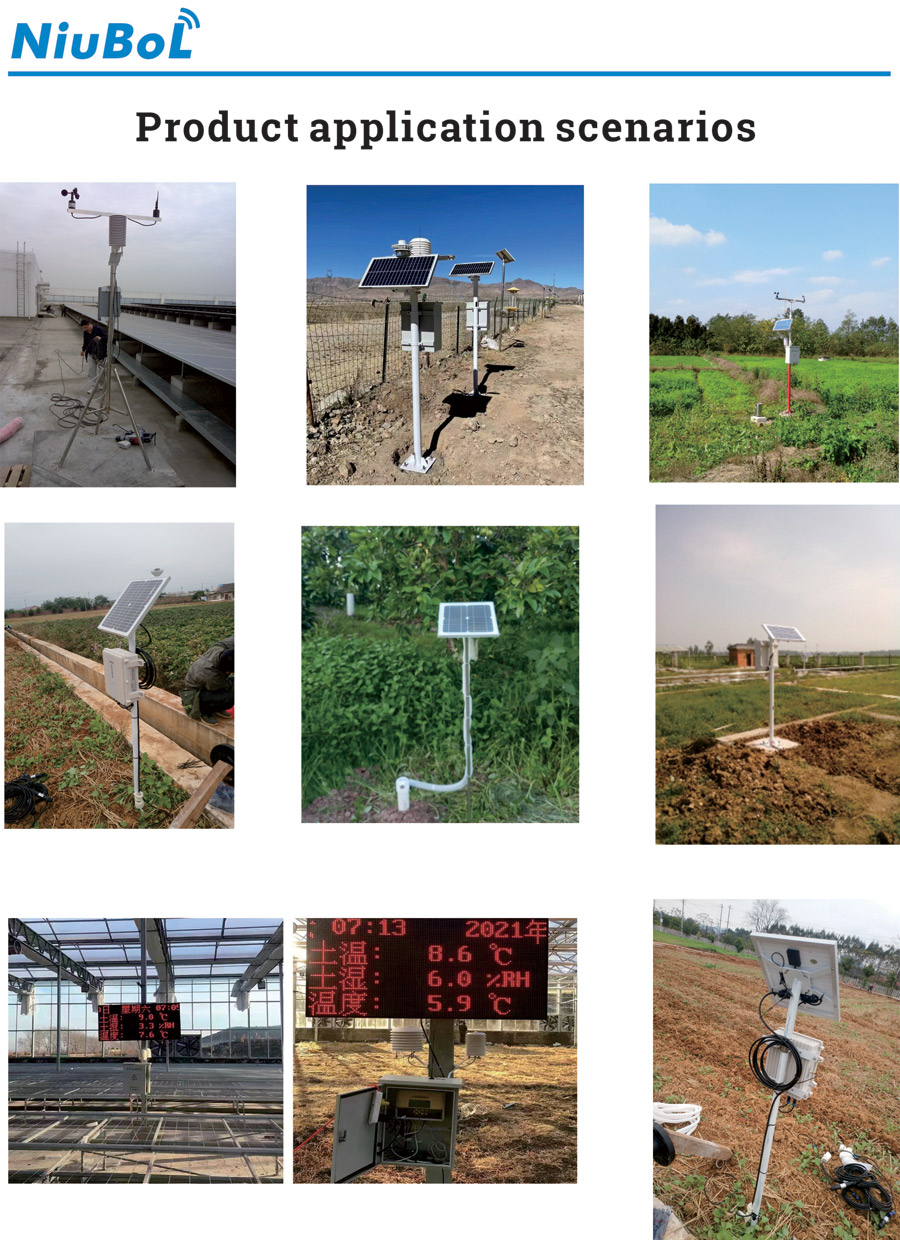
Use a stable zone identifier, device identifier and installed depth or viewing area in the data schedule. When a probe moves or a crop camera is redirected, record the change. Otherwise a new location can look like a sudden environmental event in the same historical series.
RS485 Modbus RTU channels need the correct device map and serial settings. Images usually require a separately specified file or network service; a numeric sensor register does not carry the crop scene. Ask for a real export containing the location, observation time and sample or image reference before accepting an integration claim.

No. Select observations for each management question and check which can reasonably be shared. Some zones need more soil points, while others may not need an insect imaging station.
No. They describe a vertical profile at one position. Horizontal variation in soil or irrigation may require separate positions.
They need different tests. Crop views must show the relevant plants consistently; insect images must preserve the detail needed for the configured identification and count review.
Compare the zone map, observation roles, device quantities, power arrangements and data services. A lower device count is not necessarily a saving if it removes an observation needed for an independent management unit.
Provide the field plan, crops, irrigation units, known soil differences, insect targets, camera tasks and existing communications. Identify the decisions expected from each zone so the configuration can be reviewed against them.
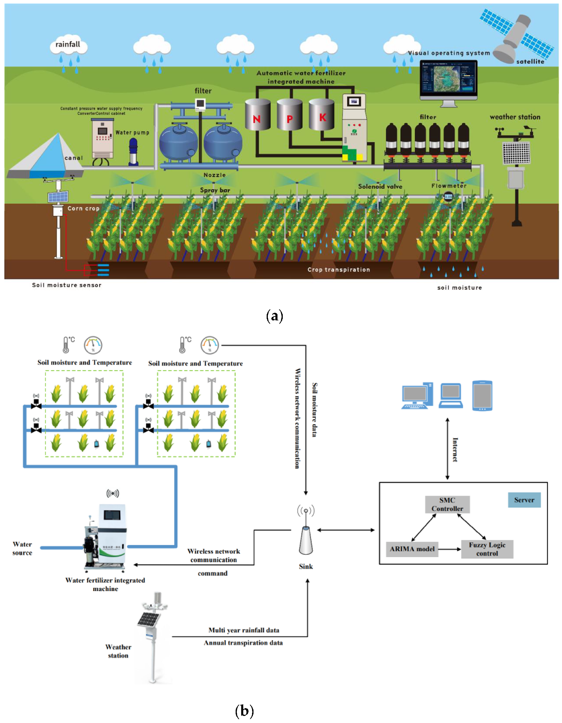
An agricultural monitoring zone layout makes the four-condition approach usable by linking each observation to a real part of the farm. Share measurements only where their relevance has been checked, preserve local differences in the data and select NiuBoL components by the required task. The result should help operators distinguish management units, not conceal them behind a farm-wide average.
Prev:Water Environment Monitoring Architecture: Sensors to Server
Next:Winter Ammonia Nitrogen Exceedance Verification: Check the Result Before the Process
Related recommendations
Sensors & Weather Stations Catalog
 Agriculture Sensors and Weather Stations Catalog-NiuBoL.pdf
Weather Stations Catalog-NiuBoL.pdf
Agriculture Sensors Catalog-NiuBoL.pdf
Water Quality Sensor Catalog-NiuBoL.pdf
Related products
 Combined air temperature and relative humidity sensor
 TDR Soil Moisture & Temperature Sensor for irrigation| RS485 |4-20mA| NBL-S-THR
 Soil pH sensor RS485 soil Testing instrument soil ph meter for agriculture |NBL-S-PH
 Wind Speed sensor Output Modbus/RS485/Analog/0-5V/4-20mA
 Tipping bucket rain gauge for weather monitoring auto rainfall sensor RS485/Outdoor/stainless steel
 Pyranometer Solar Radiation Sensor 4-20mA/RS485


Screenshot, WhatsApp to identify the QR code
WhatsApp number:+8615367865107
(Click on WhatsApp to copy and add friends)

