





— Blogs —
—Products—
 Consumer hotline +8618073152920
WhatsApp:+8615367865107
Address:Room 102, District D, Houhu Industrial Park, Yuelu District, Changsha City, Hunan Province, China
Product knowledge
Time:2025-04-03 14:15:37 Popularity:1394
Meteorological monitoring equipment applications differ in the observations and outputs they require. Agriculture may need soil response as well as weather; solar plants need appropriate irradiance data; transport operators may need local wind or visibility. Specify the decision and receiving system first. A general weather sensor does not automatically provide crop advice, certified aviation observations, pollutant compliance data or marine wave measurements.
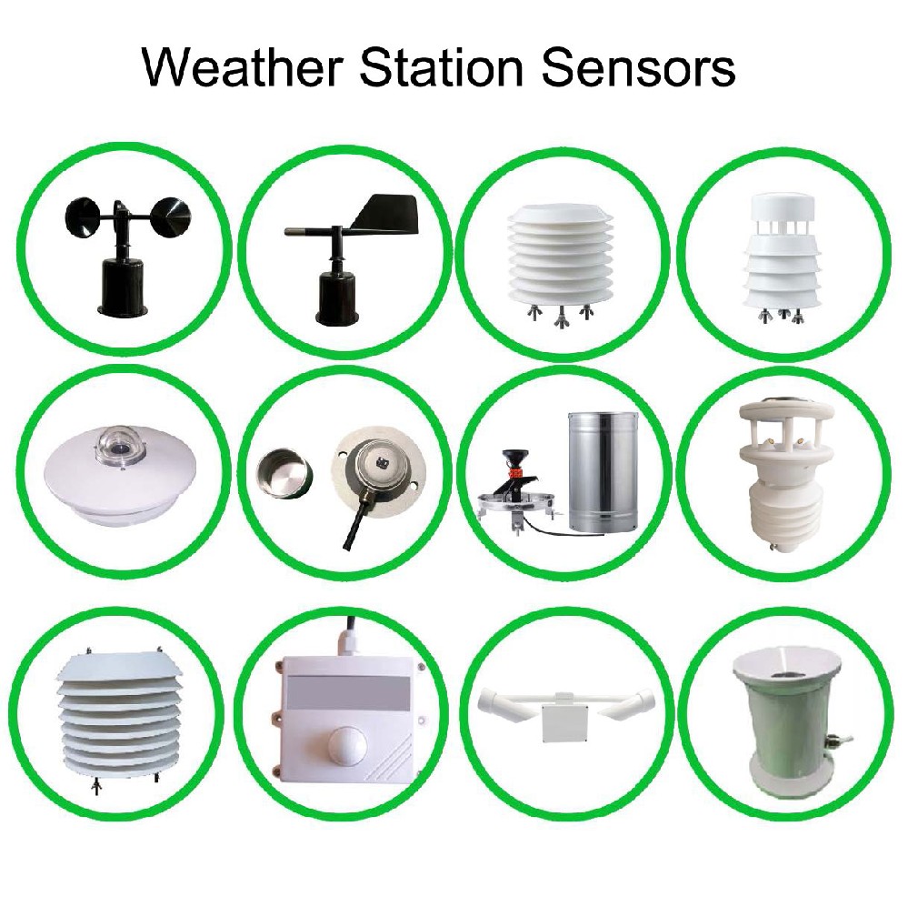
Air temperature is useful in a farm report, an urban microclimate study and a plant operating record, but these projects may need different sensing positions, averaging periods and data delivery. Buying one standard mast for all of them can leave the project with the right channel names and the wrong observations.
Describe the output someone will use. That might be a soil-moisture trend for an irrigation zone, a local wind record for a port operator or irradiance on a specified measurement plane at a solar installation. The output definition determines which instruments and acquisition settings are needed.
NiuBoL modular stations combine selected sensors with a data logger or gateway. Extra channels require suitable instruments, power, inputs and interpretation. A screen showing many possible variables is not a list of equipment physically included in every station.
| Industry and task | Useful output | Additional requirement |
|---|---|---|
| Agriculture: review an irrigation response | Rainfall with soil moisture and temperature at relevant positions | Field and irrigation records; representative probe depth and location |
| Urban planning: compare local thermal conditions | Consistently timed air observations at documented exposures | Comparable methods and information about shade, surfaces and local heat sources |
| Transport: observe a low-visibility location | Local meteorological optical range and observation validity | Operator criteria; MOR is not driver sight distance or runway visual range. |
| Solar energy: interpret irradiance | Radiation on the required measurement plane with timestamps | Appropriate sensor orientation and separate plant operating data |
| Environmental assessment: interpret an event | Wind and weather alongside the selected pollutant measurements | Dedicated pollutant instruments and the applicable assessment method |
| Ports and coastal operations | Wind, pressure or visibility at a relevant fixed location | Separate wave, tide or current instruments where those quantities are required |
Rainfall describes water arriving at the collector. It does not establish water availability at every root depth. A soil instrument adds a local observation, while crop stage, irrigation application and soil properties remain part of the interpretation. A weather station alone does not measure nutrient demand or diagnose a pathogen.
An orchard or protected growing area may differ from an open reference site. Document which location each observation represents. If a grower needs indoor humidity or crop-level light, add the appropriate sensing point instead of assuming the outdoor mast covers it.
For a distributor preparing an agricultural offer, separate the atmospheric station, soil channels and any controller functions. Provide the field layout and required output, then confirm the probes and acquisition inputs. A sensor package is not evidence that valves, vents or irrigation feedback are included.
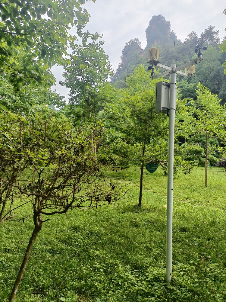
The NBL-W-VS supplies meteorological optical range over 5 m to 10 km. This can support appropriate local visibility observation. It does not directly establish road braking conditions, runway visual range or an approved traffic-management action.
Likewise, a wind head supplies observations at its installed exposure, not a universal aircraft, crane or vehicle operating limit. Aviation projects must state the applicable equipment and operational requirements before selection. A general product application list does not establish certification or approval for a safety-critical duty.
Acceptance should follow the intended data use. Check the quantity, unit, observation time and availability state at the receiving system, then demonstrate the operator's agreed response separately. Keep forecast services distinct from local measurements: a pressure or wind trend is not a complete thunderstorm or typhoon forecast.
| NiuBoL instrument | Selected specification | Useful distinction |
|---|---|---|
| NBL-W-LBTH | Air temperature -40°C to 80°C, ±0.5°C; humidity 0-100%RH, ±5%RH; DC 12-24 V | Atmospheric conditions, not soil water or crop tissue temperature |
| NBL-W-SS | Wind 0-45 m/s or 0-70 m/s version; IP65; selected pulse, analog or RS485 output | Wind speed at the chosen exposure; direction needs an appropriate channel. |
| NBL-W-VS | MOR 5 m to 10 km; DC 12 V; approximately 0.8 W; IP65 | Optical visibility, not PM2.5 mass concentration |
| NBL-W-HPRS | Solar irradiance 0-2000 W/m²; thermopile measurement; response no more than 35 seconds to 99% | Radiation measurement, not an automatic increase in power generation |
These specifications apply to the named components, not to every weather station configuration. Confirm the selected output version and its matching acquisition input. Where the project needs another quantity, specify the additional instrument rather than changing a dashboard label.
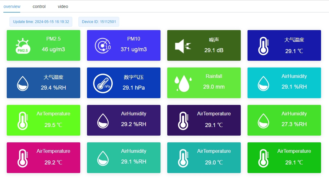
A study of paved and vegetated locations needs comparable temperature methods and meaningful site descriptions. A lower temperature at one sensor does not by itself prove the effectiveness of an urban design intervention. Shade, ventilation, sensor height and the observation period can also differ.
For pollutant assessment, wind can help describe transport conditions, but it cannot replace a particulate or gas measurement. Confirm the pollutant range and applicable method independently. A general environmental dashboard does not establish reference-method equivalence or compliance with an air-quality reporting requirement.
Retain data age and validity for each channel. A healthy wind channel and a failed particulate channel should not be combined into an unexplained green station indicator. The operator needs to know which observations remain usable for the current task.
At a photovoltaic site, irradiance must refer to the intended plane and period. Pair it with the relevant plant records when evaluating performance. Wind, air temperature and radiation are explanatory inputs; they do not independently establish why output changed or authorize a control adjustment.
At a coastal site, document whether the station is fixed or moving and what the wind direction reference means. A fixed harbour mast and a moving vessel do not have identical observation conditions. Wave height, tide level and currents need their own appropriate measurement arrangements; they are not hidden outputs of an atmospheric pressure sensor.
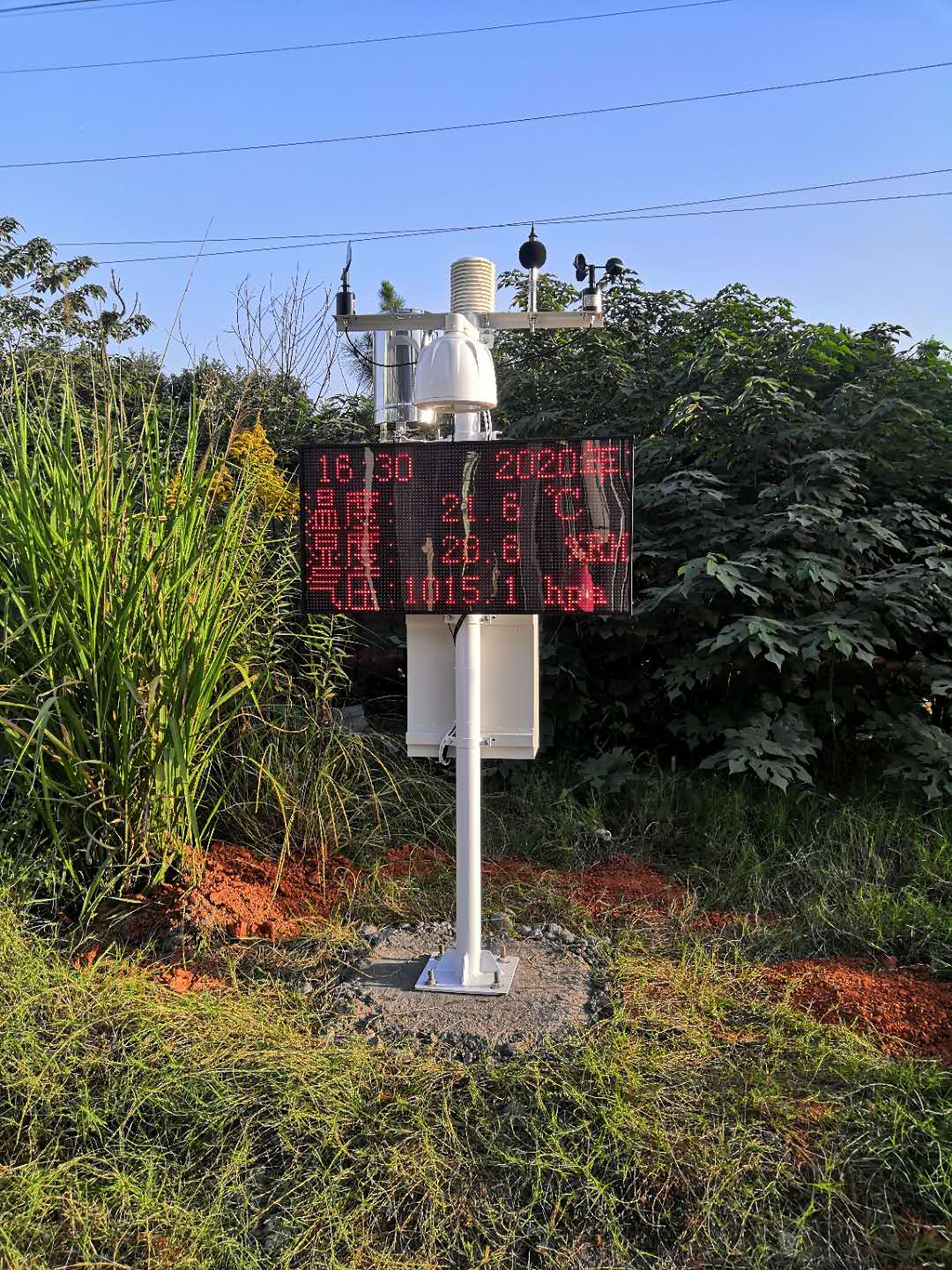
RS485 Modbus RTU can connect selected sensors to a compatible PLC, RTU, data logger or gateway. It does not automatically define the server message format, historical export or remote communications service. Check both sides of the acquisition equipment before ordering.
Provide the required channels and units, sensing locations, record interval, existing inputs and receiving-system requirements. Include any need for local storage or recovery after a connection outage. For repeat orders, retain the model and output versions with the accepted channel map so the next installation produces the same defined quantities.
Compare quotations against that scope, including power, enclosure, installation and recurring services where needed. There is no single equipment price that covers every industry's instruments, acceptance requirements and data services. A technically comparable offer identifies what each output depends on.
A farm may need rainfall, air conditions and soil readings that feed an irrigation review. A roadside project may need wind and visibility observations with clear status flags. A PV installation may need irradiance and module temperature aligned to electrical records. These systems can share a mast, logger family or communications method, but their acceptance tests are not interchangeable. The buyer should name the downstream decision first and derive the input list from it.
For each proposal, request a channel schedule with unit, output, interval, mounting point and receiving destination. Include an example of an unavailable value and the field test that proves the channel path. That small amount of engineering detail exposes when a catalogue station includes unused instruments or omits one critical measurement. It also gives a distributor an honest basis for comparing modular and integrated quotations.
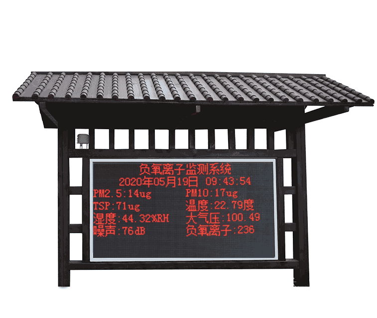
A modular platform can support different configurations, but the instruments, exposure and outputs must match the task. Specify the measured quantities and data use first; do not assume identical hardware meets farm, airport and environmental compliance requirements.
Only where suitable pollutant instruments are actually included. Wind and humidity provide context, not particulate or gas concentrations. Confirm the pollutant method and any required compliance status separately.
Not by relabeling the field. MOR and RVR are distinct. Aviation duties require assessment of the specified operational system, relevant standards and approvals, not only the sensor's numerical range.
Check channel identity, units, timestamps, summary method and missing-data behavior from sensor to final receiver. Demonstrate any derived output with its required inputs. A live connection alone does not prove that the intended observations are usable.
The equipment supplies selected local observations. Forecasting and validated warning services require additional methods and inputs. Specify those services independently rather than assigning them automatically to the weather sensors.
Send NiuBoL the application, required observations, locations, receiving equipment and intended output. State environmental and operational requirements, especially where a regulated duty is involved. That allows the proposed configuration and exclusions to be reviewed before purchase.
The receiving PLC, SCADA or research database determines whether the project needs direct registers, analog signals, event pulses or a managed data export. The selected instrument must provide the needed quantity in that usable form. Otherwise a technically capable sensor can still require an unplanned converter or software change.
Compare required quantities, mounting context, intervals and data ownership, not only a station's total sensor count. A road operator may prioritize visibility status; an irrigation project may need soil feedback; a PV plant needs irradiance context. The shared hardware list can be similar while the acceptance criteria are different.
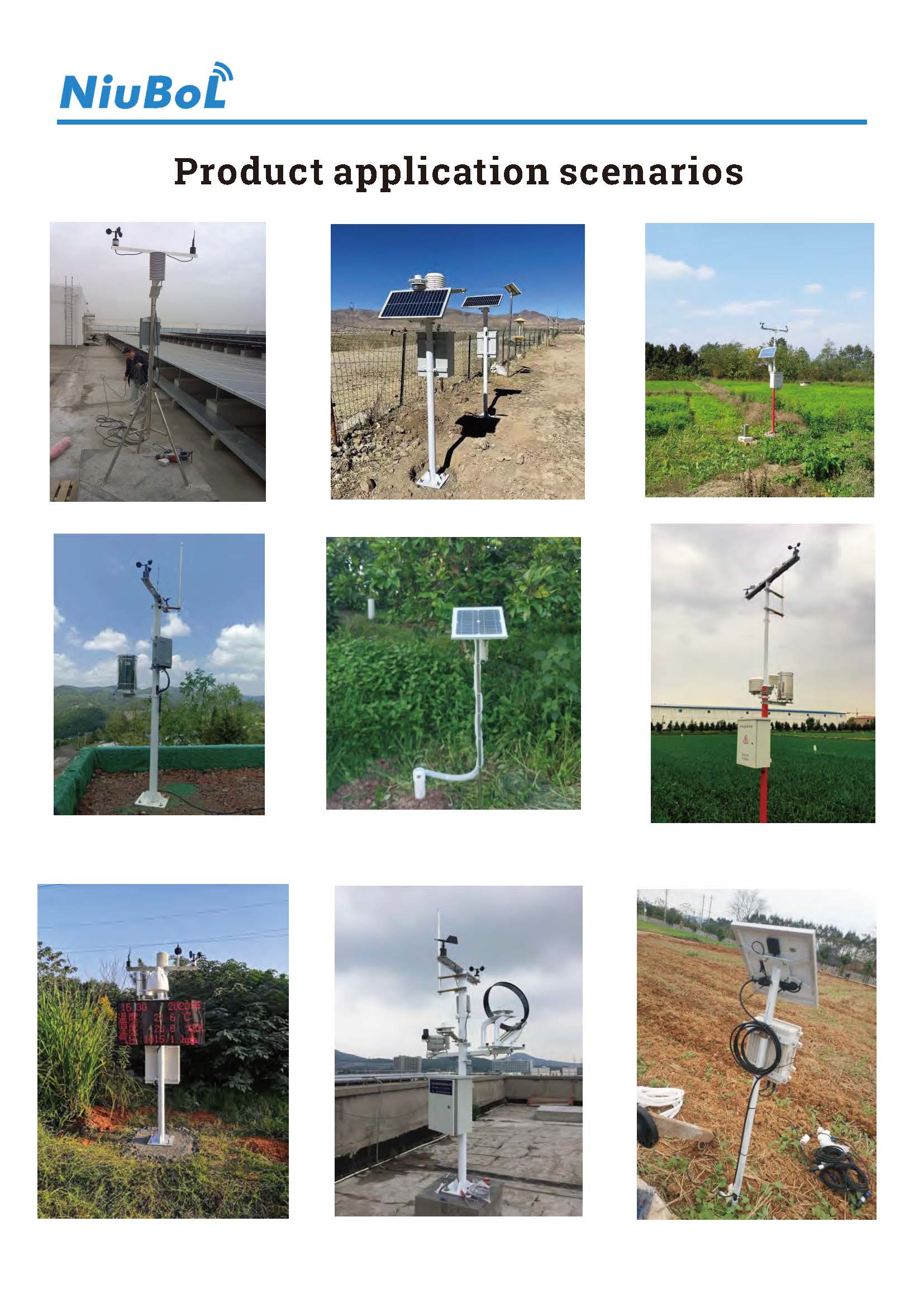
Meteorological monitoring equipment applications become clearer when each observation is linked to a defined output and user. Select the instruments, exposure and acquisition path for that use, and keep forecasts, derived advice and operational approvals separate. A useful NiuBoL configuration supplies the required evidence without claiming that every industry needs the same station.
Prev:Automatic Weather Station Operating Temperature: Check Each Component
Next:Agricultural Weather Stations: Intelligent Support for Modern Agriculture
Related recommendations
Sensors & Weather Stations Catalog
 Agriculture Sensors and Weather Stations Catalog-NiuBoL.pdf
Weather Stations Catalog-NiuBoL.pdf
Agriculture Sensors Catalog-NiuBoL.pdf
Water Quality Sensor Catalog-NiuBoL.pdf
Related products
 Combined air temperature and relative humidity sensor
 TDR Soil Moisture & Temperature Sensor for irrigation| RS485 |4-20mA| NBL-S-THR
 Soil pH sensor RS485 soil Testing instrument soil ph meter for agriculture |NBL-S-PH
 Wind Speed sensor Output Modbus/RS485/Analog/0-5V/4-20mA
 Tipping bucket rain gauge for weather monitoring auto rainfall sensor RS485/Outdoor/stainless steel
 Pyranometer Solar Radiation Sensor 4-20mA/RS485


Screenshot, WhatsApp to identify the QR code
WhatsApp number:+8615367865107
(Click on WhatsApp to copy and add friends)

