





— Blogs —
—Products—
 Consumer hotline +8618073152920
WhatsApp:+8615367865107
Address:Room 102, District D, Houhu Industrial Park, Yuelu District, Changsha City, Hunan Province, China
Product knowledge
Time:2025-03-27 20:59:53 Popularity:1974
Meteorological observation systems include surface instruments, upper-air measurements and remote sensing. They observe different locations, heights and spatial scales, so they complement rather than replace one another automatically. A surface weather station can measure local wind or rainfall; it does not become a weather radar, satellite retrieval or forecast system through a software label.
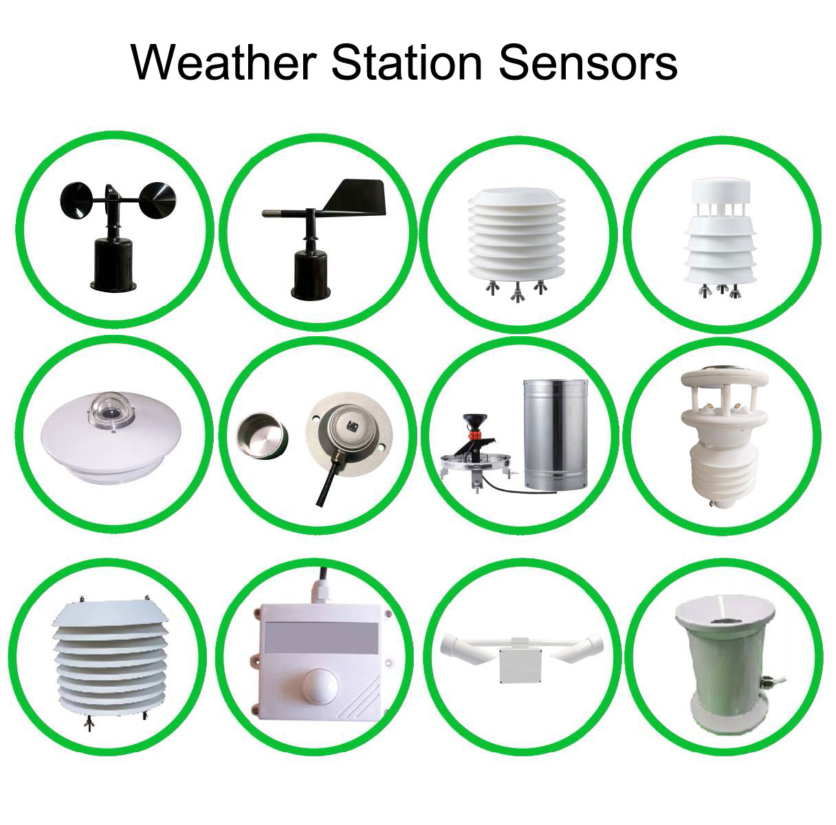
The useful distinction is not simply manual versus automatic. Ask whether an instrument senses conditions at a local point, follows a path through the atmosphere or receives electromagnetic signals from a wider region. That distinction determines what the resulting record can represent.
The National Weather Service overview of observation systems describes surface networks, upper-air observations and remote sensing as parts of the broader observing system. For an engineering project, choosing among them starts with the required observation rather than the number of parameters on a display.
| System | Typical information | Important boundary |
|---|---|---|
| Surface weather station | Local atmospheric measurements and rainfall at the installed site | One site's exposure does not establish conditions throughout a region. |
| Balloon-borne radiosonde | Atmospheric profile along an ascending flight | Not a stationary mast measurement at every height. |
| Weather radar | Remote information about precipitation and other targets within its observation geometry | A radar product is not identical to water collected at one ground point. |
| Weather satellite | Radiance observations and products over wider areas | An image pixel is not automatically a local shielded air-temperature reading. |
| Specialized local instrument | A defined quantity such as visibility, UV or a separate detection signal | Only the fitted and appropriately specified measurement is available. |
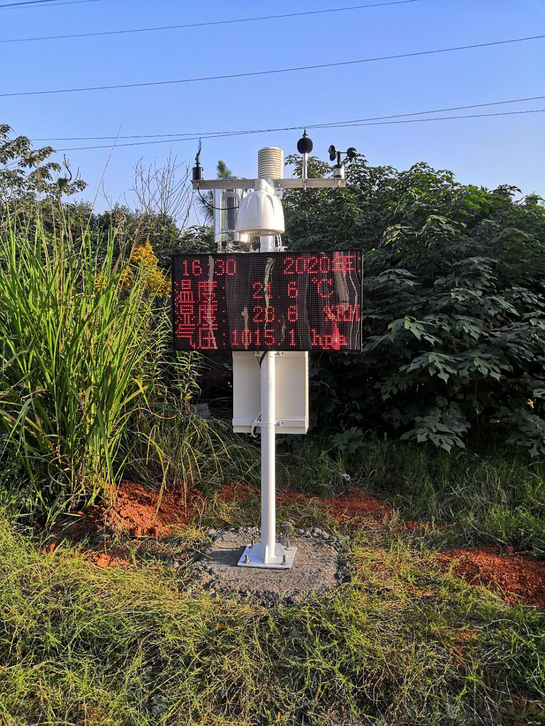
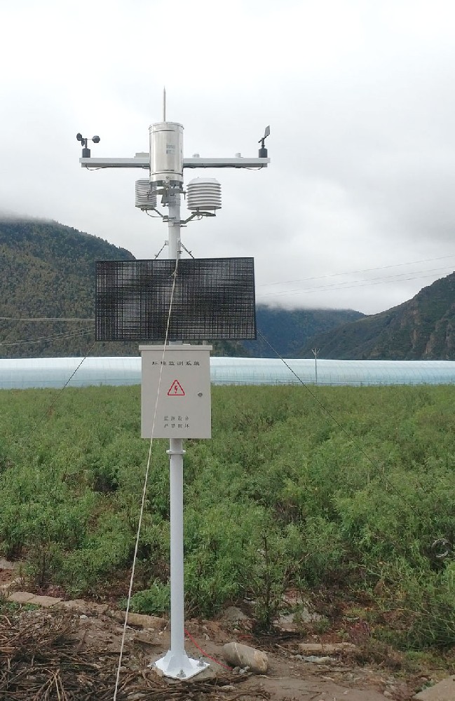
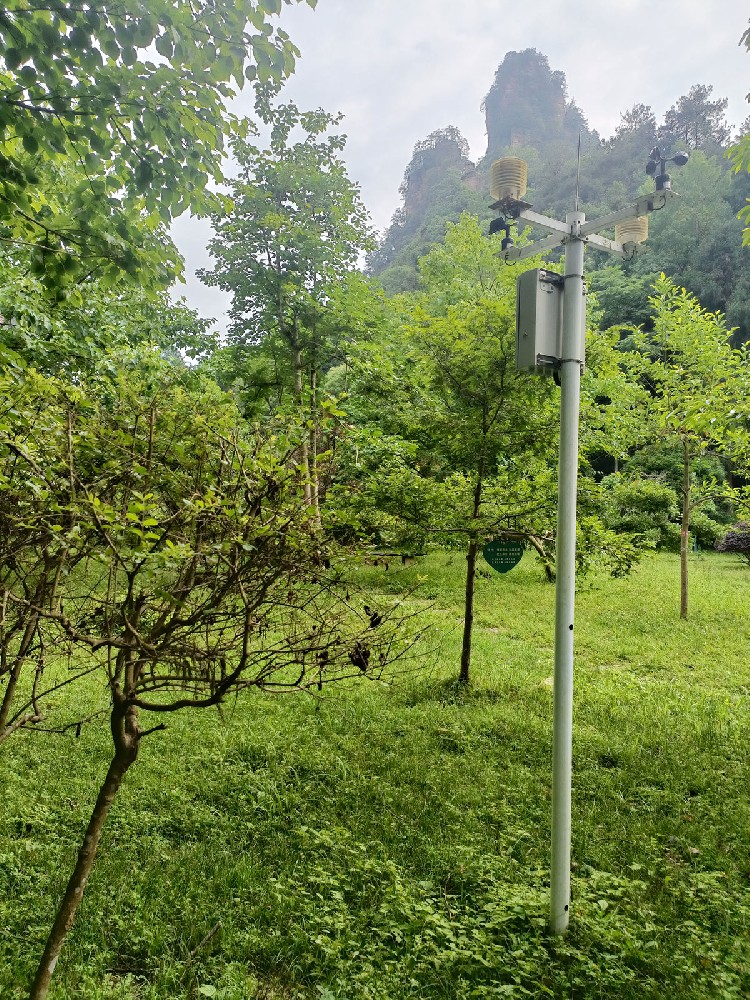
A surface station combines instruments selected for the intended site. Air temperature needs appropriate shielding and airflow; a rain collector needs the intended precipitation exposure; wind measurements need a documented height and surrounding environment. Automation changes how readings are acquired, not the need for a suitable measurement point.
A display can be installed where people can read it while the sensing position is selected for exposure. Keep those functions distinct. Adding a public display or a remote dashboard does not make the station representative of a larger area.
| NiuBoL instrument example | Measurement specification | Interpretation |
|---|---|---|
| NBL-W-LBTH | Air temperature -40°C to 80°C, ±0.5°C; humidity 0-100% RH, ±5% RH; pressure 10-1200 hPa, ±1.5 hPa | Air conditions at the sensor; pressure reference and site exposure still matter. |
| NBL-W-SS | Selected 0-45 or 0-70 m/s range; IP65 | Local wind speed, not a complete atmospheric wind profile |
| NBL-W-RS | 0.2 mm increment; 0-4 mm/min intensity range; operating 0°C to 50°C | Liquid precipitation at the collector, not a regional rainfall map |
| NBL-W-HPRS | 0-2000 W/m²; spectral range 0.3-3 µm | Irradiance at the defined sensing plane, not every radiation quantity |
A balloon-borne radiosonde measures pressure, temperature and humidity as it ascends. Tracking its position also supports wind determination. NOAA explains these measurements in its radiosonde overview. A profile describes conditions along a flight, not an array of identical ground sensors stacked above a mast.
This distinction matters when an application needs wind aloft or atmospheric structure. Increasing the range of a surface anemometer does not add vertical coverage. The project needs the appropriate observing method and expertise rather than a wider display scale on a local weather station.
Weather radar receives signals from targets within its beam and supports precipitation products over an area. Beam width and height vary with range and atmospheric conditions. NOAA's discussion of radar beams explains why observation geometry matters when interpreting the display.
Consequently, disagreement between a radar rainfall product and a ground collector is not automatically a failed rain gauge. Review the time window, position, product definition and collector condition before assigning a cause. Neither source should be silently substituted for the other in a historical series.
Visible and infrared satellite channels provide different information. Visible imagery depends on reflected sunlight; infrared imagery can show radiating surfaces or cloud tops by day and night. The National Weather Service describes this distinction in its satellite imagery guide. Product interpretation depends on the channel, conditions and retrieval method.
A cloud-top or surface-radiance product must not be relabelled as local air temperature in a radiation shield. An application may use both satellite context and field observations, but their identities and spatial meanings should remain visible in the data model.
The same discipline applies to specialized sensors. A UV channel is not obtained simply by renaming total solar irradiance. Lightning, visibility and fire-detection requirements need their own appropriate instruments and system scope.
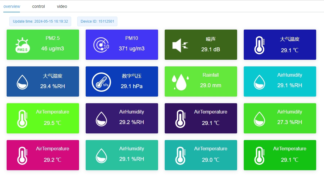
A monitoring platform can place local readings, regional products and forecasts on one screen. That is a presentation choice, not evidence that they have the same origin. Retain the source, observation or valid time, location, unit and status for each record.
A forecast concerns future conditions and may use many observations and a prediction method. A current pressure reading or rainfall total is not itself a forecast. If forecast delivery is required, specify the service, update behavior and validation separately from purchasing the field instruments.
For a local NiuBoL installation, selected RS485 Modbus RTU sensors can connect to a compatible PLC, RTU or data logger. That is the acquisition path for those sensors. Combining it with remote products needs the relevant external data interface and interpretation; RS485 does not convert a local station into a satellite or radar system.
A contractor requiring wind at a plant or rainfall at a collector has a reason to assess a surface installation. A regional storm view or an atmospheric profile is a different task. Begin with the decision, then match the observing method and its limitations to that task.
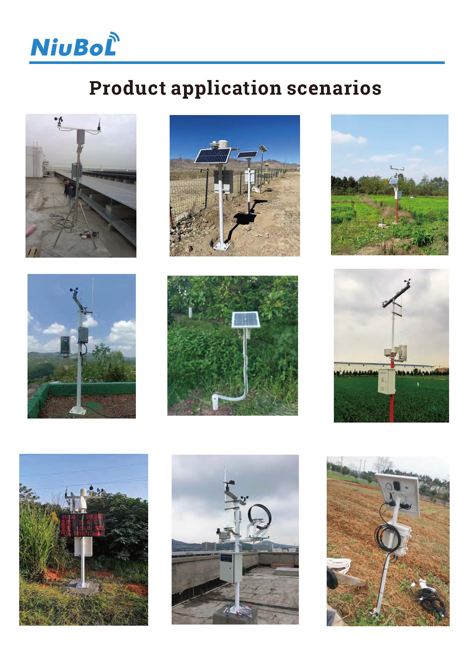
For surface equipment, NiuBoL can review the quantities, exposure and acquisition arrangement. Provide the location, intended use and receiving system. For broader context, keep external observations and forecasts identified separately. The comparison between sensor supply and a complete local station helps define that field-equipment scope without implying that every type of meteorological system is included.
A field station, weather radar and satellite product may all appear on the same map, but they are not three versions of the same ground sensor. The station reports at its installed point and height; a radar product represents a processed observation volume or area; a satellite product has its own viewing geometry and retrieval method. Keep the source identity and coverage attached to every value. Otherwise a user can mistake a grid-cell estimate for a measured condition at the project mast.
For a farm, road or PV project that needs a local threshold, first define the decision location and variable. Specify a surface instrument there if the contract requires a measured local value. Radar or satellite information can provide wider context where the product's scale and update interval are suitable, but it should not silently fill a failed station channel as though nothing changed. A forecast adds another layer: it has an issue time and a future valid time, neither of which describes a current sensor reading.
An integrator's handover should show a sample record from each source with units, timestamp convention, location or coverage, quality status and access rights. Test the display with one unavailable station record and one delayed remote product. If the system preserves those distinctions, analysts can compare sources honestly and decide which one supports a particular operation. Buying an automatic station does not confer ownership of radar, satellite or forecast services.
Not as an equivalent observation. It measures at a local site, while a radar product has its own geometry and processing. They may be useful together, but their roles and time windows must remain distinct.
No. Measurement range describes the speeds the instrument can report at its sensing position. A vertical wind profile needs an appropriate observing method, not merely a wider speed range.
No general equivalence exists. Identify the satellite channel and product, and distinguish it from the local shielded air measurement before comparing or combining values.
No. Automatic acquisition provides observations. Forecasts require a separate prediction method or service and should be identified by their issue and valid times.
Keep source identity, location or coverage, times, units and status for each. Define the intended use and avoid presenting remote estimates, local observations and forecasts as interchangeable sensor channels.
A properly sited surface station provides observations at its own location and sensor heights. It can support comparison with a radar or satellite product, but it does not validate every pixel or elevation in a region. Specify the comparison period, units and spatial representativeness before using the station as a reference.
Only if the user's decision accepts the remote product's spatial scale, latency, uncertainty and available variables. A local logger remains necessary when the contract calls for measurements at a defined field point or for a particular sensor channel. The choice is a measurement-scope decision, not a contest between 'modern' and 'traditional' equipment.
Ask for each source's location or coverage, time basis, units, quality flags, update schedule and license or access rights. Keep measured surface data, retrieved remote products and forecasts separately identified in the database. A common dashboard can display them together without implying they were obtained by identical instruments.
Meteorological observation systems answer questions at different scales. Surface stations, upper-air instruments, radar and satellites contribute different information. Select local NiuBoL equipment for an appropriate field measurement and preserve the boundaries between that observation, remote products and forecasts.
Prev:Ultrasonic Anemometer Sample Testing: Bench Checks vs Calibration
Next:Agricultural Meteorological Stations: Functions and Importance
Related recommendations
Sensors & Weather Stations Catalog
 Agriculture Sensors and Weather Stations Catalog-NiuBoL.pdf
Weather Stations Catalog-NiuBoL.pdf
Agriculture Sensors Catalog-NiuBoL.pdf
Water Quality Sensor Catalog-NiuBoL.pdf
Related products
 Combined air temperature and relative humidity sensor
 TDR Soil Moisture & Temperature Sensor for irrigation| RS485 |4-20mA| NBL-S-THR
 Soil pH sensor RS485 soil Testing instrument soil ph meter for agriculture |NBL-S-PH
 Wind Speed sensor Output Modbus/RS485/Analog/0-5V/4-20mA
 Tipping bucket rain gauge for weather monitoring auto rainfall sensor RS485/Outdoor/stainless steel
 Pyranometer Solar Radiation Sensor 4-20mA/RS485


Screenshot, WhatsApp to identify the QR code
WhatsApp number:+8615367865107
(Click on WhatsApp to copy and add friends)

