


— Blogs —
—Products—
 Consumer hotline +8618073152920
 WhatsApp:+8615367865107
Address:Room 102, District D, Houhu Industrial Park, Yuelu District, Changsha City, Hunan Province, China
Product knowledge
Time:2026-01-22 10:15:40 Popularity:527
River hydrological data serves as the core basis for flood dispatching, flood forecasting, ship navigation, and reservoir operations. With the increase in extreme weather events, traditional manual observation methods fall short in terms of timeliness, continuity, and safety. The NiuBoL rainfall and water level monitor achieves synchronized “rainfall-water level” monitoring through automated collection and remote transmission, helping managers promptly capture rainfall processes and water level responses, predict flood peak characteristics, flood volume scale, and risk areas in advance, thereby providing reliable basis for personnel evacuation, emergency rescue decisions, and engineering dispatching.

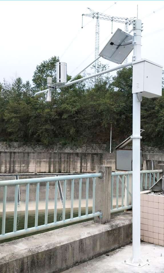
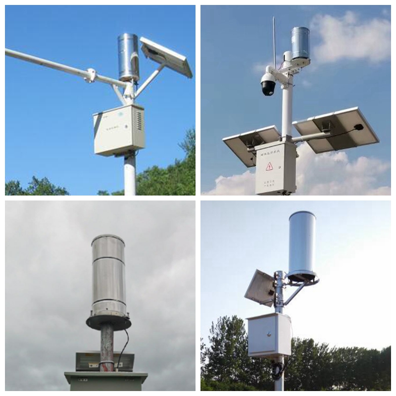
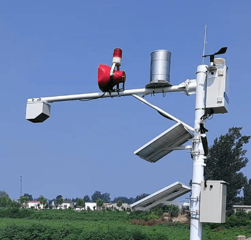
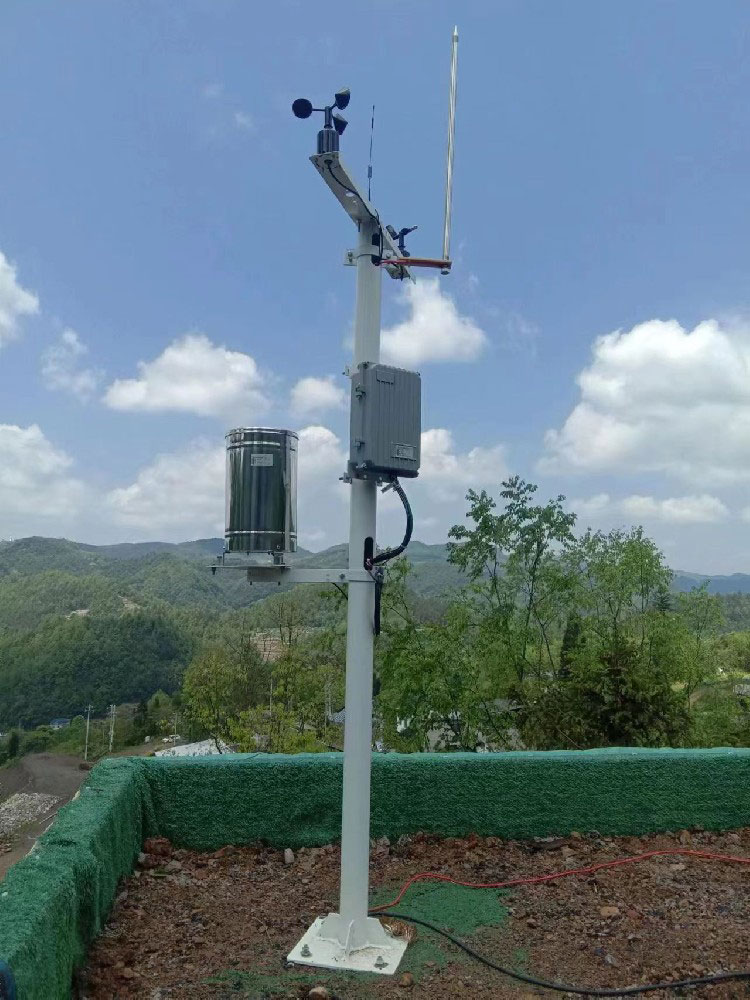
The device adopts an integrated outdoor protective enclosure design, with protection rating IP65/IP67 (depending on configuration), capable of withstanding complex environments such as rain, snow, dust, and high/low temperatures. It supports solar + battery power supply (solar panel power 60W, battery capacity 30Ah), combined with low-power design, suitable for long-term stable operation in remote areas without mains electricity. The rainfall part uses the classic tipping bucket principle, while the water level part employs a K-band planar radar for non-contact measurement, avoiding interference from sediment, floating objects, pollutants, etc.
| Parameter Name | Specification Details |
|---|---|
| Catchment Diameter | Φ200 ± 0.6 mm |
| Measurement Range (Rain Intensity) | 0~4 mm/min (maximum allowable rain intensity 8 mm/min) |
| Resolution | 0.2 mm (corresponding to 6.28 ml) |
| Accuracy | ±4% (indoor static test, at rain intensity 2 mm/min) |
| Output Form | Reed switch signal, 0~2.5V/0~5V voltage, RS485, 4-20mA |
| Power Supply Mode | DC 5V or DC 12V-24V |
| Operating Temperature | 0~50℃ |
| Storage Temperature | -40℃~80℃ |
| Instrument Cable Length | Standard 5 meters (customizable) |
The tipping bucket adopts high-precision injection molding + anti-rust bearing design, with low starting rain intensity and smooth flipping, complying with SL61-2003 “Hydrological Automatic Reporting System Specification”, GB11832-89 “Tipping Bucket Rain Gauge” and other standards.

| Parameter Name | Specification Details |
|---|---|
| Measurement Principle | FMCW frequency-modulated continuous wave (K-band, 24~24.25 GHz) |
| Range | 0.3~30 m (optionally extendable to 50 m or 70 m) |
| Accuracy | ±3 mm ~ ±1 cm (depending on range and installation conditions) |
| Resolution | 1 mm |
| Antenna Beam Angle | Water level: approx. 11°×11°; Flow velocity: approx. 14°×32° (if integrated) |
| Transmission Frequency | 24.000~24.250 GHz |
| Anti-Interference Capability | Not affected by temperature, humidity, water vapor, sediment, floating objects, pollutants |
| Output Interface | RS485 (Modbus RTU), 4-20mA, etc. |
| Protection Rating | IP67 |
The radar probe is installed above the riverbank or on a bridge, measuring the distance to the water surface in a non-contact manner and converting it to water level value. Built-in algorithms compensate for atmospheric interference and support flow calculation (requires combination with river cross-section parameters).
Acquisition frequency can be set from 1 to 60 minutes, with local caching supported (automatic re-transmission after network disconnection). Data is uploaded via GPRS/4G/5G wireless, RS485/RS232 wired, or Ethernet. The cloud platform supports:
Real-time rainfall bar chart, water level process line, multi-station comparison
Historical data query, Excel/CSV export
Threshold alarms (SMS, email, WeChat)
Modbus RTU/TCP protocol, easy integration with water conservancy SCADA or third-party systems
Optionally integrate meteorological parameters such as wind speed and direction, temperature and humidity, to realize a small hydrological and meteorological station function.
Installation process is simple:
Select an open, unobstructed position to fix the bracket;
Place the rain gauge in a level, wind-disturbance-free location, with the radar probe vertically aimed at the water surface;
Connect the solar panel, battery, and communication module;
After powering on, complete calibration and networking via APP/computer.
Low maintenance requirements: Clean the tipping bucket every 1~2 years, radar probe is basically maintenance-free. The system has built-in self-diagnosis, automatically pushing reminders for abnormalities.
Flash flood gullies and small/medium rivers: Rainfall-water linkage warning, issuing flood risk alerts several hours in advance.
Reservoir inflow dispatching: Accurately grasp incoming water volume, optimize storage and discharge balance.
Navigation channels and irrigation districts: Water level data guides navigation depth and irrigation water release.
Agricultural disaster prevention: Provide regional rainfall distribution, support precise irrigation and disaster prevention and mitigation.
In actual projects, this system has successfully captured multiple sudden heavy rainfall processes, providing key data support for grassroots flood control.

Q1. Can the tipping bucket rain gauge measure snow or solid precipitation?
Standard type is suitable for liquid rainfall; in northern regions, heated or weighing rain gauges can be selected as supplements.
Q2. How is the accuracy of the radar water level gauge in foggy or windy weather?
K-band radar has strong resistance to atmospheric interference, with built-in compensation algorithms; fog, rain, and wind have minimal impact, maintaining millimeter-level accuracy.
Q3. How is power supply ensured in remote mountainous areas?
60W solar + 30Ah battery combination, low-power design, can support continuous operation for more than 7~10 days in rainy weather.
Q4. Is the risk of data loss high?
Supports local storage + breakpoint resume transmission; automatically re-uploads after network recovery to ensure completeness.
Q5. Can it be expanded to monitor flow or other parameters?
Supported, integrate flow calculation module, wind speed, temperature and humidity sensors, etc., via RS485 bus.
Q6. How to verify device accuracy?
Rainfall: Use standard measuring cup for static water injection verification; Water level: Compare with manual staff gauge or benchmark, system records calibration logs.
The NiuBoL rainfall and water level monitor, with mature tipping bucket rainfall technology and non-contact radar water level measurement, combined with solar power supply, remote transmission, and low-maintenance design, provides an efficient and reliable solution for river hydrological monitoring. In the context of climate change, the supporting role of hydrological data in disaster prevention and resource management is becoming increasingly prominent. Choosing such a well-balanced, flexibly deployable device can significantly improve monitoring timeliness and decision-making scientificity. If you are planning river, reservoir, or flood control monitoring projects, NiuBoL can provide customized solutions and on-site guidance to jointly contribute to water safety and sustainable development.
Related recommendations
Sensors & Weather Stations Catalog
 Agriculture Sensors and Weather Stations Catalog-NiuBoL.pdf
Weather Stations Catalog-NiuBoL.pdf
Agriculture Sensors Catalog-NiuBoL.pdf
Water Quality Sensor Catalog-NiuBoL.pdf
Related products
 Combined air temperature and relative humidity sensor
 Soil Moisture Temperature sensor for irrigation|NBL-S-THR
 Soil pH sensor RS485 soil Testing instrument soil ph meter for agriculture |NBL-S-PH
 Wind Speed sensor Output Modbus/RS485/Analog/0-5V/4-20mA
 Tipping bucket rain gauge for weather monitoring auto rainfall sensor RS485/Outdoor/stainless steel
 Pyranometer Solar Radiation Sensor 4-20mA/RS485

Screenshot, WhatsApp to identify the QR code
WhatsApp number:+8615367865107
(Click on WhatsApp to copy and add friends)
