





— Blogs —
—Products—
 Consumer hotline +8618073152920
WhatsApp:+8615367865107
Address:Room 102, District D, Houhu Industrial Park, Yuelu District, Changsha City, Hunan Province, China
Product knowledge
Time:2025-03-25 09:42:55 Popularity:3514
Weather station clearance should be evaluated for each measurement, not reduced to one 10 m radius around the mast. Wind, rainfall, air temperature and irradiance respond differently to obstacles. Record the obstacle's geometry and affected channel, apply the requirements of the observation task, and keep a cabinet's convenient location separate from the position needed by its sensors.
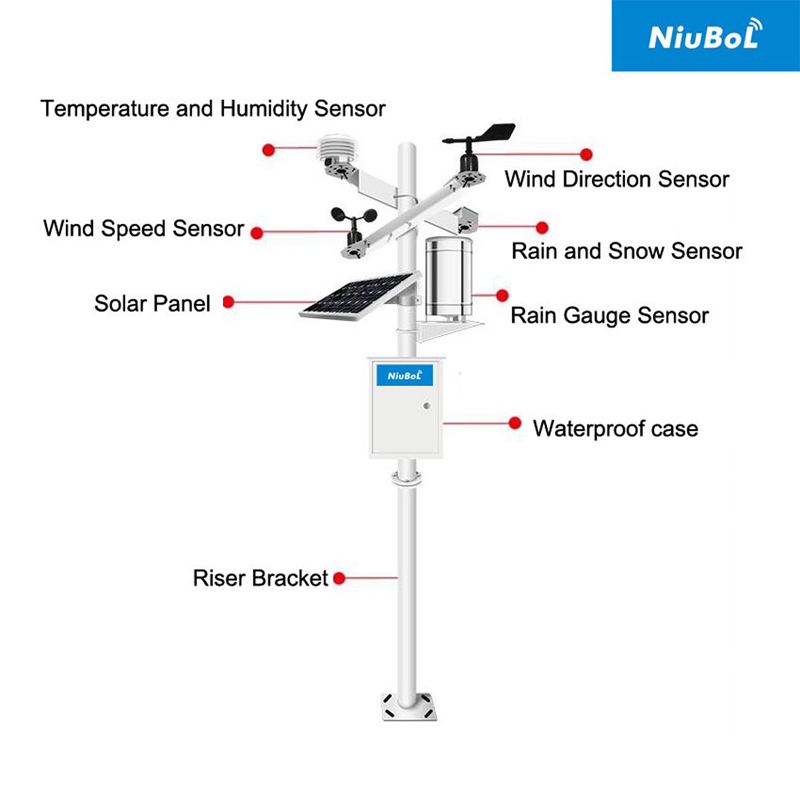
A low fence and a tall building beyond the same radius do not create equivalent conditions. Their height, distance, orientation and surrounding terrain matter differently to the instruments. A plan that marks only a clear circle can miss a roof exhaust, overhead branch, seasonal crop or shadow crossing the sensor.
The FHWA environmental sensor station siting guidance distinguishes tower siting from placement of individual sensors and relates the choices to the road-weather task. It is an example of application-specific guidance, not a reason to impose one road installation rule on every farm or research station.
Projects governed by a particular observation program must use its applicable requirements. Specify the document and measurement before approving a clearance. If a limitation cannot be removed, describe the affected observation rather than calling every remaining channel unsuitable.
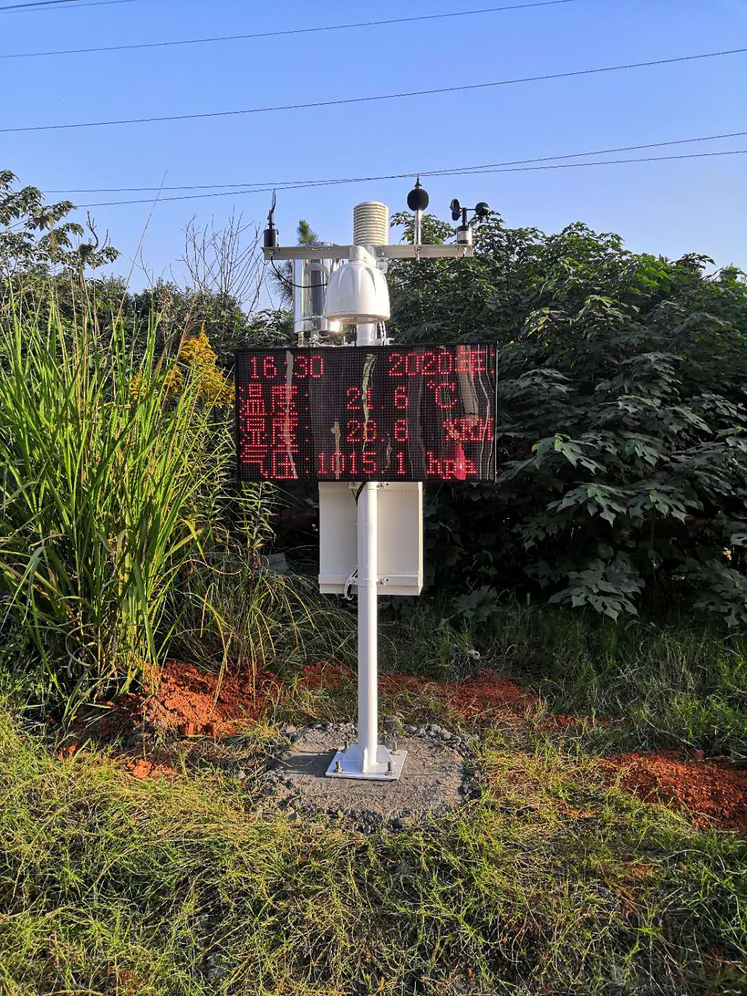
| Channel | Obstacle mechanism | What to assess |
|---|---|---|
| Wind | Sheltering, flow distortion or local acceleration | Obstacle geometry, direction and measurement height relative to the intended exposure |
| Rainfall | Interception, overhead drips, splash or altered catch conditions | The collector opening, water paths and the surrounding exposure |
| Air temperature and humidity | Local heat, radiation and inadequate airflow | Shield position, nearby surfaces, exhaust and represented environment |
| Solar irradiance | Shadows or an inappropriate sensing plane | The relevant sky or array exposure over the required observation period |
| Soil observation | Unrepresentative soil, roots or water distribution | The intended soil zone, depth and installation disturbance |
A position can therefore suit one channel while compromising another. A display at the entrance may be easy to view, while rain and radiation observations need different locations. With an integrated head, review the common-position compromise; with separate instruments, confirm the required cable routes and mounting arrangements.
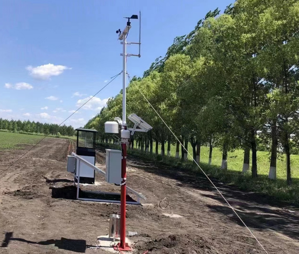
Record horizontal distance, obstacle height relative to the sensing point and direction. For a simple illustration, an obstacle top 12 m above the sensing point at 30 m horizontal distance has a distance-to-height ratio of 2.5. A top 3 m above it at the same distance has a ratio of 10. The equal distance does not describe equal geometry.
These ratios are illustrative, not pass limits or a complete airflow model. A line of trees, a solid wall and a narrow pole differ even with similar dimensions. Use the relevant instrument and observation requirements to decide whether the exposure is acceptable.
| Survey quantity | Unit or record | Interpretation |
|---|---|---|
| Horizontal separation, D | m | Distance from the sensing point to the relevant obstruction |
| Relative obstacle height, H | m | Obstacle top relative to the sensing point, not simply total tree or building height |
| Direction | Degrees with a stated north reference | Identifies affected wind sectors or shading directions |
| Extent and character | Width, continuity, material or vegetation description | Distinguishes a wall, isolated pole and tree belt |
| Change conditions | Season, operating state and date | Records growth, temporary equipment, exhaust operation or construction |
A forest understory observation may intentionally measure beneath the canopy. A roadside observation may intentionally describe a road environment. Rejecting both because they are not open rural references would change their purpose rather than improve their representativeness.
Conversely, a station beside a warm wall should not be described as an undisturbed regional reference without justification. State the environment represented and retain the local limitations. For the complete preparation process, use an individual site survey rather than a universal radius rule.
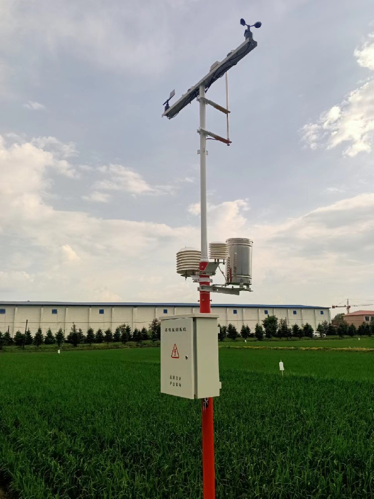
An outdoor protection rating concerns the named component; it does not make obstructed wind representative or remove a shadow. Likewise, a wide measurement range is not evidence that the site suits the observation. Keep these equipment characteristics separate from exposure.
| NiuBoL component | Selected limit or specification | What clearance still needs to resolve |
|---|---|---|
| NBL-W-SS | 0-45 or 0-70 m/s version; IP65 | Wind exposure and measurement height |
| NBL-W-LBTH | Air temperature -40°C to 80°C, ±0.5°C; DC 12-24 V | Shield airflow and the intended local air environment |
| NBL-W-RS | 0.2 mm increment; 0-4 mm/min intensity range; operating 0°C to 50°C | Collector exposure and unintended water paths |
RS485 Modbus RTU compatibility can make the selected instruments readable by a compatible logger or PLC. It does not compensate for an unsuitable position. Verify the electronic channel and physical exposure as separate questions during commissioning.
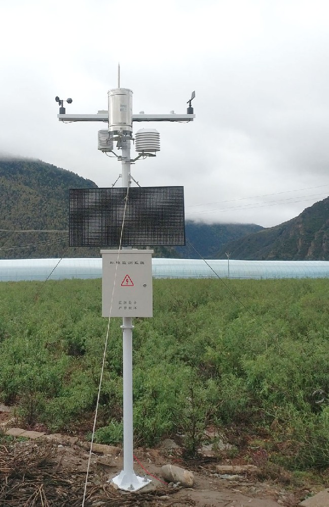
Mark the approved sensing positions, heights, orientation references and relevant obstructions. Identify which channel is affected by any remaining limitation. Keep the site record available to installers so a moved bracket or a convenient replacement location does not silently change the observation.
Review the layout again after construction and when surrounding conditions change. Trees, crop growth, new signs and temporary equipment can affect a previously acceptable position. Include practical service access, but do not move an instrument solely to shorten a cable without reviewing its exposure.
For a NiuBoL configuration review, provide the required quantities, observation purpose and measured obstacle geometry, with the proposed sensor and cabinet positions. A clear channel-by-channel record helps decide whether separate sensors, a revised mast position or a different observation target is appropriate.
No. Assess the relevant obstacles, sensor height, directions and observation purpose. A fixed radius alone cannot establish suitable wind, rainfall, temperature and radiation exposure.
Equal distances can correspond to very different geometries. Record height relative to the sensing point and the obstacle's direction and extent; then assess the exposure against the applicable requirement.
No. It depends on the intended observation. Understory measurements can be intentional, but must not be presented as equivalent to an open reference without the necessary interpretation.
No. Protection and measurement span are equipment characteristics. They do not remove flow distortion, shading, heat sources or intercepted precipitation.
Review separate sensing positions or a different configuration, with compatible acquisition and cable routes. Record any remaining limitation and confirm whether the monitoring task can still be met before construction.
Weather station clearance is a measurement-specific decision. Replace the universal-radius shortcut with obstacle geometry, a defined observation purpose and separate exposure checks for each channel. Select NiuBoL equipment and positions together so the installed system represents the conditions the project actually needs.
Prev:Small Weather Station Installation and Maintenance: Preserve the Data Record
Next:PV Weather Station Standards: Match Requirements to Evidence
Related recommendations
Sensors & Weather Stations Catalog
 Agriculture Sensors and Weather Stations Catalog-NiuBoL.pdf
Weather Stations Catalog-NiuBoL.pdf
Agriculture Sensors Catalog-NiuBoL.pdf
Water Quality Sensor Catalog-NiuBoL.pdf
Related products
 Combined air temperature and relative humidity sensor
 TDR Soil Moisture & Temperature Sensor for irrigation| RS485 |4-20mA| NBL-S-THR
 Soil pH sensor RS485 soil Testing instrument soil ph meter for agriculture |NBL-S-PH
 Wind Speed sensor Output Modbus/RS485/Analog/0-5V/4-20mA
 Tipping bucket rain gauge for weather monitoring auto rainfall sensor RS485/Outdoor/stainless steel
 Pyranometer Solar Radiation Sensor 4-20mA/RS485


Screenshot, WhatsApp to identify the QR code
WhatsApp number:+8615367865107
(Click on WhatsApp to copy and add friends)

