





— Blogs —
—Products—
 Consumer hotline +8618073152920
WhatsApp:+8615367865107
Address:Room 102, District D, Houhu Industrial Park, Yuelu District, Changsha City, Hunan Province, China
Product knowledge
Time:2025-03-20 11:19:09 Popularity:1661
Scenic area weather station specifications should be compared by measurement purpose, accuracy, exposure and data delivery, not by a presumed distinction between professional stations and tourist-site stations. Both can use the same types of instruments. Visitor displays and additional environmental channels change the system scope, but do not remove the need for credible measurements.
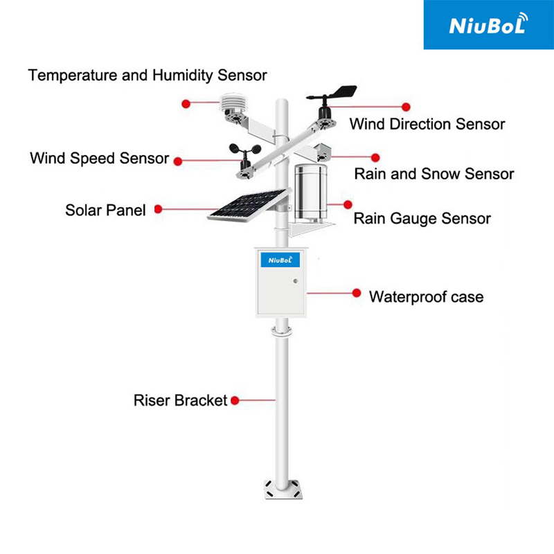
A conventional meteorological station may be automated, remotely connected and compact. A scenic-site station may operate for many years at a fixed location. Size, portability and the word automatic do not establish a reliable division between research and tourism equipment. Compare the actual requirements instead of assuming that one category is inherently more accurate or easier to maintain.
The practical difference is often the intended user. A research team may require documented uncertainty and a controlled long-term record. A visitor-services team may prioritize a readable display, current conditions and clear maintenance responsibility. A park can need both, but one instrument location or public screen may not satisfy every purpose.
| Comparison item | Question for a research record | Question for visitor information |
|---|---|---|
| Location | Does the exposure represent the study and remain documented? | Does the displayed reading represent the place visitors think it describes? |
| Accuracy | What uncertainty and supporting calibration are required? | Is the claimed precision meaningful for the displayed measurement? |
| Time treatment | Are intervals and raw or processed records defined? | Is the displayed value current, averaged or stale? |
| Additional channels | Do they answer a study question with a suitable instrument? | Can visitors understand the quantity without unsupported health or safety claims? |
| Operations | Can changes and gaps be traced? | Who responds when a screen or sensor stops updating? |
Require suppliers to identify the instrument, output and included service for each channel. A longer sensor list is not automatically a better configuration. An optional visibility or particulate channel is useful only if its measurement method, location and maintenance fit the intended use.
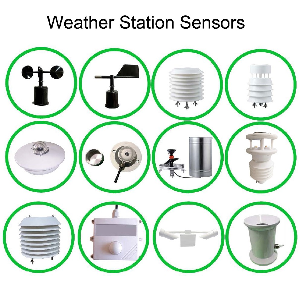
A modular NiuBoL station can use separate wind, air and rainfall instruments in either setting. For the NBL-W-LBTH air sensor, a suitable radiation shield and exposure remain important whether the data serves a paper or a public display. The display does not correct heat from nearby walls or poor ventilation.
| Component parameter | Value | Meaning for comparison |
|---|---|---|
| NBL-W-LBTH air temperature | -40 to +80 degrees C; accuracy +/-0.5 degrees C | Compare stated accuracy and exposure, not just decimal places. |
| NBL-W-LBTH relative humidity | 0-100% RH; accuracy +/-5% RH | Specify whether the required decision can tolerate this measurement limit. |
| NBL-W-SS wind speed | 0-45 m/s or 0-70 m/s versions; IP65 | Select the required range and output rather than assuming all versions are identical. |
| NBL-W-RS rain gauge | 0.2 mm increment; operating temperature 0 to +50 degrees C | Do not confuse increment with field accuracy or assume snow measurement. |
Where a specification requires a classification, traceable calibration or a particular test, obtain evidence for the actual proposed instrument. A general statement about use in meteorology does not establish compliance with a project's acceptance requirements.
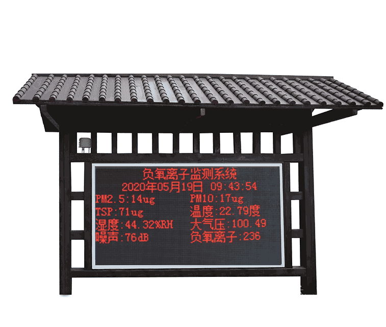
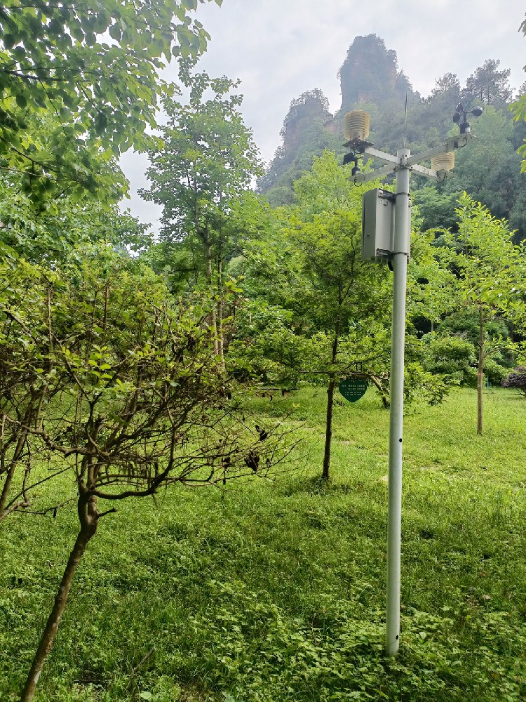
A public information board belongs where it can be read; a wind sensor belongs where its exposure answers the monitoring question. Those locations may differ. A sheltered entrance can be suitable for a display while the measured wind comes from a more exposed point. Identify the source location so visitors and operators do not assume the measurement describes every path or viewpoint.
Show the relevant units and update time, and define what appears when data is unavailable. Retaining an old plausible value without a stale indication can mislead staff. A good presentation makes the measurement's scope clear instead of adding claims that the instruments cannot support.
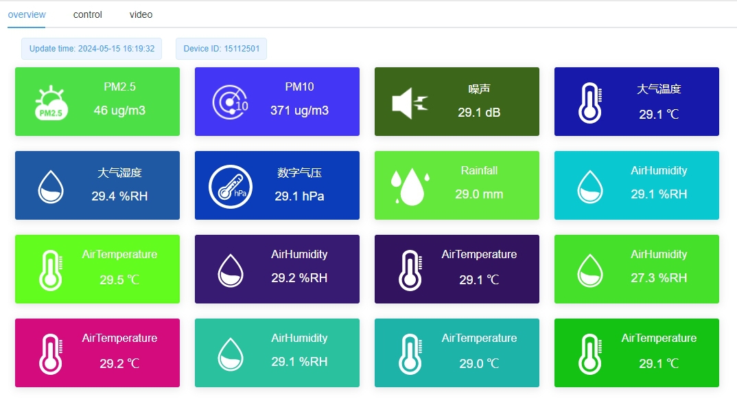
UV, particulate concentration, visibility and negative air-ion concentration are different quantities requiring dedicated instruments. Broadband solar irradiance does not provide a UV channel. Air temperature and humidity do not provide a measured PM2.5 concentration. Confirm the channel source rather than inferring capability from a dashboard tile.
Do not present a negative-ion reading as proof of a health benefit or a complete assessment of air quality. Likewise, a visibility observation at one location does not establish safe conditions on an entire mountain route. If an operational decision uses environmental observations, the responsible operator must define the relevant locations, limits and procedures.
RS485 Modbus RTU instruments need matching addresses, serial settings and register decoding at the PLC, RTU or logger. Analog and pulse instruments need suitable inputs. These compatibility checks apply to both research and scenic-site systems. A change of category name does not provide a standard universal interface.
The TG462/TG462S data logger family provides multiple acquisition and communication interfaces; the required record format, destination and local display remain configuration decisions. Confirm outdoor enclosure protection, power and the response to communication loss rather than assuming that remote access includes all recording and notification services.
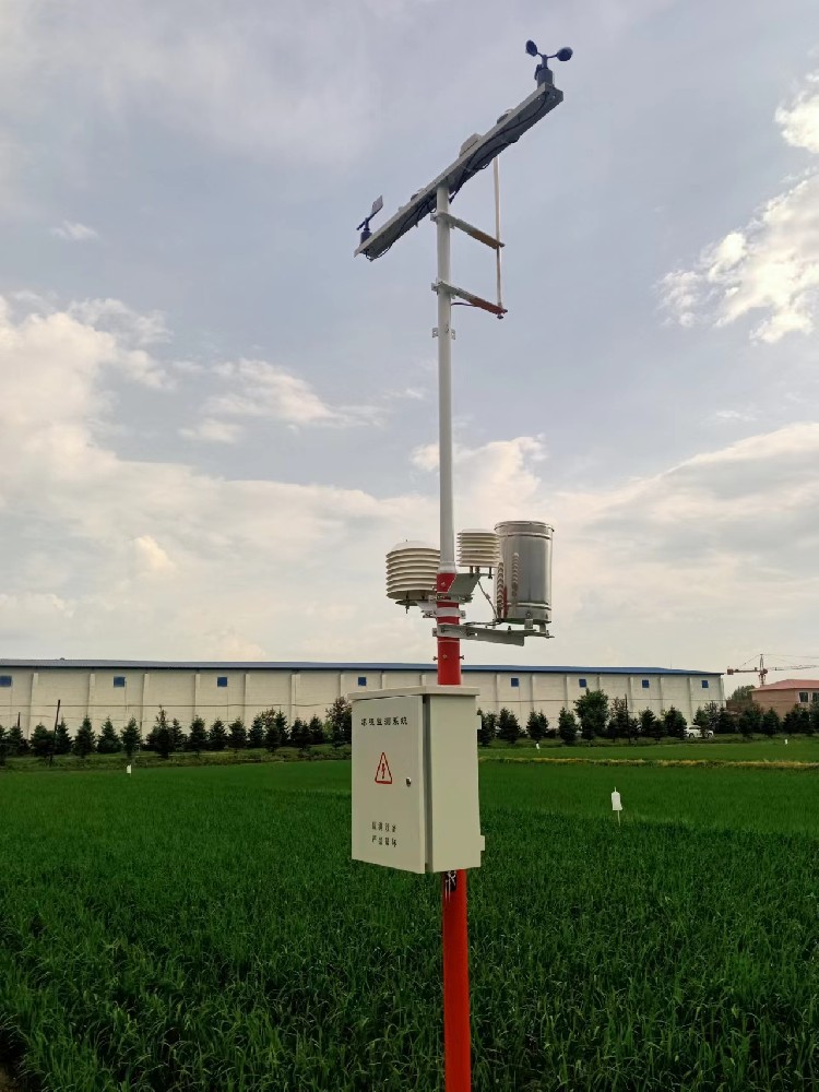
First check instrument identity, installation, units and the received values. Then check the board or application: source channel, timestamps, missing-data indication and required historical access. A functioning screen does not establish sensor accuracy, and a calibrated instrument does not establish correct presentation at the public endpoint.
For a quotation, describe the site, core observations, optional environmental channels, public display and any research archive requirement. Separate instruments, presentation equipment, installation and ongoing services. This makes two proposals comparable without treating every attraction as the same monitoring project.
Not by definition. Accuracy depends on the selected instruments, installation and verification. Compare model-specific limits and project requirements rather than the location label.
Only when they answer a defined need and can be maintained and interpreted appropriately. Each channel adds equipment, power, service and data-handling requirements.
Not automatically. Elevation, shelter and terrain can create different conditions. Identify which location each observation represents and assess additional sites where the operating question requires them.
Yes, with a compatible data connection and suitable power. Verify the source channel and update time at the display, and define its behavior during a communication interruption.
Provide the intended users, measurement list, site photographs, required accuracy, power and communications, display location and archive needs. Identify any formal acceptance evidence so the configuration can be reviewed against the real requirements.
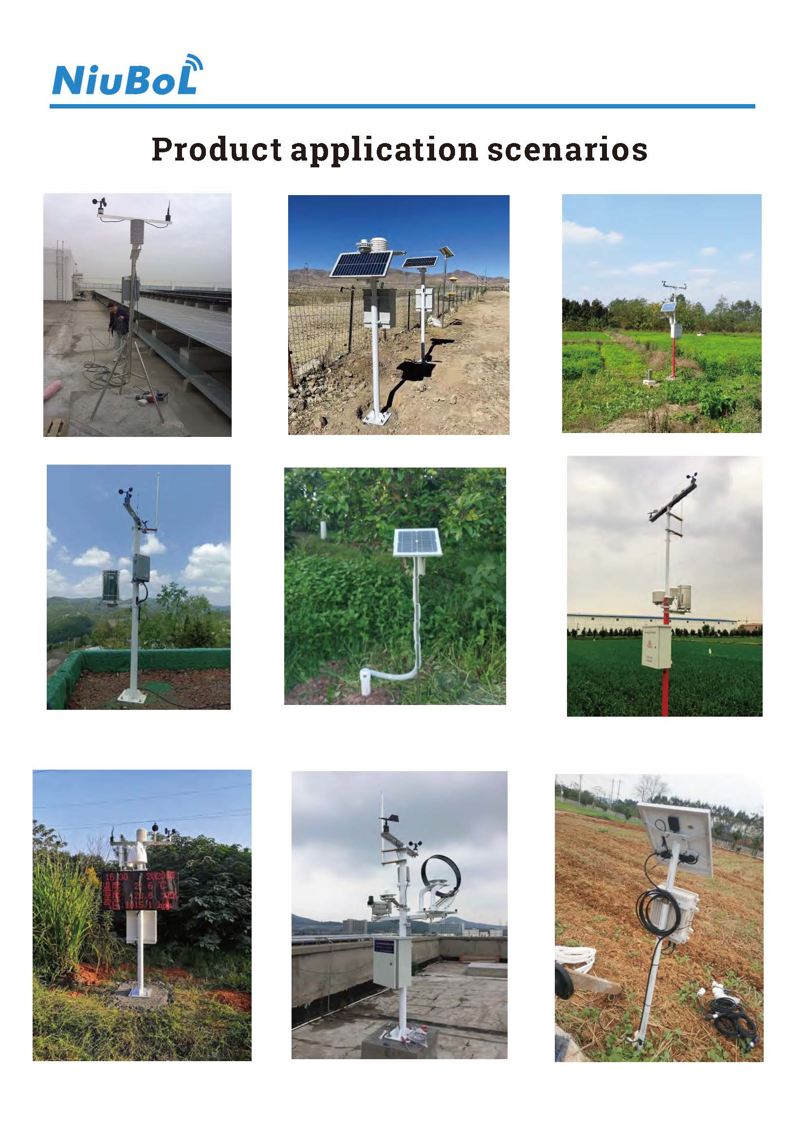
Scenic area weather station specifications become useful when they describe measurements and services that can be checked. Research and visitor-information systems may share hardware but use their records differently. Compare exposure, model limits, data delivery and presentation so a NiuBoL configuration fits the actual site without unsupported health or safety promises.
Prev:Weather Station Software Compatibility: Test Computer Access and Data Export
Next:Campus Weather Station Data Archive: Keep Records Usable Across School Years
Related recommendations
Sensors & Weather Stations Catalog
 Agriculture Sensors and Weather Stations Catalog-NiuBoL.pdf
Weather Stations Catalog-NiuBoL.pdf
Agriculture Sensors Catalog-NiuBoL.pdf
Water Quality Sensor Catalog-NiuBoL.pdf
Related products
 Combined air temperature and relative humidity sensor
 TDR Soil Moisture & Temperature Sensor for irrigation| RS485 |4-20mA| NBL-S-THR
 Soil pH sensor RS485 soil Testing instrument soil ph meter for agriculture |NBL-S-PH
 Wind Speed sensor Output Modbus/RS485/Analog/0-5V/4-20mA
 Tipping bucket rain gauge for weather monitoring auto rainfall sensor RS485/Outdoor/stainless steel
 Pyranometer Solar Radiation Sensor 4-20mA/RS485


Screenshot, WhatsApp to identify the QR code
WhatsApp number:+8615367865107
(Click on WhatsApp to copy and add friends)

