





— Blogs —
—Products—
 Consumer hotline +8618073152920
WhatsApp:+8615367865107
Address:Room 102, District D, Houhu Industrial Park, Yuelu District, Changsha City, Hunan Province, China
Product knowledge
Time:2025-03-18 11:08:32 Popularity:1756
A highway weather monitoring station should be specified for a particular road section and operating task. Visibility, crosswind, rainfall and road-surface observations are different channels; none substitutes for the others. Map the hazards and measurement locations first, then choose compatible instruments and the data connection to the road operator's system.
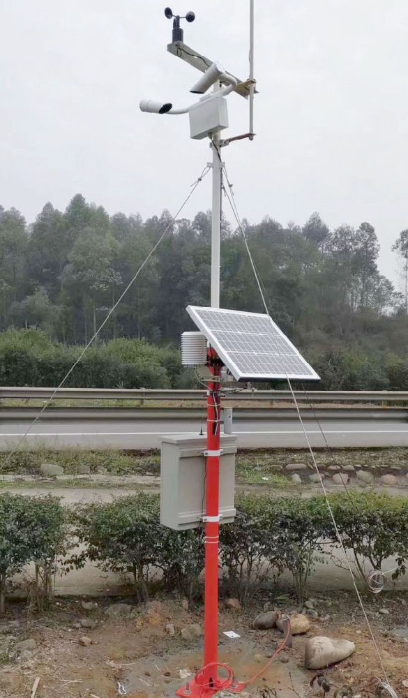
A bridge, a shaded cutting and a fog-prone valley can have different conditions during the same weather event. A station at a maintenance depot may provide useful background observations without representing any of those locations. For contractors designing a roadside network, the first deliverable should be a route-section map identifying what each monitoring point needs to describe.
Separate observed conditions from the action taken by traffic management. A visibility value does not itself authorize a speed restriction, and a rainfall total does not establish water depth on the carriageway. This distinction prevents an equipment schedule from promising functions that require additional sensing, software or an approved operating procedure.
| Road section | Measurement need | Configuration boundary |
|---|---|---|
| Fog-prone valley or low-lying approach | Local atmospheric visibility, with weather context | A forward-scattering sensor samples a local volume, not every bend ahead. |
| Exposed bridge or elevated road | Wind speed and direction at a representative location | A sheltered verge mast may not describe the exposed deck. |
| Shaded or winter-sensitive section | Road-surface temperature and condition, plus air observations | Air temperature alone cannot confirm ice or friction. |
| Low point with drainage concerns | Rainfall and, where required, separate water-level or flooding observations | Rain intensity is not a measurement of standing water. |
The NiuBoL NBL-W-VS uses forward scattering to estimate Meteorological Optical Range (MOR). Its output is a visibility distance. It does not directly identify every cause of reduced visibility, measure particulate mass concentration or report a driver's actual sight distance around a curve.
Use the expected fog exposure and a safe service position to select the measuring location. Avoid vehicle exhaust plumes, irrigation spray, obstructions and locations dominated by splash. If the fog layer changes along the route or between road and hillside, assess whether another monitoring point is necessary rather than assigning a longer road segment to the same sensor.
| NBL-W-VS parameter | Specification | System-design implication |
|---|---|---|
| Measured range | 5 m-10 km MOR | Keep metres and kilometres consistent across controller, archive and display. |
| Accuracy | 2% at up to 2 km; +/-10% from 2 to 10 km | Distinguish instrument accuracy from route representativeness. |
| Supply and average consumption | DC 12 V; 0.8 W | Budget the remaining station loads separately. |
| Output | RS485 Modbus RTU; default 9600 bps | Match address, serial format, register interpretation and units. |
| Environment and cable | -40 to 80 C; 0-95% RH; IP65; standard 10 m cable | Check the cabinet route and provide safe optical-cleaning access. |
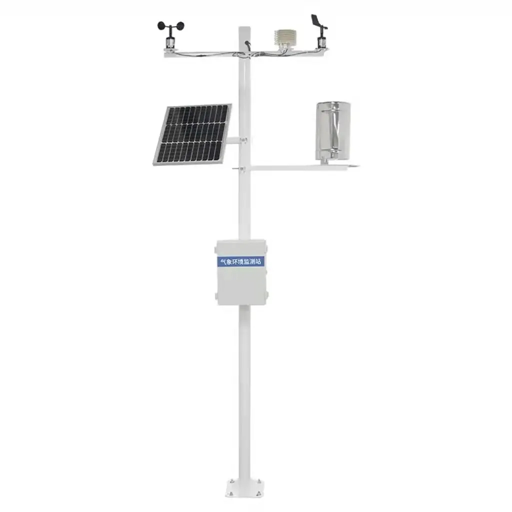
Separate NBL-W-SS wind-speed and NBL-W-DS wind-direction instruments can provide crosswind context; both have IP65 protection. Record mounting height, direction reference and nearby barriers. An ultrasonic alternative requires its own model-specific range and performance assessment; a generic wind specification must not be transferred between instrument types.
The NBL-W-LBTH measures air temperature, relative humidity and barometric pressure. Its temperature range is -40 to 80 C with +/-0.5 C accuracy; humidity range is 0-100% RH with +/-5% RH accuracy. These observations describe the atmosphere. A road surface exposed to sun, shade, stored heat or treatment can differ from the air, so an icing-related project needs an appropriate surface measurement strategy.
The NBL-W-RS rain gauge has 0.2 mm resolution, a 0-4 mm/min intensity range and a 0-50 C operating range. It is a liquid-precipitation instrument; do not treat this unheated configuration as a winter snowfall channel. Keep the catch opening clear of barriers and overhead equipment. Drainage response also depends on road geometry and the drainage system's condition.
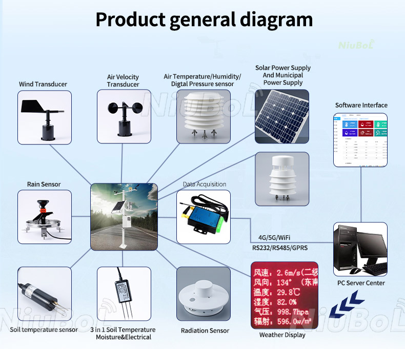
A highway weather monitoring station commonly places a data logger or RTU between the field instruments and the control centre. RS485 Modbus RTU describes the sensor-side exchange; it does not specify the message format accepted by a traffic-management server. Agree the upstream protocol, station identifiers and point mapping before configuring communications.
For each value, map its sensor location, unit, observation time and averaging or accumulation period. Wind averages and gusts must not share an ambiguous label. Rain accumulation needs a defined time window. Keep a timeout separate from a valid zero, and show an old observation as old even if the network connection has recovered. The receiving system should retain the measurement timestamp rather than replacing it with the upload time.
Acceptance should include comparing a sensor reading with the logger record and the control-centre value, checking a disconnected channel, and confirming the treatment of delayed records. Test any roadside display interface separately from data acquisition. Do not demonstrate a warning system by deliberately creating unsafe road conditions; use controlled test inputs under the operator's approved procedure.
Optical windows, a rain funnel and moving wind elements require different inspections. Select mounting positions and cabinet access with the road operator's maintenance team, including traffic protection and access authorization. A theoretically representative position is not workable if routine cleaning requires an unplanned lane closure.
Specify the power source, telecommunications coverage and cabinet protection for each location. The visibility sensor's 0.8 W average does not include a modem, logger or accessories. Nor does a particular pole height establish foundation adequacy or road-authority approval. Those requirements depend on the site and its civil design.
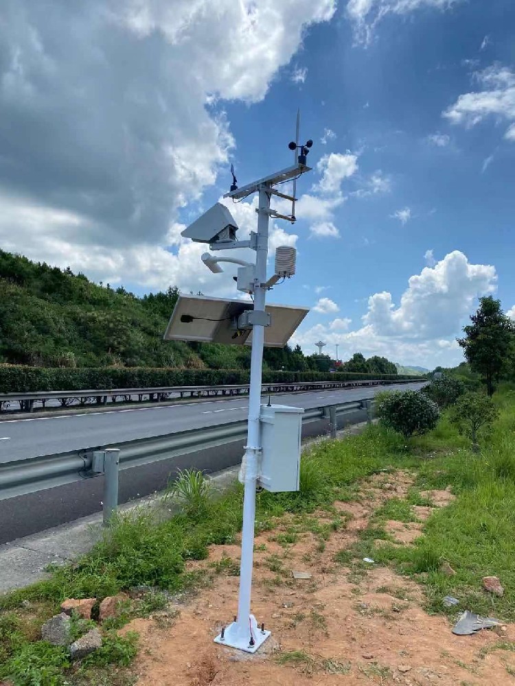
Only to the extent that its observations represent that route. Fog pockets, bridge exposure and shaded surfaces can change over short distances. Group locations by the operational condition being monitored, then decide where a separate point is justified.
No. They provide atmospheric context, not direct surface temperature, ice confirmation or tire-road friction. Select additional surface instruments when those quantities are required, and define their target area and installation geometry.
Not on its own. Fog, precipitation, smoke and other scattering particles can reduce MOR. Use weather context and instrument checks when interpreting the value; specify separate weather-type detection if the project requires classification.
Confirm supply, wiring, unique addresses, serial settings, register maps, scaling and polling requirements for each purchased version. Then verify those same units and timestamps in the upstream application. Sharing RS485 does not automatically make all device data interchangeable.
No universal reduction follows from installing sensors. End-to-end time depends on observation intervals, validation, transmission, server processing and operator action. Measure the configured system's response during acceptance against the project's agreed requirement.
Provide the route-section map, required observations, monitoring locations, receiver protocol, power availability and service-access conditions. Identify whether surface sensing, displays and civil work are included. A priced sensor list alone leaves those major scope differences unresolved.
A highway weather monitoring station is useful when its channels describe the road conditions the operator needs to assess. NiuBoL visibility and meteorological instruments can form part of that network. Start the configuration review with the road-section map and required measurements, rather than a promise that one standard mast monitors every hazard.
Prev:Tourist Attraction Weather Station: Design Useful Visitor Displays
Next:Small Outdoor Weather Station Installation: Fit the Sensors, Not Just the Mast
Related recommendations
Sensors & Weather Stations Catalog
 Agriculture Sensors and Weather Stations Catalog-NiuBoL.pdf
Weather Stations Catalog-NiuBoL.pdf
Agriculture Sensors Catalog-NiuBoL.pdf
Water Quality Sensor Catalog-NiuBoL.pdf
Related products
 Combined air temperature and relative humidity sensor
 TDR Soil Moisture & Temperature Sensor for irrigation| RS485 |4-20mA| NBL-S-THR
 Soil pH sensor RS485 soil Testing instrument soil ph meter for agriculture |NBL-S-PH
 Wind Speed sensor Output Modbus/RS485/Analog/0-5V/4-20mA
 Tipping bucket rain gauge for weather monitoring auto rainfall sensor RS485/Outdoor/stainless steel
 Pyranometer Solar Radiation Sensor 4-20mA/RS485


Screenshot, WhatsApp to identify the QR code
WhatsApp number:+8615367865107
(Click on WhatsApp to copy and add friends)

