





— Blogs —
—Products—
 Consumer hotline +8618073152920
WhatsApp:+8615367865107
Address:Room 102, District D, Houhu Industrial Park, Yuelu District, Changsha City, Hunan Province, China
Product knowledge
Time:2024-11-18 08:51:23 Popularity:2338
Hydrologic monitoring is the repeated observation of water conditions at defined locations and times. It can include water level, velocity, discharge, precipitation and selected water-quality parameters. These are different quantities: a level sensor does not automatically measure flow, and a pH sensor does not identify every pollutant. A useful monitoring specification identifies the required quantity, its reference and how the result will be used.
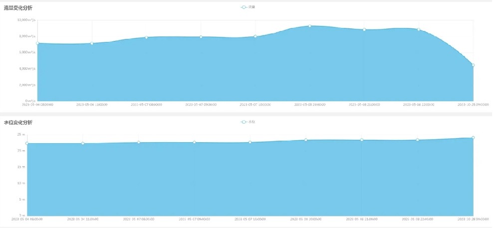
A water-level series describes a surface relative to a reference. A discharge series describes water volume passing a section per unit time. A rainfall series describes precipitation depth collected at a point over time. Their charts may rise and fall together, but that does not make the quantities interchangeable.
Before comparing records, identify the station, units, observation interval and whether the values are measured directly or calculated. A chart labelled only "water data" leaves essential questions unanswered. For a river, reservoir, drainage channel or irrigation project, the first equipment decision is which of those quantities is actually required.
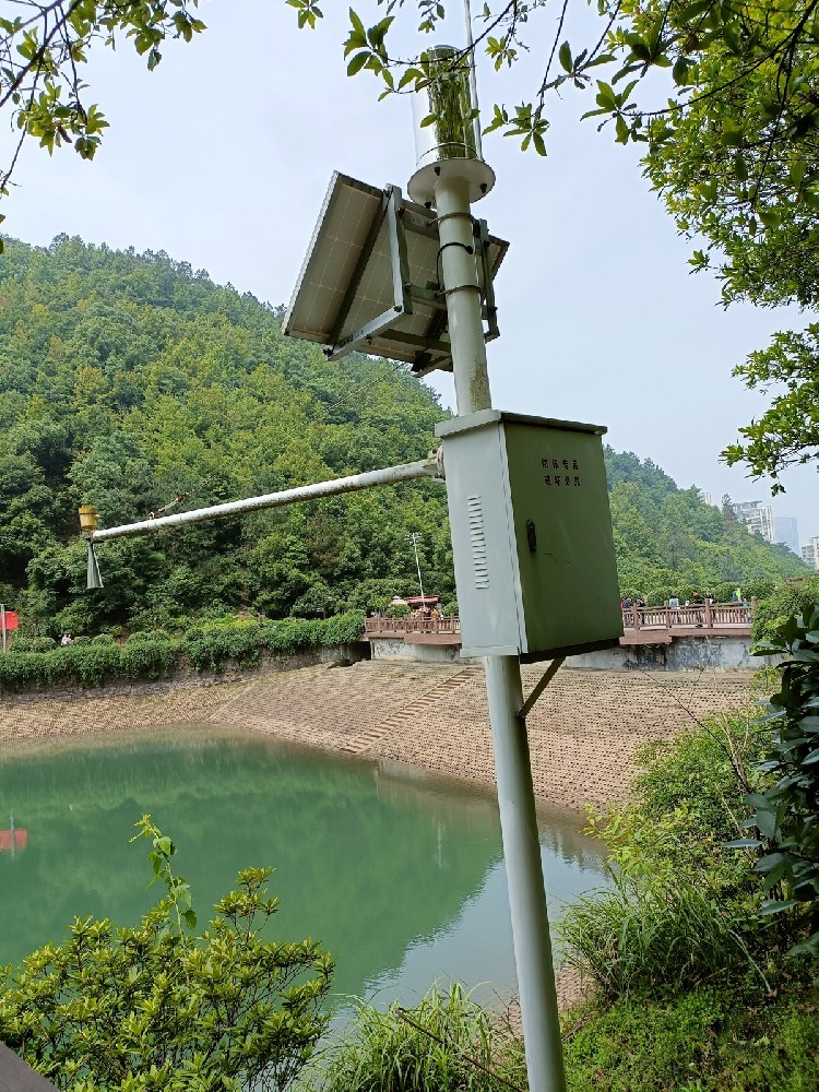
An overhead instrument measures distance to the water surface. Converting that distance into a reported level requires the installation reference. Calling the result depth additionally requires an appropriate bed reference; calling it elevation requires a relationship to the chosen survey datum. These labels should not be changed casually in a dashboard.
Consider an illustrative installation with its sensor reference 8.0 m above a selected zero. A measured surface distance of 3.2 m gives a level of 4.8 m relative to that zero. It does not establish that the river is 4.8 m deep. If the bed changes, depth can change even when that reference level remains the same.
| Radar level instrument item | Specification | What still needs definition |
|---|---|---|
| Standard ranging span | 0.1-65 m | Mounting reference and usable path throughout the water range |
| Specified accuracy | +/-1 mm under specified conditions | Installed reference and site effects; not a discharge accuracy |
| Power and protection | DC 10-30 V; less than 0.2 W; IP67 | Complete station power budget and enclosure arrangement |
| Field connection | RS485 Modbus RTU | Address, data map, units and receiving-system interpretation |
These figures apply to the NiuBoL radar water-level sensor, not to every instrument shown in a general hydrological installation.
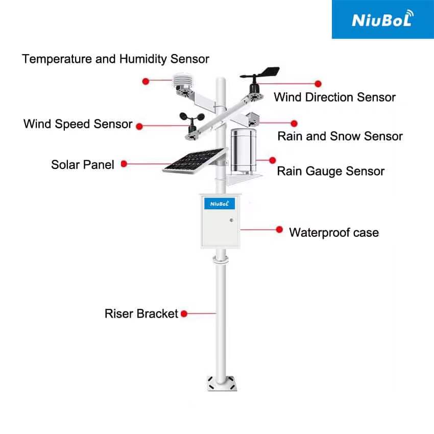
A weather station can provide rainfall and atmospheric conditions relevant to a catchment or reservoir study. It does not measure every part of the water balance. For example, rain collected beside a reservoir is not automatically the average rainfall over the entire contributing area, and wind data alone do not constitute a complete evaporation measurement.
The NBL-W-RS provides liquid-rain increments with 0.2 mm resolution. Wind, air temperature and humidity require their own channels and exposures. Choose them when the project uses those observations, rather than assuming that a standard mast includes every hydrological variable.

Water quality is not one universal sensor output. pH, conductivity, dissolved oxygen and turbidity describe different properties. Some assessments also require sampling and laboratory analysis. Specify each required parameter and reporting basis; a multiparameter label does not establish that an instrument measures every contaminant of concern.
The NBL-WQ-PH online pH sensor measures 0-14 pH with specified +/-0.1 pH accuracy and RS485 Modbus RTU output. Its reading does not directly identify a contaminant or demonstrate regulatory compliance. An appropriate sampling location, verification procedure and assessment method are still required.
A water-quality observation also needs its context: position, immersion arrangement, temperature and service condition. Avoid combining a sample from one branch with a flow record from another and presenting them as one sampling point.
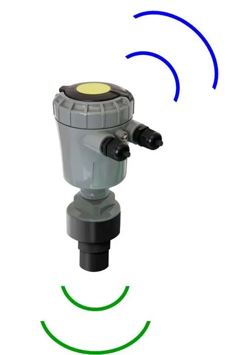
Discharge is commonly reported in m3/s or L/s; velocity is reported in m/s. An area-times-mean-velocity calculation requires the wetted cross-section and a velocity that represents it. A surface-velocity observation is not automatically the cross-sectional mean. The conversion and its conditions belong to the method, not merely to the display unit.
The NiuBoL non-contact radar flowmeter combines surface-velocity sensing, ranging and configured flow calculations. Provide the channel section and relevant site information for an application assessment. Do not transfer a correction from one channel to another without checking that it applies.
Another approach uses a site-specific stage-discharge relationship. The USGS explanation of rating curves describes establishing that relationship through discharge measurements and adjusting it when channel conditions change. A level sensor alone does not supply such a relationship.
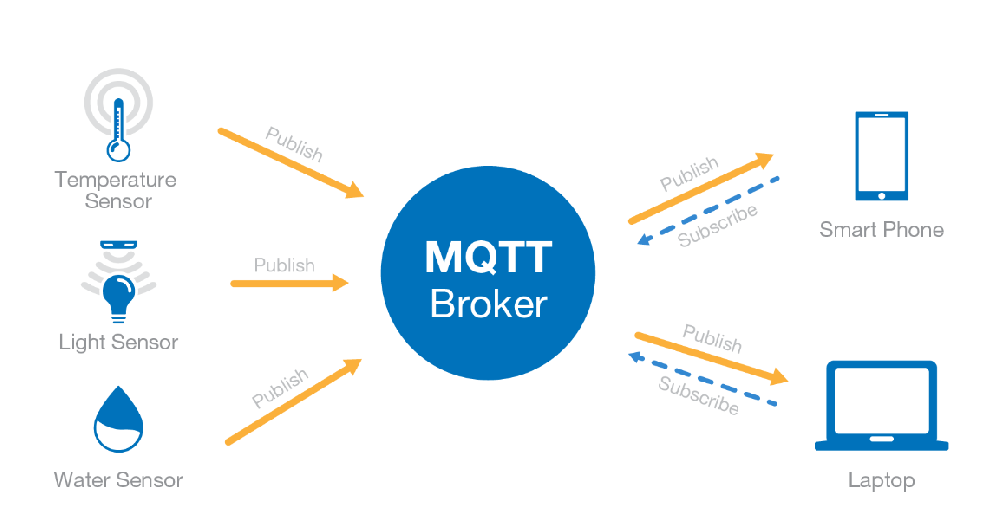
RS485 Modbus RTU can connect compatible field instruments to an acquisition device. The receiving system must use the actual register map, units and scaling. A successful response from the sensor address proves communication, not that a field labelled discharge contains a valid discharge calculation.
The TG462 / TG462S data logger provides three RS485 ports, analog and digital interfaces, and Ethernet connections. Cellular availability depends on its modem and regional configuration. MQTT is a messaging option in the configured architecture; GNSS positioning is not itself a telemetry network. The complete sensor-to-server arrangement needs explicit selection.
For an irrigation canal, the operational question may be delivered flow, with gate position and channel geometry affecting interpretation. For a reservoir, surface level may need a current level-storage relationship before it becomes stored volume. For environmental monitoring, selected water-quality parameters may be more important than adding another weather channel.
A river investigation may require several locations and independent discharge checks. Groundwater observation needs a suitable well reference and sensor arrangement, not an ordinary river mast relabelled as a groundwater station. State the water body and decision first; then select the sensing method and service access.
Where the task specifically concerns rainfall-driven events, the rainfall and river-response discussion addresses event interpretation rather than the general definition of hydrologic monitoring.
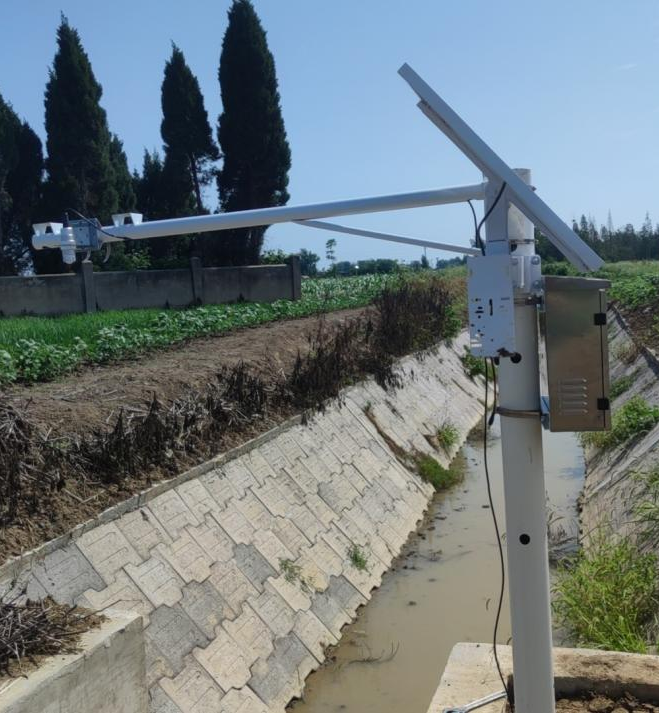
Level is surface height relative to a reference; discharge is water volume passing a section per unit time. Converting between them needs a suitable relationship or additional measurements.
It directly measures surface distance. A depth result also requires a relevant bed reference and correct conversion. Bed movement can invalidate a previously assumed depth relationship.
Not by itself. Discharge requires the wetted area and an appropriate relationship between the observed velocity and cross-sectional flow. Check the calculation method and site configuration.
No. List the required parameters and determine which need online sensors, separate sampling or laboratory analysis. A pH reading cannot substitute for an unspecified pollutant analysis.
Give NiuBoL the water body, required quantities and units, expected water range, mounting or immersion conditions, available power and receiving interface. Include channel information if calculated discharge is required.
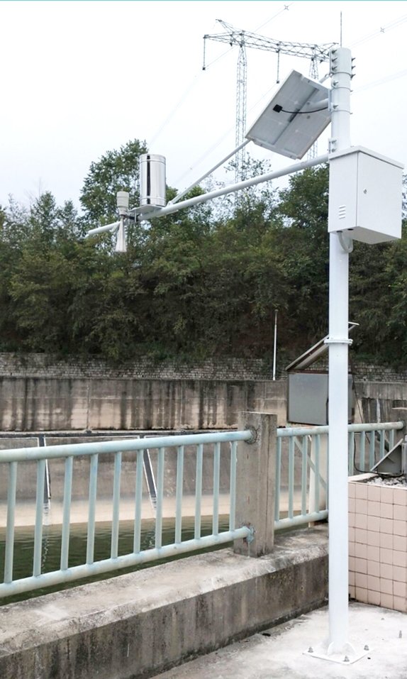
Hydrologic monitoring is useful when each result has a clear physical meaning. Keep level, depth, velocity, discharge, rainfall and water quality distinct, and identify calculated relationships explicitly. Select NiuBoL sensors and acquisition equipment for those named measurements instead of treating a general station package as a complete answer to every water-management question.
Prev:Weather Information for Precision Planting: Checking a Sowing Window
Next:Monitoring Hydrometeorological Hazards: Rainfall and River Response
Related recommendations
Sensors & Weather Stations Catalog
 Agriculture Sensors and Weather Stations Catalog-NiuBoL.pdf
Weather Stations Catalog-NiuBoL.pdf
Agriculture Sensors Catalog-NiuBoL.pdf
Water Quality Sensor Catalog-NiuBoL.pdf
Related products
 Combined air temperature and relative humidity sensor
 TDR Soil Moisture & Temperature Sensor for irrigation| RS485 |4-20mA| NBL-S-THR
 Soil pH sensor RS485 soil Testing instrument soil ph meter for agriculture |NBL-S-PH
 Wind Speed sensor Output Modbus/RS485/Analog/0-5V/4-20mA
 Tipping bucket rain gauge for weather monitoring auto rainfall sensor RS485/Outdoor/stainless steel
 Pyranometer Solar Radiation Sensor 4-20mA/RS485


Screenshot, WhatsApp to identify the QR code
WhatsApp number:+8615367865107
(Click on WhatsApp to copy and add friends)

