





— Blogs —
—Products—
 Consumer hotline +8618073152920
WhatsApp:+8615367865107
Address:Room 102, District D, Houhu Industrial Park, Yuelu District, Changsha City, Hunan Province, China
Product knowledge
Time:2025-03-27 21:22:50 Popularity:1537
Weather station vegetation management should preserve the intended observation as crops and trees change. Inspect growing obstructions, leaf litter, shading and cable contact, then decide whether the station should remain an open reference or measure conditions within the vegetation. Do not clear a canopy observation into an open site, or explain an exposure change as sensor drift without checking the surroundings.
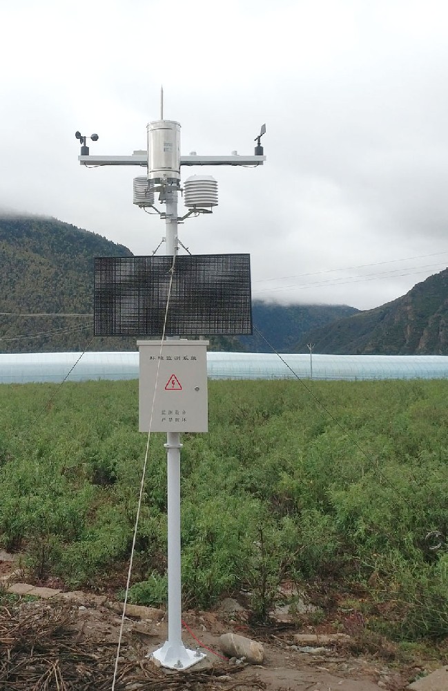
An agricultural station installed before crop emergence can face a different environment at full crop height. A forestry station can change as nearby trees grow, branches fall or a stand is thinned. The instruments may remain operational while their exposure changes substantially.
Begin with the station's purpose. An open weather reference, a crop-zone observation and an understory research point are not interchangeable. Document the intended relationship to vegetation before planning trimming, mowing or relocation. A maintenance action that makes an installation look tidier can remove the condition the project intended to study.
| Site change | Observation to review | Field decision |
|---|---|---|
| Crop height increases | Airflow and the sensor's position relative to the crop | Confirm whether the channel remains a reference or has become a crop-zone observation. |
| Branches grow toward the mast | Wind obstruction, shading and mechanical contact | Review exposure and authorized clearance before changing calibration. |
| Leaves accumulate in a collector | Rainwater entry and drainage | Document and remove obstruction under the instrument's service procedure. |
| Harvest or thinning opens the site | Changed wind, radiation and surrounding surface | Record the intervention; do not assume an unchanged observation environment. |
| Vegetation reaches cables or enclosure | Strain, rubbing, access and cable-entry condition | Protect the installation without disturbing research plots or unauthorized land. |
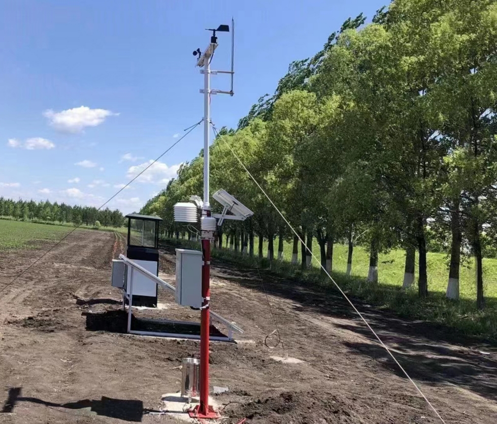
At installation, record the positions of nearby trees, crop rows and other important obstructions. Retain views in known directions and note the measurement heights and site purpose. Repeat the observations at comparable growth stages or after a material change rather than relying on memory of how open the site once looked.
Use the project's exposure requirements to decide whether action is needed. There is no single clearance distance suitable for every weather sensor and every forest study. Review wind, rain and radiation placement as separate tasks, even when the instruments share one mast.
For forestry work, retain the distinction between clearing, ridge and understory locations. An understory reading is not necessarily defective because it differs from a clearing. The question is whether it still represents the intended environment.
Where a forest project includes separate flame-detection equipment, its view or sensing coverage must be reviewed independently of the weather sensors. Wind, temperature and humidity measurements do not establish smoke recognition, a fire location or a detector's coverage.
If such equipment is included, review its own placement and service requirements separately. Do not assume clearing around a wind sensor also preserves a detector's sensing coverage. Arrange necessary vegetation work through authorized personnel, with site-access and ecological restrictions observed.
A blocked funnel can leave a connected rain gauge showing a plausible dry interval. Inspect the opening, drainage and tipping mechanism for the condition relevant to the installed model. Record what was found before cleaning, and keep service-generated tips separate from natural rainfall.
Under trees, water dripping from branches can also produce a record different from open-site rainfall. Decide whether the project measures open precipitation or a canopy-related process before moving the collector. Clearing or relocating a gauge can change the quantity represented, even if the same logger channel is retained.
| Component | Relevant specification | Vegetation-related inspection |
|---|---|---|
| NBL-W-RS | 0.2 mm increment; 0-4 mm/min intensity range; operating 0°C to 50°C | Collector obstruction, drainage and unintended branch drips |
| NBL-W-SS | Selected 0-45 or 0-70 m/s range; IP65 | Obstructed airflow, contact with the cups and mounting condition |
| NBL-W-DS | Wind direction; IP65 | Vane obstruction, changed support position and orientation reference |
| NBL-W-LBTH | Air temperature -40°C to 80°C, ±0.5°C; humidity 0-100% RH, ±5% RH | Vegetation against the radiation shield and the intended airflow environment |
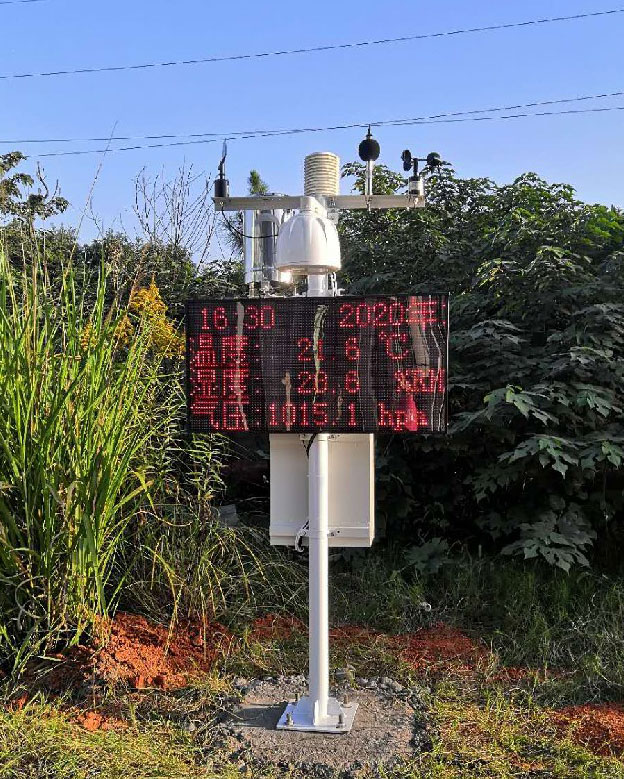
A new direction-dependent reduction in wind may coincide with vegetation growth. A daily radiation pattern may change when a branch creates shade at a particular time. Compare the exposure record and field observations with the data; these clues support an investigation, not an automatic diagnosis.
Check physical obstruction, electrical acquisition and measurement condition separately. RS485 Modbus RTU communication can continue normally while the sensing environment changes. A valid reply does not establish representative exposure, and a weather change does not by itself establish a calibration fault.
Do not apply an unexplained offset to make the station agree with a distant reference. If comparison or calibration is needed, perform it under an appropriate procedure. Keep environmental differences distinct from an instrument error that has actually been demonstrated.
Record the time, extent and location of work that may affect the observation. Routine clearing of material from the collector differs from removing a nearby tree or raising a sensing head. The latter changes the exposure and may require an updated channel or site record.
Where a measurement point moves, retain its previous position and effective change time. Keep raw observations available and identify the transition for later analysis. A continuous-looking chart should not conceal the change from one height or canopy condition to another.
For a NiuBoL station review, provide the crop or forest context, intended measurement purpose, present sensor heights, seasonal growth conditions and site-access constraints. Include current and installation views. These details help distinguish a service need, a placement problem and a requirement for a different observation point without assuming that more sensors alone will resolve the issue.
At commissioning, photograph the station from repeatable directions and record the height and distance of nearby vegetation relevant to each channel. Revisit those views after crop emergence, harvest, pruning or a major branch fall. The purpose is not to remove every plant near a forestry station. It is to know whether the intended measurement remains an open-air reference, a canopy-edge observation or a deliberate understory condition.
The maintenance sheet should connect a visible change with the affected quantity. Leaves entering a collector can interrupt rainfall capture; new shade may alter a radiation exposure; branches near a wind instrument can change airflow while the instrument still responds to Modbus polls. Note the date, location and action taken before adjusting a threshold or blaming a sensor. If relocation is needed, mark the break in the data series and retain both site descriptions.
For farms and forest plots managed by different teams, put responsibility in the installation agreement. State who may prune, who clears the rain collector, who inspects the mast after vegetation work and who updates the data record. This prevents a well-intended contractor from changing the observation environment without telling the people who interpret the records. A useful field report describes both the electronic status and the physical exposure.
A vegetation note is especially important when the same station supplies data to both field operations and long-term research. Operators may want clear access for maintenance, while researchers may want to preserve an understory setting. The installation record should state which purpose takes precedence before trimming changes the exposure.
Keep a dated site photograph after each major harvest or pruning event, and tell the data user when the exposure changed. The next season's pattern is otherwise easy to misread as an instrument drift or a climate trend.
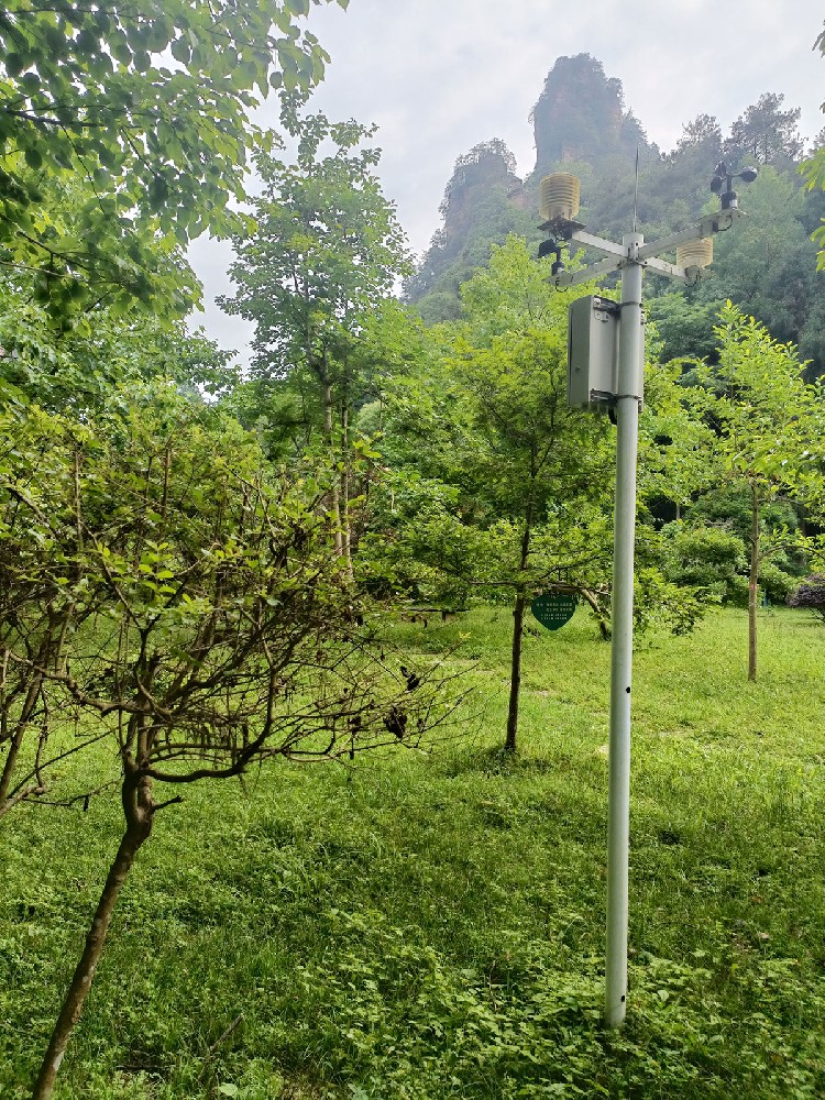
No. Preserve the intended observation and follow authorized site procedures. An understory study may require the surrounding canopy. Review each sensor's exposure before deciding on clearing or relocation.
Yes. It can alter airflow, shade or the sensor's position relative to the crop. Record growth and exposure alongside the readings before treating a changed pattern as sensor drift.
Document the obstruction and affected period, then service the collector under the appropriate procedure. Mark cleaning or test tips separately. Do not retrospectively invent rainfall for a period that was not validly observed.
No. Communication verifies the data path, not unobstructed airflow or representative rain and radiation exposure. Physical inspection remains necessary when surrounding conditions change.
Retain the intervention time, location and new exposure. Review the observation before joining the before-and-after periods as an unchanged series. Do not remove old records simply because the site is now more open.
Show each sensing exposure from the relevant direction, nearby canopy or crop height and the condition of the collector and cables. Repeat comparable viewpoints over time. A close-up of the instrument alone may miss the branch or crop row that explains a changed wind, light or rainfall pattern.
Not solely because the observation changed. First document the pruning date and compare the exposure before and after; a real environmental change is not a calibration error. Investigate the instrument separately if its own check fails. Keep this event in the data record so analysts do not mistake it for a long-term climate trend.
Relocation may be preferable when the vegetation is protected, part of the intended study or impossible to maintain without disturbing the site. Reassess representativeness, power, communications and the historical series before moving. Record both positions and the change date; data from the new exposure should not be silently merged with the old one.
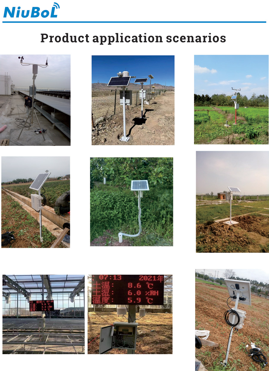
Weather station vegetation management is part of maintaining a meaningful observation. Preserve the site purpose, inspect each sensing path and record changes in crop or tree exposure. Select and service NiuBoL instruments around those requirements rather than treating every change as an electronics problem or clearing every site in the same way.
Prev:Agricultural Meteorological Stations: Functions and Importance
Next:PV Weather Station Data Export: Formats, Context and Access
Related recommendations
Sensors & Weather Stations Catalog
 Agriculture Sensors and Weather Stations Catalog-NiuBoL.pdf
Weather Stations Catalog-NiuBoL.pdf
Agriculture Sensors Catalog-NiuBoL.pdf
Water Quality Sensor Catalog-NiuBoL.pdf
Related products
 Combined air temperature and relative humidity sensor
 TDR Soil Moisture & Temperature Sensor for irrigation| RS485 |4-20mA| NBL-S-THR
 Soil pH sensor RS485 soil Testing instrument soil ph meter for agriculture |NBL-S-PH
 Wind Speed sensor Output Modbus/RS485/Analog/0-5V/4-20mA
 Tipping bucket rain gauge for weather monitoring auto rainfall sensor RS485/Outdoor/stainless steel
 Pyranometer Solar Radiation Sensor 4-20mA/RS485


Screenshot, WhatsApp to identify the QR code
WhatsApp number:+8615367865107
(Click on WhatsApp to copy and add friends)

