


— Blogs —
—Products—
 Consumer hotline +8618073152920
 WhatsApp:+8615367865107
Address:Room 102, District D, Houhu Industrial Park, Yuelu District, Changsha City, Hunan Province, China
Product knowledge
Time:2026-02-09 15:17:07 Popularity:464

Traditional meteorological monitoring networks rely on a hierarchical architecture of national meteorological stations and regional automatic stations, with inter-station spacing typically ranging from several kilometers to tens of kilometers, making it difficult to capture micro-scale meteorological processes such as urban canyon effects and heat island circulations. The smart street lamp automatic weather station achieves a quantum leap in monitoring granularity by embedding multi-element environmental monitoring units into the densest urban infrastructure network—street lamp poles.
As a comprehensive IoT device carrier, smart lamp poles provide engineering feasibility for meteorological sensor deployment through their top mounting space and power/communication conditions. Typical deployment density can reach one monitoring node every 500 meters to 1 kilometer, forming a city-scale environmental perception grid with meter-level resolution.
For system integrators and project contractors, the core commercial value of smart street lamp weather stations is reflected in:
Infrastructure Reuse: Utilizing existing lamp pole power supply systems (AC 220V/DC12-24V) and communication conduits, avoiding land acquisition and pole erection costs
Decreasing Marginal Costs: Incremental deployment cost per point is only 15%-20% of traditional weather stations
Operation and Maintenance Synergy: Sharing operation and maintenance channels with urban lighting management systems, reducing full lifecycle costs
Data Fusion Potential: Spatial registration of meteorological data with lighting control, security monitoring, and traffic flow data

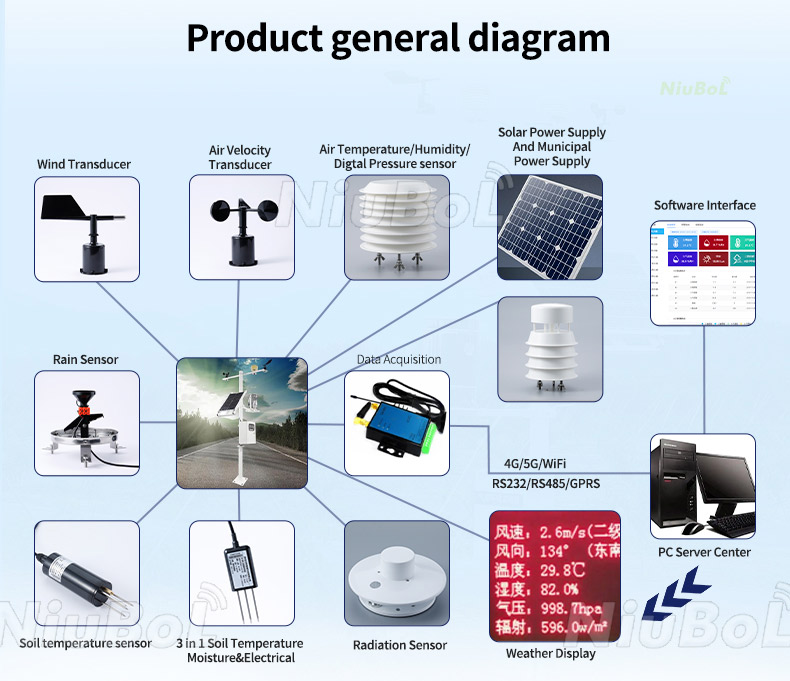
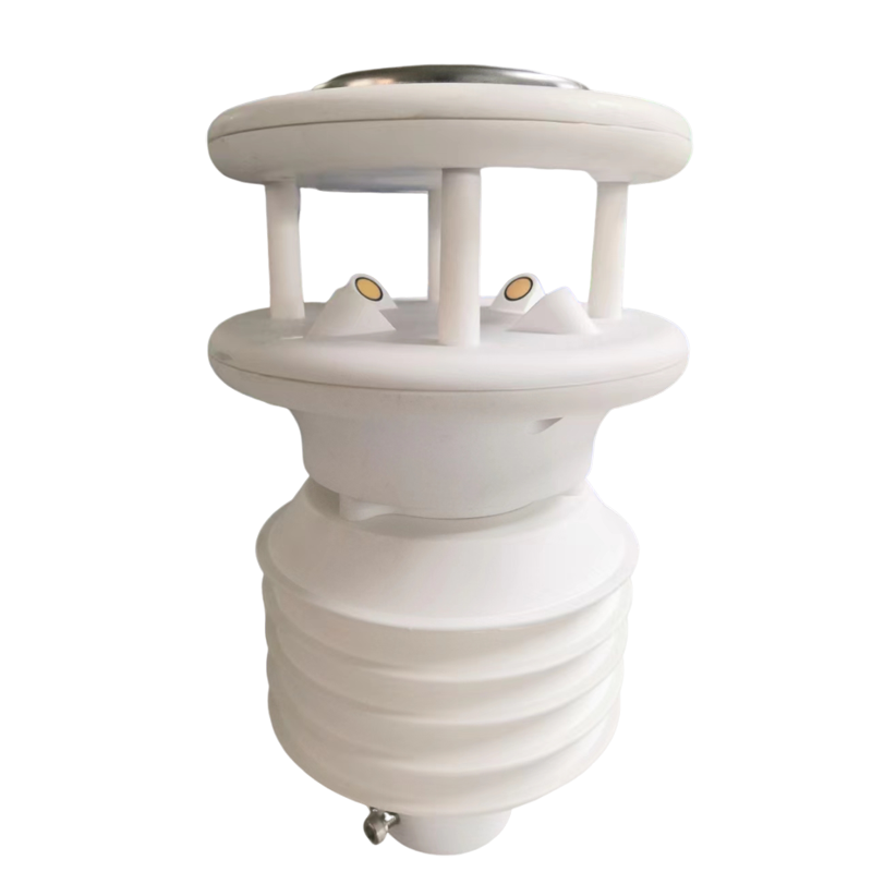
The core of the smart street lamp automatic weather station lies in a highly integrated multi-parameter sensor array. The following details the technical principles and engineering selection points of each sensing unit:
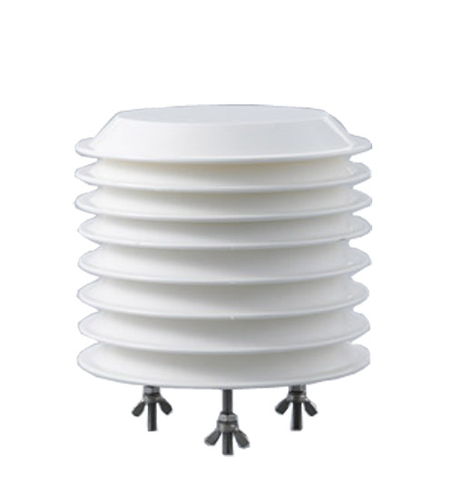
Sensing Principle: Integrated chip using capacitive humidity sensing and bandgap temperature sensing. The humidity-sensitive element is a polymer dielectric layer; adsorption of environmental water molecules changes the dielectric constant, which is converted into a frequency signal through an RC oscillation circuit. The temperature sensor utilizes the negative temperature coefficient characteristic of Vbe voltage for thermoelectric conversion.
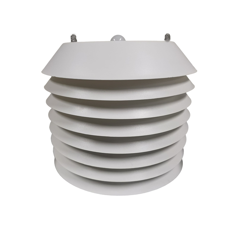
Technical Parameters: Measurement range -40℃~+80℃, accuracy ±0.2℃; relative humidity 0-100%RH, accuracy ±2%RH. Requires a radiation shield (louvered box structure) to avoid solar radiation heating and direct precipitation influence, ensuring representativeness of the boundary layer atmosphere.
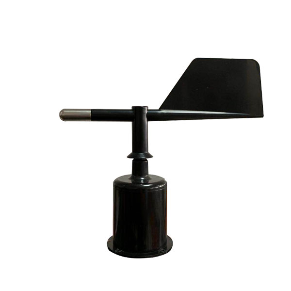
Ultrasonic Anemometer Principle: Based on the time-difference method, ultrasonic transducers are arranged in three-dimensional orthogonal directions. Measures the time difference Δt of sound wave propagation with and against the wind. No mechanical rotating parts, starting threshold below 0.1 m/s, suitable for urban weak wind environments.
Mechanical Anemometer: Some projects use propeller anemometers combined with wind vanes, outputting pulse signals through magnetic encoders. Lower cost but requires regular bearing maintenance, suitable for cost-constrained mass deployment scenarios.
MEMS Piezoresistive Sensor: Utilizes the piezoresistive effect of single-crystal silicon, with thin-film resistors deposited on the back of a vacuum cavity to form a Wheatstone bridge. Atmospheric pressure causes deformation of the thin film, changing resistivity and outputting an mV-level differential signal, which is converted to digital via a 24-bit ADC. Range 500-1100 hPa, accuracy ±0.5 hPa.
Tipping Bucket Rain Gauge: Rain collector diameter Φ200mm, precipitation converges through a funnel into the measuring tipping bucket. When accumulated water reaches 0.1mm/0.2mm/0.5mm rainfall, the bucket's center of gravity shifts, triggering a reed switch magnetic closure to output an on-off pulse. Dual-bucket design achieves self-stabilizing rapid drainage, with maximum measurable precipitation intensity up to 4mm/min.
Piezoelectric Rain Sensor: Uses piezoelectric thin film to sense raindrop impact kinetic energy, distinguishing rainfall from vibration interference through spectral analysis. No mechanical moving parts, suitable for maintenance-free operation in highly polluted urban environments.
Silicon Photocell Illuminance Meter: Based on photovoltaic effect, spectral response range 380-780nm (visible light). Outputs 4-20mA or RS485 signal for smart street lamp dimming feedback control, typical range 0-200,000 lux.
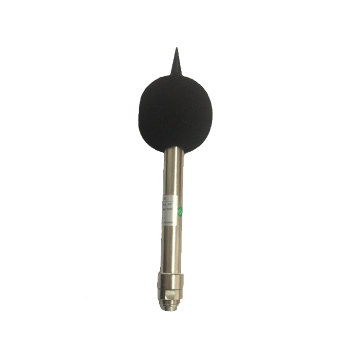
Total Radiation Sensor (Optional): Thermopile principle, sensing surface coated with high-absorptivity blackbody coating, measuring total solar radiation in the 280-3000nm band (unit W/m²), used for urban heat balance studies.
Laser Scattering Principle: Uses a 650nm semiconductor laser source; aerosol particles produce Mie scattered light when passing through the measurement chamber, with photomultiplier tube receiving 90° or forward scattered light intensity. Calculates mass concentration (μg/m³) based on the calibration relationship between particle count and scattered light intensity. Requires a sheath gas system to prevent optical window contamination, sampling flow rate 1.0-2.83 L/min.
RS485 Bus Architecture: As the most mature differential serial communication standard in industrial field applications, RS485 supports transmission distances up to 1200 meters and multi-device topology of 32 nodes per segment. Smart street lamp weather stations typically use Modbus-RTU protocol (master-slave query-response), default baud rate 9600bps, 8N1 frame format.
Single Bus/Analog Interface: Some simple deployments use 4-20mA current loop to transmit temperature and humidity data.
LoRa/LoRaWAN: Sub-GHz band (CN470-510MHz) license-free operation, using CSS (Chirp Spread Spectrum) spread spectrum technology, receiver sensitivity up to -148dBm. Urban environment transmission distance 2-5 kilometers, with gateways aggregating data backhauled via 4G/fiber. Suitable for building private IoT networks, avoiding operator data charges.
4G/5G Cellular Communication: For video linkage or high-frequency sampling (minute-level) scenarios, Cat.1/Cat.4 LTE modules are used, supporting TCP/IP transparent transmission or MQTT protocol direct cloud connection. 5G NR networks can meet uRLLC (ultra-reliable low-latency communication) requirements for real-time triggering of extreme weather warnings.
MQTT Protocol: Based on publish/subscribe mode, weather stations act as Publishers sending JSON format messages to Brokers, including timestamps, GPS coordinates, and values of various elements.
 |  |  |  |  |
| Wind Speed sensor | Wind direction sensor | Tipping bucket rain gauge sensor | Atmospheric Temperature Humidity pressure Sensor | All-in-One Weather Station |
 |  |  |  |  |
| Solar Radiation Sensor | Ultraviolet Radiation Sensor | PM2.5 and PM10 sensors | Noise sensor | Four gas and two dust sensor |
Project Background: Mountainous highway curves, bridges, and long downhill sections are prone to团雾 (patchy fog), road icing, etc. Traditional weather station spacing is too large to capture local microclimates.
Deployment Scheme:
Linear deployment along the route with 3-5 km spacing, densified to 1 km at accident-prone sections
Integrated visibility meter (transmissive, range 10-10000m), road surface condition sensors (remote or embedded)
Communication via industrial-grade 4G routers, VPN private network access to traffic police command platform
Power taken from street lamp circuits, with UPS uninterruptible power supply to ensure continuous operation in foggy conditions
Data Application: When visibility<200m or road surface temperature <0℃ with="" humidity="">85% is detected, automatically trigger variable message sign speed limit prompts and fog light linkage control.
Project Background: Megacities need to evaluate the spatial correlation between building density, green space layout, and thermal environment to guide urban planning and energy scheduling.
Deployment Scheme:
Leveraging 100,000+ smart lamp pole resources, grid deployment at 500m intervals
Monitoring elements: air temperature, humidity, black globe temperature (WBGT index calculation), solar radiation
Data aggregated via LoRaWAN to district-level gateways, transmitted to city brain through government extranet
GIS platform generates real-time heat island intensity distribution maps (spatial interpolation of temperature differences between urban and suburban areas)
The NiuBoL smart street lamp automatic weather station adopts a modular design concept, with core features including:
Sensor Array Configuration:
Standard version: temperature-humidity, wind speed-direction, barometric pressure, PM2.5, noise, illuminance — seven parameters
Extended version: adds PM10, O₃, NO₂, CO, rainfall, ultraviolet radiation, and other modules
All sensors support hot-swappable replacement, maintenance without disassembling the entire unit
Electrical and Mechanical:
Power supply: DC 12-24V wide voltage input, power consumption<5W (excluding heating)
Protection: IP65 rating, operating temperature -30℃~+70℃
Installation: Compatible with Φ60-120mm lamp poles, quick-install bracket supports 30-minute single-point deployment

The smart street lamp automatic weather station is evolving from a standalone monitoring device into the data foundation of urban digital twin systems. For system integrators and engineering contractors, its value lies not only in hardware supply but also in reducing the technical barriers and integration risks of scenario-based smart city deployments through standardized data interfaces, flexible communication architectures, and reliable engineering adaptations.
NiuBoL is committed to providing large-scale project-validated environmental perception terminals, supporting full-process technical services from solution design and equipment selection to platform integration. Driven by the dual forces of refined urban governance and climate-adaptive planning, high-density, intelligent lamp pole meteorological monitoring networks will become a standard configuration of new urban infrastructure.
Related recommendations
Sensors & Weather Stations Catalog
 Agriculture Sensors and Weather Stations Catalog-NiuBoL.pdf
Weather Stations Catalog-NiuBoL.pdf
Agriculture Sensors Catalog-NiuBoL.pdf
Water Quality Sensor Catalog-NiuBoL.pdf
Related products
 Combined air temperature and relative humidity sensor
 Soil Moisture Temperature sensor for irrigation|NBL-S-THR
 Soil pH sensor RS485 soil Testing instrument soil ph meter for agriculture |NBL-S-PH
 Wind Speed sensor Output Modbus/RS485/Analog/0-5V/4-20mA
 Tipping bucket rain gauge for weather monitoring auto rainfall sensor RS485/Outdoor/stainless steel
 Pyranometer Solar Radiation Sensor 4-20mA/RS485

Screenshot, WhatsApp to identify the QR code
WhatsApp number:+8615367865107
(Click on WhatsApp to copy and add friends)
